Keszthely Festetics Kilato Panorama ( Balaton Ungarn )
luz
Navegue por
Navegue por
Consigue este tour en tu móvil
Keszthely Festetics Kilato Panorama ( Balaton Ungarn )
luz
Ciclismo
13,40
km
Escanee el código QR e inicie la navegación en la aplicación bergfex

Senderismo y rastreo


Keszthely Festetics Kilato Panorama ( Balaton Ungarn )
luz
Distancia
13,40
km
Duración
01:30
h
Ascenso
115
m
Nivel del mar
104 -
216
m
Descarga de pistas
Keszthely Festetics Kilato Panorama ( Balaton Ungarn )
luz
Ciclismo
13,40
km
Fotos de nuestros usuarios
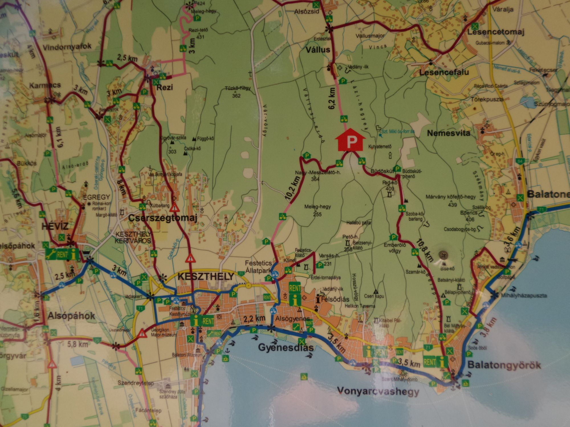
Radtour von Keszthely zum Festetics Kilato ( Aussichtsturm ) nahe Nagymesö ; zurück nach Keszthely ( Balaton Ungarn ) Markierung: "K4" = Festetics Tura" + Start: *KESZTHELY Stadt-Mitte / Hotel Helikon...
Descripción de la
Radtour von Keszthely zum Festetics Kilato ( Aussichtsturm ) nahe Nagymesö ; zurück nach Keszthely ( Balaton Ungarn )
*Markierung: "K4" = Festetics Tura"
- Start: KESZTHELY Stadt-Mitte / Hotel Helikon
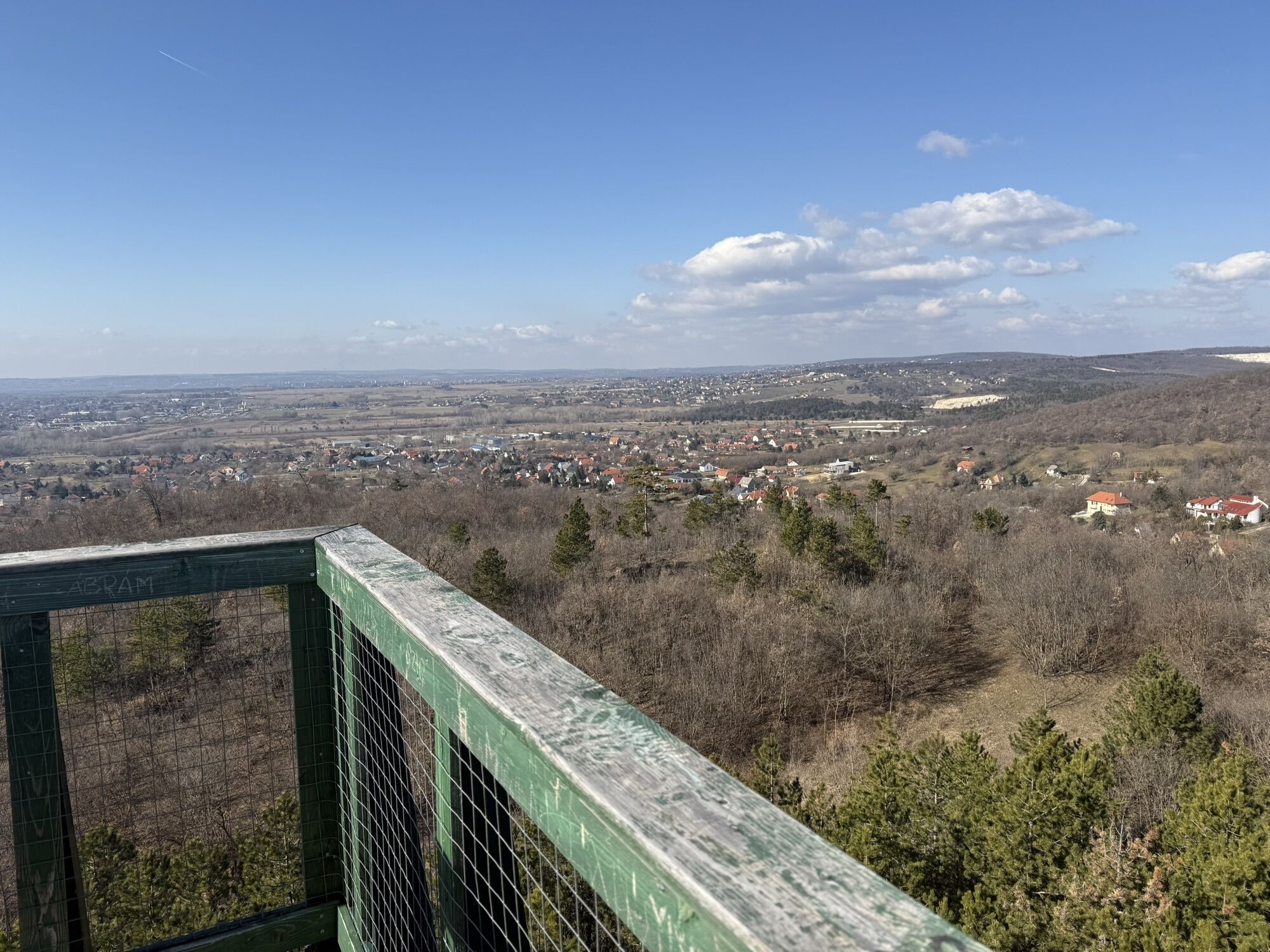
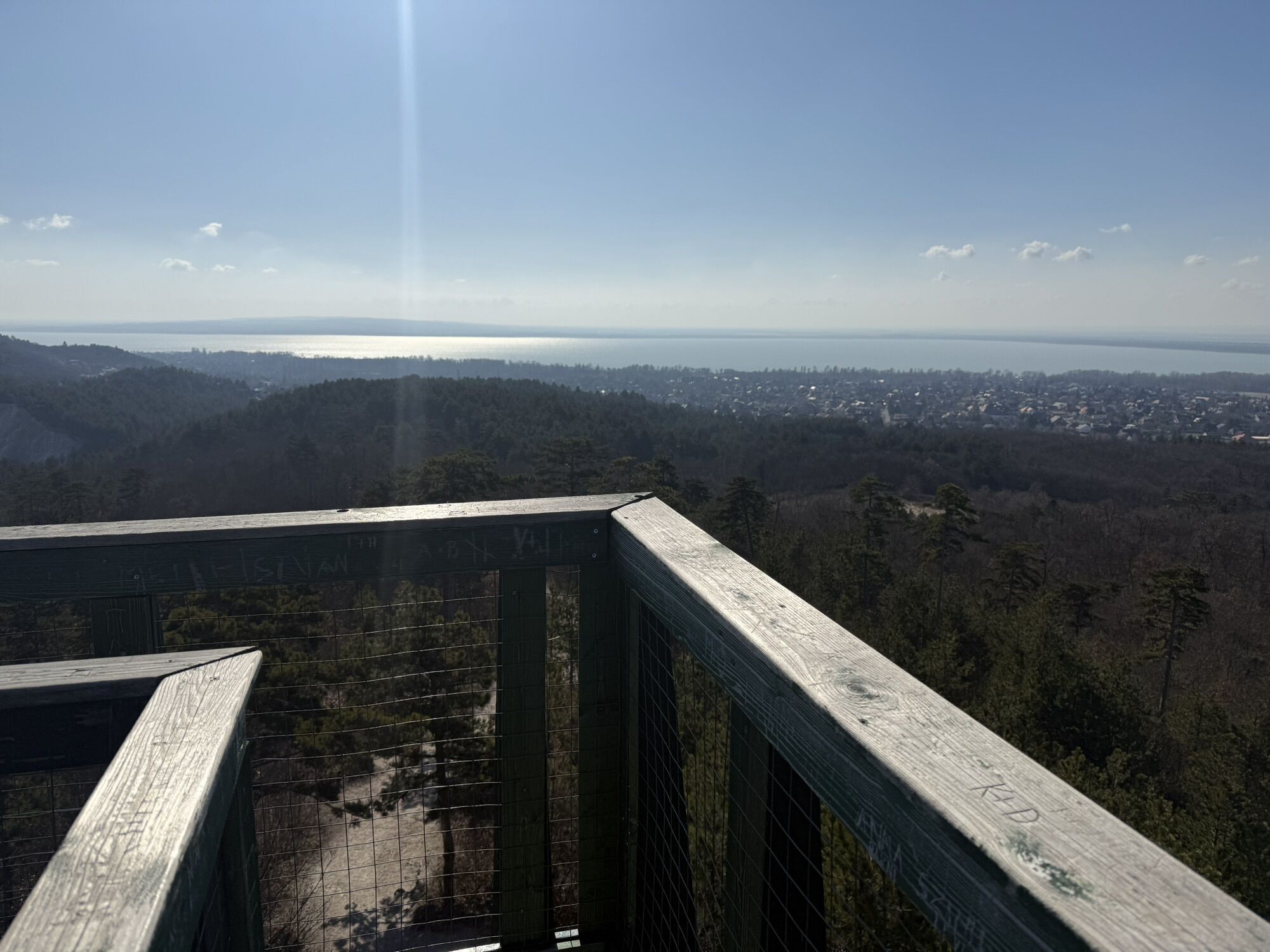
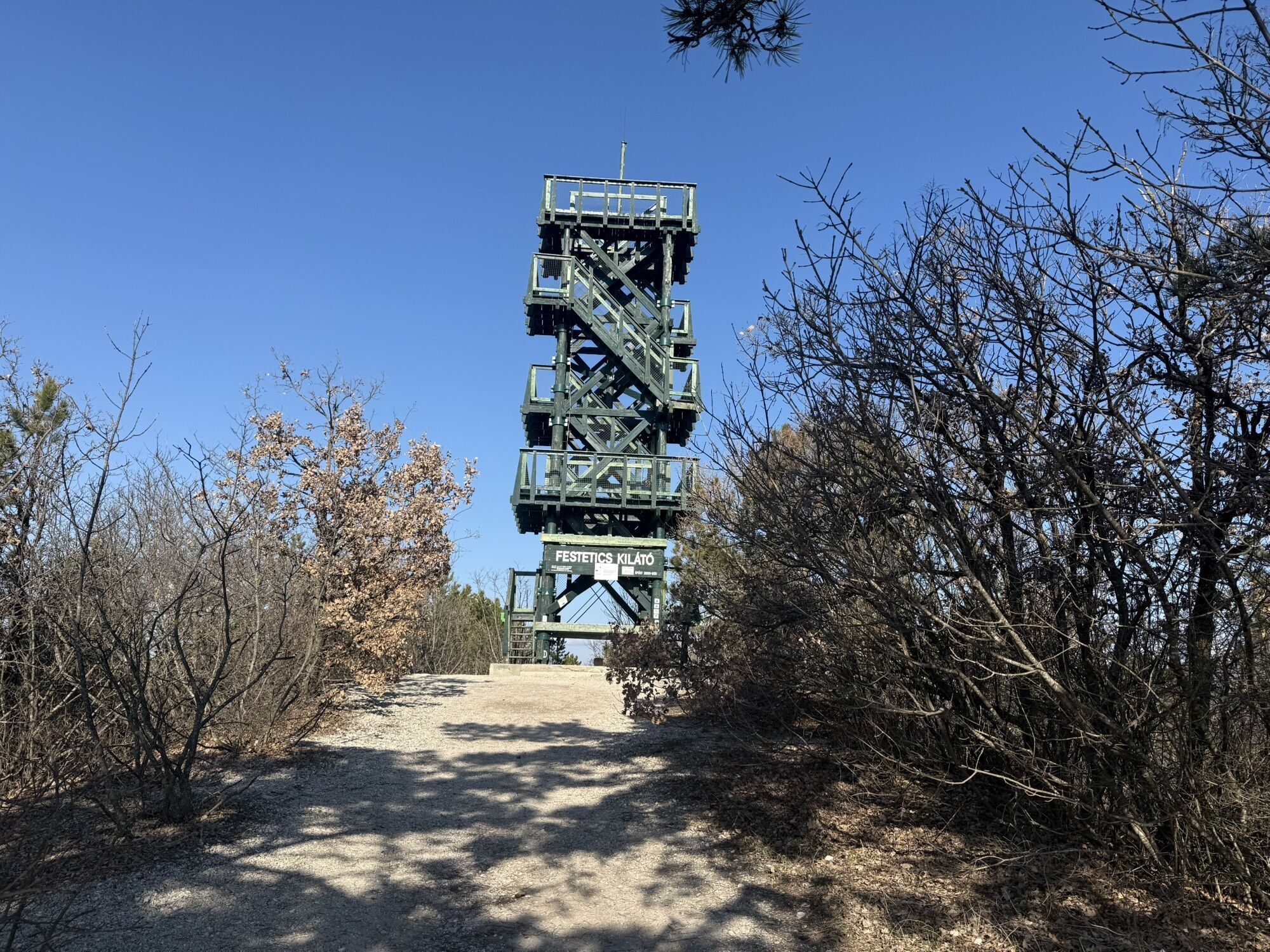
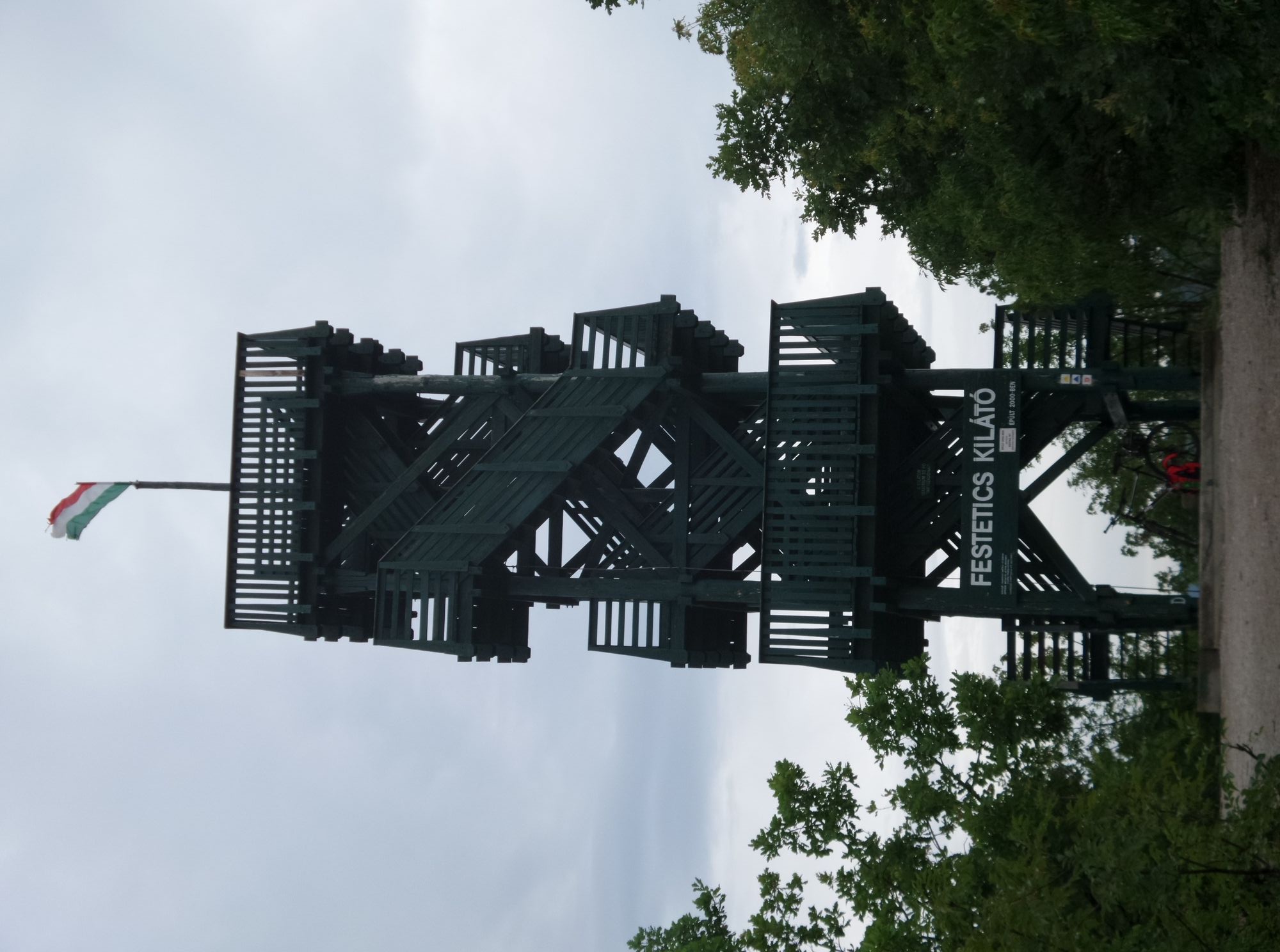
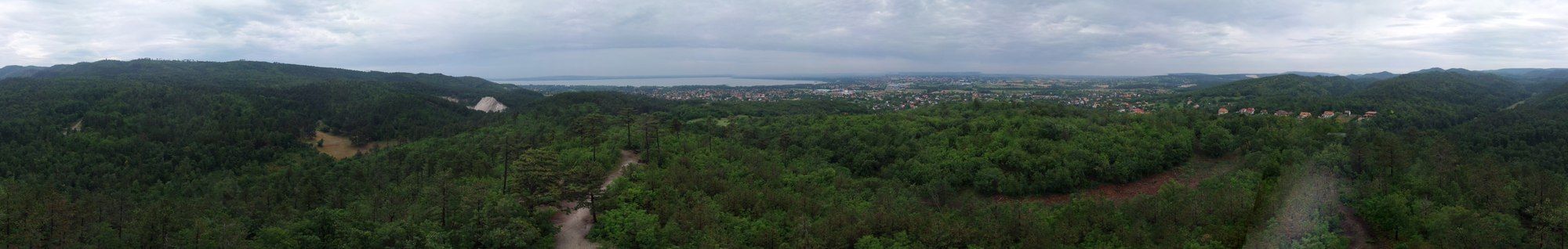
- Festetics Kilato (Aussichtsturm) Panorama
- Ziel: KESZTHELY Stadt-Mitte / Hotel Helikon
Ruta
Keszthely
(114 m)
Ciudad
0,8 km
Szent Ilona csárda
(147 m)
Restaurante
8,6 km
Nagymező
(184 m)
Corredor/terreno
12,1 km
Festetics-kilátó
(229 m)
Punto de vista
13,3 km
Varsás-hegy
(231 m)
Cumbre
13,3 km
Ruta
Keszthely Festetics Kilato Panorama ( Balaton Ungarn )
luz
Ciclismo
13,40
km
Keszthely
(114 m)
Ciudad
0,8 km
Szent Ilona csárda
(147 m)
Restaurante
8,6 km
Nagymező
(184 m)
Corredor/terreno
12,1 km
Festetics-kilátó
(229 m)
Punto de vista
13,3 km
Varsás-hegy
(231 m)
Cumbre
13,3 km
Compartir gira
Keszthely Festetics Kilato Panorama ( Balaton Ungarn )
luz
Ciclismo
13,40
km
Error
Se ha producido un error. Por favor, inténtelo de nuevo.

Información sobre la ruta
Material de la tarjeta
Visita a la Cumbre
Sí
Hermosa vista
Sí
Zona forestal
Sí
Información adicional y consejos
Neumáticos de carretera
Sí
Neumáticos todoterreno
Sí
Aún no hay opiniones
Rutas populares en los alrededores
-
5,0
Rundfahrt mit Schiff über Balatonmariafürdo - Balatongyörög ( Balaton Ungarn )
medioCiclismo 33,6 km -
Heviz Tófürdő - Thermalbadesee ( Balaton Ungarn )
luzCiclismo 16,9 km -
Balatonszentgyörgy - Vörs Kilato - Balatonbereny ( Balaton Ungarn )
medioCiclismo 40,9 km -
Keszthelygebirge - Bakonyerdö - Pad-Kö Kilato - Szépkilátó ( Balaton Ungarn )
medioMountainbike 35,6 km -
Ruine Burg Rezi Var Panorama ( Balaton Ungarn )
medioMountainbike 15,7 km -
4,0
OKT-025-026 Vállus-Tapolca
luzSenderismo 18,8 km -
Keszhelyi - hg tele kalandal
pesadoMountainbike 52,6 km -
4,0
Balatonberény, Dél-Dunántúl/Magyarország
Senderismo 10,4 km -
5,0
Balatongyörök - Garga-hegy - Batsányi-kilátó
luzSenderismo 4,91 km -
Keszthely Gehen
Pasear 4,27 km
Senderismo y rastreo

Más de 550.000 sugerencias de excursiones, mapas detallados y un intuitivo planificador de rutas hacen de esta aplicación una herramienta imprescindible para todos los amantes de la naturaleza.

No se pierda las ofertas y la inspiración para sus próximas vacaciones
Suscribirse al boletín de noticias
Error
Se ha producido un error. Por favor, inténtelo de nuevo.
Gracias por inscribirse
Su dirección de correo electrónico se ha añadido a la lista de correo.
Viajes por Europa
Austria
Suiza
Alemania
Italia
Eslovenia
Francia
Países Bajos
Belgium
Polonia
Liechtenstein
República Checa
Slovakia
España
Croacia
Bosnia y Herzegovina
Luxemburgo
Andorra
Portugal
Iceland
United Kingdom
Ireland
Greece
Albania
North Macedonia
Malta
Norway
Montenegro
Moldova
Kosovo
Hungary
San Marino
Romania
Estonia
Latvia
Belarus
Cyprus
Lithuania
Serbia
Bulgaria
Monaco
Denmark
Sweden
Finland