


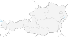


Via Springlessteig and Steirerspur to the Hubertushaus on the Hohe Wand
Fotos de nuestros usuarios
-

 © Mario LibardiCreado el 25.04.2026
 -

 © Karin SvozilCreado el 21.12.2025
 -
 © kristianduusCreado el 14.12.2025
 -

 © Anton GigeleCreado el 28.09.2025
 -
 © Anton GigeleCreado el 28.09.2025
 -
 © Anton GigeleCreado el 28.09.2025
 -
 © Anton GigeleCreado el 28.09.2025
 -
 © mmeckiCreado el 09.03.2025
 -
 © PadoleCreado el 08.03.2025
 -
 © PadoleCreado el 08.03.2025
 -
 © PadoleCreado el 08.03.2025
 -
 © PadoleCreado el 08.03.2025
 -
 © BergpiratCreado el 30.10.2024
 -
 © Gino Valentino PensuniCreado el 19.10.2024
 -
 © BergpiratCreado el 16.10.2024
 -
 © BergpiratCreado el 16.10.2024
 -
 © Aga MCreado el 26.04.2024
 -
 © BergpiratCreado el 21.10.2023
 -
 © BergpiratCreado el 21.10.2023
 -
 © BergpiratCreado el 21.10.2023
 -
 © BergpiratCreado el 21.10.2023
 -
 © BergpiratCreado el 21.10.2023
 -
 © BergpiratCreado el 21.10.2023
 -
 © BergpiratCreado el 21.10.2023
 -
 © BergpiratCreado el 21.10.2023
 -
 © BergpiratCreado el 21.10.2023
 -
 © KonradCreado el 14.11.2021
 -

 © eva_mountaininloveCreado el 22.05.2021
 -
 © Anton GigeleCreado el 28.09.2025
 -
 © Anton GigeleCreado el 28.09.2025
 -
 © Anton GigeleCreado el 28.09.2025
 -
 © Birgit naglCreado el 06.09.2022
 -
 © Mario LibardiCreado el 27.02.2026
 -
 © Mario LibardiCreado el 06.02.2026
 -
 © Mario LibardiCreado el 06.02.2026
 -
 © Mario LibardiCreado el 06.02.2026
 -
 © Leopold SchlögelhoferCreado el 09.08.2025
 -
 © Aga MCreado el 22.02.2025


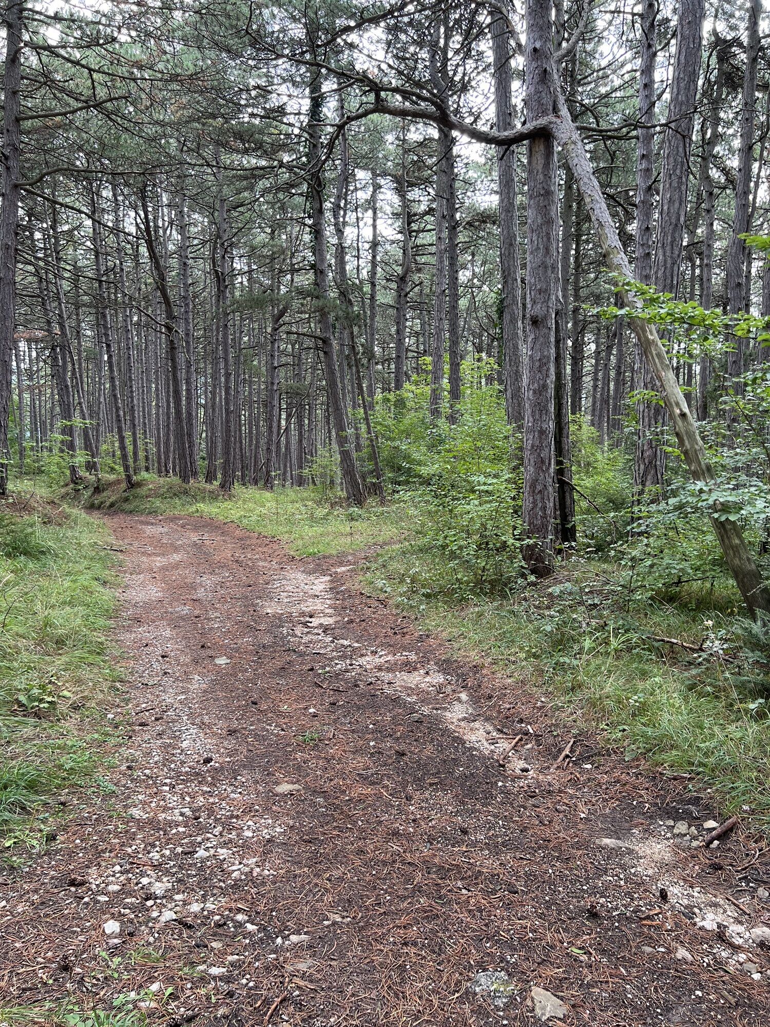


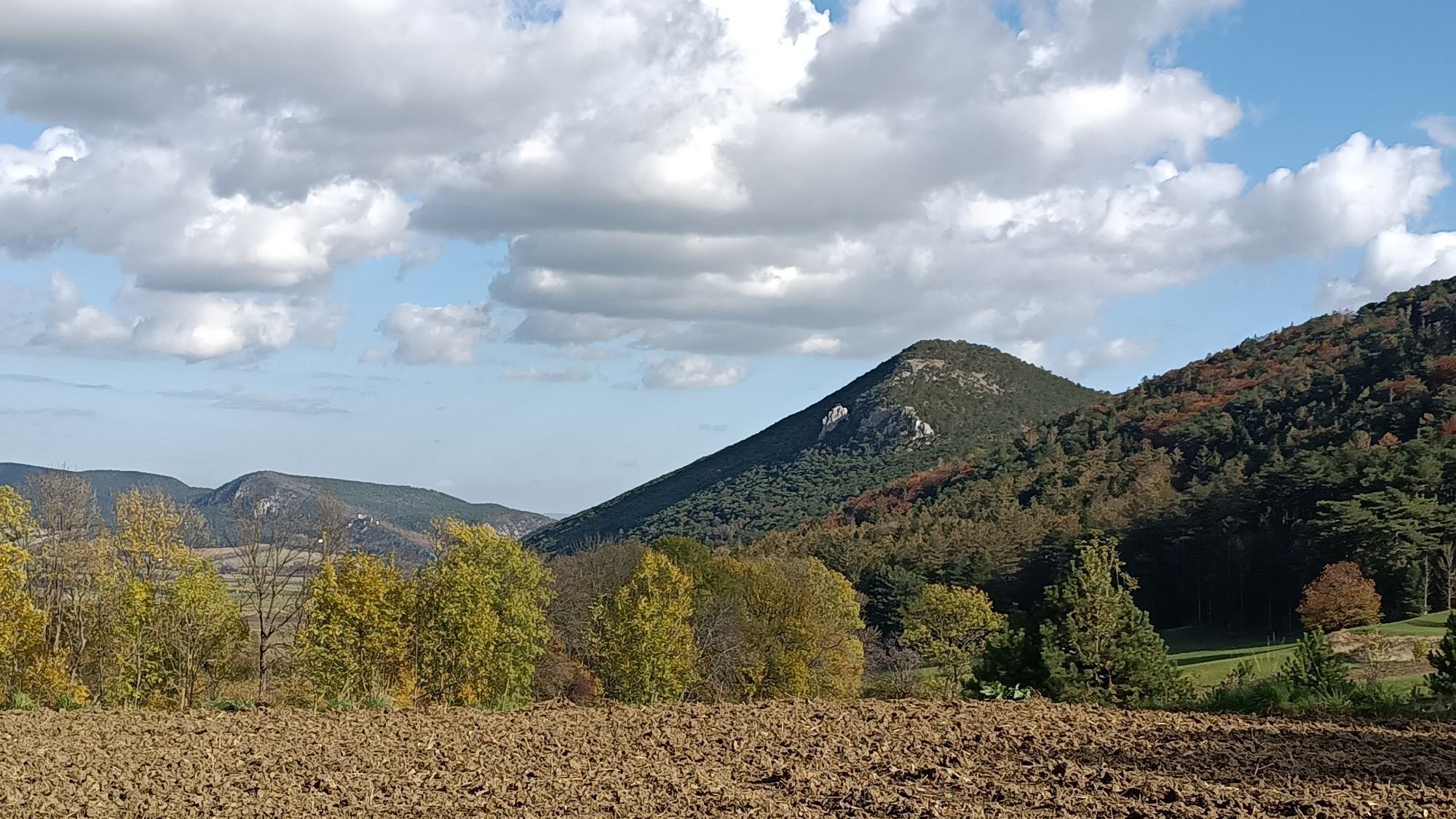


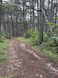
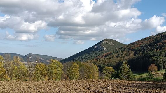
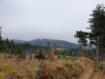
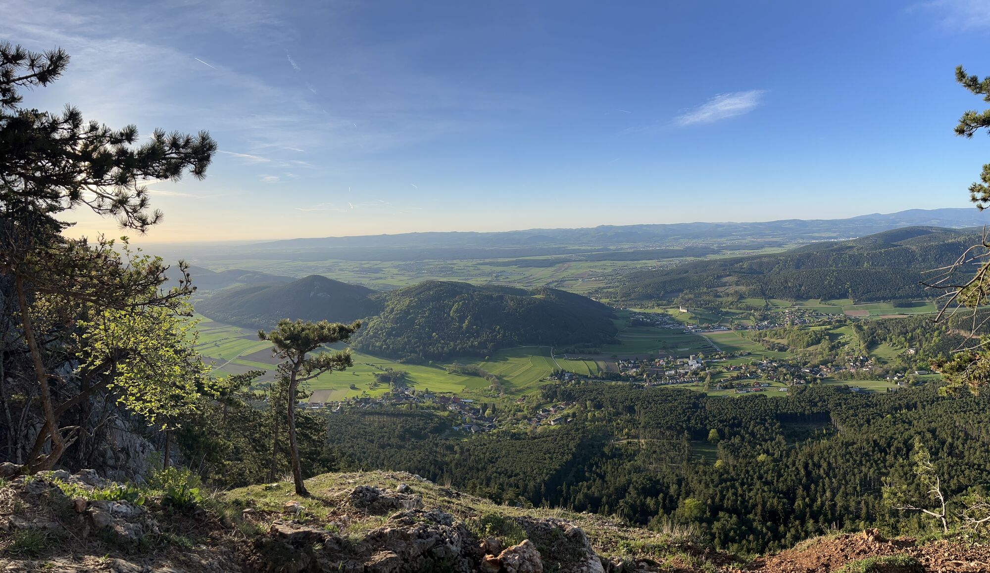
Starting from the small "Wanderparadies" parking area in Zweiersdorf, the trail leads directly towards the "Hohe Wand" (High Wall). Initially, the ascent is moderate. To avoid getting lost in the maze...
Starting from the small "Wanderparadies" parking area in Zweiersdorf, the trail leads directly towards the "Hohe Wand" (High Wall). Initially, the ascent is moderate. To avoid getting lost in the maze of trails, follow the signs pointing the way to the Hubertushaus. This hut, belonging to the Austrian Alpine Club, is located at an altitude of 946 meters and is the destination of the hike.
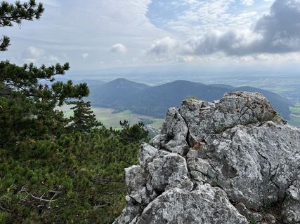
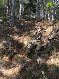
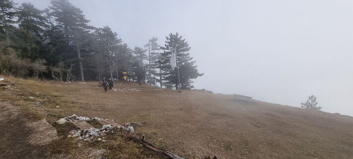
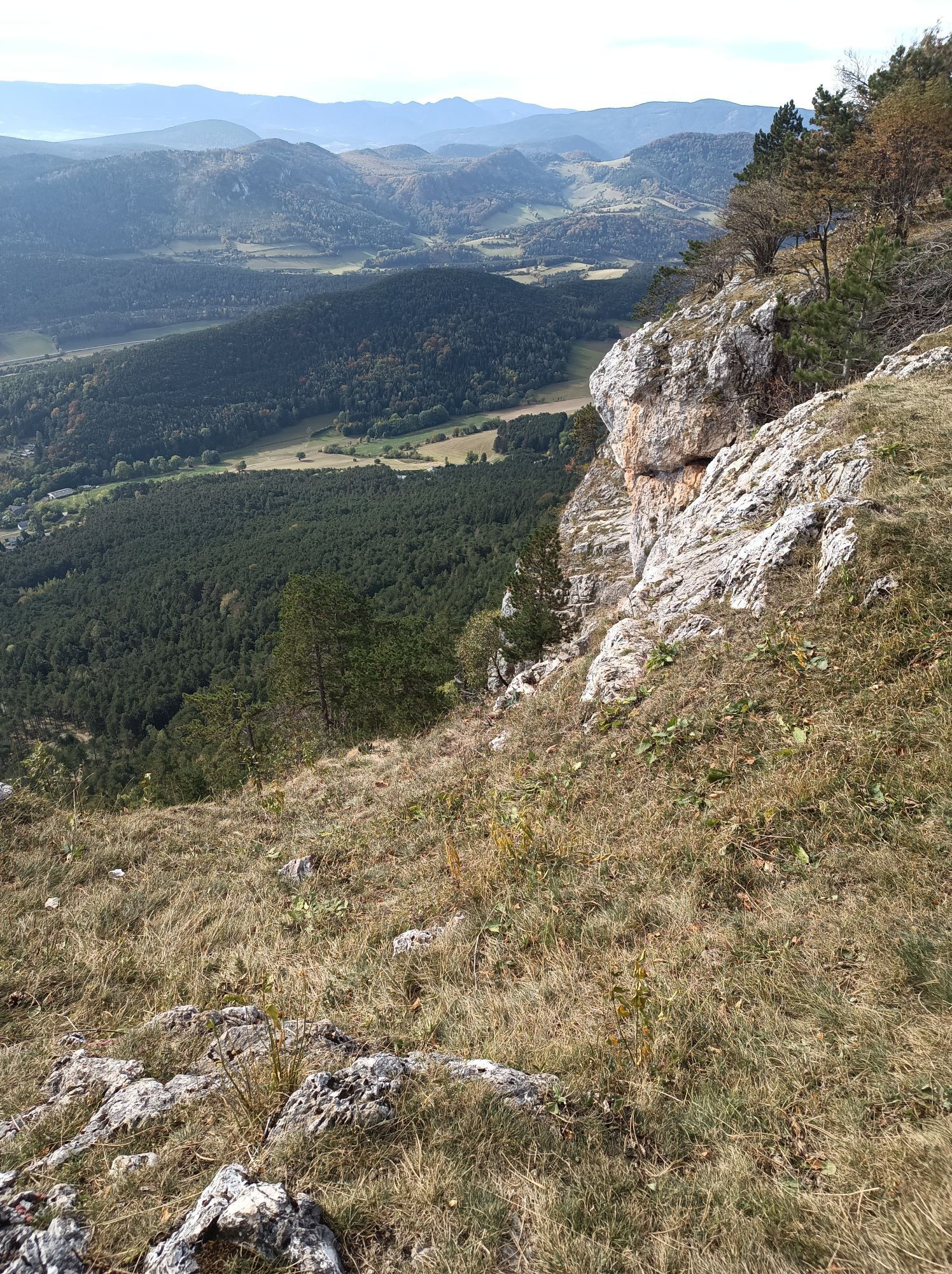
The shady forest thins out every now and then, offering glimpses of the approaching "Hohe Wand" (High Wall). The path presents no difficulties whatsoever. Only after a little over a kilometer (0.6 mi) and about 20 minutes does the trail become slightly steeper.
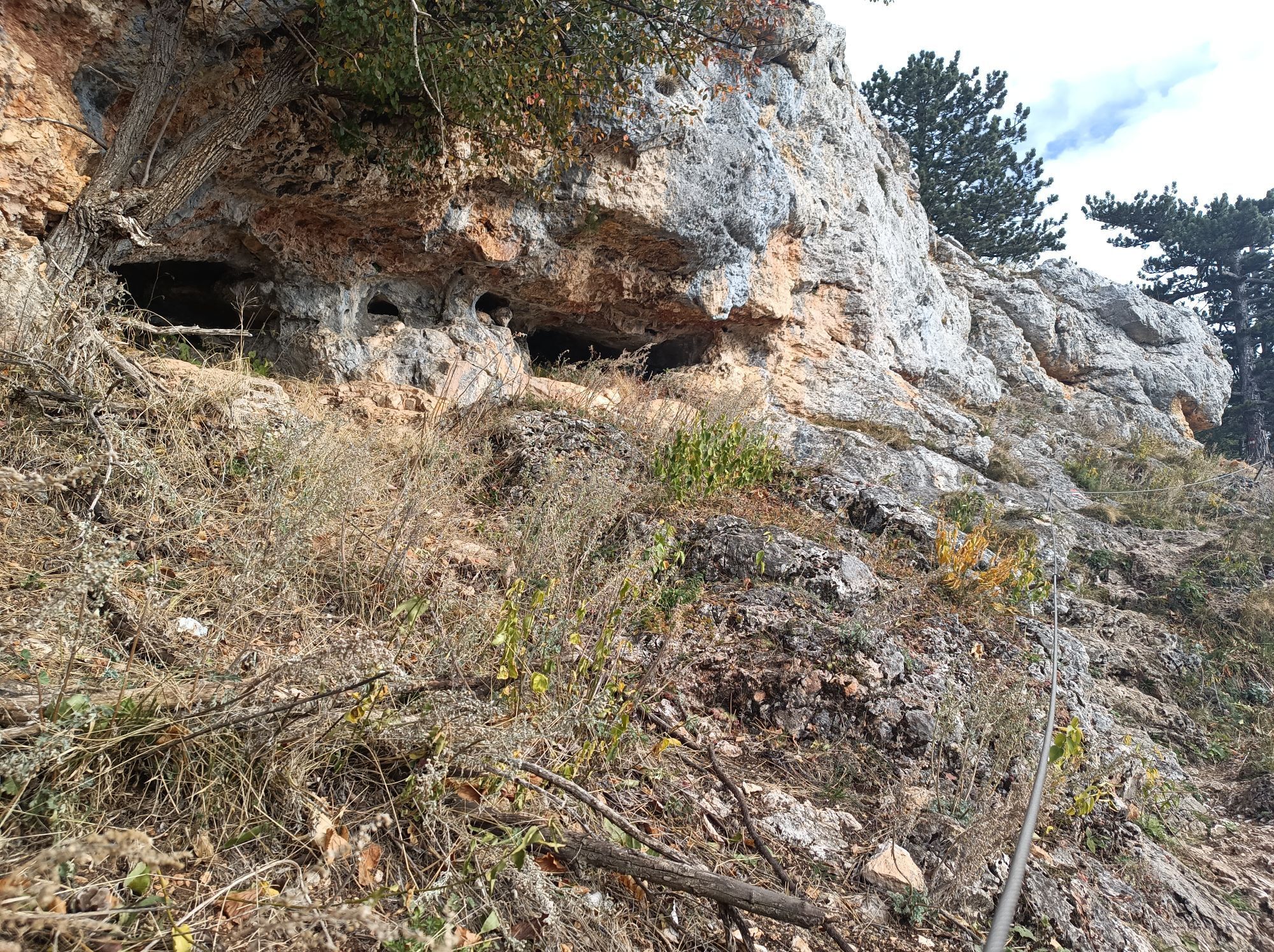
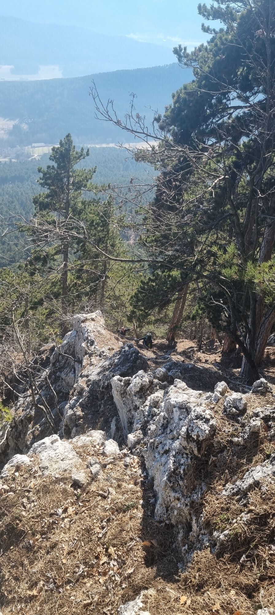
If you're out early in the morning, it's not unlikely you'll encounter a few ibex. These animals, which otherwise live in high alpine terrain, don't actually belong here. However, in 2003, three animals escaped from an enclosure, and since then the free-roaming colony has grown to a considerable number, presumably well over 70 animals. Because of these animals and the heavily frequented trails, it's advisable to put on a helmet once you reach the base of the cliffs.
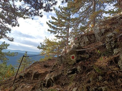
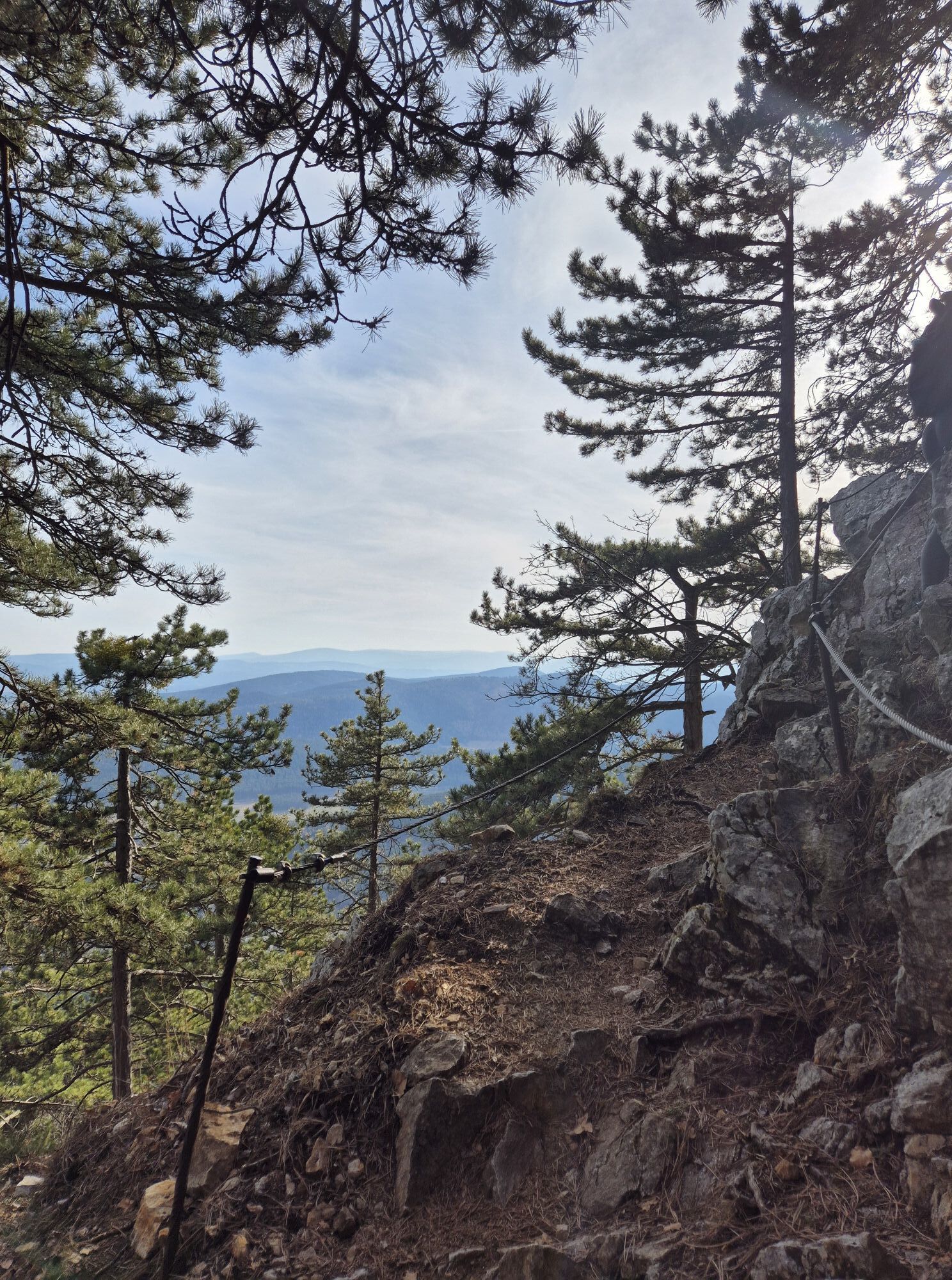
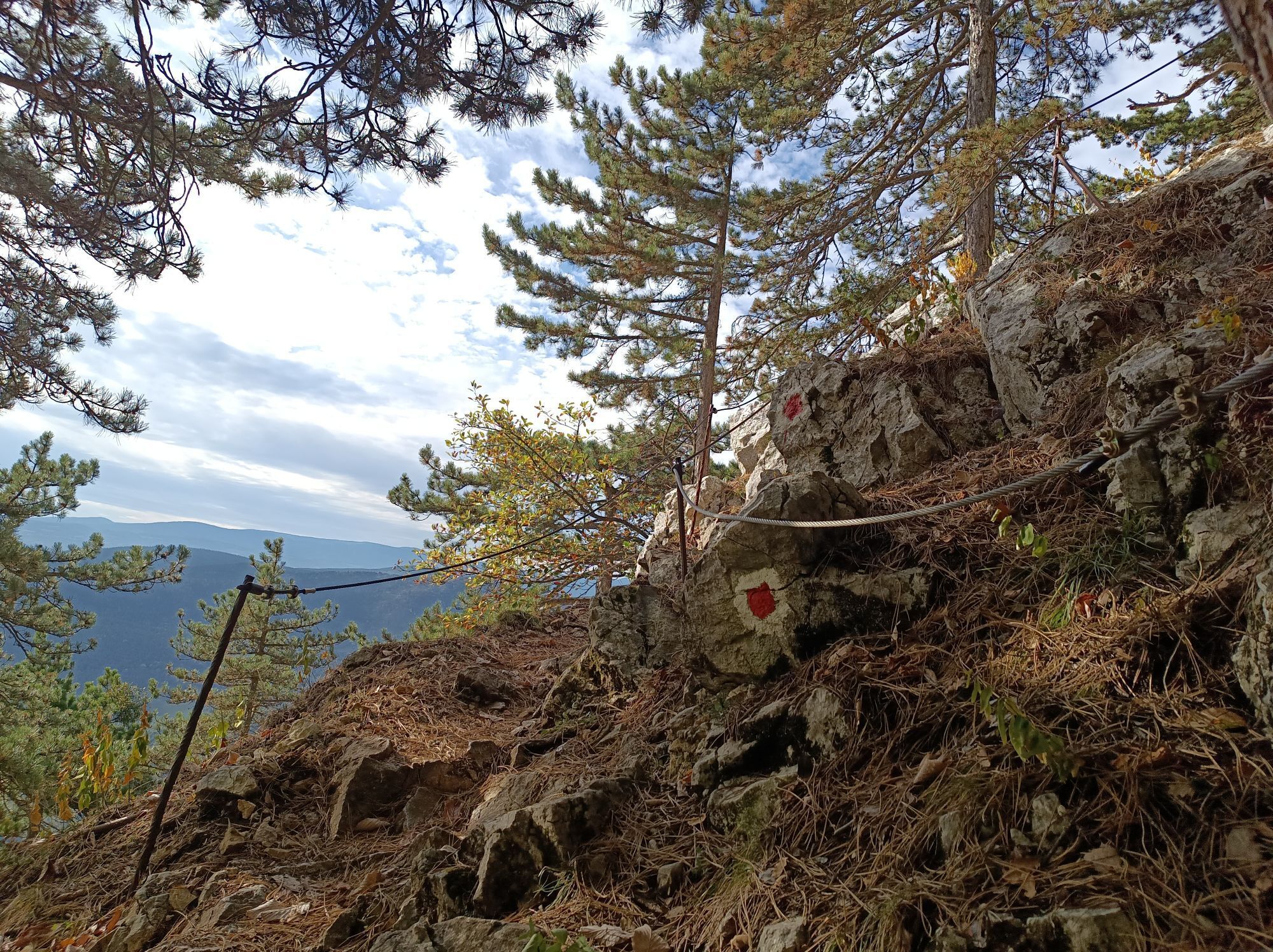
Springlessteig (A)
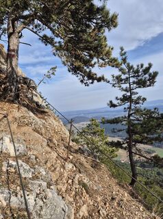
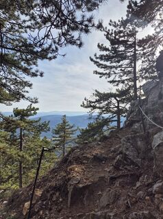
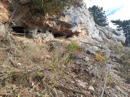
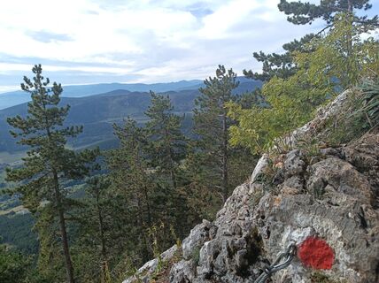
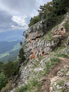
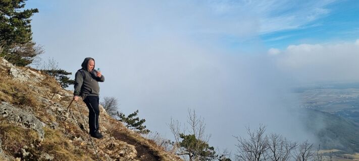
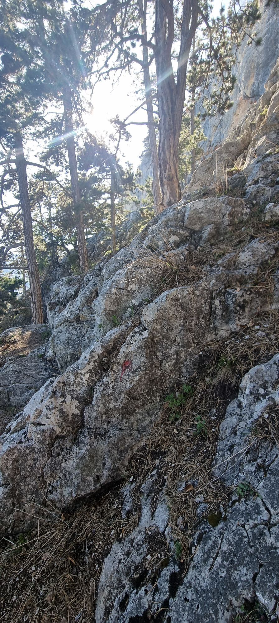
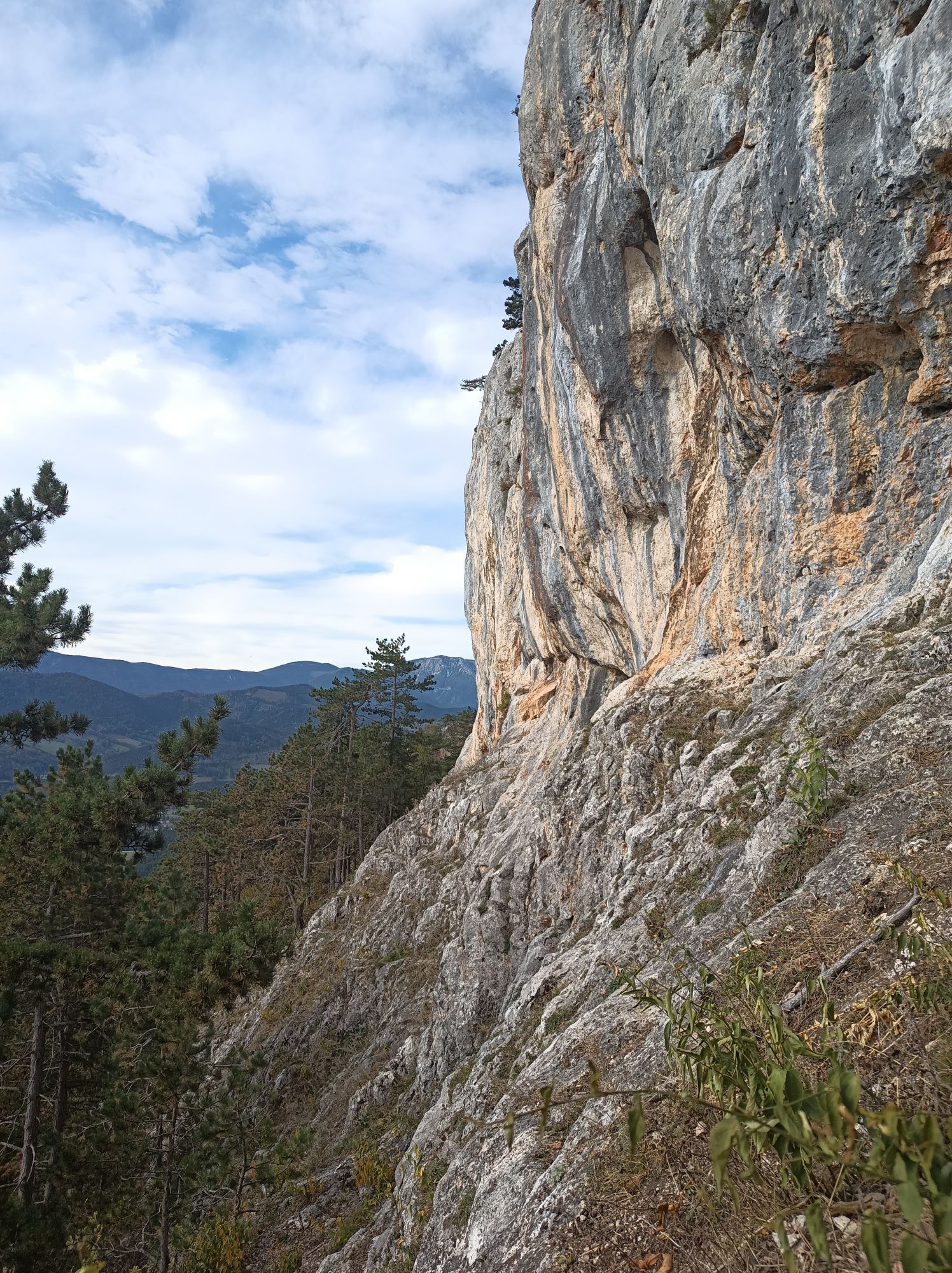
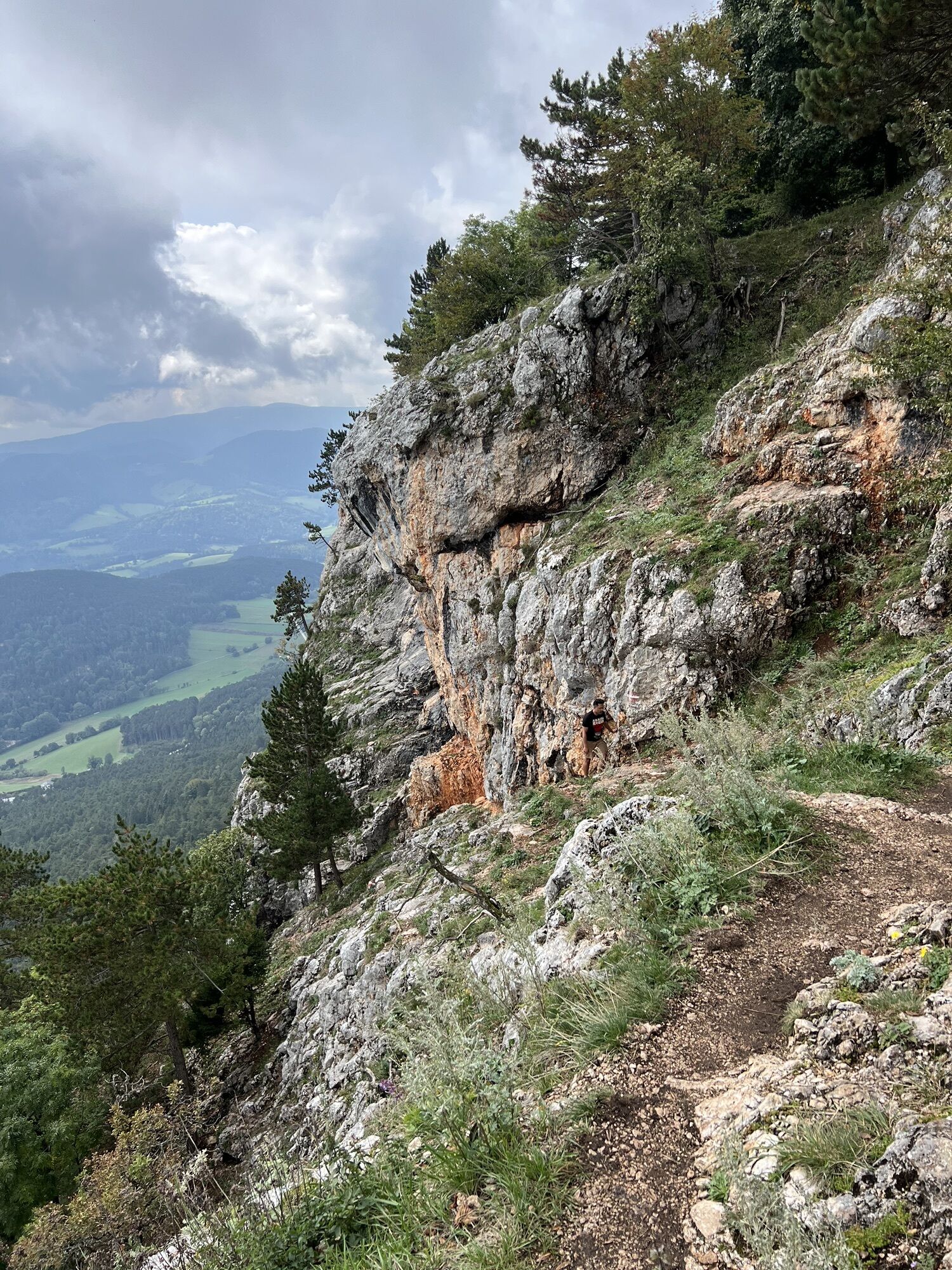
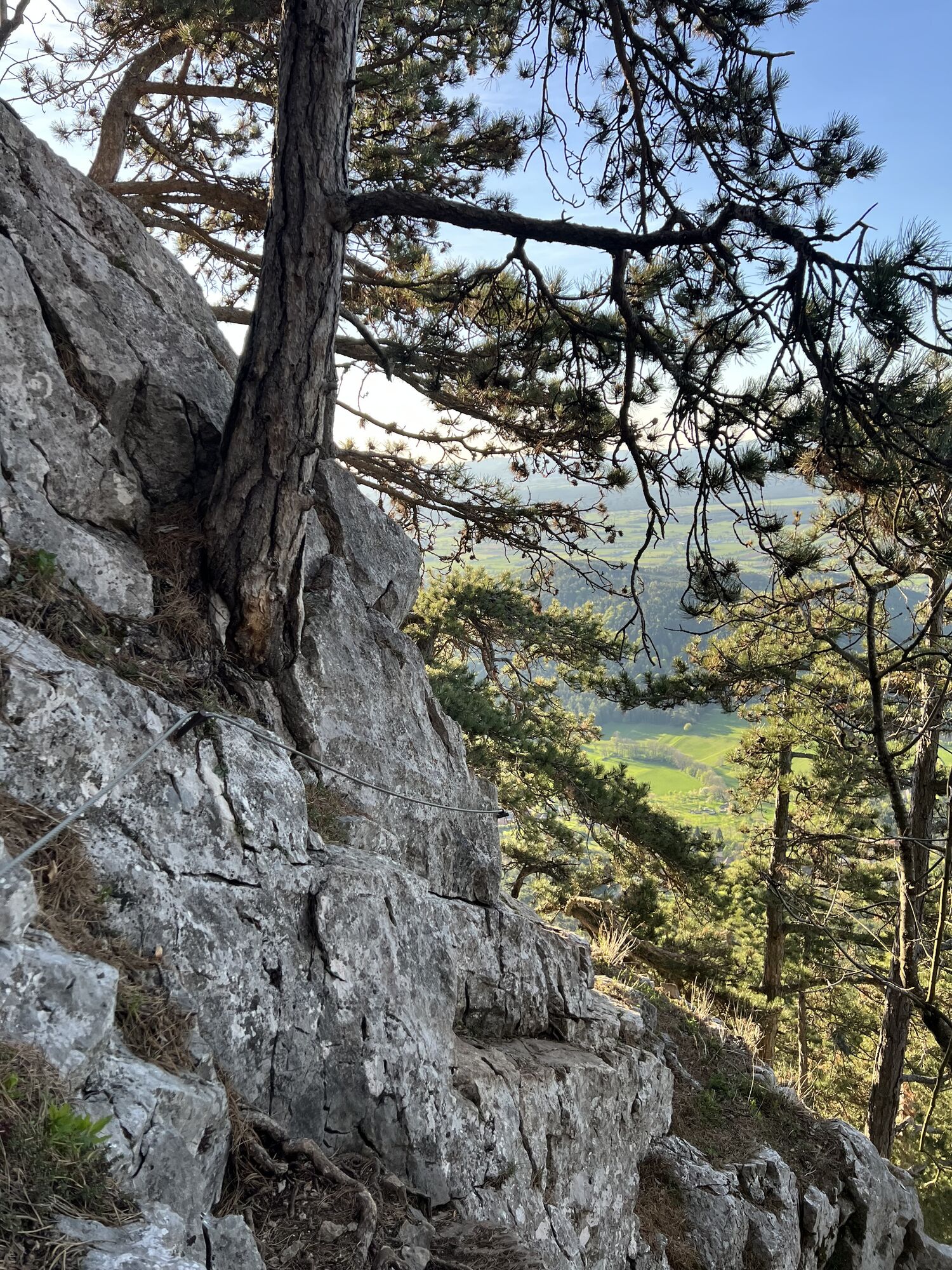
Finally, you reach the sections of the Springlessteig (A) trail secured with steel cables. However, these are never truly exposed and are usually traversed by experienced hikers without a via ferrata set but the sometimes very polished rock does require a certain degree of caution.
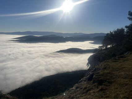
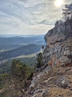
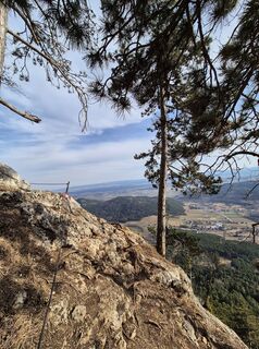
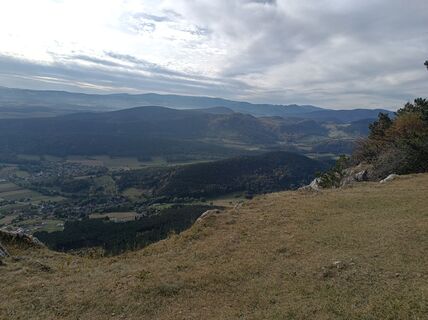
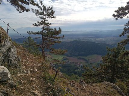
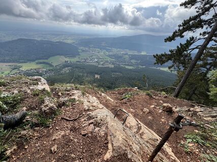
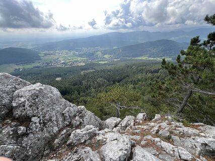
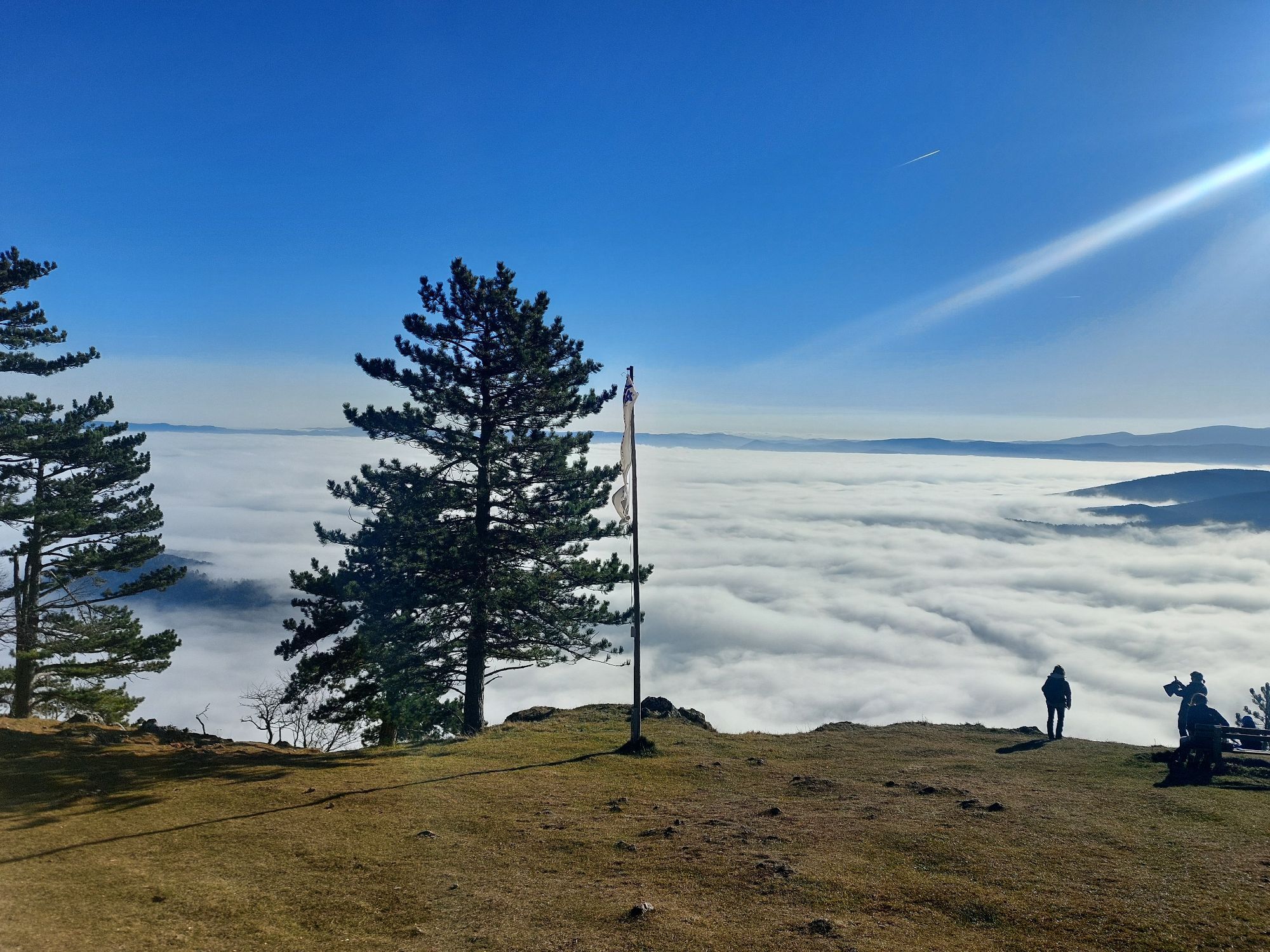
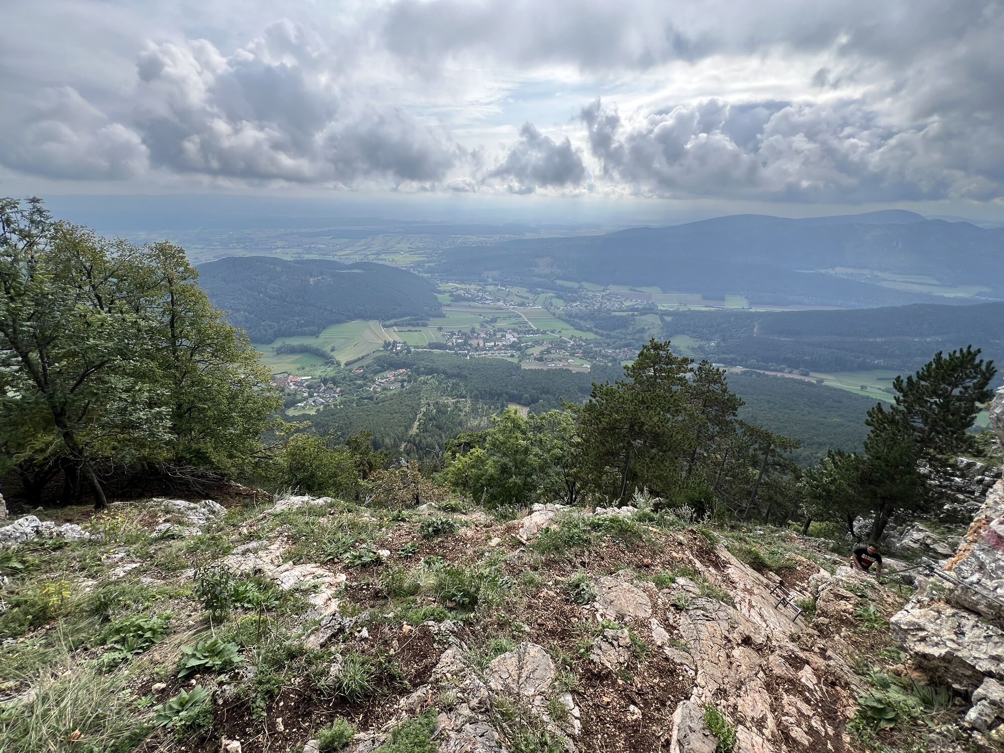
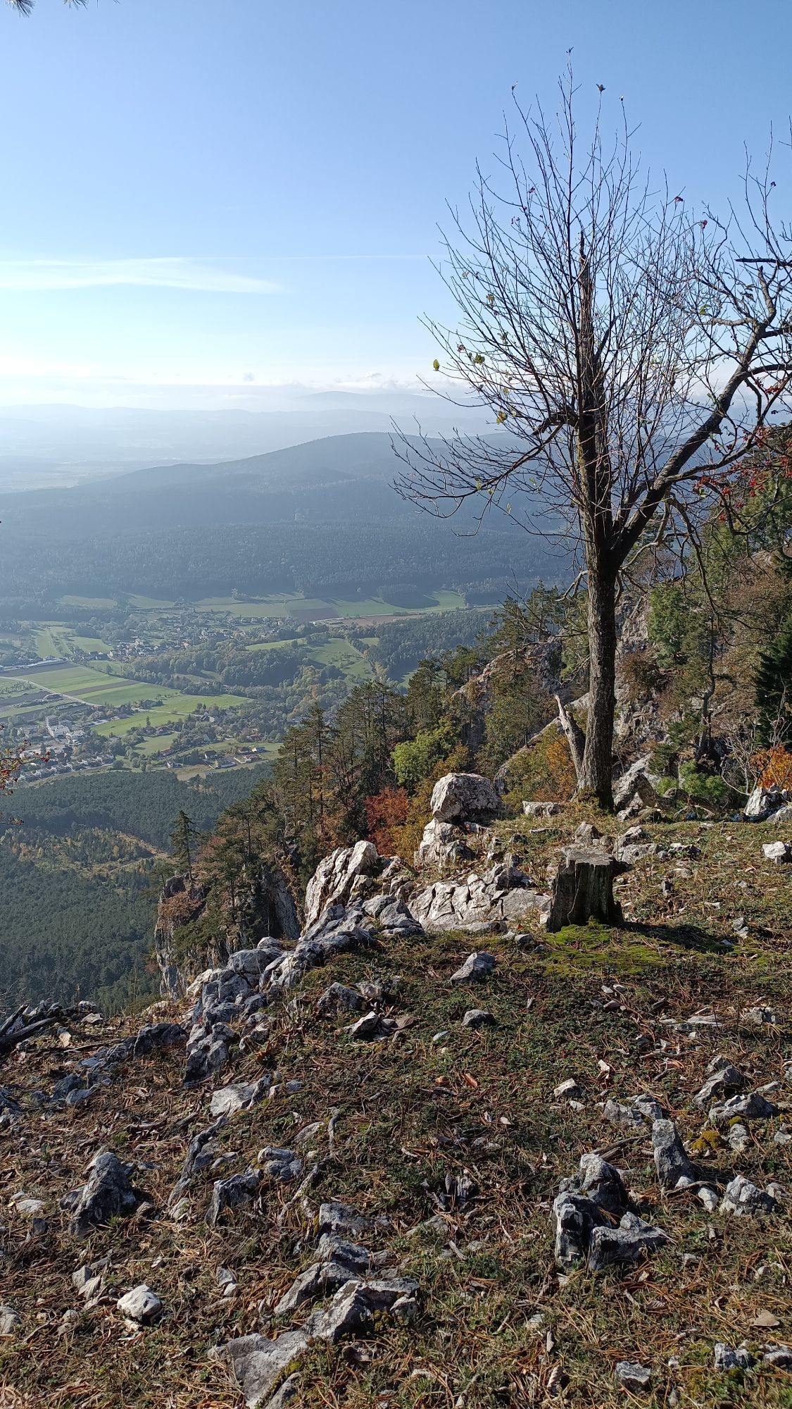
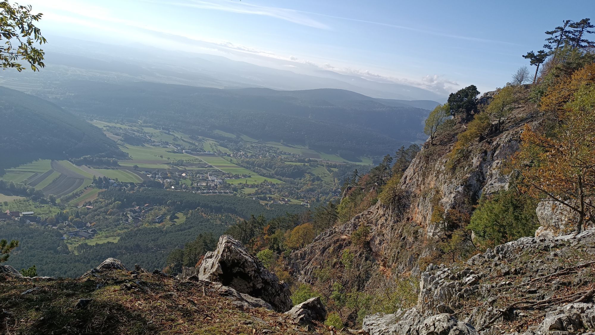
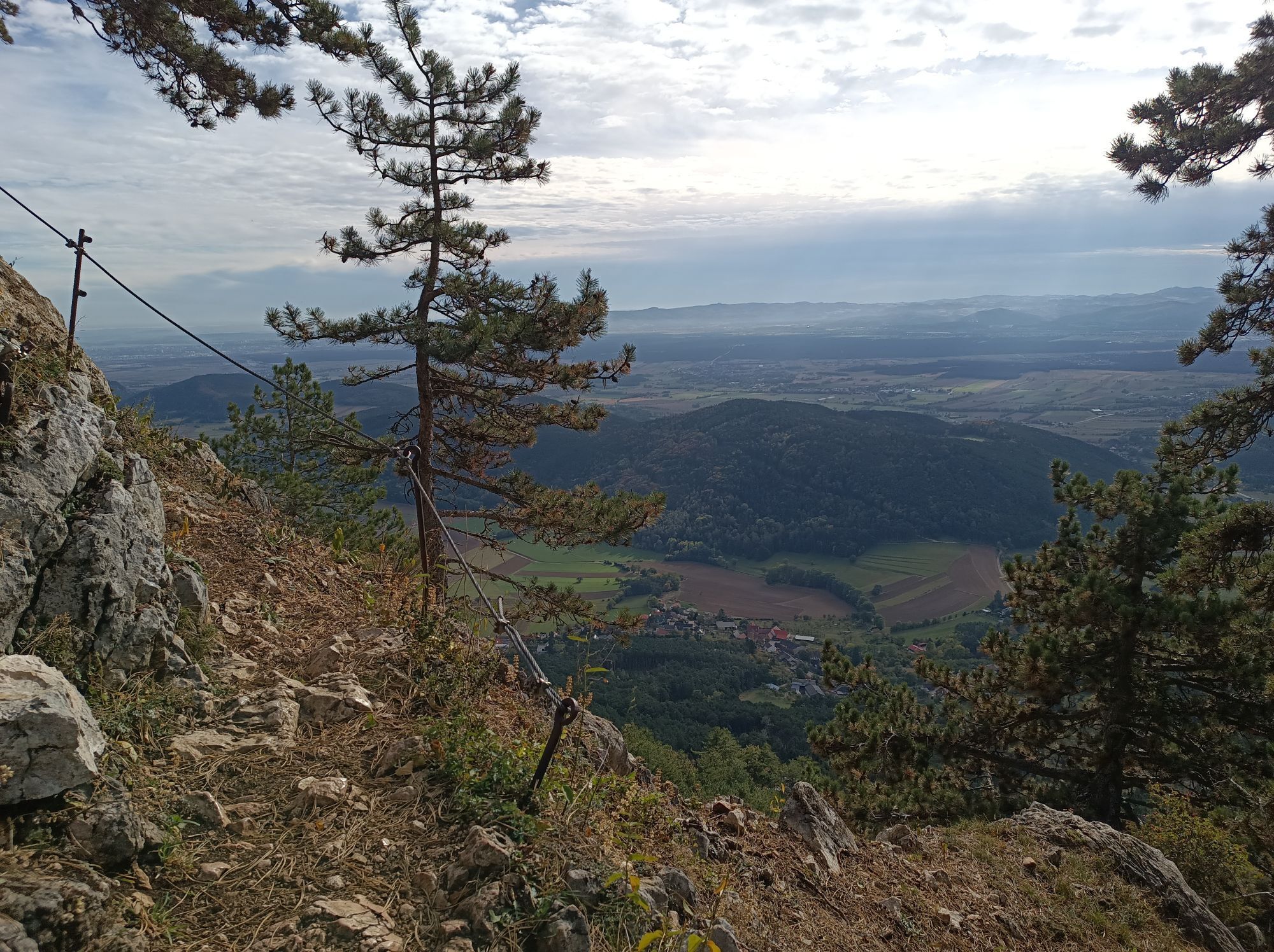
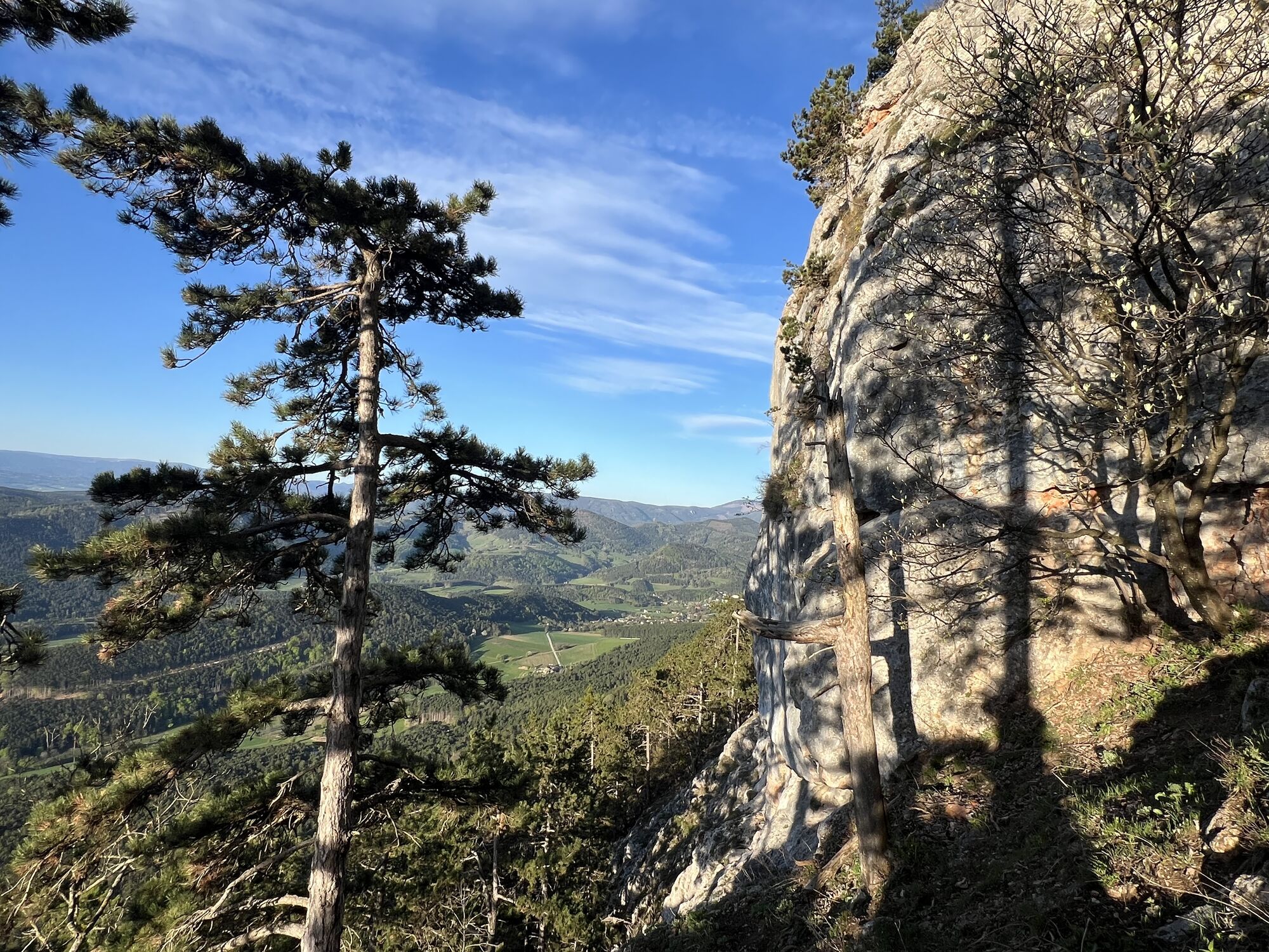
As you ascend, the via ferrata becomes increasingly impressive, leading upwards along a wide ledge and almost continuously secured with steel cables in the upper section. In addition, there is the panorama, which becomes more beautiful with every meter of altitude and should really be enjoyed from time to time.
An iron ladder must be climbed, and memorial plaques for mountaineers who have perished serve as constant reminders to exercise caution. Although the via ferrata is relatively easy, it is still an alpine route.
Steirerspur (C)
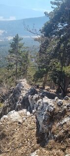
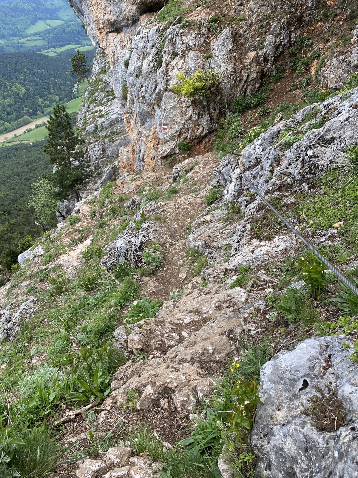
Eventually, the path turns left, and in the immediate vicinity of a memorial plaque for a father and son, the Steirerspur (C) branches off to the right. While the Springlessteig continues without difficulty to the edge of the plateau, the Steirerspur is a more challenging ascent. Once the via ferrata's steel cable is reached, the route becomes noticeably more exposed than the Springlessteig, running horizontally along the rock face.
The first slightly tricky section is a slab that requires downclimbing at difficulty level B. Shortly after, you reach the first junction of the climbing route, which was originally built for practice purposes. I take the left-hand branch. A steep gully leads upwards, requiring considerable effort to pull myself up the steel cable. The polished rock and the sparse footholds clearly demonstrate why the B/C to C rating is quite justified. It isn't long, however, before the edge of the plateau comes within reach and is finally achieved after about an hour.
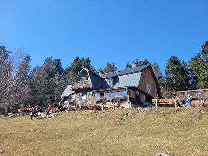
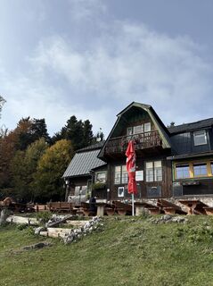
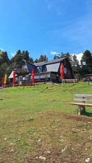
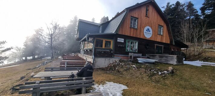
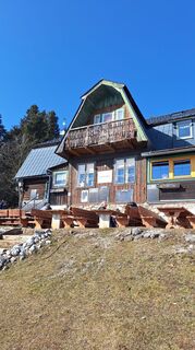
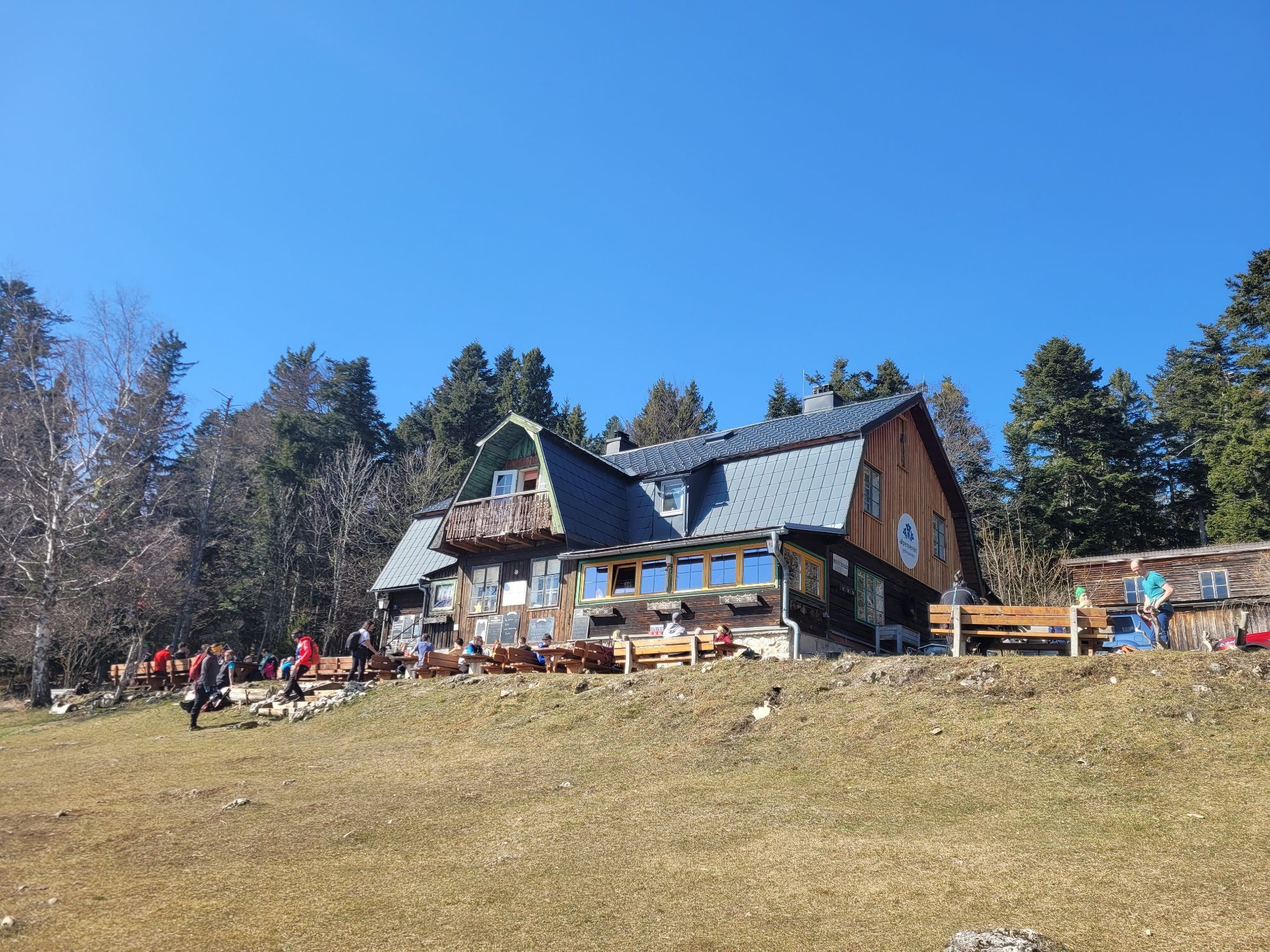
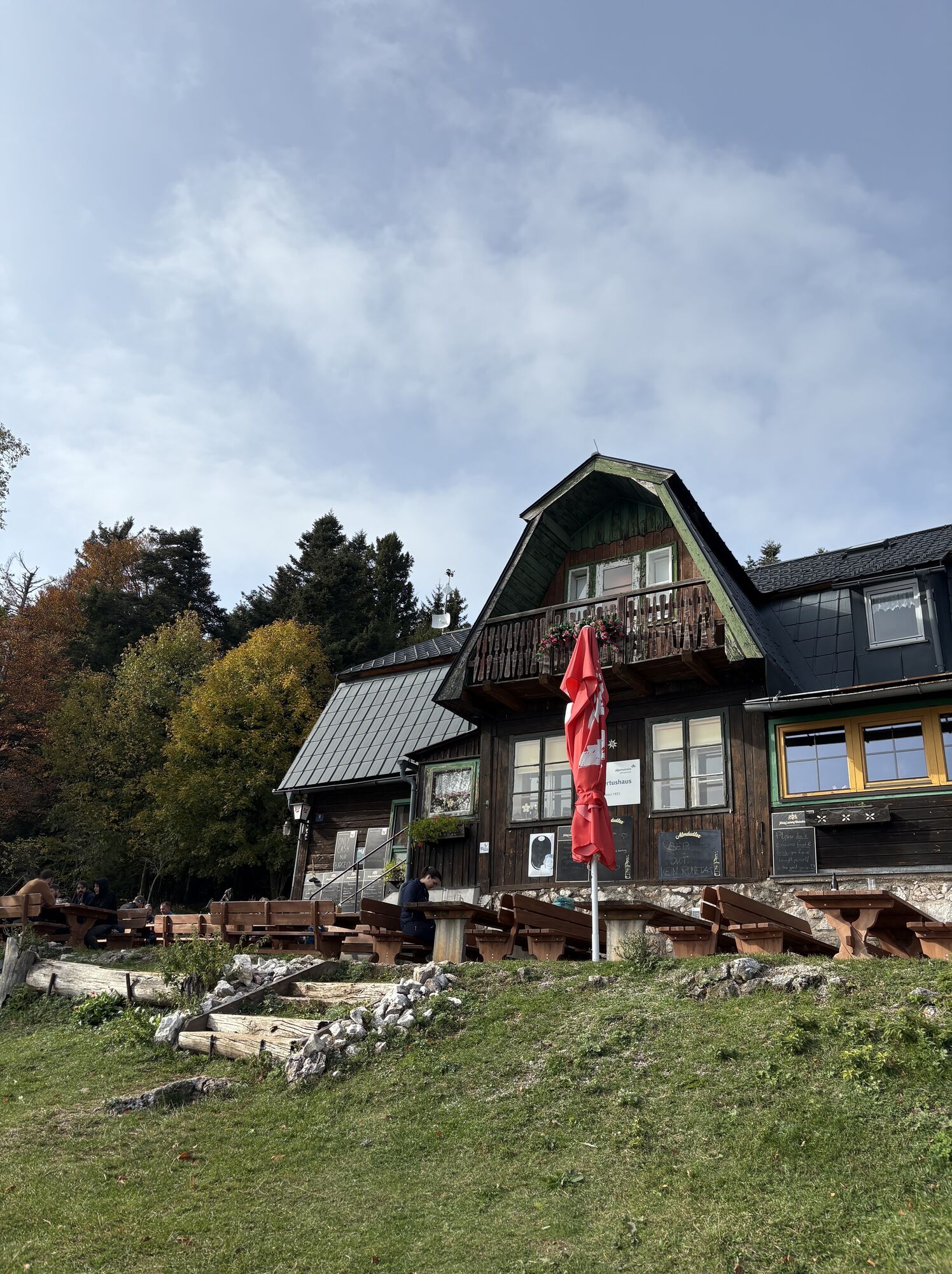
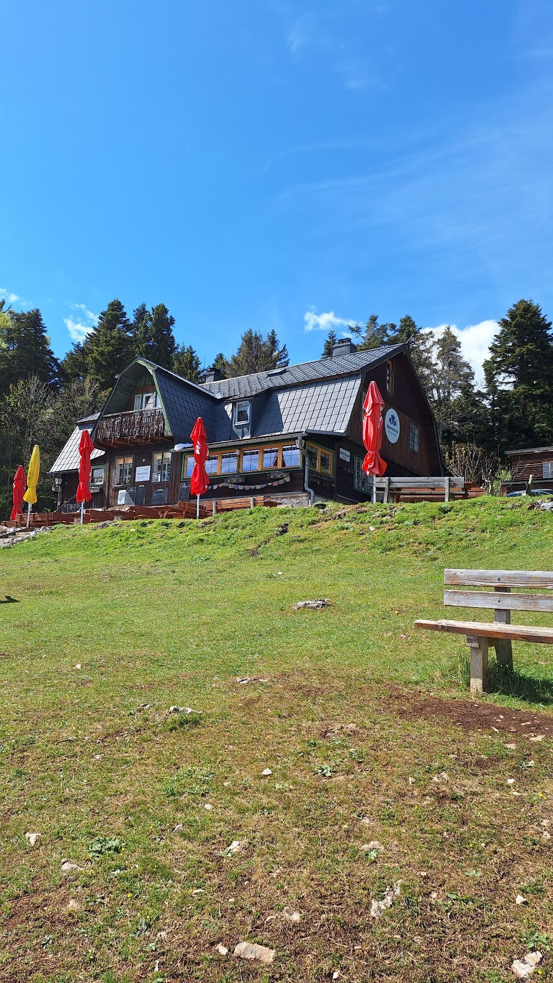
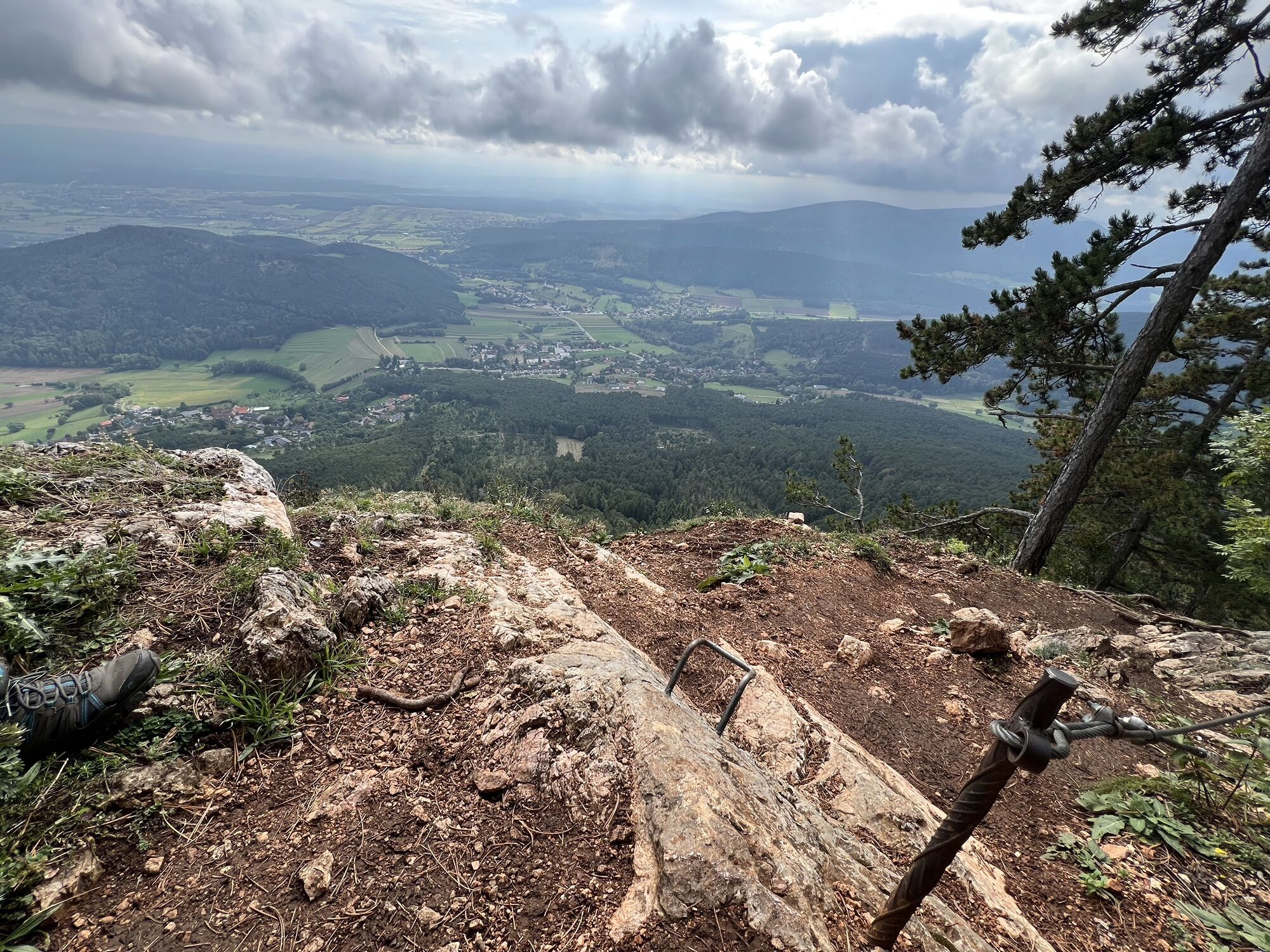
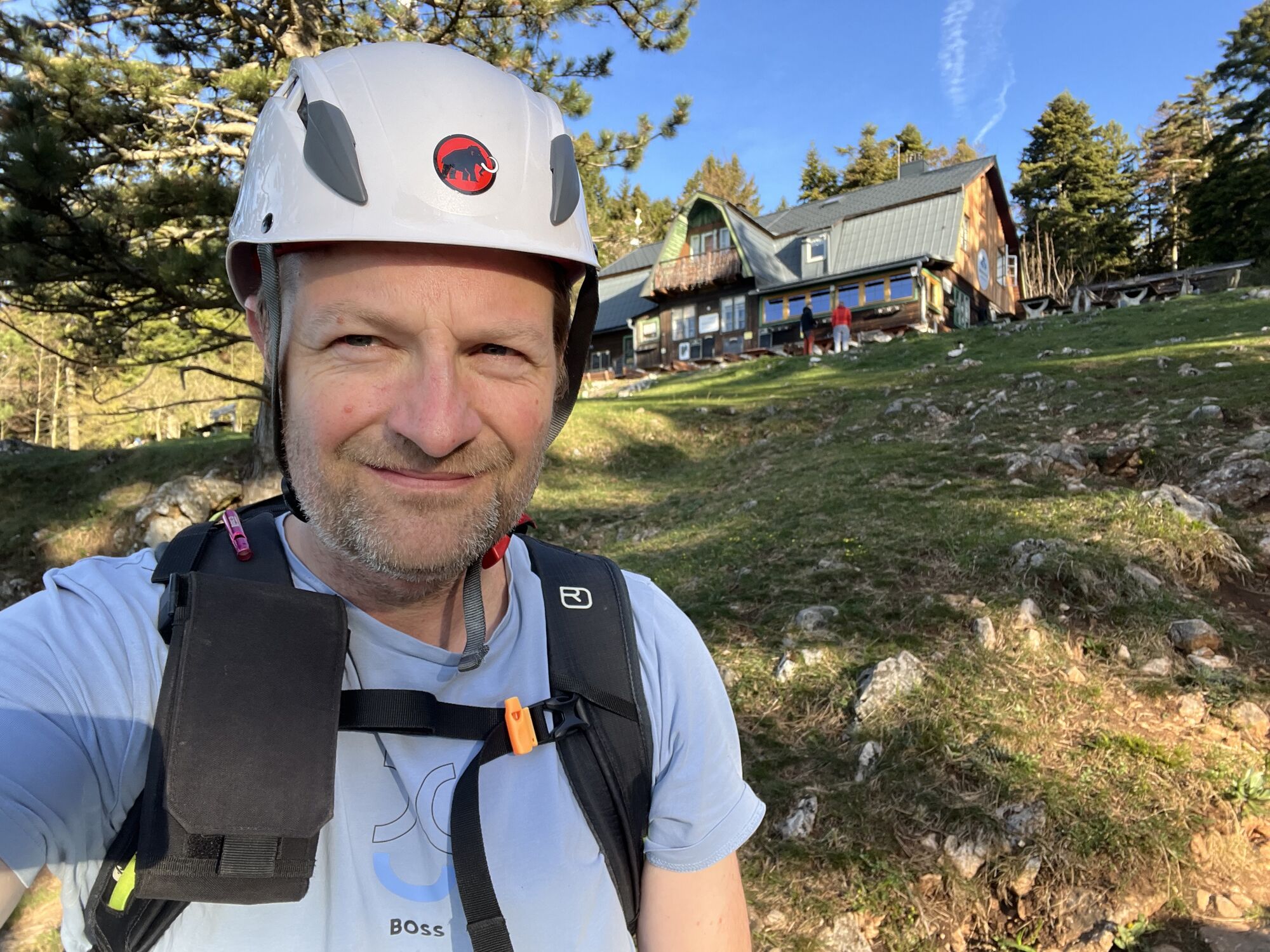
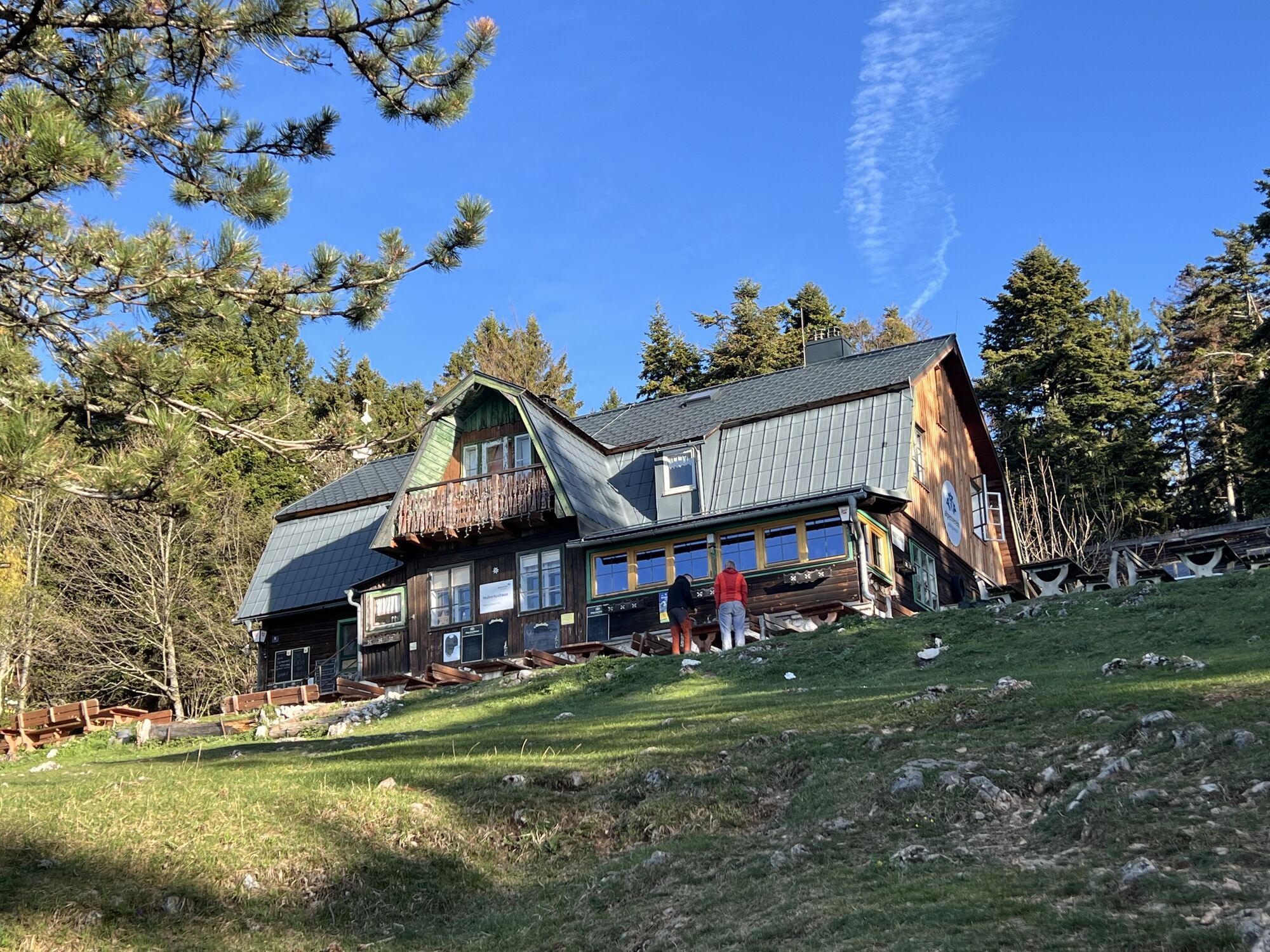
Hubertushaus (946 m / 3104 ft)
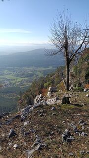
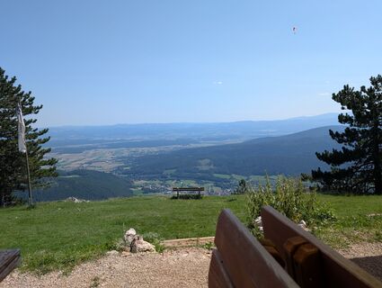
Upon reaching the plateau, the Hubertushaus (946 m) comes into view. This is a good opportunity to take a look at the hut, which is open almost year-round, enjoy some refreshments, and take in the magnificent view of the Vienna Basin. The Hubertushaus is also a suitable base for further exploration of the Steirerspur trail variations, including the challenging Robansersteig (D/E). Finally, the route leads back to the parking lot via the Springlessteig, largely following the ascent path, and is reached after about 30 minutes.
Conclusion
In conclusion, the tour was rather short but comparatively varied and offered stunning views. The Springlessteig, in particular, is suitable for the whole family, including children, although the latter should definitely wear a via ferrata set and, if necessary, belayed by an adult.


Easier variant (B) of the Steirerspur to the plateau or the branch from the Steirerspur to the significantly more difficult Robanser via ferrata (D/E)
Hubertushaus
Sí
Rockfall helmet and possibly a via ferrata set
Parking lot "hiking paradise" in Zweiersdorf
Webcams del recorrido
Rutas populares en los alrededores
-
4,8
Flatzer Wand Wanderung
luzSenderismo 5,62 km -
4,8
Hohe Wand: Babygrat (1+), Rundwanderung und Wagnersteig (A)
pesadoSenderismo 11,8 km -
4,8
ÖTK Klettersteig (vormals HTL Klettersteig) und Blutspur (D/E)
pesadoVía ferrata 1,41 km -
4,8
Hohe Wand Wagnersteig - Springlessteig
medioSenderismo 5,59 km -
4,6
Prigglitz - Pottschacher Hütte - Rote Wand - Prigglitz
luzSenderismo 8,80 km -
4,6
Grünbach - Eselsteig - Geländ
luzSenderismo 5,22 km -
4,6
Bergstation Hochschneeberg - Klosterwappen - Bahnhof Puchberg am Schneeberg
medioSenderismo 16,8 km -
4,6
"Waxriegel 1888m" - Schneebergdörfl - Niederösterreich / Österreich
luzSenderismo 14,2 km -
4,5
Johannesbachklamm - Würflach
medioSenderismo 11,3 km -
4,5
Hohe Wand: Frauenlucke und Völlerin
medioSenderismo 1,90 km

Senderismo y rastreo


No se pierda las ofertas y la inspiración para sus próximas vacaciones
Su dirección de correo electrónico se ha añadido a la lista de correo.