


The Branica Valley
Fotos de nuestros usuarios
The trail begins in the old city center, adorned as it is by the baroque Lanthieri mansion. Starting on the main road, the first part heads east towards Podnanos. After a while on flat terrain you will...
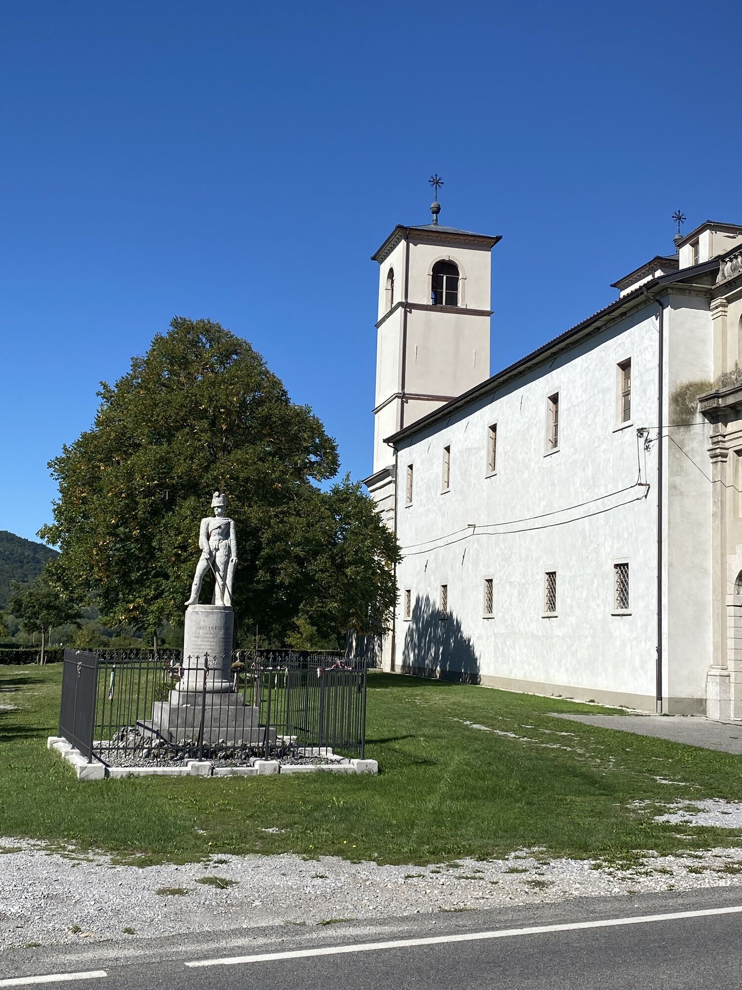
The trail begins in the old city center, adorned as it is by the baroque Lanthieri mansion. Starting on the main road, the first part heads east towards Podnanos. After a while on flat terrain you will come across an intersection, which you will take right towards Štanjel. Once in the village of Manče you will have a brief climb leading up to the turnoff for Goče, and if you will like it, you can leave the trail to climb further up to this village. Goče is one of the oldest and one of the most picturesque villages in Vipava, home to more than 60 stone wine cellars. After the turnoff for Goče you will start your descent toward the Branica Valley. Right after Trebižani the road veers right towards Branik. Follow the main, quiet road past orchards, vineyards, and fields until you get to the Štanjel–Branik road, which you will take towards Branik. Soon Rihemberk castle comes into view, one of the biggest and most well-preserved castles in this part of Slovenia, built above the village of Branik. Continue along to Dornberk, where you will take a right towards Ajdovščina. Cross the Vipava River before you get to Zalošče, where a short and undemanding climb will put you at the top of the village. Selo is your next milestone, where you will get back onto the main road from Nova Gorica to Ajdovščina. We recommend driving through the center of Ajdovščina, where among other attractions you will enjoy the well-preserved ruins of the Roman fortress Castra. After leaving Ajdovščina your next stop will be Budanje, home to the pilgrimage church of Mary Our Lady of Consolation. The Zemono Manor House is also found a little bit further ahead, elevated above the main road and located at the end of a paved promenade. Zemono is also home to the well-known restaurant “Pri Lojzetu”. You can take a walk around the manor house and treat yourself to a beautiful view of the upper Vipava Valley. From Zemono you’ll head down a back road leading to Vipava, where your cycling journey will have come to an en


Rutas populares en los alrededores
-
3,7
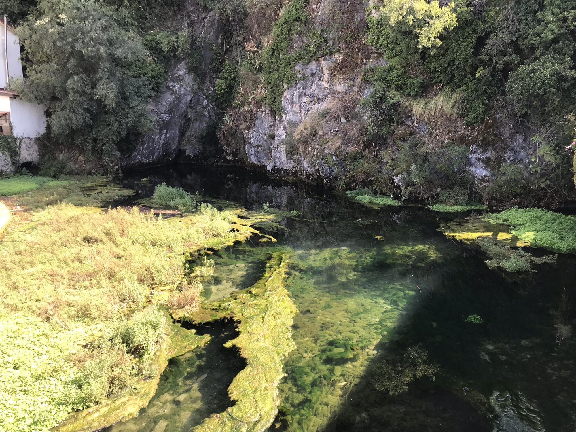
Recorrido hacia el puente natural de piedra Skozno
luzSenderismo 5,62 km -
4,0
La ventana natural Otlica
medioSenderismo 10,5 km -
Gradiška Tura (via ferrata) – Abram
pesadoVía ferrata 11,9 km -
5,0
Camino por el borde
luzSenderismo 14,5 km -
Educational Trail along the River Hubelj
luzSenderismo 3,79 km -
Carsus Trail: sendero de gran recorrido por la región kárstica de Eslovenia e Italia
medioSendero de largo recorrido 102,2 km -
2,0
The Upper Vipava Valley
luzCiclismo 34,2 km -
Camino circular Skrlanka
luzSenderismo 5,75 km -
Por los caminos de Vertovec
luzSenderismo 17,7 km -
Ruta circular de Vitovlje
medioSenderismo 7,80 km

Senderismo y rastreo


No se pierda las ofertas y la inspiración para sus próximas vacaciones
Su dirección de correo electrónico se ha añadido a la lista de correo.