4 peak tour at the Glungezer panoramic trail

Senderismo

© Tourismusverband Region Hall-Wattens - Hall Wattens
- Breve descripción
-
At the distance from the Zirbenweg we take this beautiful and quite trail with views down to the Viggartal
- Dificultad
-
difícil
- Valoración
-
- Ruta
-
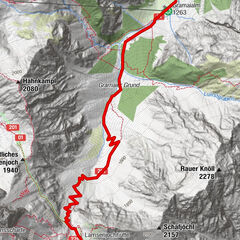
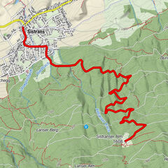
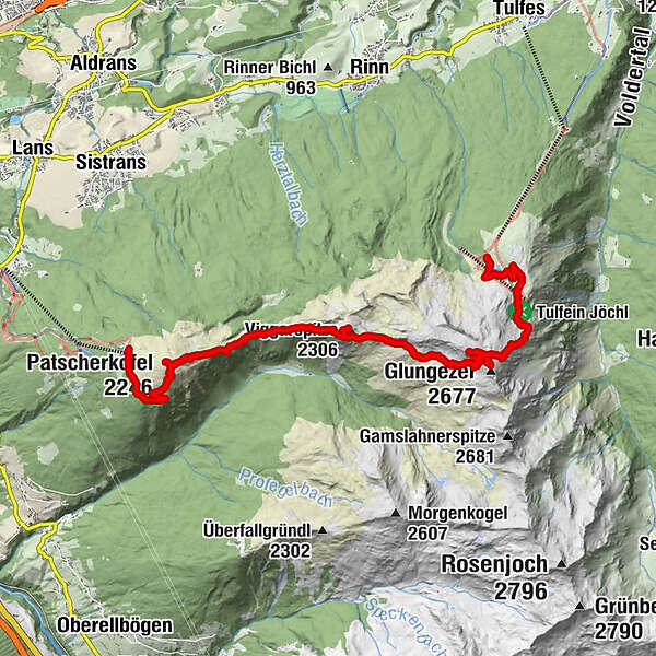
Patscherkofel Schutzhaus0,0 kmPatscherkofel (2.246 m)2,3 kmBoscheben3,9 kmViggarspitze (2.306 m)6,2 kmSonnenspitze (2.639 m)9,7 kmGlungezer (2.677 m)10,4 kmGlungezerhütte10,6 kmTulfeinjöchl12,2 kmSpielplatz Zirbensee13,8 kmTulfein Alm14,3 km
- La mejor temporada
-
enefebmarabrmayjunjulagosepoctnovdic
- Punto álgido
- 2.658 m
- Punto final
-
Glungezer
- Perfil alto
-

- Autor
-
La gira 4 peak tour at the Glungezer panoramic trail es utilizado por outdooractive.com proporcionado.
GPS Downloads


Más circuitos por las regiones