Iseltrail Stage 3
medio
Consigue este tour en tu móvil
Iseltrail Stage 3
medio
Senderismo
16,96
km
Escanee el código QR e inicie la navegación en la aplicación bergfex

Senderismo y rastreo


Iseltrail Stage 3
medio
Distancia
16,96
km
Duración
05:30
h
Ascenso
545
m
Nivel del mar
932 -
1.314
m
Descarga de pistas
Iseltrail Stage 3
medio
Senderismo
16,96
km

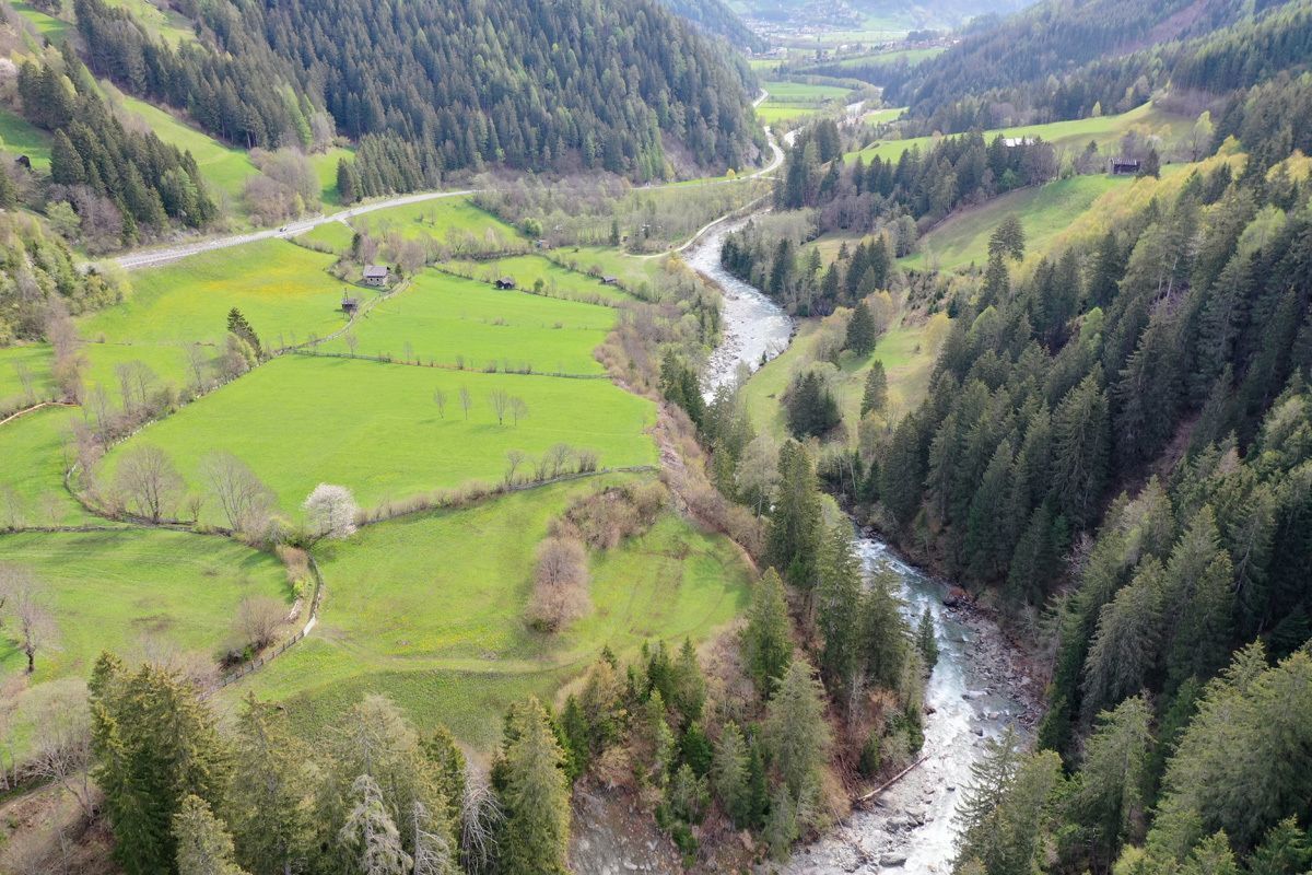
After the Matrei basin, the valley narrows and the Isel shows its impetuous side: massive cataracts and partly inaccessible gorge wilderness under steeply towering mountains. The Iseltrail initially leads...
Descripción de la
After the Matrei basin, the valley narrows and the Isel shows its impetuous side: massive cataracts and partly inaccessible gorge wilderness under steeply towering mountains. The Iseltrail initially leads you mainly through forests on the shady side of the valley, which promises pleasant, cool forest and mountain air on hot summer days. Again and again you can refresh yourself at the crystal-clear streams that cross the path.
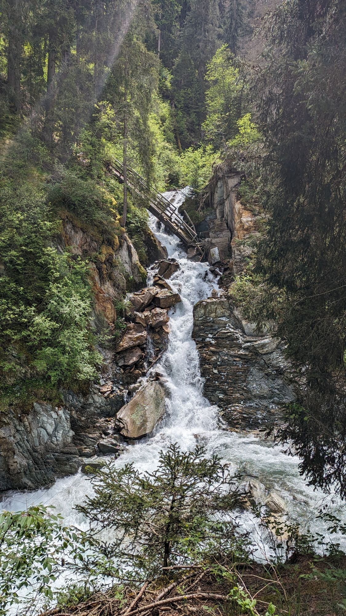
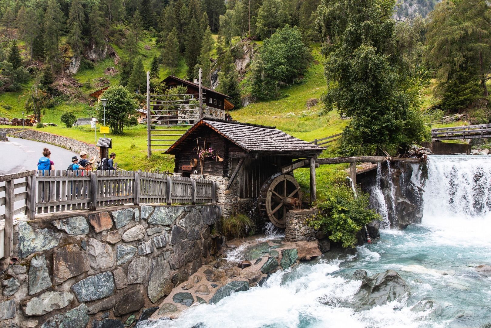
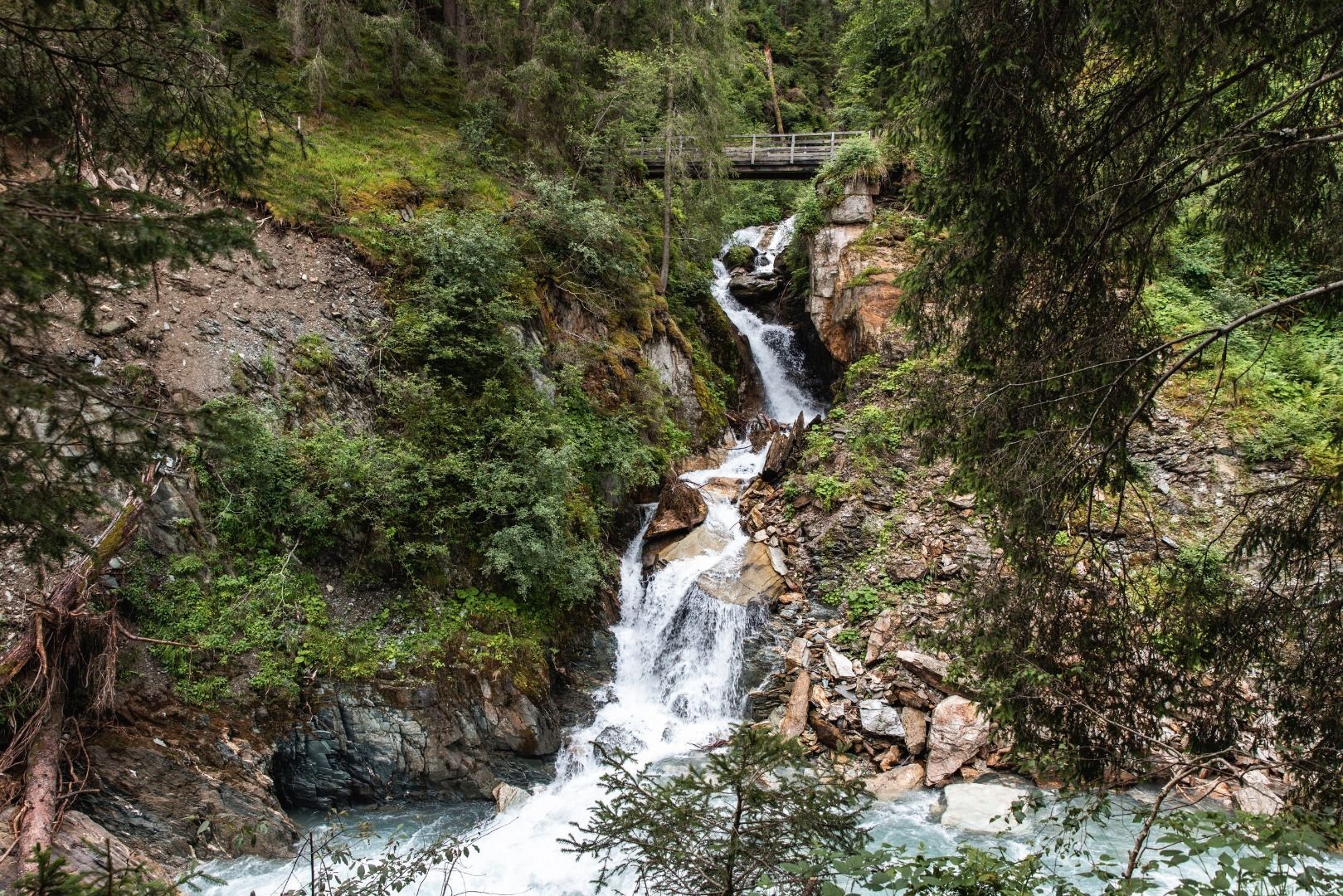
An impressive, lonely forest gorge hides below Virgen, where the Virgen cataract thunders down to the valley over several steps.
The mountain village Virgen nestles into the southern slope of the valley "Virgental" (which is still the Iseltal) dominated by meadows and hedges. A detour through the village is definitely worthwhile: picturesque vantage points, historic farms, the pilgrimage church of Maria Schnee (in the district Obermauern) and delicacies in the local inns will reward you handsomely. Virgen also offers camping facilities.
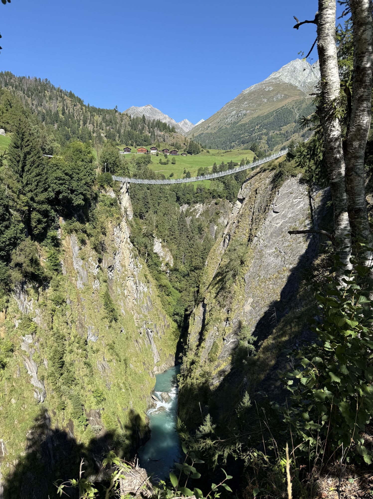
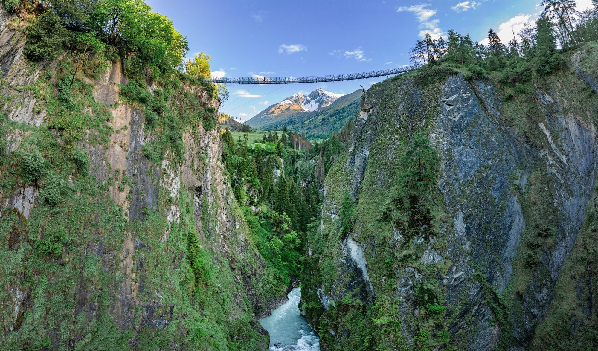
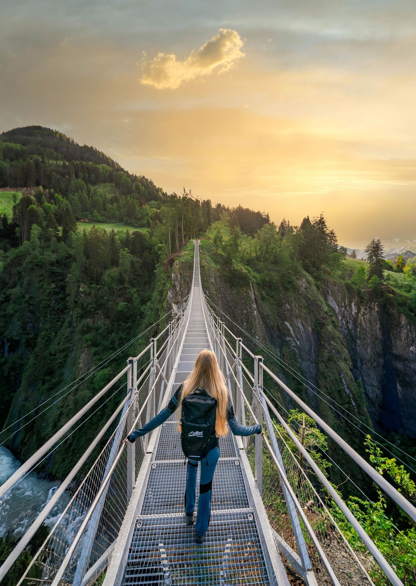
The trail up the valley then leads you to the edge of the dramatic and pathless gorge Iselschlucht between Welzelach (inn) and Bobojach (catering, accommodation). The almost one-kilometre-long canyon is of extraordinary scenic beauty. Deep down in the gorge you can hear the Isel raging. The Iseltrail offers some insights into this remote primeval landscape. To make it even easier to experience the magnificent wilderness, a new suspension bridge was built over the Isel Gorge, complete with a photo point and a viewing platform.
Above the Iselschlucht, the river (temporarily) calms down again. Meadows line its course on the sunny side.
Shortly before Prägraten you can relax at a "Gries", a stretch of beach, and dip your feet in the water ...
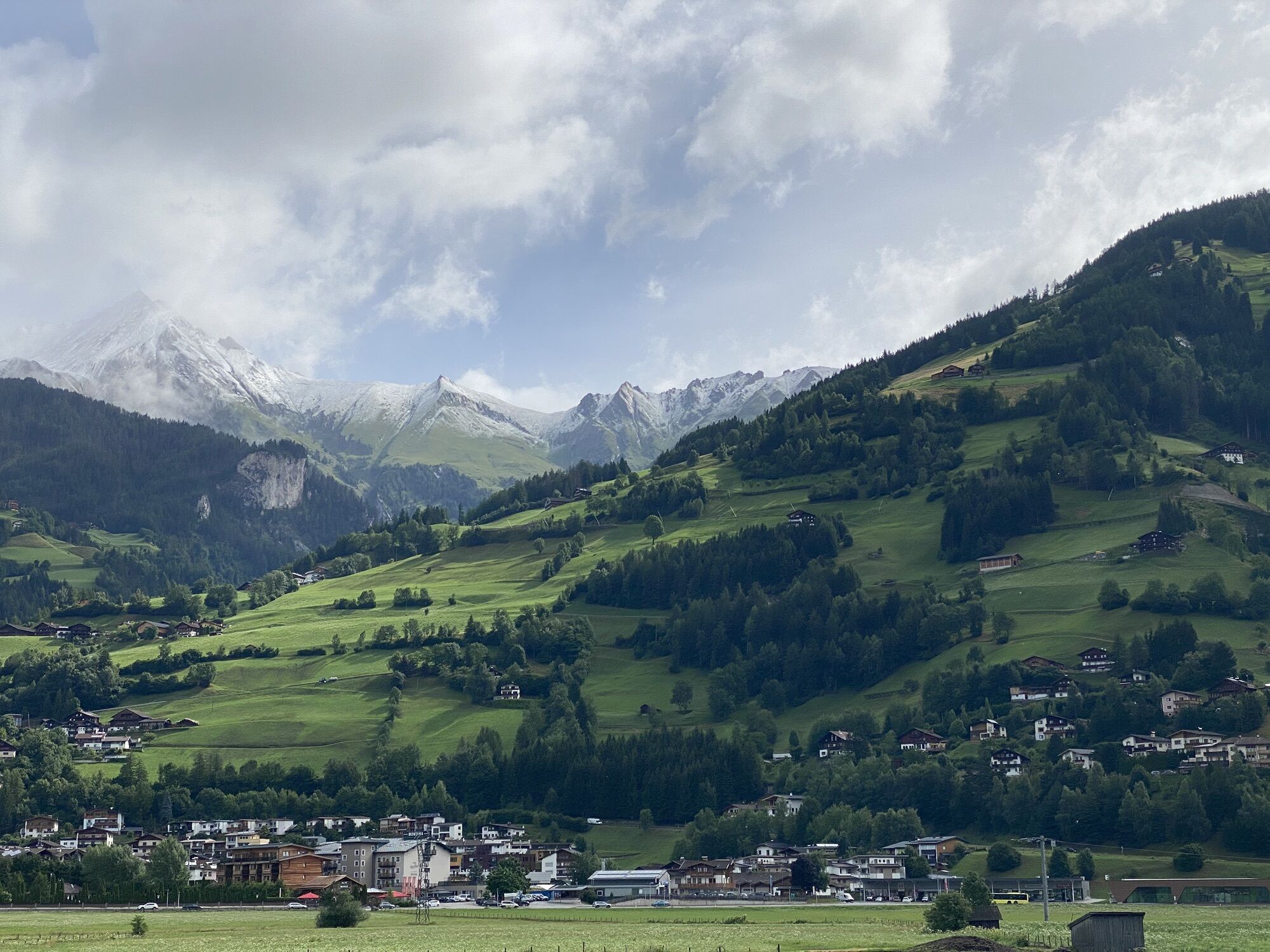
The mountain village Prägraten offers refreshment stops and overnight accommodation. You can also walk on to Hinterbichl (inn, camping site, room rental).
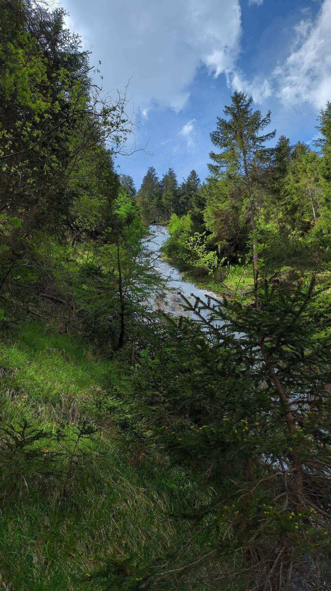
On the shady side, a little above the trail south of Prägraten, the stream Zopatnitzenbach falls through a steep ditch. Millions of water drops fill the air. The waterfall can be reached via a spur trail.
An impressive, lonely forest gorge hides below Virgen, where the Virgen cataract thunders down to the valley over several steps.
The mountain village Virgen nestles into the southern slope of the valley "Virgental" (which is still the Iseltal) dominated by meadows and hedges. A detour through the village is definitely worthwhile: picturesque vantage points, historic farms, the pilgrimage church of Maria Schnee (in the district Obermauern) and delicacies in the local inns will reward you handsomely. Virgen also offers camping facilities.
The trail up the valley then leads you to the edge of the dramatic and pathless gorge Iselschlucht between Welzelach (inn) and Bobojach (catering, accommodation). The almost one-kilometre-long canyon is of extraordinary scenic beauty. Deep down in the gorge you can hear the Isel raging. The Iseltrail offers some insights into this remote primeval landscape. To make it even easier to experience the magnificent wilderness, a new suspension bridge was built over the Isel Gorge, complete with a photo point and a viewing platform.
Above the Iselschlucht, the river (temporarily) calms down again. Meadows line its course on the sunny side.
Shortly before Prägraten you can relax at a "Gries", a stretch of beach, and dip your feet in the water ...
The mountain village Prägraten offers refreshment stops and overnight accommodation. You can also walk on to Hinterbichl (inn, camping site, room rental).
On the shady side, a little above the trail south of Prägraten, the stream Zopatnitzenbach falls through a steep ditch. Millions of water drops fill the air. The waterfall can be reached via a spur trail.
Ruta
Matrei in Osttirol
(974 m)
Ciudad
0,4 km
Bruggen
(957 m)
Pueblo
0,5 km
Ganz
(963 m)
Pueblo
1,1 km
Niedermauern
(1.136 m)
Pueblo
8,0 km
Gries
(1.106 m)
Liquidación
9,2 km
Rain
(1.165 m)
Liquidación
9,8 km
Prägraten
(1.306 m)
Pueblo
15,4 km
Ruta
Iseltrail Stage 3
medio
Senderismo
16,96
km
Bichl
(955 m)
Pueblo
0,0 km
Matrei in Osttirol
(974 m)
Ciudad
0,4 km
Bruggen
(957 m)
Pueblo
0,5 km
Waier
(949 m)
Pueblo
0,6 km
Ganz
(963 m)
Pueblo
1,1 km
Mitteldorf
(1.089 m)
Pueblo
4,9 km
Virgener Katarakt
(1.031 m)
Cascada
5,5 km
Niedermauern
(1.136 m)
Pueblo
8,0 km
Gries
(1.106 m)
Liquidación
9,2 km
Gasthof Schwaigerhof
(1.115 m)
Restaurante
9,2 km
Rain
(1.165 m)
Liquidación
9,8 km
Wallhorn
(1.372 m)
Pueblo
15,0 km
Prägraten
(1.306 m)
Pueblo
15,4 km
Gries
(1.302 m)
Liquidación
16,7 km
Autor
Proporcionado por TVB Osttirol
Error
Se ha producido un error. Por favor, inténtelo de nuevo.
Último seguimiento
4 hace días
Información de llegada
Transporte público
Take bus 951 towards ‘Prägraten a. G.’ to the ‘Matrei i. O. - Auerfeld’ stop. Cross the bridge to reach the starting point of stage 3.
Aparcamiento
Car park Goldried Bergbahnen
Valoraciones
Actividades a lo largo del recorrido

Rutas populares en los alrededores
-
4,8
NaturKraftWeg Umbalfälle
luzSendero temático 5,99 km -
4,1
Gletscherlehrweg Innergschlöß
medioSenderismo 9,36 km -
4,5
Circular hike Proßeggklamm
medioSenderismo 8,41 km -
4,6
Vom Matreier Tauernhaus über die Felsenkapelle nach Innergschlöss
luzSenderismo 9,19 km -
5,0
Rotenkogel
pesadoSenderismo 4,22 km -
4,8
Stoden - Clarahütte
medioSenderismo 7,12 km -
4,9
Circular hike suspension bridge Isel Canyon via "Hohe Bank"
medioSenderismo 8,11 km -
4,7
Wiesbauerspitze 2.767 m
medioSenderismo 9,66 km -
4,2
Seespitze
medioSenderismo 13,7 km -
5,0
Muhs-Panoramaweg
medioSenderismo 14,0 km
Senderismo y rastreo

Más de 550.000 sugerencias de excursiones, mapas detallados y un intuitivo planificador de rutas hacen de esta aplicación una herramienta imprescindible para todos los amantes de la naturaleza.

No se pierda las ofertas y la inspiración para sus próximas vacaciones
Suscribirse al boletín de noticias
Error
Se ha producido un error. Por favor, inténtelo de nuevo.
Gracias por inscribirse
Su dirección de correo electrónico se ha añadido a la lista de correo.
Viajes por Europa
Austria
Suiza
Alemania
Italia
Eslovenia
Francia
Países Bajos
Belgium
Polonia
Liechtenstein
República Checa
Slovakia
España
Croacia
Bosnia y Herzegovina
Luxemburgo
Andorra
Portugal
Iceland
United Kingdom
Ireland
Greece
Albania
North Macedonia
Malta
Norway
Montenegro
Moldova
Kosovo
Hungary
San Marino
Romania
Estonia
Latvia
Belarus
Cyprus
Lithuania
Serbia
Bulgaria
Monaco
Denmark
Sweden
Finland