


Alpine pilgrim trail "Hoch und Heilig" - Stage 8: Obermauern - Kals a. G.
Fotos de nuestros usuarios
-

 © Hermann CzerwenyCreado el 06.09.2025
 -
 © Hermann CzerwenyCreado el 06.09.2025
 -
 © 〽️anni.bbCreado el 26.08.2025
 -
 © Lisa RafllerCreado el 10.02.2026
 -
 © Lisa RafllerCreado el 10.02.2026
 -
 © Lisa RafllerCreado el 10.02.2026
 -
 © Joe PasiCreado el 30.07.2025
 -
 © Joe PasiCreado el 30.07.2025
 -
 © Joe PasiCreado el 30.07.2025
 -
 © René MayrhoferCreado el 08.07.2025
 -
 © Helmut SchuchterCreado el 03.05.2025
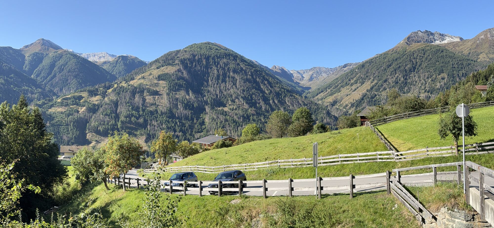


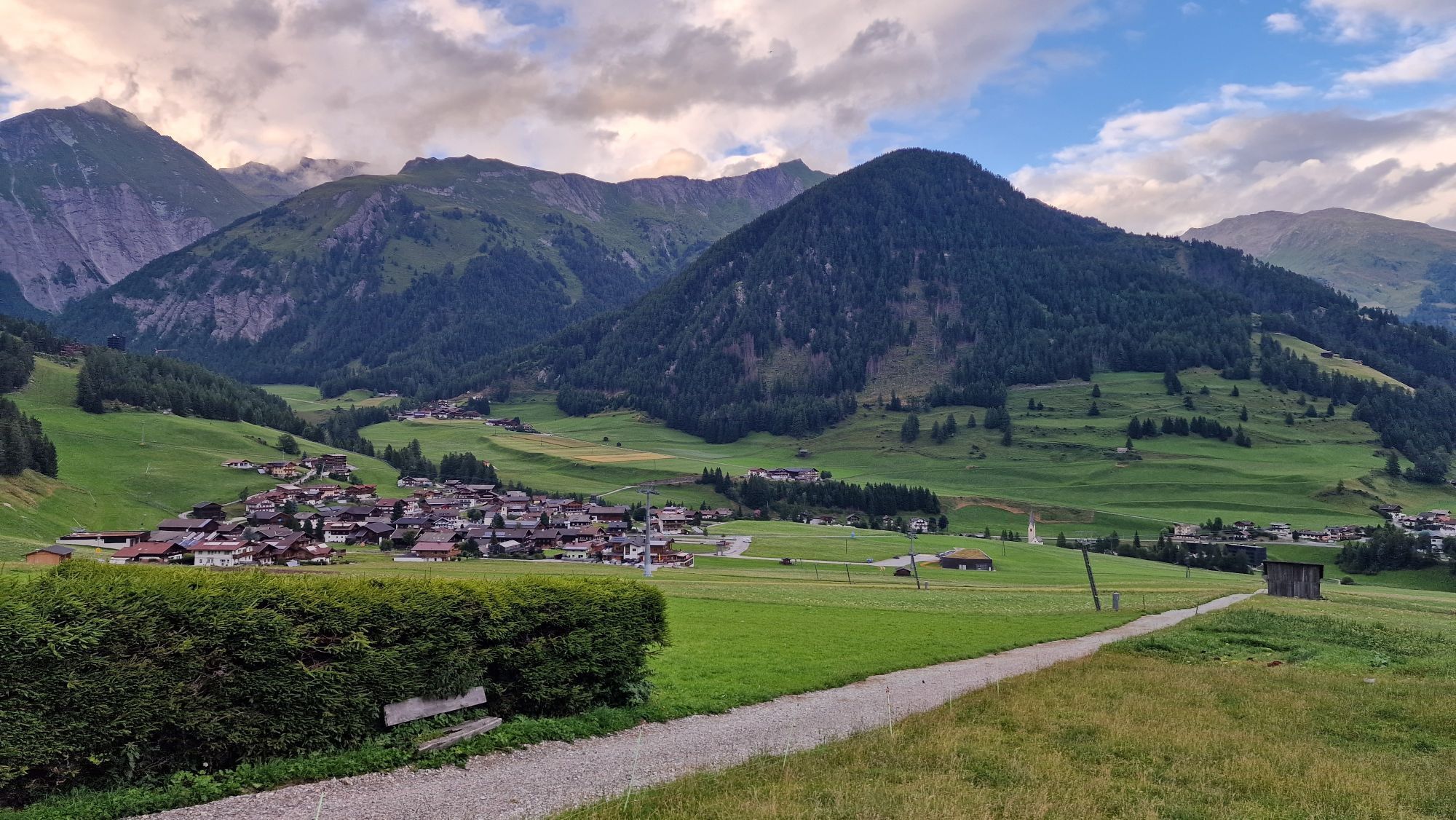


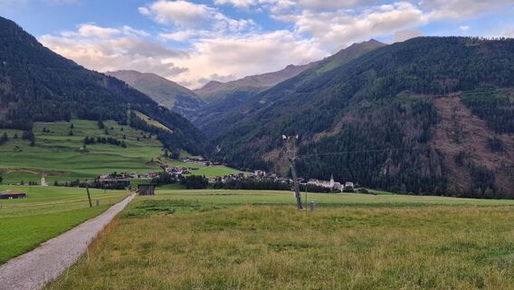
From Obermauern, we follow the Way of the Cross towards Göriach and Virgen. This romantic dirt road, which connects the pilgrimage site of Maria Schnee with Virgen, is considered the most popular pilgrimage...
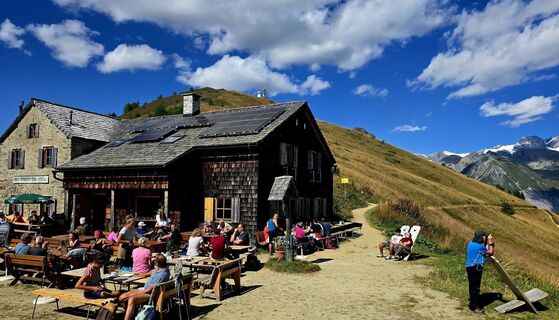
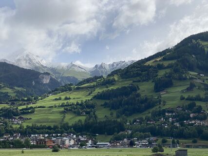
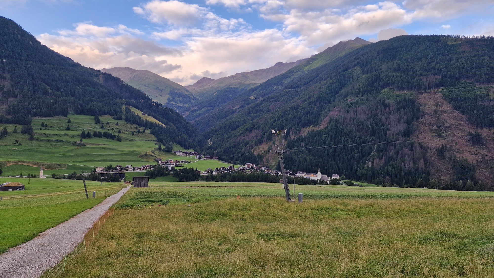
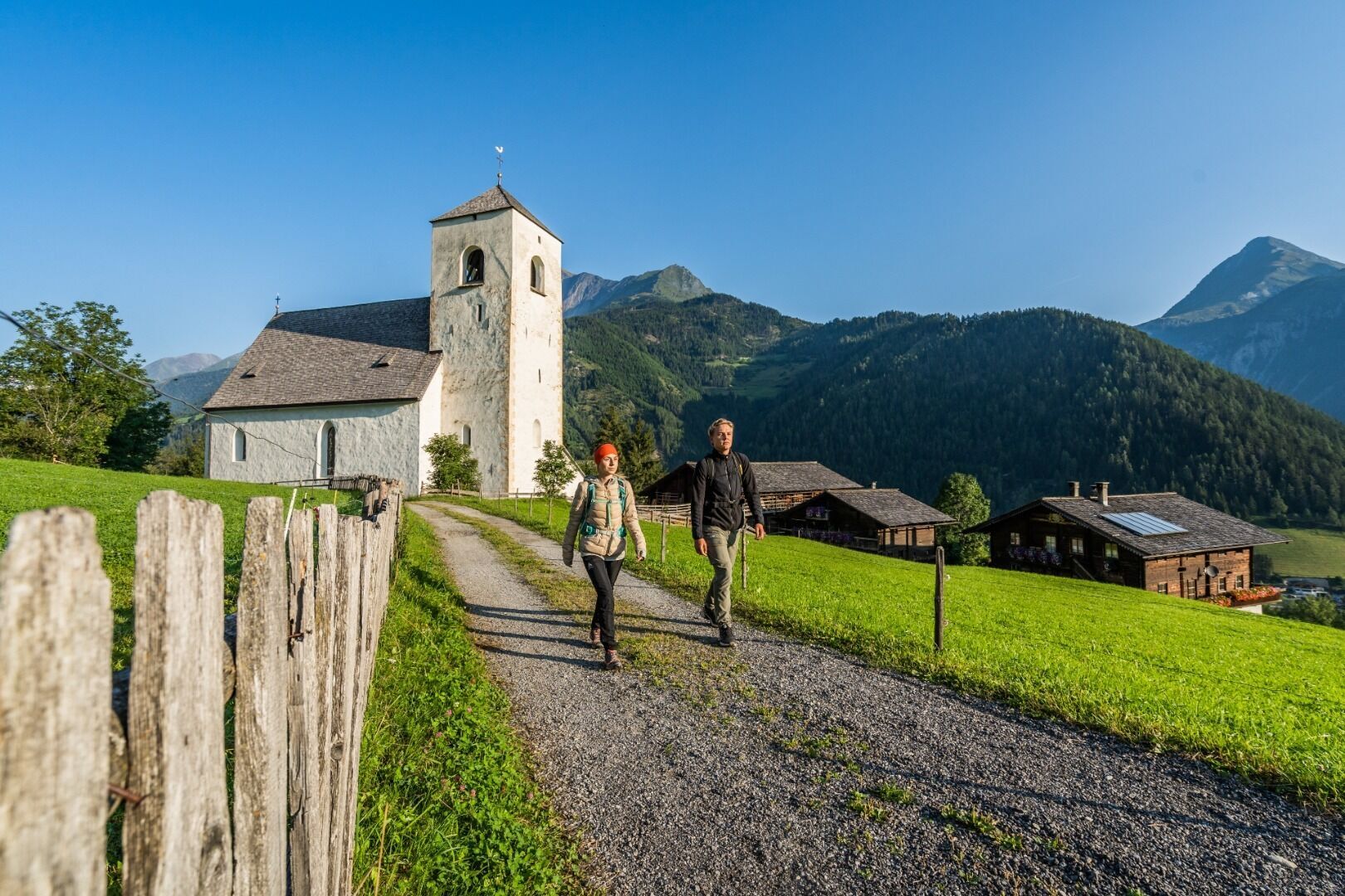
From Obermauern, we follow the Way of the Cross towards Göriach and Virgen. This romantic dirt road, which connects the pilgrimage site of Maria Schnee with Virgen, is considered the most popular pilgrimage route in Tyrol. We continue along the ‘Path of the Senses’ (starting at the Virgen drag lift) through the hedge-rich fields of Virgen and along the ‘Iselweg’ to the bridge over the Isel below Mitteldorf. From here, we hike along the orographic right bank of the Isel on trail no. 91 towards Ganz and from there on a detour up to the Romanesque church of St. Nikolaus. After visiting and resting, we leave this culturally and historically significant place and reach the centre of Matrei via Bichl. We cross the village with its large ‘Landdom’ St. Alban, stock up on provisions in the regional ‘Talladen’ and begin the ascent along the Bretterwandbach stream to the Klaunzer Berg via trail no. 515, where we also pass St. Veit Stöckl. Finally, we reach the highest point of the stage at the Kals-Matreier-Törl (2,207 m). The refuge of the same name at the pass offers a place to rest, good food and a magnificent view of the many surrounding three-thousand-metre peaks.
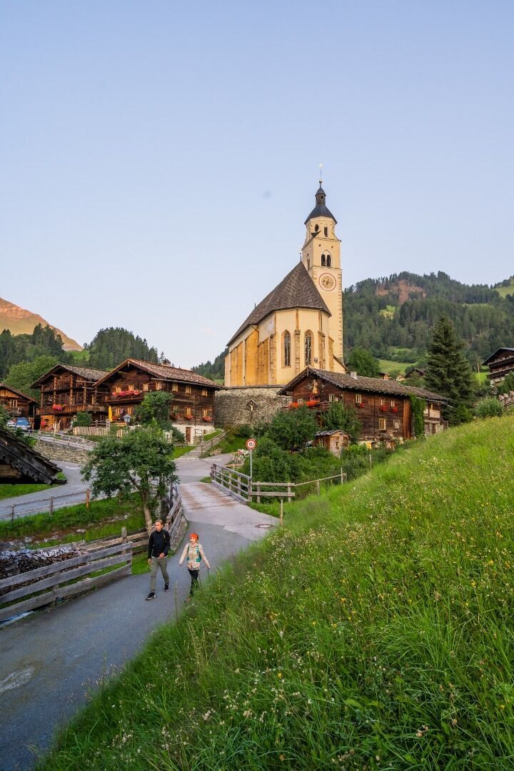
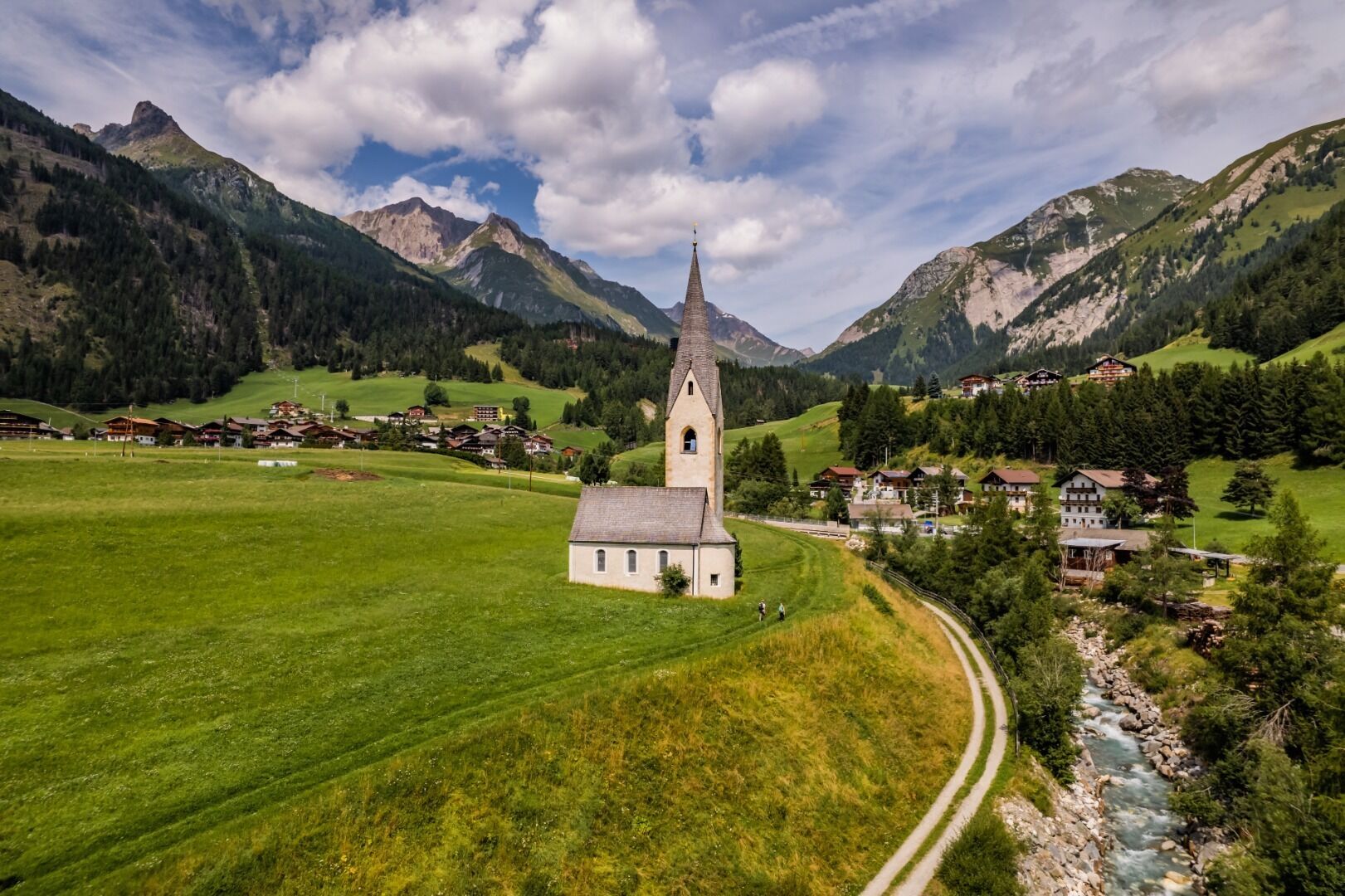
For the descent to Kals a. G., we choose the direct, steeper route no. 502B to Temblerhof. From here, our route leads across the village fields to the valley station of the gondola lift. We continue from Großdorf to Unterburg along the footpath. In Unterburg, we pass the famous Romanesque St. George's Church, which stands freely in the village fields. After the bridge, we turn right onto path no. 31 and walk on the left side of the stream to the lower Ködnitz, reaching the parish church of St. Rupert directly via path 39.
Webcams del recorrido
-
Matrei in Osttirol
-
Matrei Bergstation Goldried
-
Kals am Großglockner
-
Kals am Großglockner
-
Adlerlounge - Cimaross
-
Adlerlounge - Cimaross
-
Adlerlounge - Cimaross
-
Adlerlounge - Cimaross
-
Adlerlounge - Cimaross
-
Adlerlounge - Cimaross
-
Adlerlounge - Cimaross
-
Glocknerwinkel
-
Kalser Glocknerstraße - Glocknerwinkel
-
Virgen Sonnberg
-
Virgen Würfelehütte
-
Lucknerhaus
-
Matrei in Osttirol - Bethuberhof
-
Matrei in Osttirol / Strumerhof
-
Matrei in Osttirol
Rutas populares en los alrededores
-
4,3
Stüdlhütte -Großglockner
Senderismo 4,68 km -
4,3
Lucknerhaus zur Glorerhütte über Lucknerhütte zurück
medioSenderismo 11,2 km -
4,9
Glockner
medioExcursión de alta montaña 19 km -
4,0
Böses Weibele, 3119m, Lucknerhaus
pesadoSenderismo 13,8 km -
4,5
Großglockner Normalweg (1-Tages-Tour) - Top of Austria 3798m
pesadoExcursión de alta montaña 19,9 km -
5,0
Figerhorn, 2743m, Lucknerhaus
medioSenderismo 6,69 km -
5,0
Rotenkogel
pesadoSenderismo 4,22 km -
4,5
1 Großglockner Normalweg von der Stüdlhütte (Tirol & Kärnten)
pesadoExcursión de alta montaña 8,17 km -
5,0
Muhs-Panoramaweg
medioSenderismo 14,0 km -
4,7
Goldtoni - Alpenbogen A024-1 Lucknerhaus-Adlersruhe
pesadoSendero de largo recorrido 26,2 km
Senderismo y rastreo


No se pierda las ofertas y la inspiración para sus próximas vacaciones
Su dirección de correo electrónico se ha añadido a la lista de correo.