
Ski tour Regenstein 2.891m
pesado
Consigue este tour en tu móvil
Ski tour Regenstein 2.891m
pesado
Esquí de travesía
5,48
km
Escanee el código QR e inicie la navegación en la aplicación bergfex


Senderismo y rastreo





Ski tour Regenstein 2.891m
pesado
Distancia
5,48
km
Duración
05:00
h
Ascenso
1.194
m
Nivel del mar
1.642 -
2.848
m
Descarga de pistas
Ski tour Regenstein 2.891m
pesado
Esquí de travesía
5,48
km
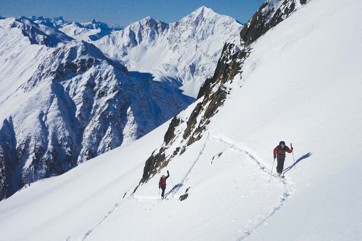
On the alpine road into the valley over the bridge at 1.623 metres, after about 250 metres nearby an alpine hut cross the stream to the right on the alpine path that leads to the Arnalmen. Follow it to...
Descripción de la
On the alpine road into the valley over the bridge at 1.623 metres, after about 250 metres nearby an alpine hut cross the stream to the right on the alpine path that leads to the Arnalmen. Follow it to the Unterarnalm at about 1.800 metres. Through open larch forest around the summer path, pass the Oberarnalm at approx. 1.960 metres to the tree line. Now in open terrain in the valley floor up to approx. 2.440 metres, where a ramp runs through the steep slope to the left. Follow it to the broad crest of the Mitterberg. Now flatter towards the north past the Kleiner Regenstein and steep again to the beginning of the channel that descends to the right of the summit (ski depot). Over this steep channel (key point) to the ridge and on it to the summit.
Description:
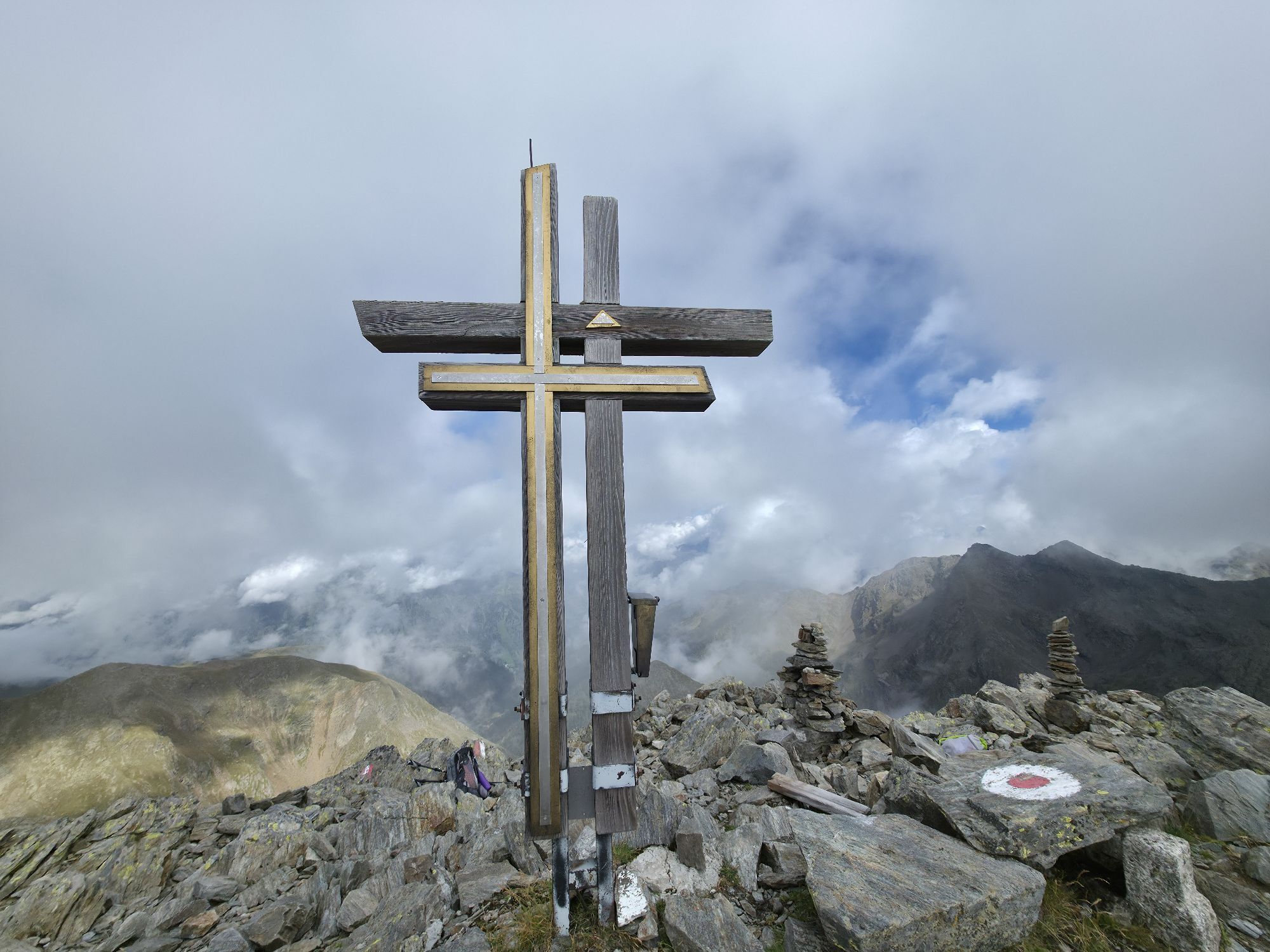
The Regenstein is not a distinct ski touring summit, but it is a challenge for experienced ski mountaineers. This shapely mountain with the unusual double cross should only be climbed in safe conditions. Due to the exposure to the south-east, an early departure is essential, then the fantastic firn slopes can also be enjoyed. The descent across the 40 ° steep summit channel is only recommended for very experienced skiers.
Do not go on the tour too late because of the lack of snow in spring.
Descent:
Like ascent. With little snow in the forest area to the Oberarnalm difficult descent.
Description:
The Regenstein is not a distinct ski touring summit, but it is a challenge for experienced ski mountaineers. This shapely mountain with the unusual double cross should only be climbed in safe conditions. Due to the exposure to the south-east, an early departure is essential, then the fantastic firn slopes can also be enjoyed. The descent across the 40 ° steep summit channel is only recommended for very experienced skiers.
Do not go on the tour too late because of the lack of snow in spring.
Descent:
Like ascent. With little snow in the forest area to the Oberarnalm difficult descent.
Ruta
Autor
Proporcionado por TVB Osttirol

Compartir gira
Ski tour Regenstein 2.891m
pesado
Esquí de travesía
5,48
km
Error
Se ha producido un error. Por favor, inténtelo de nuevo.

Información de llegada
Llegada
Mit dem Auto bis zur Reiterstube Außervillgraten
Transporte público
Mit dem Bus bis zur Haltestelle "Reiterstube Außervillgraten"
Aparcamiento
Parkplatz Reiterstube
Aún no hay opiniones
Rutas populares en los alrededores
-
5,0
Schwarzsee
medioSenderismo 7,38 km -
5,0
Kleiner Zunig, Matrei in Osttirol, Österreich Matrei in Osttirol, Österreich
medioSenderismo 12,6 km -
4,4
Böses Weibele - Pustertaler Höhenweg
medioSenderismo 13,2 km -
5,0
Böses Weibele
luzSenderismo 10,1 km -
5,0
Kreuzspitze, 2.624 m
medioSenderismo 5,27 km -
4,3
Thurntaler Rundweg - Parggenspitze - Hochrast
medioSenderismo 18,0 km -
3,5
Speikboden
medioSenderismo 8,60 km -
4,0
Iseltrail Stage 2
medioSenderismo 14,5 km -
4,6
Brugger Alm - Ragötzel Hütte - Eggenhütte
medioSenderismo 10,1 km -
4,6
Van Dobbiaco naar Lienz
luzCiclismo 50,8 km

Senderismo y rastreo

Más de 550.000 sugerencias de excursiones, mapas detallados y un intuitivo planificador de rutas hacen de esta aplicación una herramienta imprescindible para todos los amantes de la naturaleza.

No se pierda las ofertas y la inspiración para sus próximas vacaciones
Suscribirse al boletín de noticias
Error
Se ha producido un error. Por favor, inténtelo de nuevo.
Gracias por inscribirse
Su dirección de correo electrónico se ha añadido a la lista de correo.
Viajes por Europa
Austria
Suiza
Alemania
Italia
Eslovenia
Francia
Países Bajos
Belgium
Polonia
Liechtenstein
República Checa
Slovakia
España
Croacia
Bosnia y Herzegovina
Luxemburgo
Andorra
Portugal
Iceland
United Kingdom
Ireland
Greece
Albania
North Macedonia
Malta
Norway
Montenegro
Moldova
Kosovo
Hungary
San Marino
Romania
Estonia
Latvia
Belarus
Cyprus
Lithuania
Serbia
Bulgaria
Monaco
Denmark
Sweden
Finland





