


723 | Imbach climb

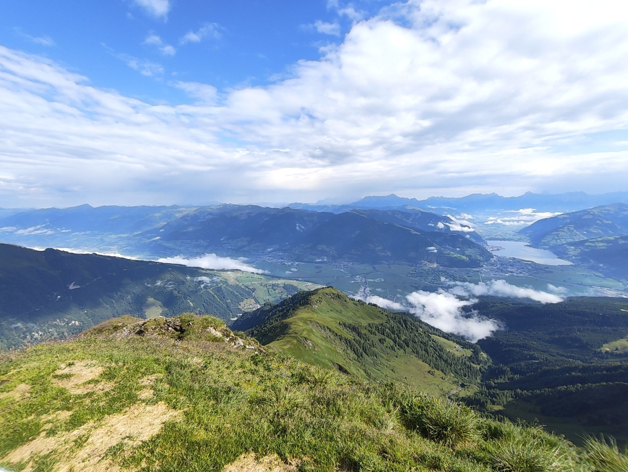
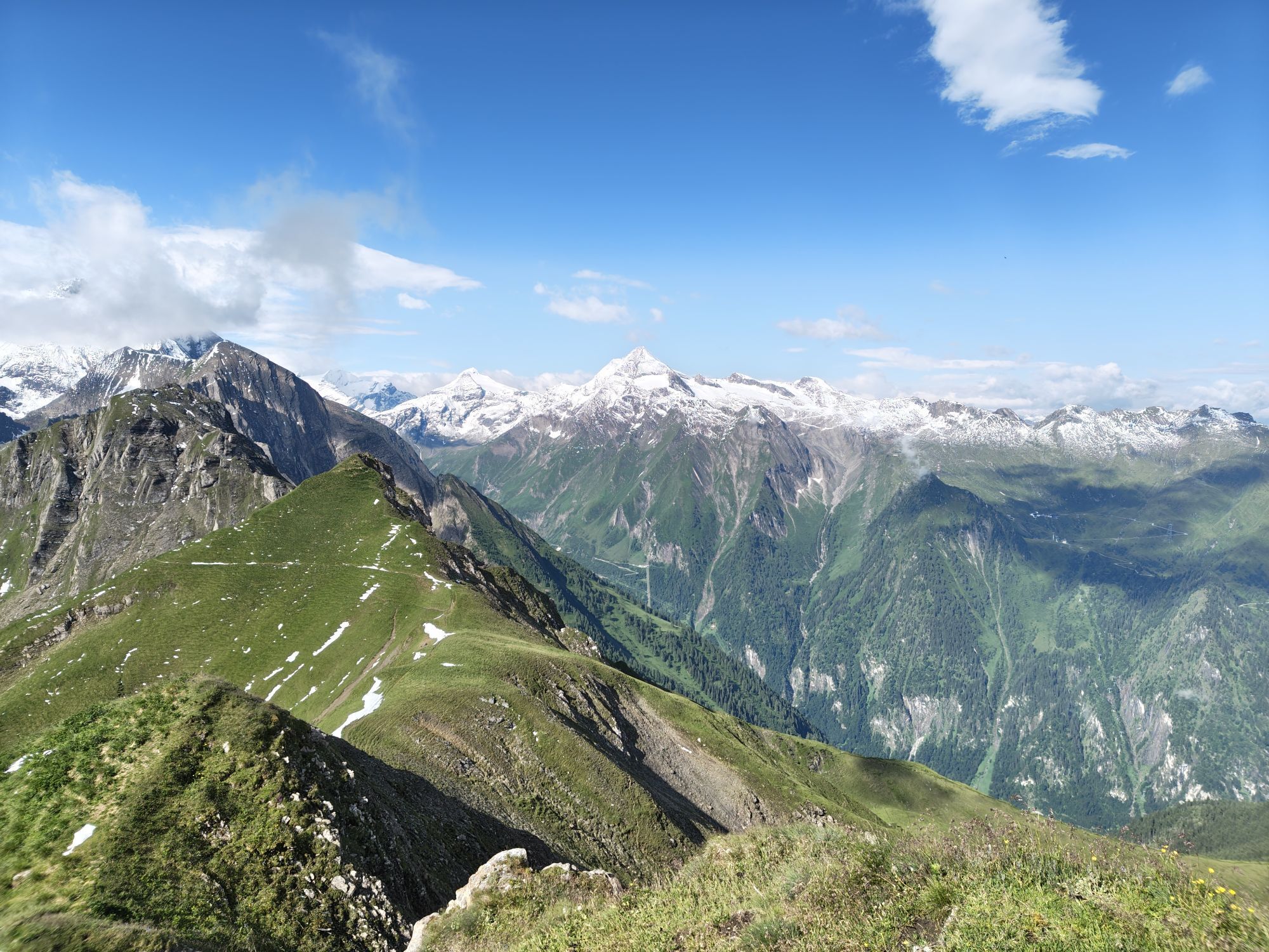
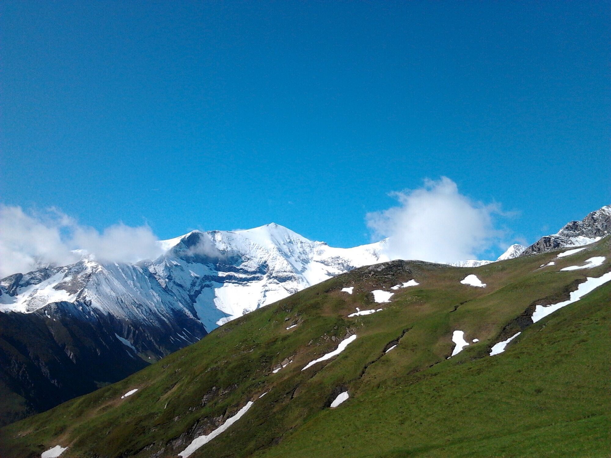
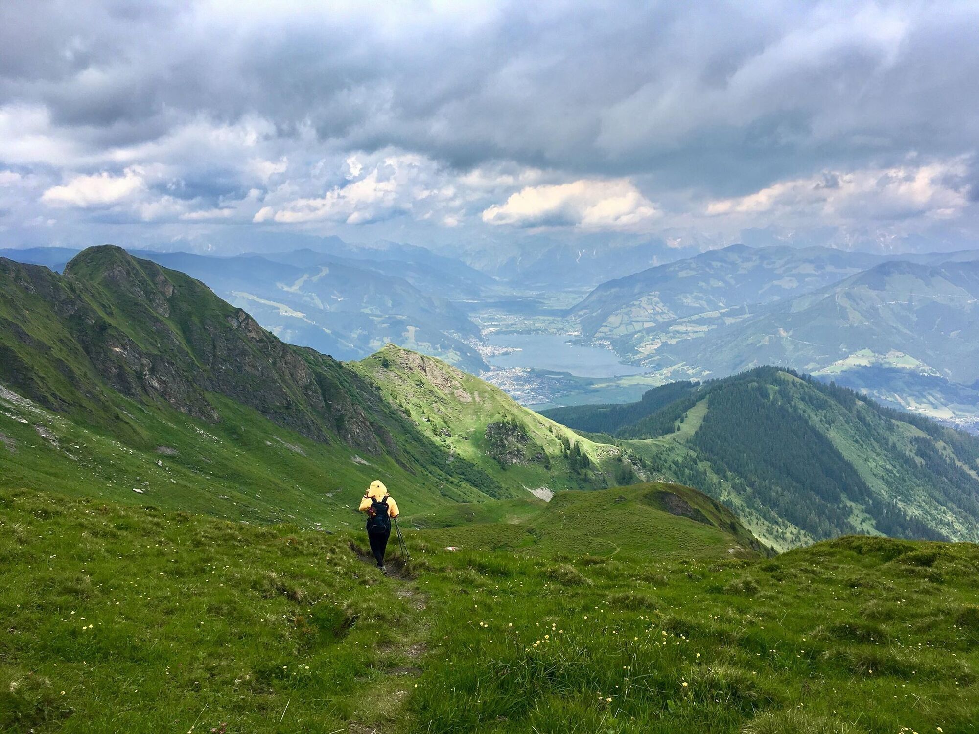
This impressive mountain tour starts right in the centre of Kaprun and leads along the Lechnerbergweg trail, following the Imbach stream uphill to the unmanaged Neumayeralm. The route continues across...
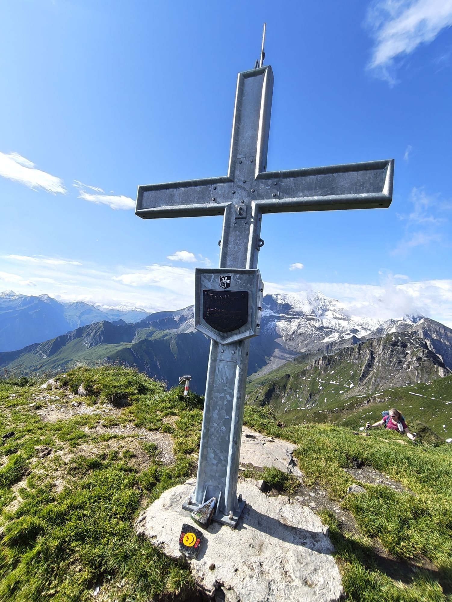
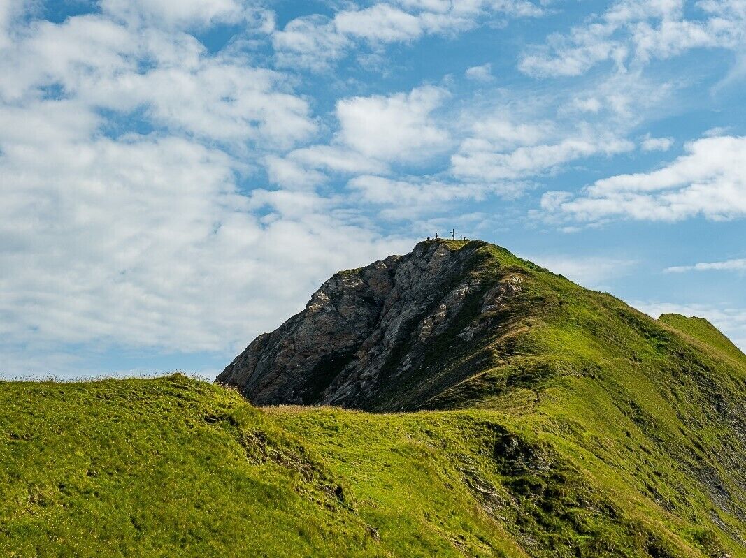
This impressive mountain tour starts right in the centre of Kaprun and leads along the Lechnerbergweg trail, following the Imbach stream uphill to the unmanaged Neumayeralm. The route continues across flowering alpine pastures to the Piffschafte (1,785 m) and past the Türchelkopf to the Roßkopfscharte. There, the trail either branches off to the 2,470 m high Imbachhorn or continues on to the Gleiwitzer Hütte. This offers ideal accommodation for multi-day tours.
path number 723 you see on the yellow signs.
At the Injoy gym or at the MK Maiskoglbahn.
Rutas populares en los alrededores
-
4,3
Schwalbenwand Nr. 80, 81, 82
medioSenderismo 13,0 km -
4,8
Sigmund Thun Klamm, Klammsee, Bürgkogel
luzSenderismo 4,56 km -
4,0
Maurerkogel (Top)
Senderismo 10,5 km -
4,9
Hochsonnberg Runde
medioMountainbike 59,8 km -
4,5
Thumersbach, Runde um den Zeller See
luzSenderismo 13,3 km -
4,4
Sigmund Thun Klamm
luzSenderismo 3,10 km -
4,2
Hundstein-Runde von Maria Alm
pesadoMountainbike 44,4 km -
4,9
Großes Wiesbachhorn 3564 mnv Kaprun, Austrija
pesadoSenderismo 13,4 km -
3,9
Großglockner Hochalpenstrasse
pesadoCiclismo 20,2 km -
4,6
3 Oktober Fusch Walcher Grung und Hohalm
medioSenderismo 8,57 km
Senderismo y rastreo


No se pierda las ofertas y la inspiración para sus próximas vacaciones
Su dirección de correo electrónico se ha añadido a la lista de correo.