Lauf- und Walkingpark Köttmannsdorf

Logotipo Lauf- und Walkingpark Köttmannsdorf
Datos del tour
9,2km
521 - 582m
Distancia
124hm
134hm
Ascenso
01:58h
 
Duración
Breve descripción

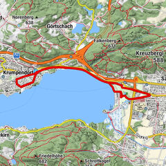
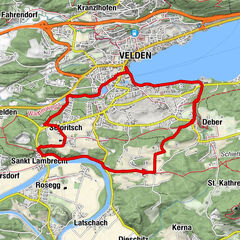
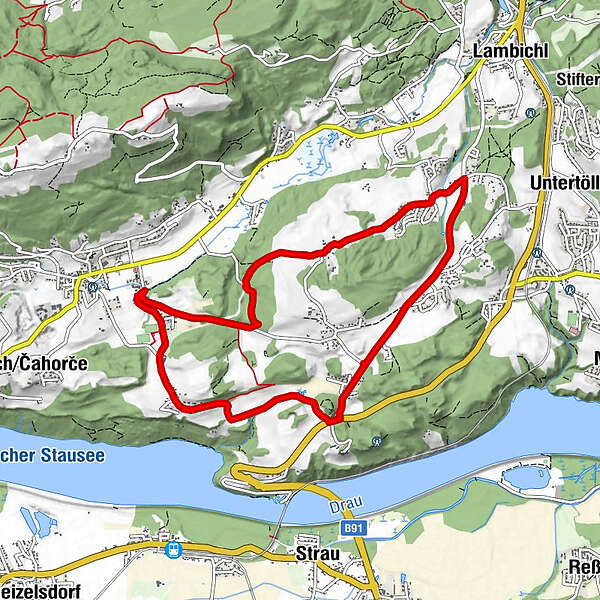
Auf der Karte ist nur eine Route angeführt. Alle Wege starten beim Sportplatz Köttmanndorf und sind ausreichend ausgeschildert.

Dificultad
fácil
Valoración
Técnica
Nivel
Paisaje
Experiencias
Ruta
V duәlә
0,2 km
Köttmannsdorf (558 m)
0,3 km
Hl. Gandolf
0,5 km
Sankt Gandolf
0,6 km
Pole
0,7 km
Hurčәca
0,9 km
Tretram
2,7 km
Aich
3,9 km
Tschedram
4,8 km
Gaisach
5,3 km
Wegscheide
6,4 km
Preliebl
8,5 km
Na štuҟә
9,0 km
Sankt Gandolf
9,1 km
La mejor temporada
ene
feb
mar
abr
may
jun
jul
ago
sep
oct
nov
dic
Punto álgido
582 m
Perfil alto

Autor
La gira Lauf- und Walkingpark Köttmannsdorf es utilizado por outdooractive.com proporcionado.

5,0
Valoración global

5

100

%

4

0

%

3

0

%

2

0

%

1

0

%

GPS Downloads
  • GPX GPS Exchange Format (XML)
  • KML Google Earth, Google Maps
Códigos de descarga QR para teléfonos móviles
Más circuitos por las regiones

Excursiones opcionales por los alrededores

Rauschelesee Runde

medio Running
8,73km | 21hm | 02:30h

Golfmoosburg Runde

medio Running
10,48km- | 02:00h

Hafnersee Runde

fácil Running
4,24km- | 00:45h

X-BIONIC Runde

medio Running
11,81km | 130hm | 02:20h