Scuol – S-charl – Süsom Givè
pesado
Consigue este tour en tu móvil
Scuol – S-charl – Süsom Givè
pesado
Senderismo
26,62
km
Escanee el código QR e inicie la navegación en la aplicación bergfex

Senderismo y rastreo


Scuol – S-charl – Süsom Givè
pesado
Distancia
26,62
km
Duración
07:30
h
Ascenso
1.220
m
Nivel del mar
1.242 -
2.391
m
Descarga de pistas
Scuol – S-charl – Süsom Givè
pesado
Senderismo
26,62
km

From Gurlaina on the right side of the valley opposite Scuol to the right along a narrow path, through the wild Clemgia gorge towards Plan da Funtanas, then along the road past the entrance to the National...
Descripción de la
From Gurlaina on the right side of the valley opposite Scuol to the right along a narrow path, through the wild Clemgia gorge towards Plan da Funtanas, then along the road past the entrance to the National Park in Mingèr to S-charl (post office van can also take you this far).
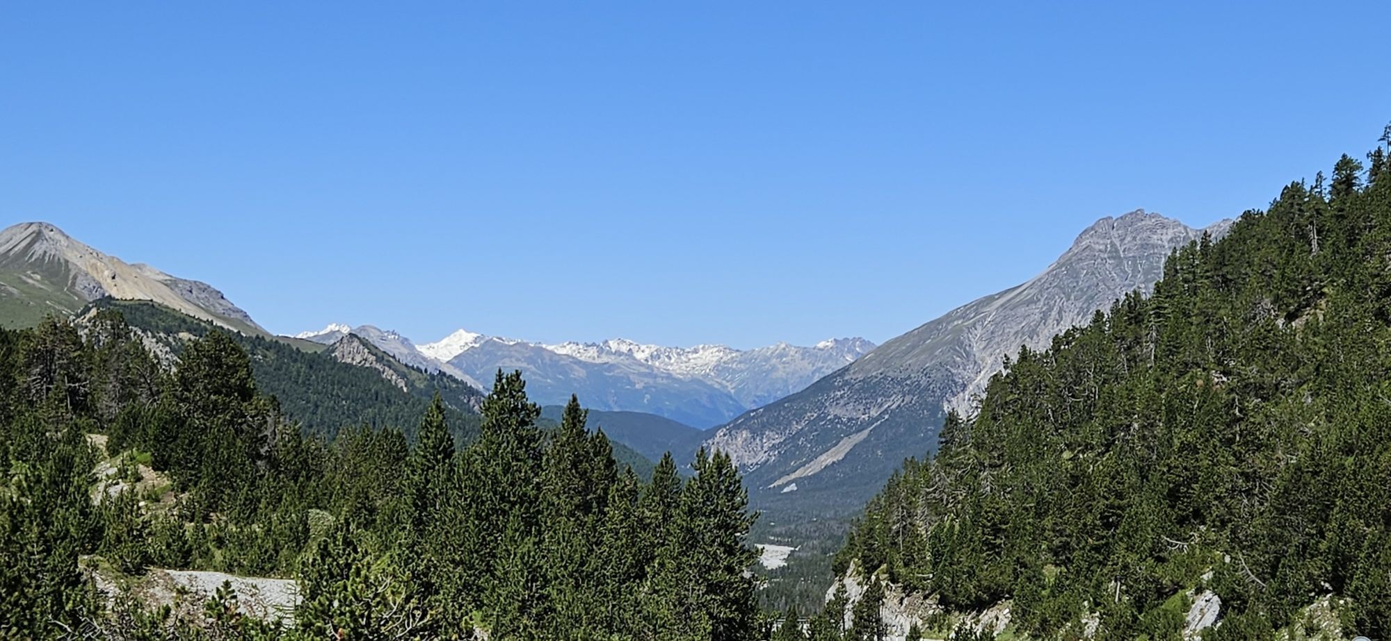
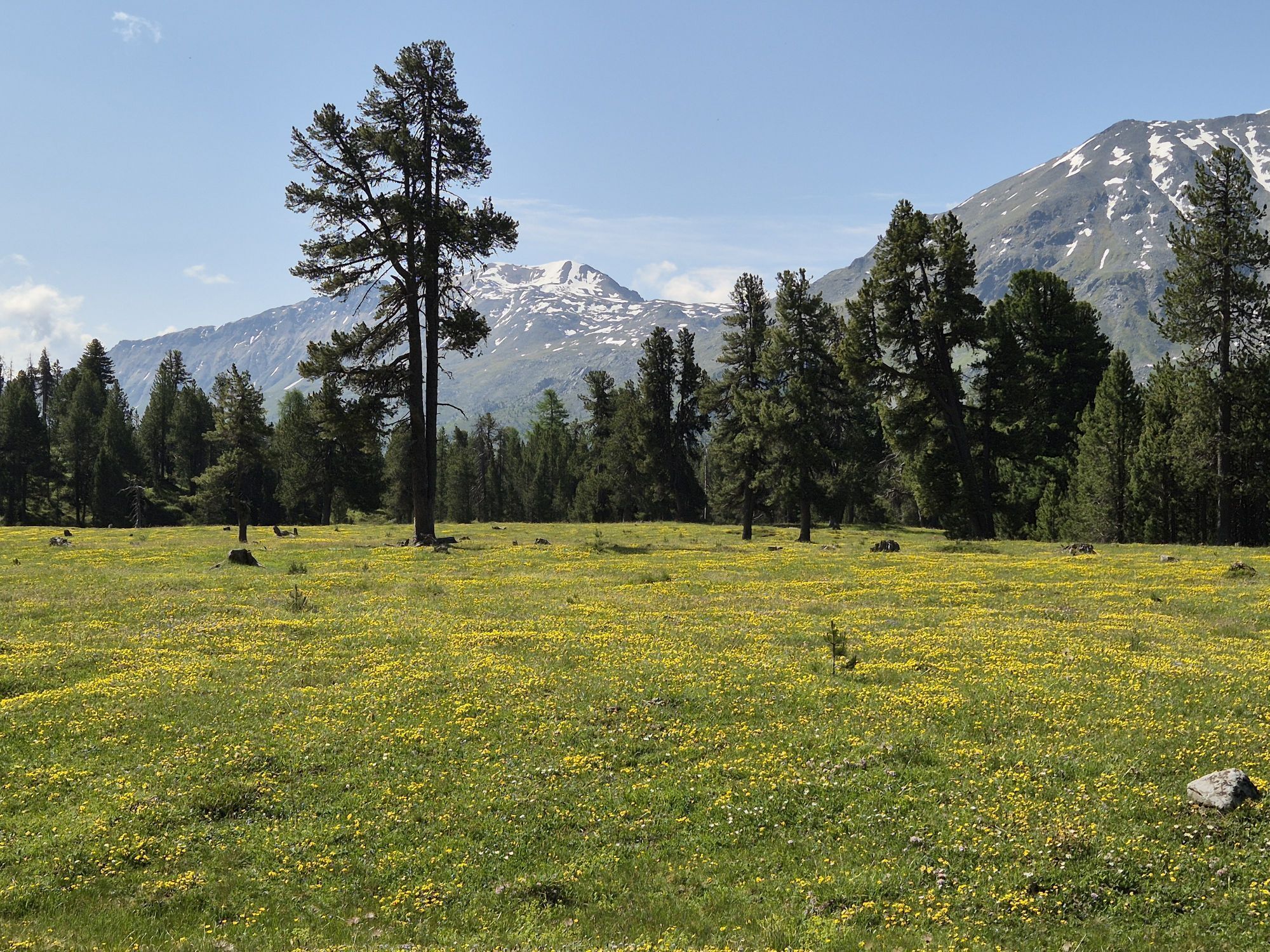
The valley, which is narrow and wild to this point, splits into three valleys and becomes noticeably more welcoming. Meadows full of flowers frame the pretty village.
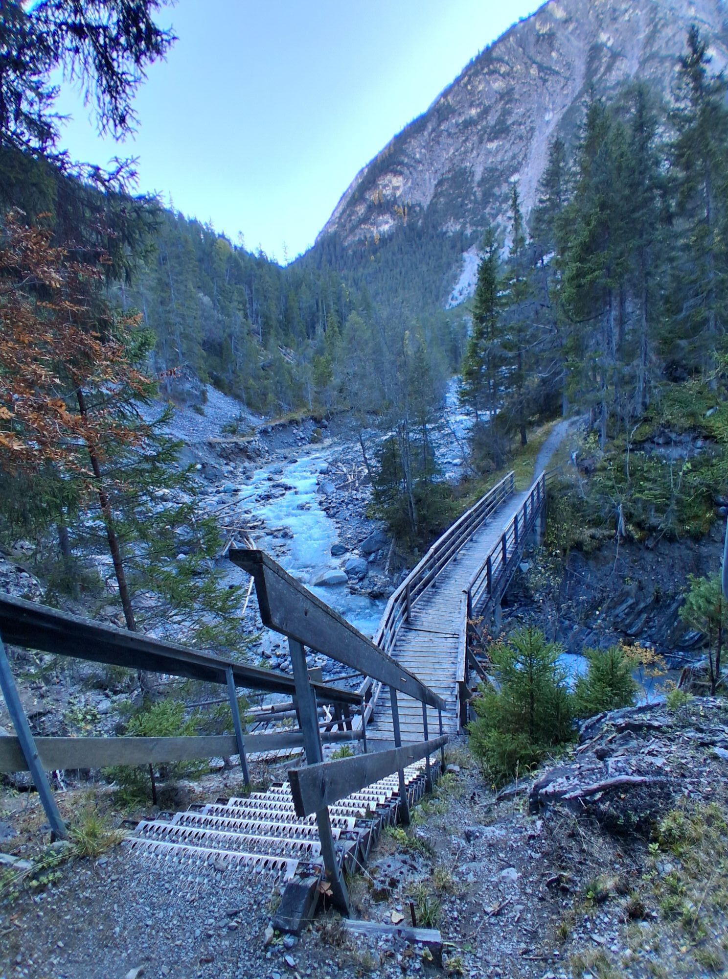
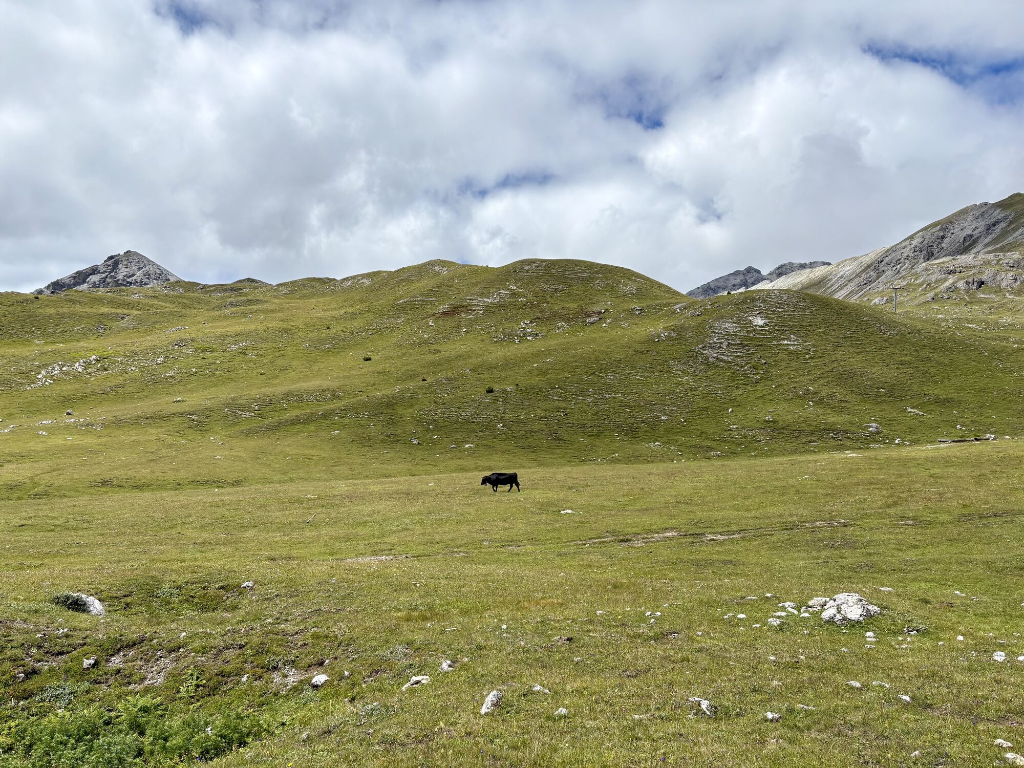
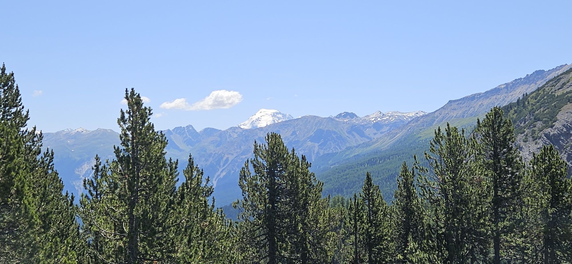
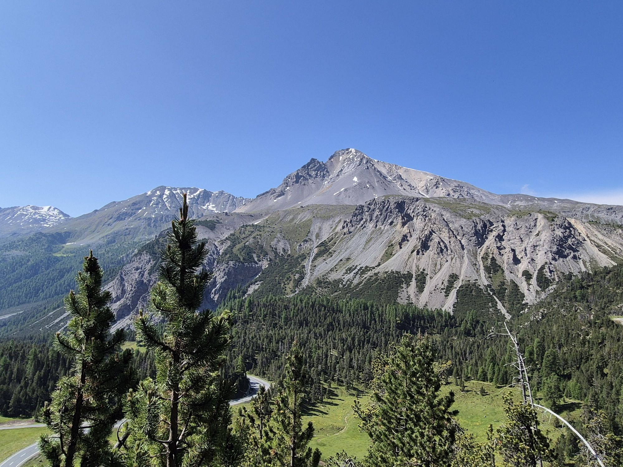
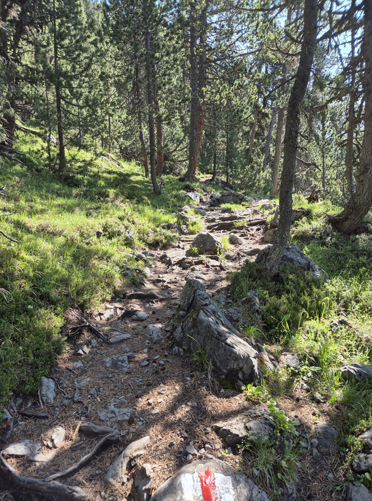
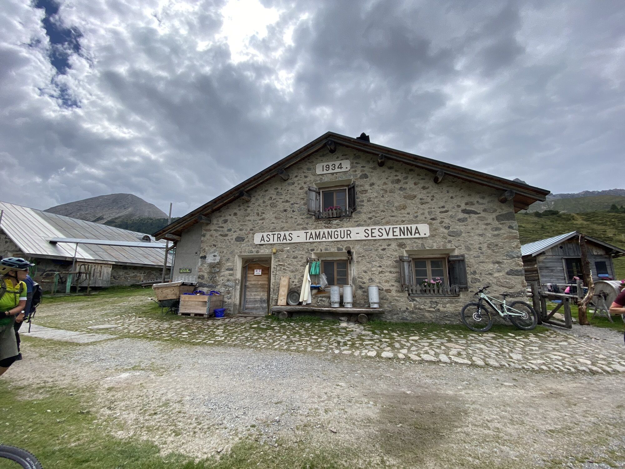
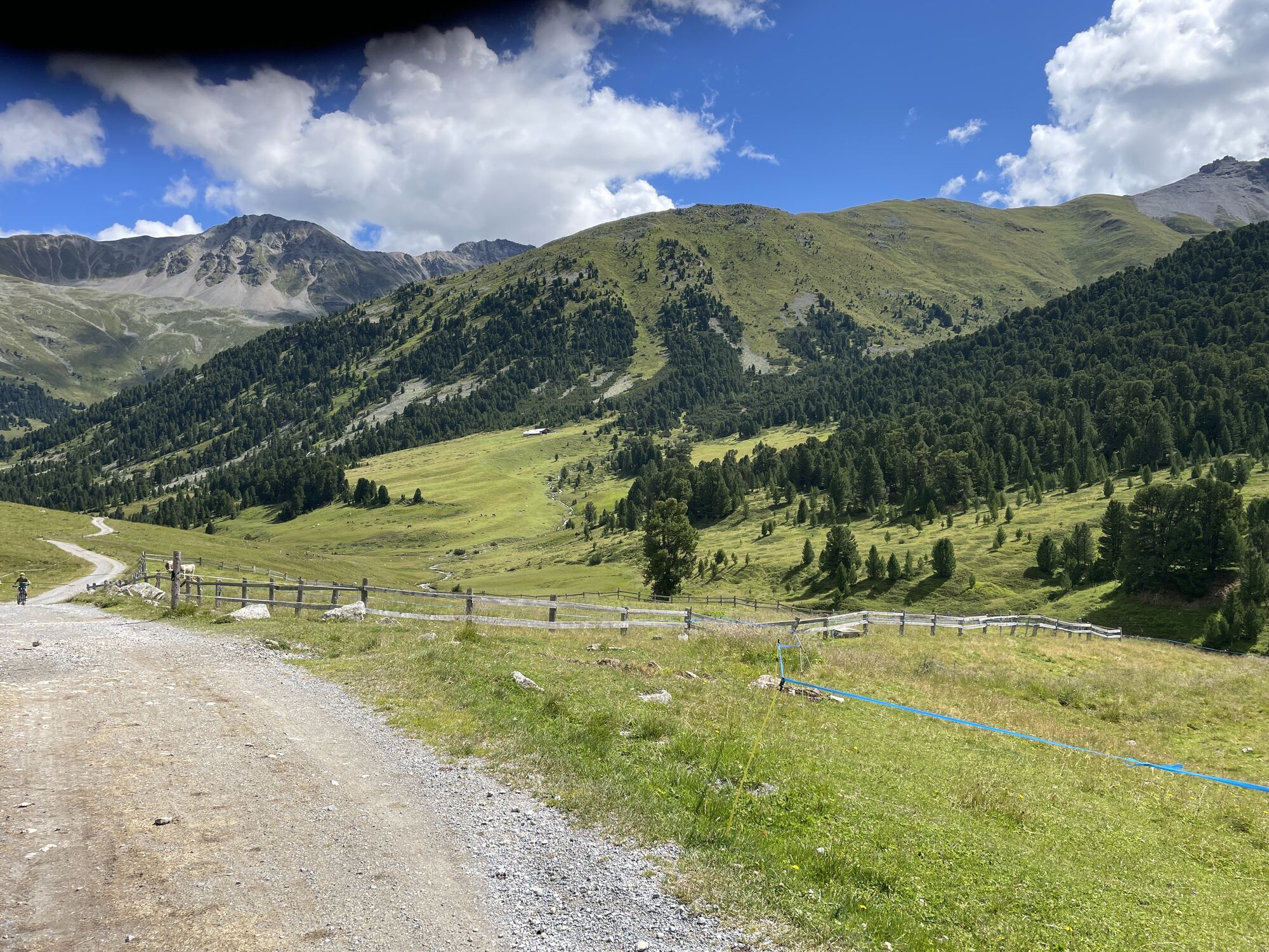
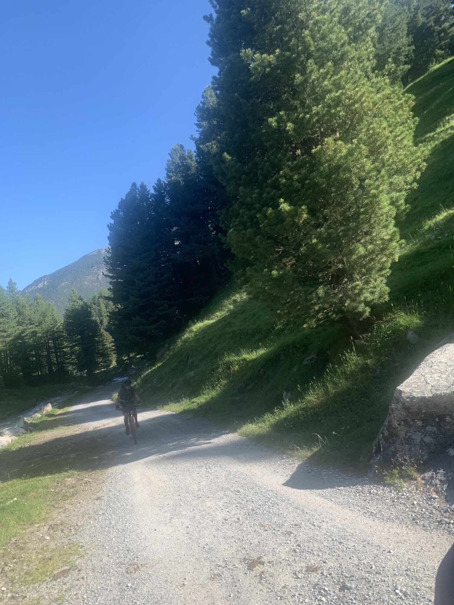
From S-charl heading into the valley, we stay beside the main creek. Pine forests mixed with larches dominate both mountain ridges. After the first creek crossing at Pt. 2018, the path rises more steeply to Alp Praditschöl (Pt. 2131), and then leads to Alp Astras (Pt. 2135). Opposite us, on the right side of the valley, extend the mighty trees of the primitive pine forest of Tamangur, the highest closed pine forest in Europe. In the canopy particularly, fierce struggles are waged beside the cadaverous, pale trunks of fallen tree giants, which acts as sheltered nurseries for delicate new shoots (the excursion to God da Tamangur above Pt. 2018 and Tamangur Dadoura, Pt. 2127, to Alp Tamangur Dadaint – or the other way around – does not take much time).
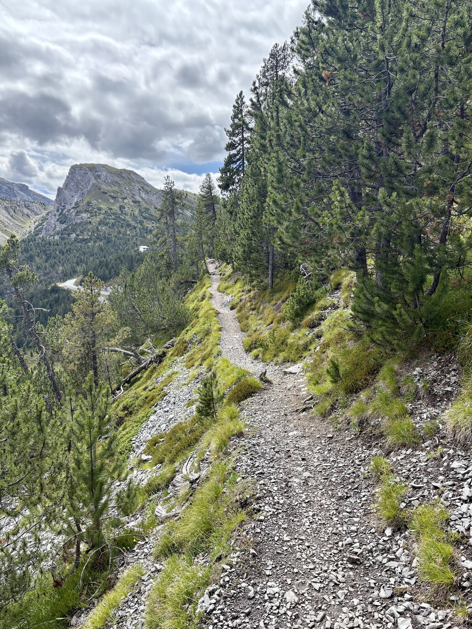
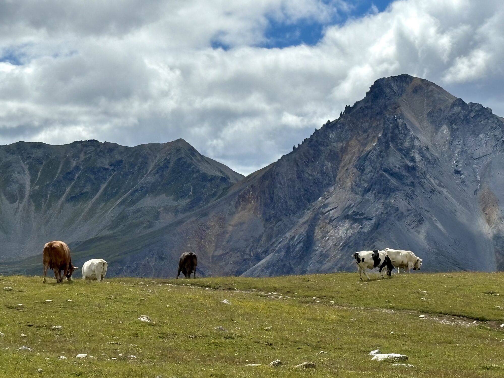
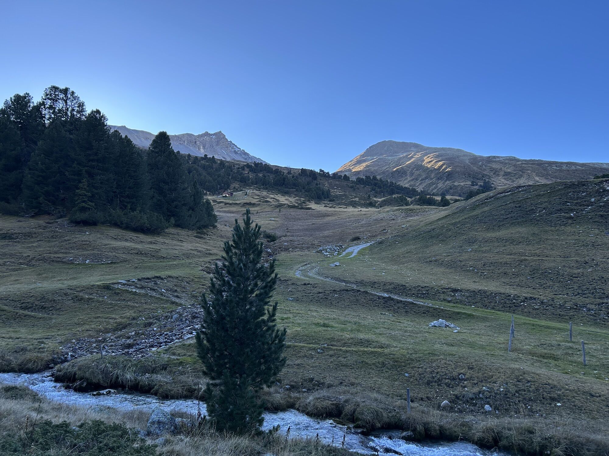
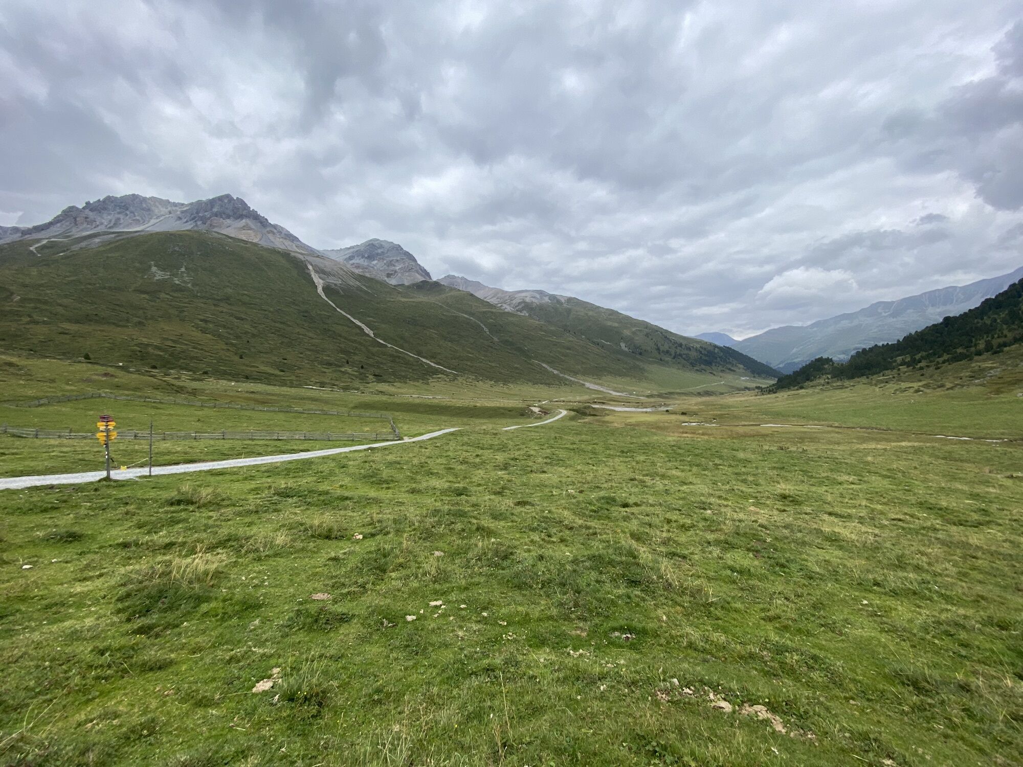
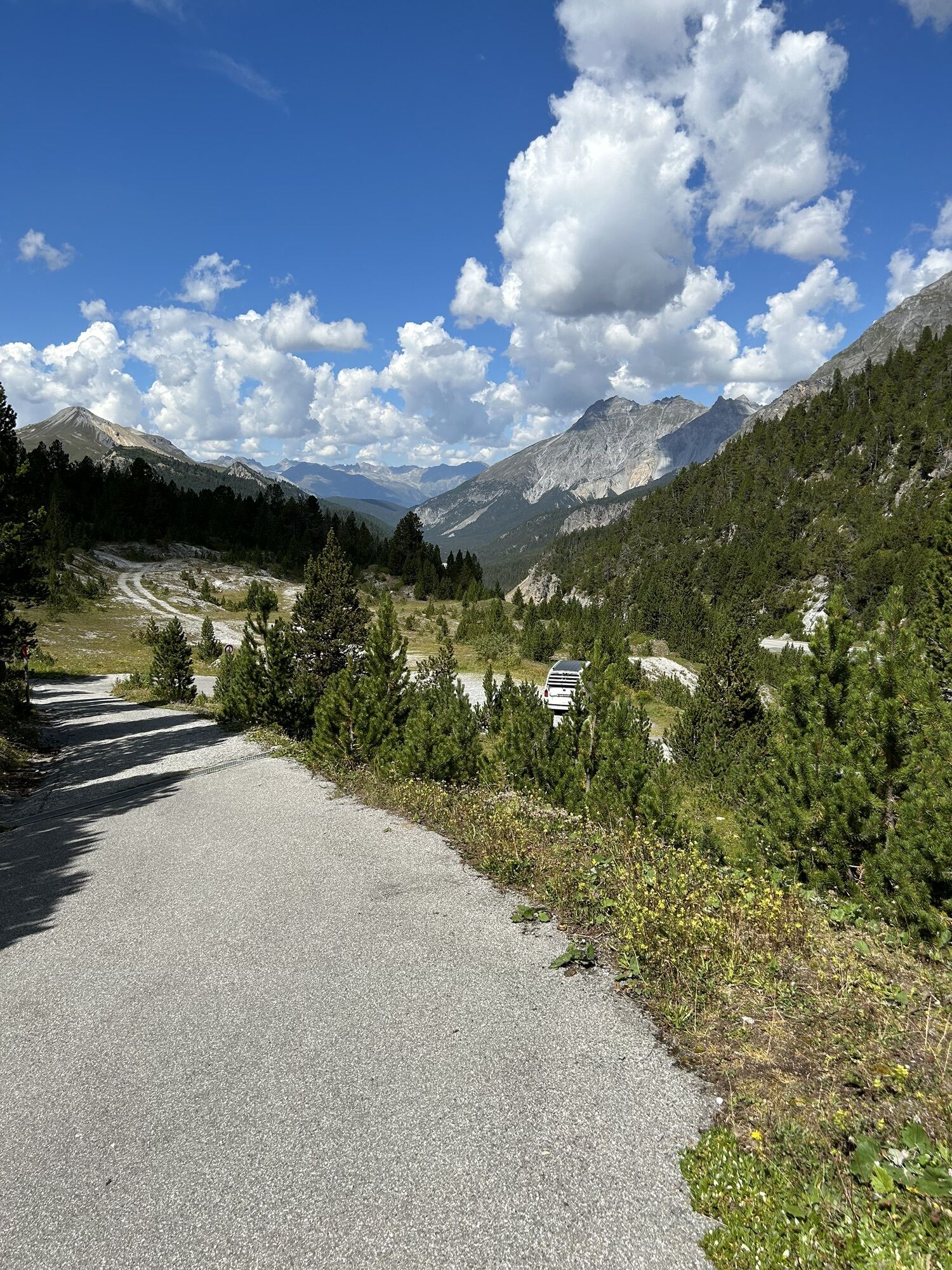
To get to Pass dal Fuorn, climb Alp Astras (Pt. 2135) heading southwest to Funtana da S-charl (Pt. 2393). At over 2400 metres, the rare Alpine orchid (chamorchis alpina) with its small blue-green blossoms grows here amid edelweiss and lobelia, as does the equally rare coriander-leafed “jewel flower” (callianthemum coriandrifolium) and saxifrage (saxifraga androsacea). The descent initially leads towards Alp da Munt, but later passes this, heading north to the plateaus of Plan da l'Aua. At Pt. 2152 you take a path on the right that leads through the forest to the pass of Süsom Givè, staying at the same altitude.
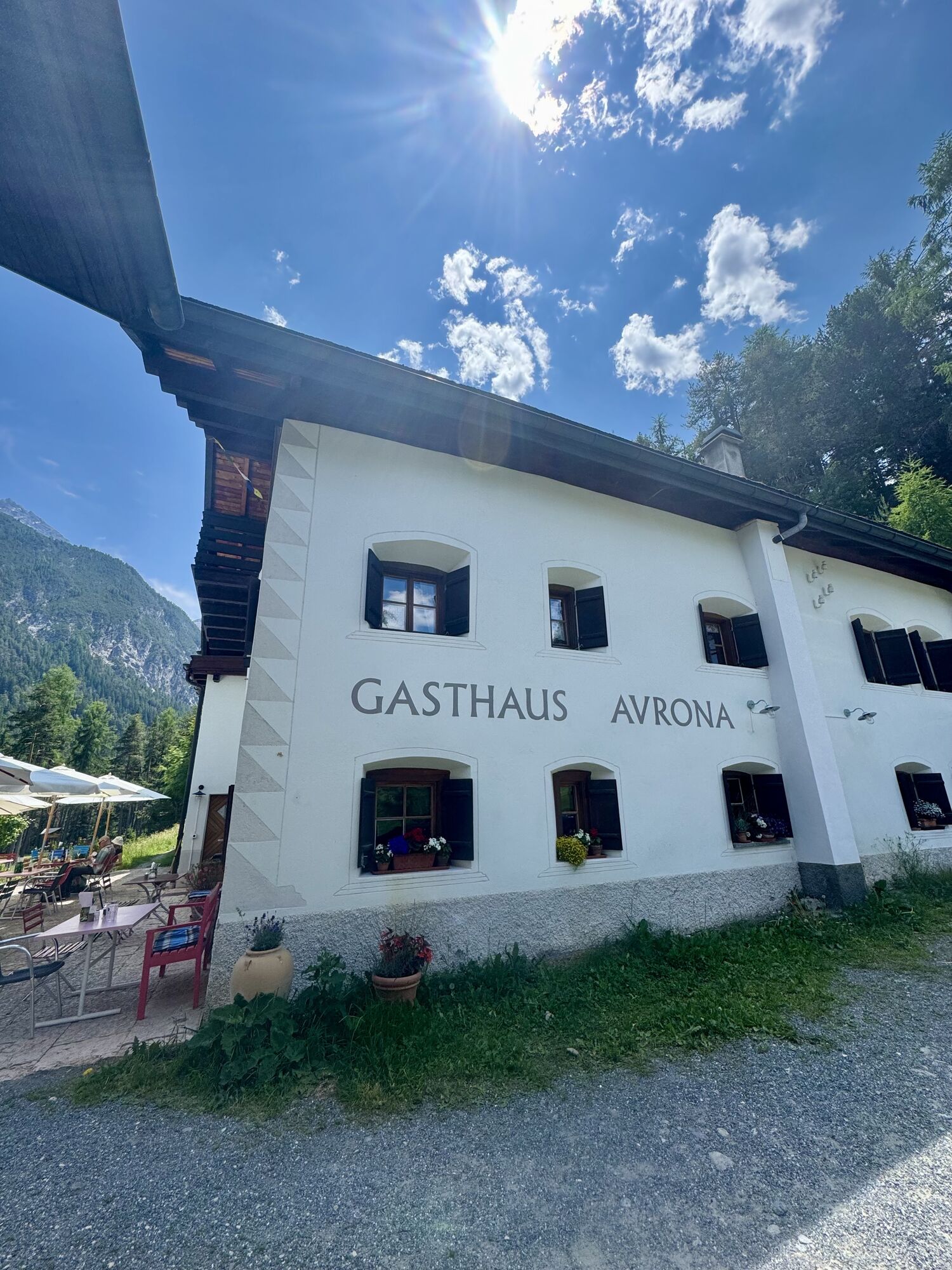
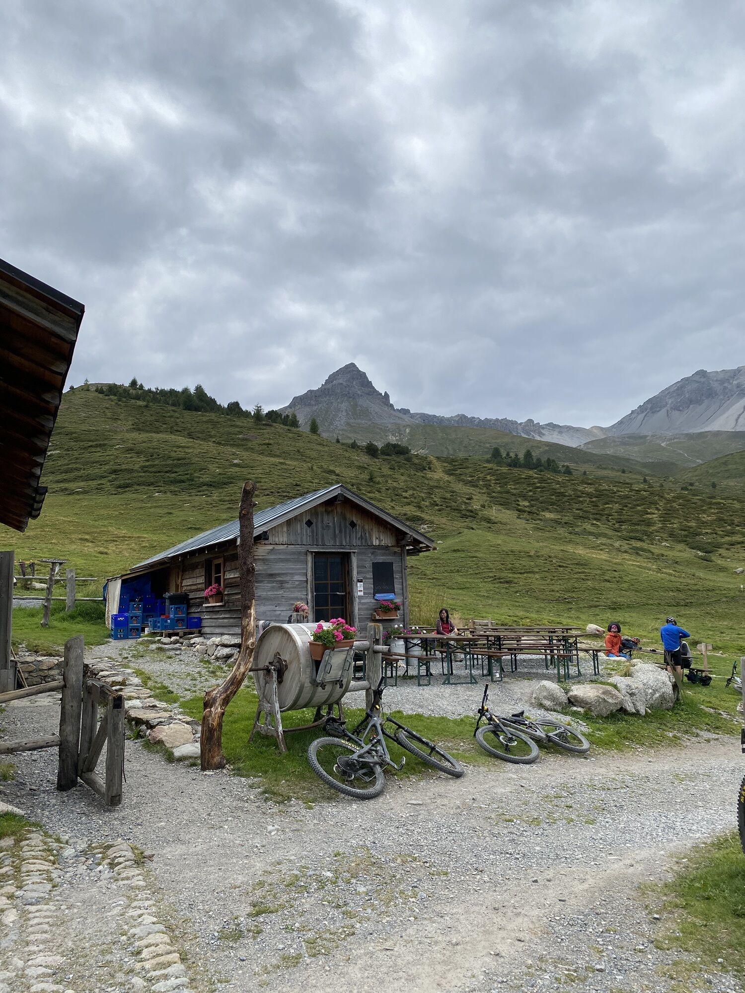
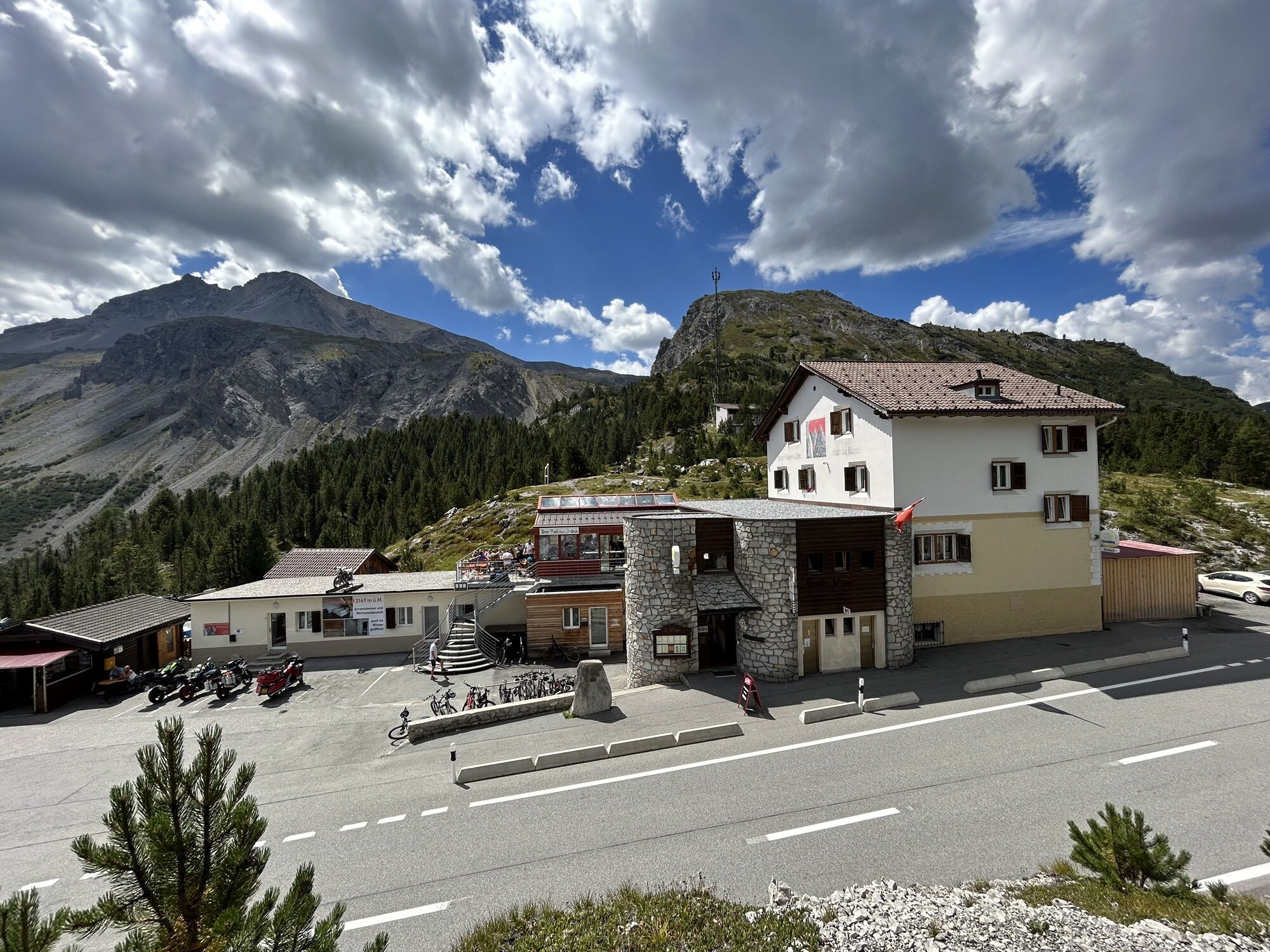
Inns en route: S-charl: Alvetern (open end of May – end of October) Tel. +41 (0)81 864 14 03, Crusch Alba Tel. +41 (0)81 864 14 05, Mayor Tel. +41 (0)81 864 14 12. In Süsom Givè: Tel. +41 (0)81 858 51 82 (open Easter – end of October).
The valley, which is narrow and wild to this point, splits into three valleys and becomes noticeably more welcoming. Meadows full of flowers frame the pretty village.
From S-charl heading into the valley, we stay beside the main creek. Pine forests mixed with larches dominate both mountain ridges. After the first creek crossing at Pt. 2018, the path rises more steeply to Alp Praditschöl (Pt. 2131), and then leads to Alp Astras (Pt. 2135). Opposite us, on the right side of the valley, extend the mighty trees of the primitive pine forest of Tamangur, the highest closed pine forest in Europe. In the canopy particularly, fierce struggles are waged beside the cadaverous, pale trunks of fallen tree giants, which acts as sheltered nurseries for delicate new shoots (the excursion to God da Tamangur above Pt. 2018 and Tamangur Dadoura, Pt. 2127, to Alp Tamangur Dadaint – or the other way around – does not take much time).
To get to Pass dal Fuorn, climb Alp Astras (Pt. 2135) heading southwest to Funtana da S-charl (Pt. 2393). At over 2400 metres, the rare Alpine orchid (chamorchis alpina) with its small blue-green blossoms grows here amid edelweiss and lobelia, as does the equally rare coriander-leafed “jewel flower” (callianthemum coriandrifolium) and saxifrage (saxifraga androsacea). The descent initially leads towards Alp da Munt, but later passes this, heading north to the plateaus of Plan da l'Aua. At Pt. 2152 you take a path on the right that leads through the forest to the pass of Süsom Givè, staying at the same altitude.
Inns en route: S-charl: Alvetern (open end of May – end of October) Tel. +41 (0)81 864 14 03, Crusch Alba Tel. +41 (0)81 864 14 05, Mayor Tel. +41 (0)81 864 14 12. In Süsom Givè: Tel. +41 (0)81 858 51 82 (open Easter – end of October).
Ruta
Vulpera
(1.280 m)
Pueblo
1,5 km
S-charl
(1.810 m)
Liquidación
13,0 km
Reformierte Kirche
(1.809 m)
Lugar de culto
13,1 km
Plan d'Immez
(1.976 m)
Corredor/terreno
15,7 km
Fuorcla Funtana da S-charl
(2.393 m)
Sillín de montaña
22,3 km
Süsom Givè
(2.153 m)
Corredor/terreno
26,5 km
Hotel Süsom Givè
(2.150 m)
Restaurante
26,6 km
Ruta
Scuol – S-charl – Süsom Givè
pesado
Senderismo
26,62
km
Vulpera
(1.280 m)
Pueblo
1,5 km
Avrona
(1.450 m)
Liquidación
3,5 km
Gasthaus Avrona
(1.449 m)
Restaurante
3,5 km
S-charl
(1.810 m)
Liquidación
13,0 km
Reformierte Kirche
(1.809 m)
Lugar de culto
13,1 km
Plan d'Immez
(1.976 m)
Corredor/terreno
15,7 km
Fuorcla Funtana da S-charl
(2.393 m)
Sillín de montaña
22,3 km
Süsom Givè
(2.153 m)
Corredor/terreno
26,5 km
Hotel Süsom Givè
(2.150 m)
Restaurante
26,6 km
Autor
Proporcionado por Engadin Samnaun Val Müstair
El tour Scuol – S-charl – Süsom Givè es proporcionado por outdooractive.com.

Compartir gira
Scuol – S-charl – Süsom Givè
pesado
Senderismo
26,62
km
Error
Se ha producido un error. Por favor, inténtelo de nuevo.
Información sobre la ruta
Ruta
Scuol – S-charl – Süsom Givè
Información de llegada
Transporte público
Arrival: As far as Scuol-Tarasp
Departure: By post bus from Süsom Givè (Pass Fuorn)
Información adicional y consejos
Información complementaria
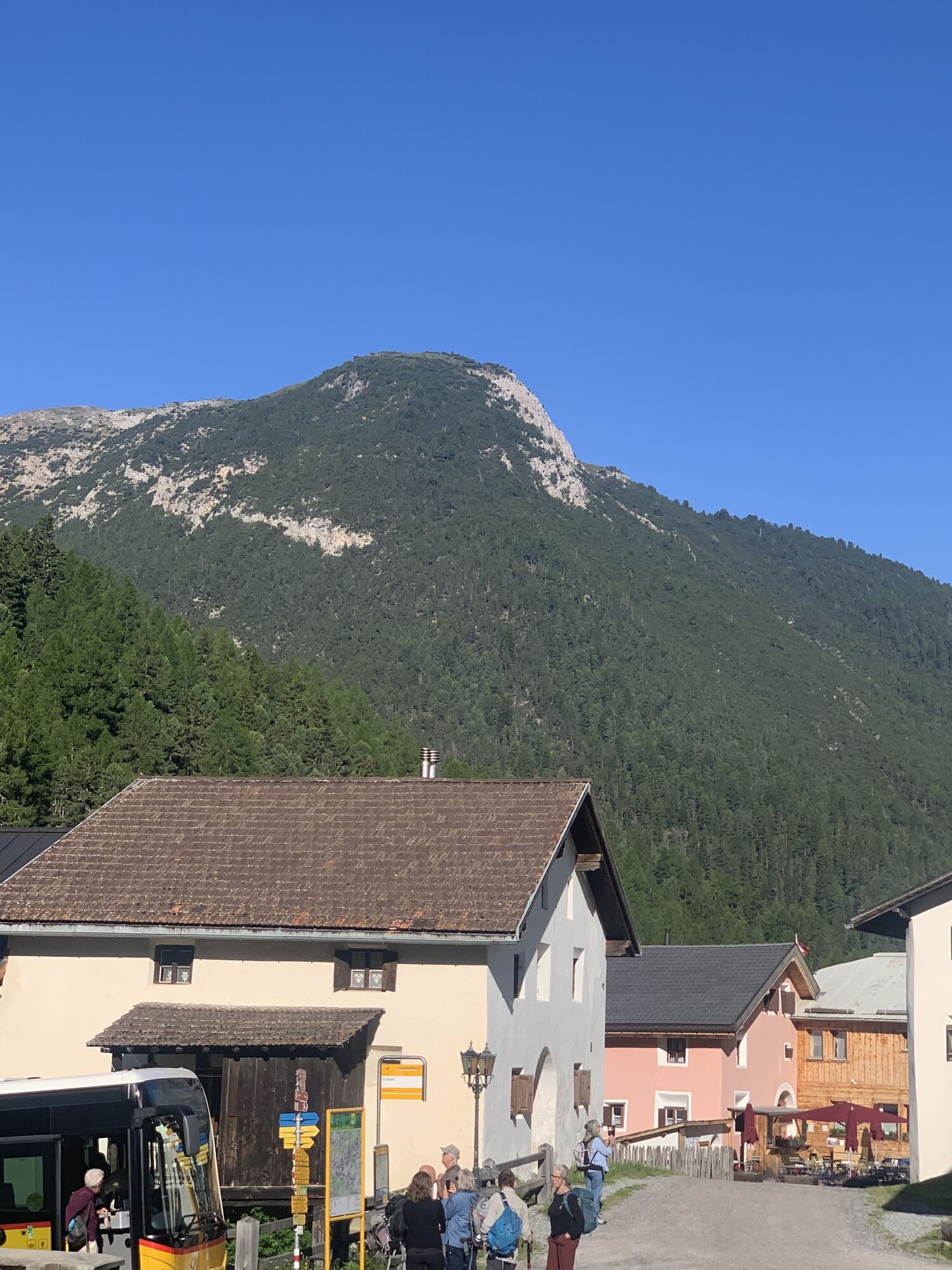
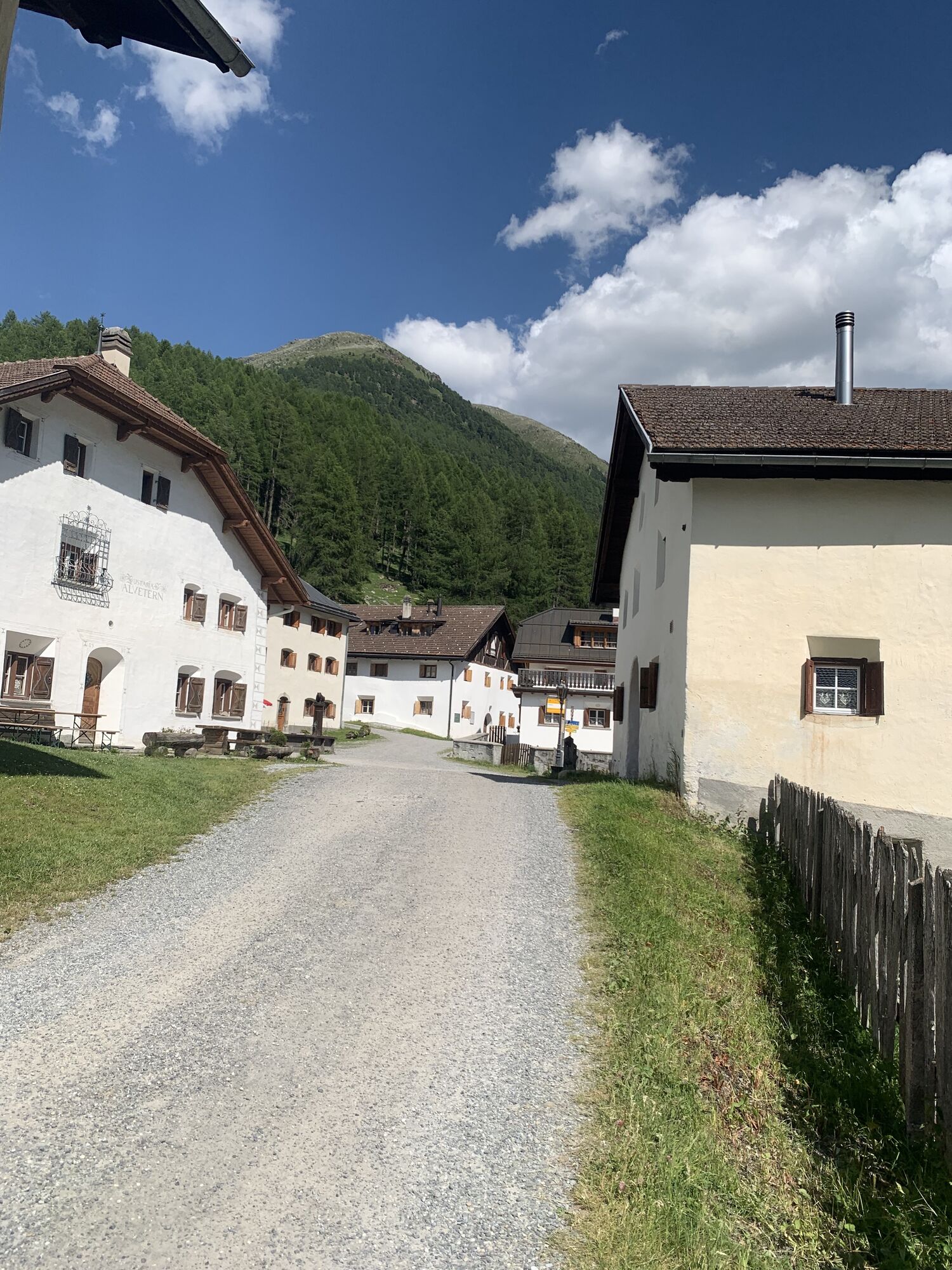
S-charl: S-charl was once inhabited all-year round; today it is a summer village. The Roman church dating from the 11th or 12th century was renovated repeatedly. It fits in charmingly with the village. The broad, sturdy miner's house from 1673 completes the spacious, pretty village square pleasantly. S-charl was the site of vigorous mining between 1370 and 1828. Even today, the partially collapsed tunnels and ruins at the northwest entrance to the village serve as a reminder of that era. The main product was silver-containing galenite, sphalerite and brown iron ore. The main building of the time has been restored by experts and now houses a mining museum.
Aún no hay opiniones
Rutas populares en los alrededores
-
5,0
Mountain restaurant Plantaptasch (without Lift)
medioSenderismo 3,42 km -
3,6
Easy hiking rout to the top of the Watles Moutain (2.550 m)
medioSenderismo 2,35 km -
4,5
Rundwanderweg Wattles und Sesvenna
luzSenderismo 16,4 km -
4,0
Margunet (sendero natural en el Parque Nacional Suizo)
luzSenderismo 7,76 km -
4,5
Tarasp Fontana – Sparsels – Lai Nair (circular)
luzSenderismo 7,67 km -
4,8
Parque Nacional: Grimmels (ruta circular)
luzSenderismo 6 km -
5,0
San Jon – Chamonna Lischana (ida y vuelta)
medioSenderismo 12,0 km -
4,0
Prui – Piz Clünas – Alp Laret – Ftan
medioSenderismo 13,6 km -
4,5
Bergwanderung Schlinig -Seswenahütte
medioSenderismo 13,6 km -
5,0
3 Länder Tour Uinaschlucht MTB
pesadoMountainbike 74,6 km

Senderismo y rastreo

Más de 550.000 sugerencias de excursiones, mapas detallados y un intuitivo planificador de rutas hacen de esta aplicación una herramienta imprescindible para todos los amantes de la naturaleza.

No se pierda las ofertas y la inspiración para sus próximas vacaciones
Suscribirse al boletín de noticias
Error
Se ha producido un error. Por favor, inténtelo de nuevo.
Gracias por inscribirse
Su dirección de correo electrónico se ha añadido a la lista de correo.
Viajes por Europa
Austria
Suiza
Alemania
Italia
Eslovenia
Francia
Países Bajos
Belgium
Polonia
Liechtenstein
República Checa
Slovakia
España
Croacia
Bosnia y Herzegovina
Luxemburgo
Andorra
Portugal
Iceland
United Kingdom
Ireland
Greece
Albania
North Macedonia
Malta
Norway
Montenegro
Moldova
Kosovo
Hungary
San Marino
Romania
Estonia
Latvia
Belarus
Cyprus
Lithuania
Serbia
Bulgaria
Monaco
Denmark
Sweden
Finland