Unterwart/Alsóőr - Pfarrkirche hl. Ladislaus - Pfarrkirche Hl. Michael - Ungarischer Hof
medio
Navegue por
Navegue por
Consigue este tour en tu móvil
Unterwart/Alsóőr - Pfarrkirche hl. Ladislaus - Pfarrkirche Hl. Michael - Ungarischer Hof
medio
Ciclismo de carrera
59,26
km
Escanee el código QR e inicie la navegación en la aplicación bergfex

Senderismo y rastreo


Unterwart/Alsóőr - Pfarrkirche hl. Ladislaus - Pfarrkirche Hl. Michael - Ungarischer Hof
medio
Distancia
59,26
km
Duración
03:02
h
Ascenso
372
m
Nivel del mar
233 -
371
m
Descarga de pistas
Unterwart/Alsóőr - Pfarrkirche hl. Ladislaus - Pfarrkirche Hl. Michael - Ungarischer Hof
medio
Ciclismo de carrera
59,26
km
Ruta
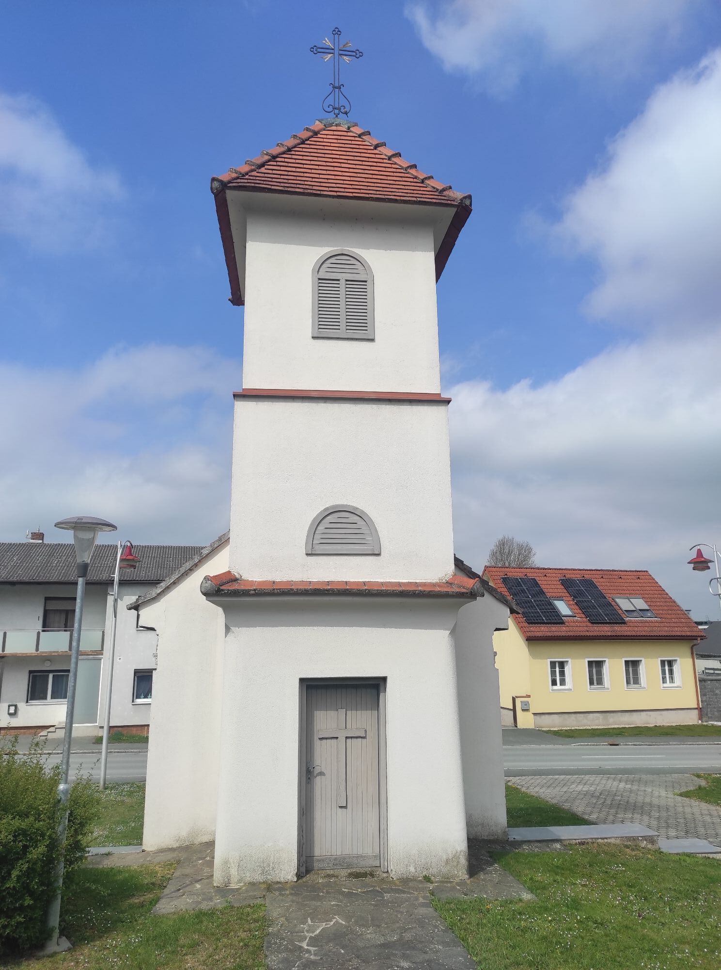
Evangelische Kirche
(282 m)
Lugar de culto
3,8 km
Pfarrkirche hl. Ladislaus
(264 m)
Lugar de culto
11,4 km
Marienkapelle
(267 m)
Lugar de culto
17,5 km
Kapelle hl. Antonius
(259 m)
Lugar de culto
35,1 km
Wallfahrtskapelle Maria Helferin
(260 m)
Lugar de culto
38,0 km
Patriciuskapelle
(274 m)
Lugar de culto
42,0 km
Pfarrkirche Auferstehung Christi
(321 m)
Lugar de culto
55,5 km
Ruta
Unterwart/Alsóőr - Pfarrkirche hl. Ladislaus - Pfarrkirche Hl. Michael - Ungarischer Hof
medio
Ciclismo de carrera
59,26
km
Unterwart/Alsóőr
(301 m)
Pueblo
0,0 km
Ungarischer Hof
(299 m)
Restaurante
0,0 km
Rotenturm an der Pinka
(297 m)
Pueblo
1,0 km
Evangelische Kirche
(282 m)
Lugar de culto
3,8 km
Jabing
(281 m)
Pueblo
4,4 km
Rohrbach an der Teich
(273 m)
Pueblo
8,3 km
Filialkirche Christi Himmelfahrt
(272 m)
Lugar de culto
8,4 km
Großbachselten
(268 m)
Pueblo
9,7 km
Kleinbachselten
(270 m)
Pueblo
10,0 km
Pfarrkirche hl. Ladislaus
(264 m)
Lugar de culto
11,4 km
Mischendorf
(270 m)
Pueblo
11,4 km
Kohfidisch
(258 m)
Pueblo
15,5 km
Filialkirche zur Heiligen Dreifaltigkeit
(260 m)
Lugar de culto
15,6 km
Gasthof Landauer
(257 m)
Restaurante
15,7 km
Marienkapelle
(267 m)
Lugar de culto
17,5 km
Kirchfidisch
(275 m)
Pueblo
18,0 km
HangarOne
(289 m)
Restaurante
21,1 km
Sankt Michael im Burgenland
(252 m)
Pueblo
25,9 km
Gasthof - "Zum Storch"
(252 m)
Restaurante
26,0 km
Pfarrkirche Hl. Michael
(253 m)
Lugar de culto
26,1 km
Rauchwart im Burgenland
(235 m)
Pueblo
29,1 km
Stegersbach
(261 m)
Pueblo
34,9 km
Kastell Stegersbach
(261 m)
Restaurante
35,0 km
Kapelle hl. Antonius
(259 m)
Lugar de culto
35,1 km
Neue Pfarrkirche hl. Geist
(258 m)
Lugar de culto
35,8 km
Alte Pfarrkirche hl. Ägidius
(258 m)
Lugar de culto
36,0 km
Steinbach
(258 m)
Liquidación
36,8 km
Gasthaus Holper
(261 m)
Restaurante
37,9 km
Wallfahrtskapelle Maria Helferin
(260 m)
Lugar de culto
38,0 km
Ollersdorf im Burgenland
(266 m)
Pueblo
39,3 km
Mizzi's Wirzhaus
(276 m)
Restaurante
41,6 km
Litzelsdorf
(272 m)
Pueblo
41,8 km
Patriciuskapelle
(274 m)
Lugar de culto
42,0 km
Kemeten
(299 m)
Pueblo
46,7 km
Oldtimer
(321 m)
Restaurante
52,6 km
Evangelische Pfarrkirche Oberwart A. B.
(316 m)
Lugar de culto
54,8 km
Oberwart/Felsőőr
(313 m)
Ciudad
55,2 km
Pfarrkirche Auferstehung Christi
(321 m)
Lugar de culto
55,5 km
Unterwart/Alsóőr
(301 m)
Pueblo
59,1 km
Ungarischer Hof
(299 m)
Restaurante
59,2 km
Autor
Proporcionado por Bergfex Tour Generator
Compartir gira
Unterwart/Alsóőr - Pfarrkirche hl. Ladislaus - Pfarrkirche Hl. Michael - Ungarischer Hof
medio
Ciclismo de carrera
59,26
km
Error
Se ha producido un error. Por favor, inténtelo de nuevo.
Aún no hay opiniones
Webcams del recorrido
Rutas populares en los alrededores
-
4,3
Ruta ciclista de la antigua vía férrea
medioCiclismo 41,6 km -
4,6
S21 Sendero circular de la paz
luzSenderismo 11,4 km -
3,9
S23 Recorrido Circular Tres Viñedos
luzSenderismo 14,1 km -
5,0
Südburgenländischer Bahntrassen-Radweg
luzCiclismo 67 km -
2,9
Ruta Paradiesrunde
pesadoCiclismo de larga distancia 261,6 km -
3,2
Camino circular (3) Desfiladero de Pinka - Senderismo en la idílica región vinícola
medioSenderismo 11,2 km -
4,4
Eisenberg, Csaterberg, Georgssee
pesadoSenderismo 13,2 km -
5,0
Burgau: Waldtour
Ciclismo 25,0 km -
4,0
B56 Stremtal-Radwanderweg
medioCiclismo 37,4 km -
5,0
Senderismo en el idilio del vino: recorrido circular (2) Eisenberg
luzSenderismo 4,34 km
Senderismo y rastreo

Más de 550.000 sugerencias de excursiones, mapas detallados y un intuitivo planificador de rutas hacen de esta aplicación una herramienta imprescindible para todos los amantes de la naturaleza.

No se pierda las ofertas y la inspiración para sus próximas vacaciones
Suscribirse al boletín de noticias
Error
Se ha producido un error. Por favor, inténtelo de nuevo.
Gracias por inscribirse
Su dirección de correo electrónico se ha añadido a la lista de correo.
Viajes por Europa
Austria
Suiza
Alemania
Italia
Eslovenia
Francia
Países Bajos
Belgium
Polonia
Liechtenstein
República Checa
Slovakia
España
Croacia
Bosnia y Herzegovina
Luxemburgo
Andorra
Portugal
Iceland
United Kingdom
Ireland
Greece
Albania
North Macedonia
Malta
Norway
Montenegro
Moldova
Kosovo
Hungary
San Marino
Romania
Estonia
Latvia
Belarus
Cyprus
Lithuania
Serbia
Bulgaria
Monaco
Denmark
Sweden
Finland