


3-Huts-Hike Nilltal


This highlight for pleasure hikers starts at the Marin parking lot in Virgen and leads first along trail no. 923 and the All Saints Chapel to the Gottschaunalm. At the first of the three huts you will...
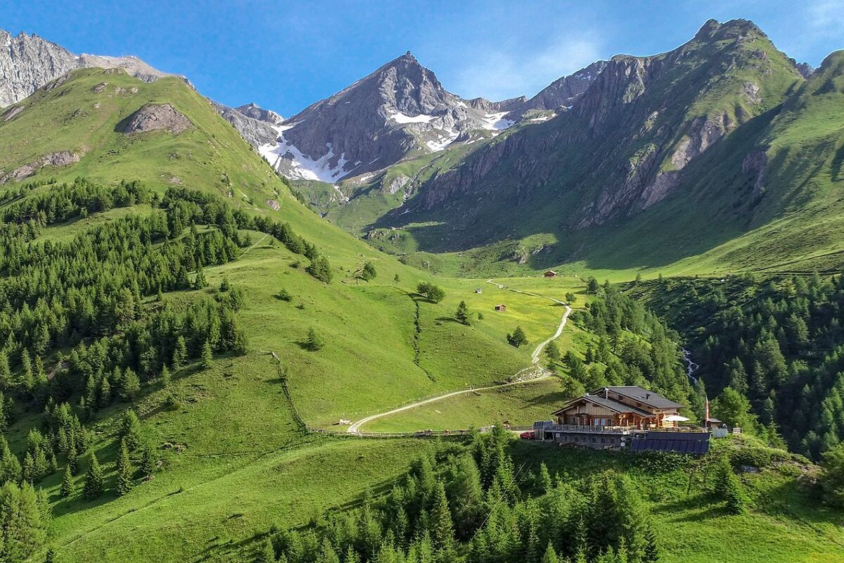
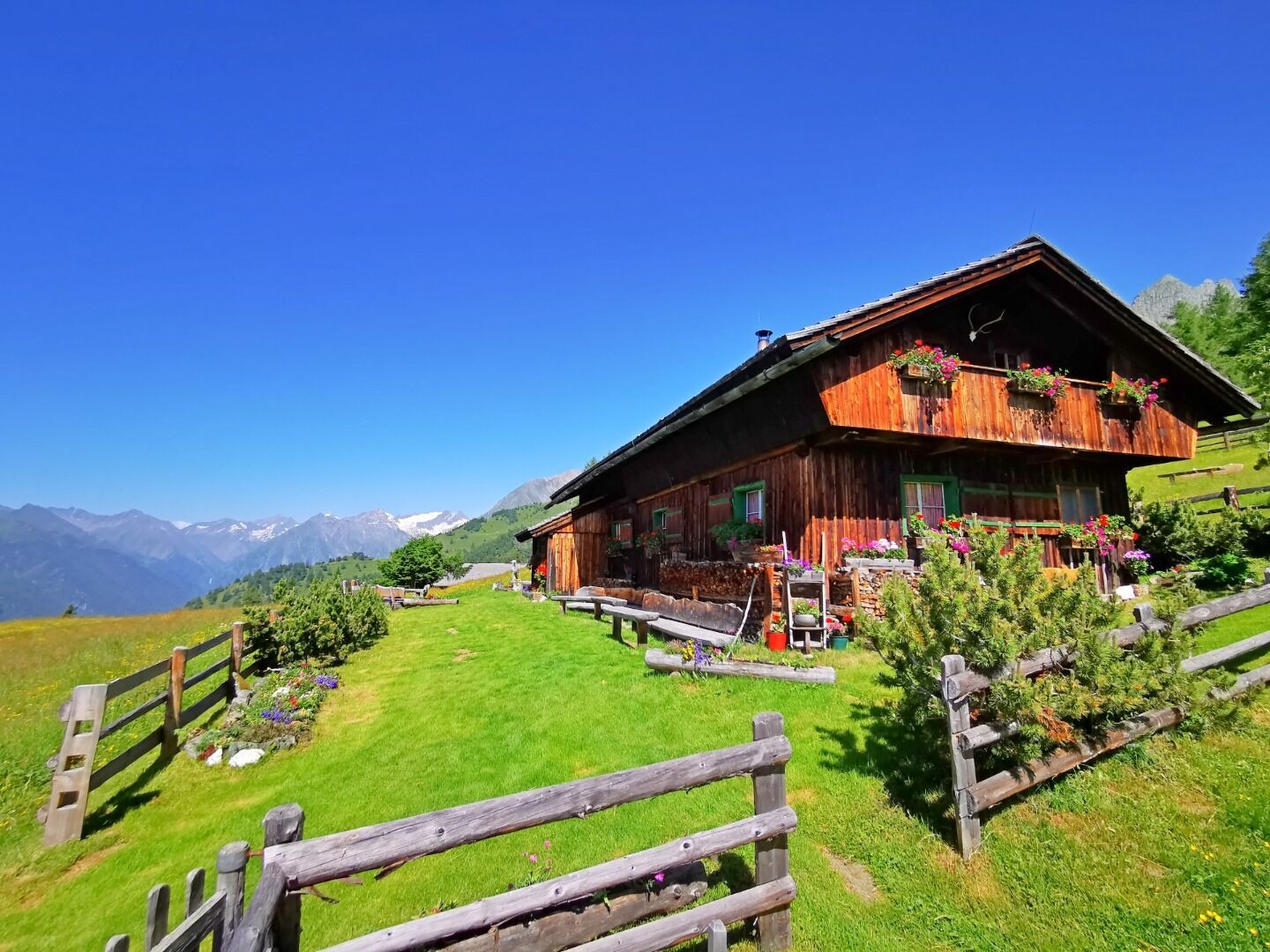
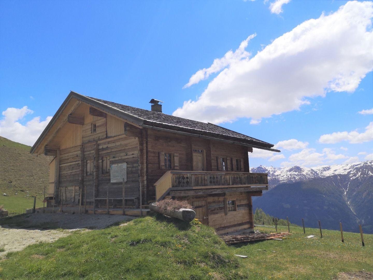
This highlight for pleasure hikers starts at the Marin parking lot in Virgen and leads first along trail no. 923 and the All Saints Chapel to the Gottschaunalm. At the first of the three huts you will be rewarded with a fragrant blossom and crystal clear views. The path to the Schmiedleralm can be covered in just under 30 minutes. Here you will be spoiled with homemade products. The third hut is only a few hundred meters away: the Nilljochhütte with its large sun terrace is the crowning glory. The way back to the parking lot is partly on the trail, partly on the forest road.

Virgen Abzw. Obermauern
Parkplatz Marin
Rutas populares en los alrededores
-
4,6
Vom Matreier Tauernhaus über die Felsenkapelle nach Innergschlöss
luzSenderismo 9,19 km -
4,1
Gletscherlehrweg Innergschlöß
medioSenderismo 9,36 km -
4,5
Circular hike Proßeggklamm
medioSenderismo 8,41 km -
4,8
NaturKraftWeg Umbalfälle
luzSendero temático 5,99 km -
5,0
Gletscherweg Innergschlöß Großvenediger
medioSenderismo 11,0 km -
5,0
Vom Matreier Tauernhaus zum Venedigerhaus
luzSenderismo 8,98 km -
5,0
Muhs-Panoramaweg
medioSenderismo 14,0 km -
3,0
Neukirchen: recorrido Großvenediger
pesadoSenderismo 7,40 km -
4,8
Wanderung zu den Umballfällen
luzSenderismo 6,73 km -
4,4
Themenweg "Geschichte(n)weg Dorfertal"
luzSenderismo 16,4 km
Senderismo y rastreo


No se pierda las ofertas y la inspiración para sus próximas vacaciones
Su dirección de correo electrónico se ha añadido a la lista de correo.