


Castle path
Start at the village square in Castelbello and go to the Köfelgut wine-growing estate to take the Latschander irrigation channel path (no. 3) eastwards. Cross the road to Monte Trumes to get to the „Kastelbeller...
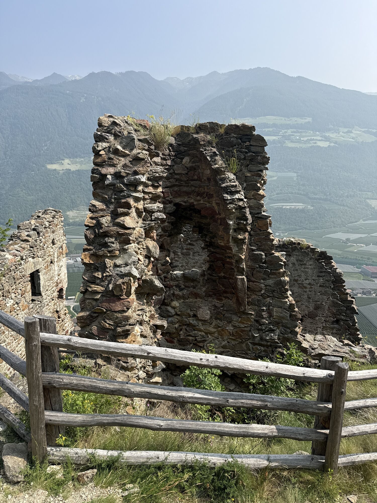
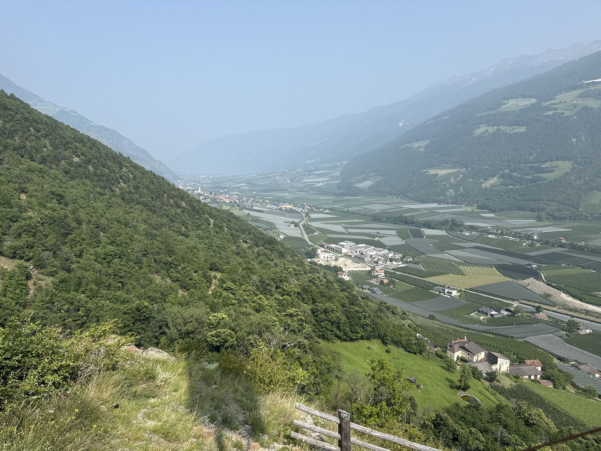
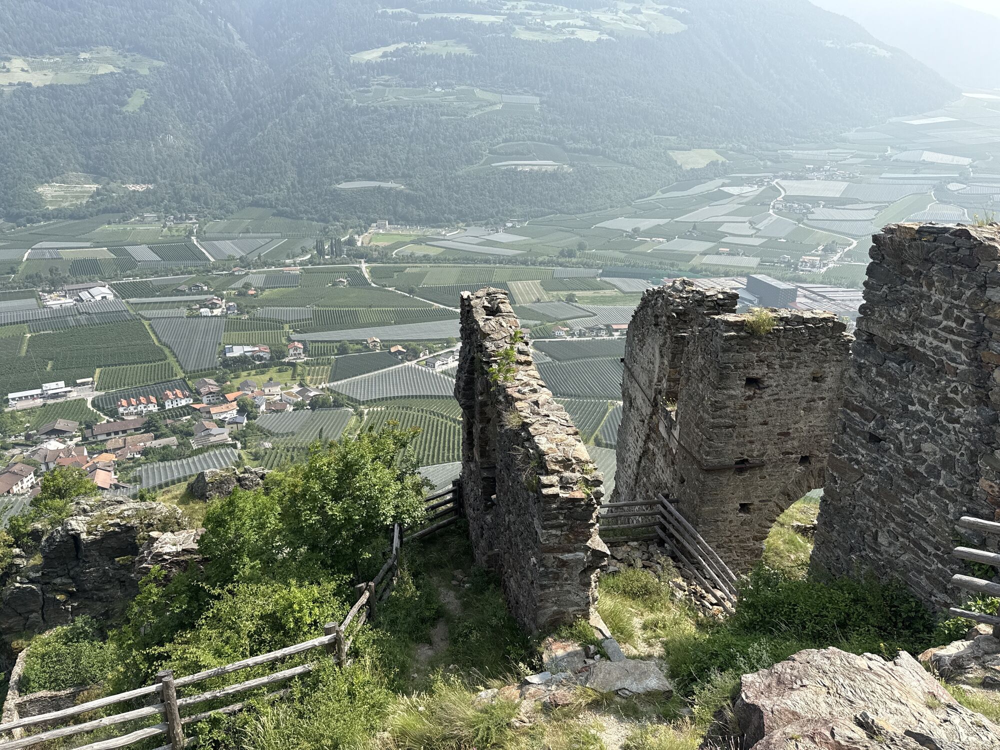
Start at the village square in Castelbello and go to the Köfelgut wine-growing estate to take the Latschander irrigation channel path (no. 3) eastwards. Cross the road to Monte Trumes to get to the „Kastelbeller Sunnenweg“ signpost after the game fence. Then continue upwards through downy oaks until you reach the castle ruin of Colsano Castle. Descend on the east side of the castle hill to return to the irrigation channel path that takes you back to Castelbello. Alternatively, you can continue eastwards along the Senales irrigation channel path to Ciardes or Juval.


Restaurants at Castelbello-Ciardes
Sí
Sí
Sí
Train station Castelbello
Rutas populares en los alrededores
-
4,8
Naturns Unterstellbahn bis Texelbahn auf dem Meraner Höhenweg
medioSenderismo 9,77 km -
4,3
Vorderkaser - Eishof / Texelgruppe
luzSenderismo 4,83 km -
4,5
Aschbach / Rio Lagundo – Naturnser Alm mountain pasture - Vigiljoch/San Vigilio
medioSenderismo 10,3 km -
4,2
Rundweg Vernagter See plus Einkehr Finailhof
medioSenderismo 8,73 km -
4,1
Vernagt-Stausee (Seerundgang)
luzSenderismo 6,70 km -
4,9
Pfossental - vom Vorderkaser auf die Stettinerhütte
medioSenderismo 23,7 km -
4,7
Hoher Dieb von Steinrast aus
medioSenderismo 13,6 km -
4,8
Meran Naturnser Alm, Suedtirol, Italien
medioMountainbike 49,6 km -
5,0
Similaun-Hütte
medioSenderismo de montaña 14 km -
4,0
Vinschger Höhenweg
luzSenderismo 12,2 km

Senderismo y rastreo


No se pierda las ofertas y la inspiración para sus próximas vacaciones
Su dirección de correo electrónico se ha añadido a la lista de correo.