


Bad Schandau - Schrammsteinaussicht - Breite Kluft - Bad Schandau
Marktplatz Bad Schandau - Hotel Lindenhof - Badallee - Lutherweg - Lutherdenkmal - Lutherweg - Panoramaweg - Ostrauer Personenaufzug - Ostrauer Ring - Falkensteinstraße - Abzweig Klüfftelweg - Zahnsgrund...
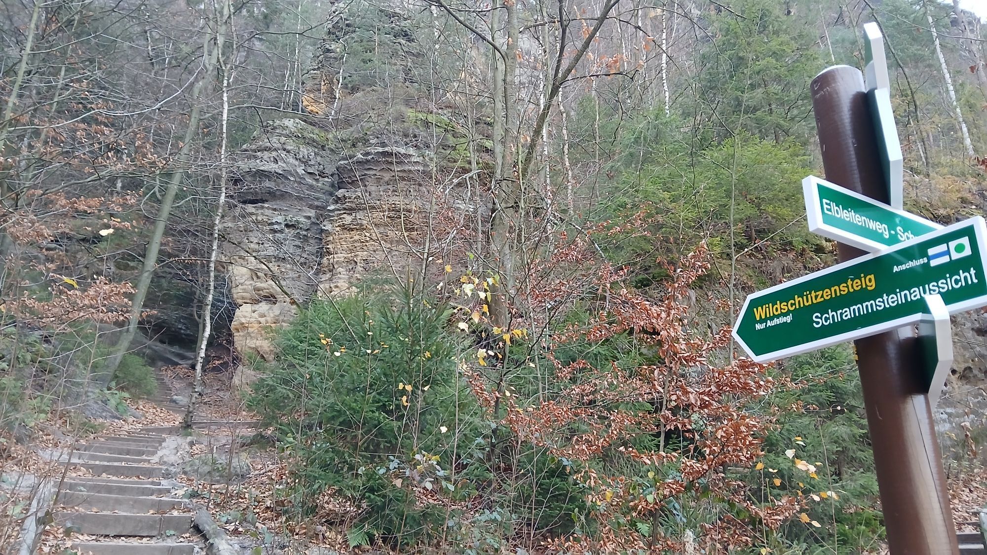
Marktplatz Bad Schandau - Hotel Lindenhof - Badallee - Lutherweg - Lutherdenkmal - Lutherweg - Panoramaweg - Ostrauer Personenaufzug - Ostrauer Ring - Falkensteinstraße - Abzweig Klüfftelweg - Zahnsgrund - Treppenaufstieg durch den Lattengrund - Schrammsteintor - Wildschützensteig- Schrammsteinaussicht - Schrammsteingratweg - Abzweig „Breite Kluft“ - Elbleitenweg - Schrammsteinaussicht Richtung Obrigensteig - Elbufer Bad Schandau
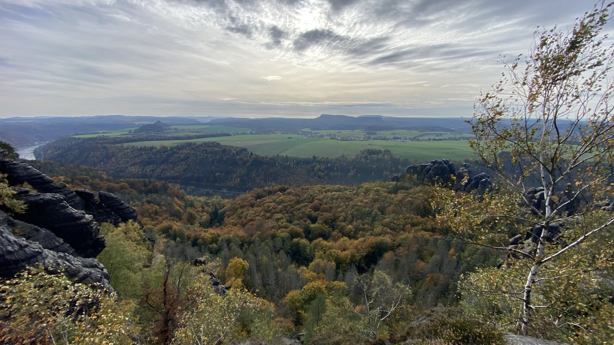
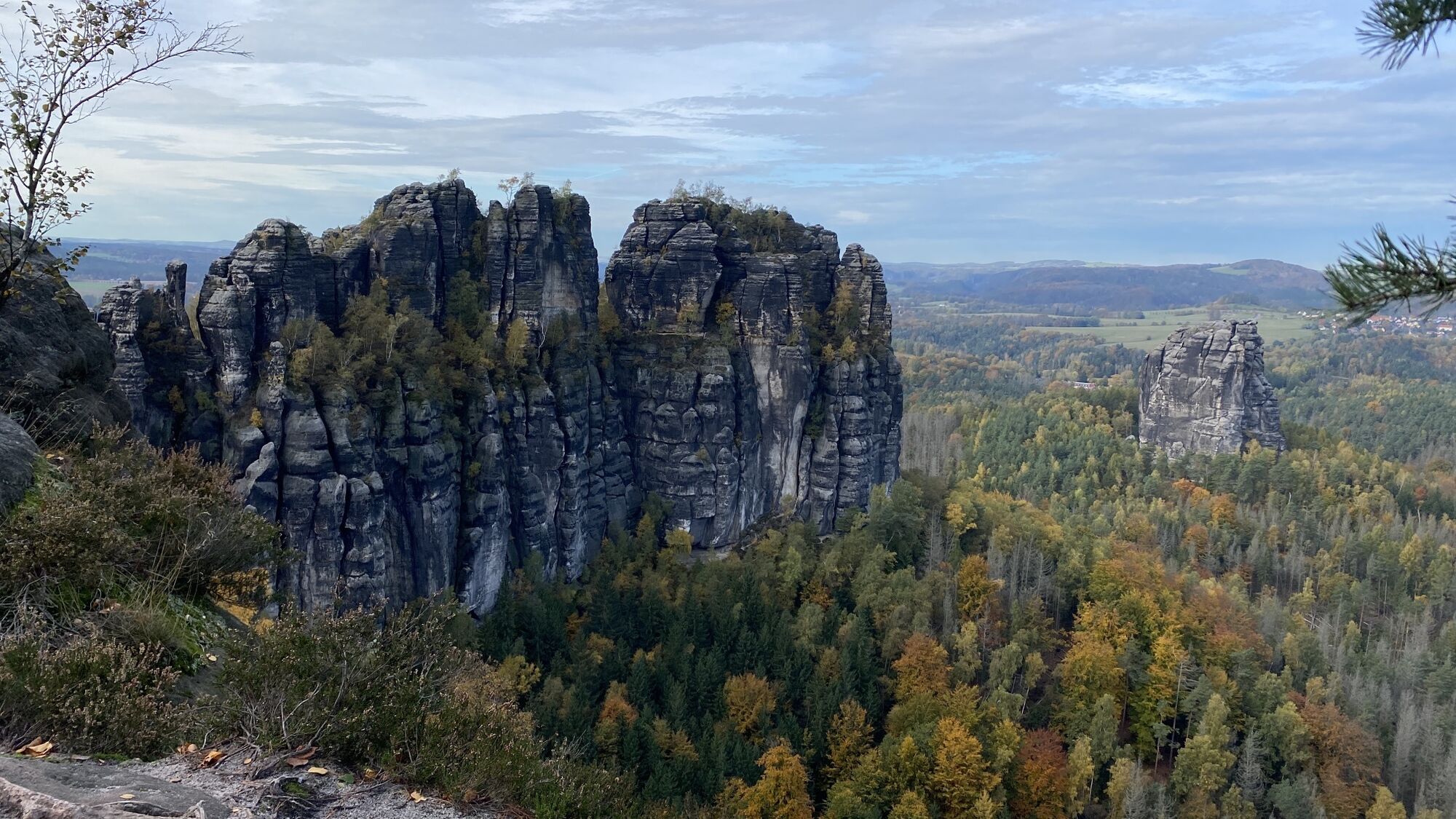
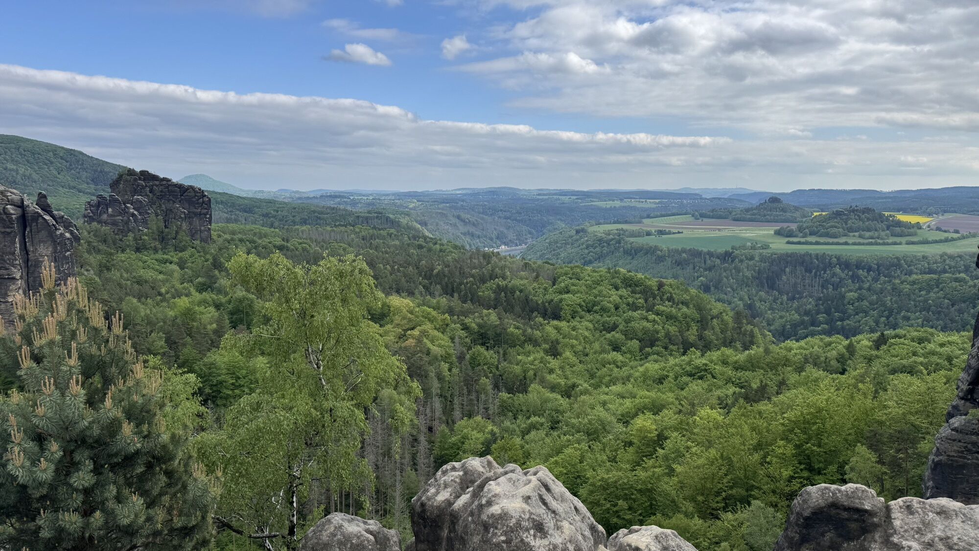
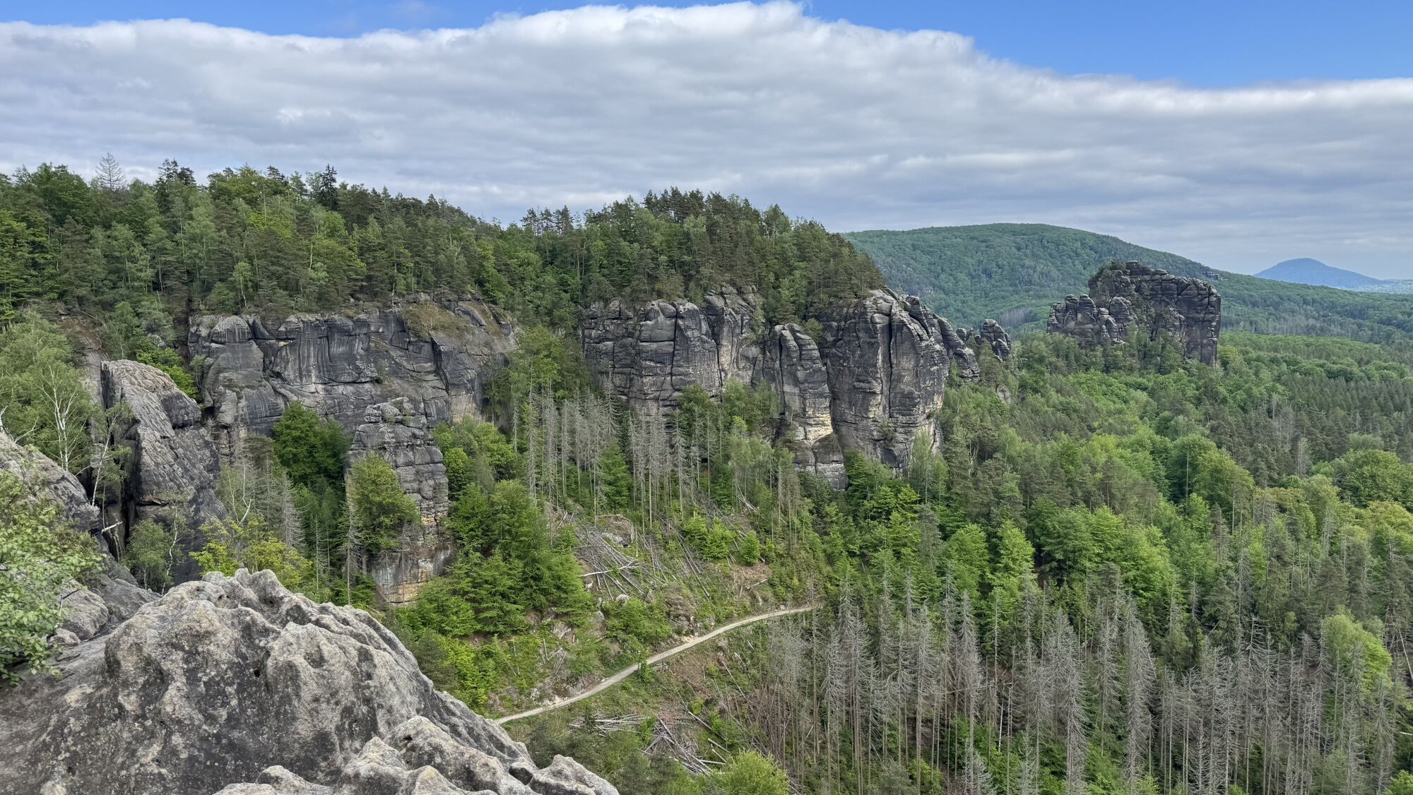
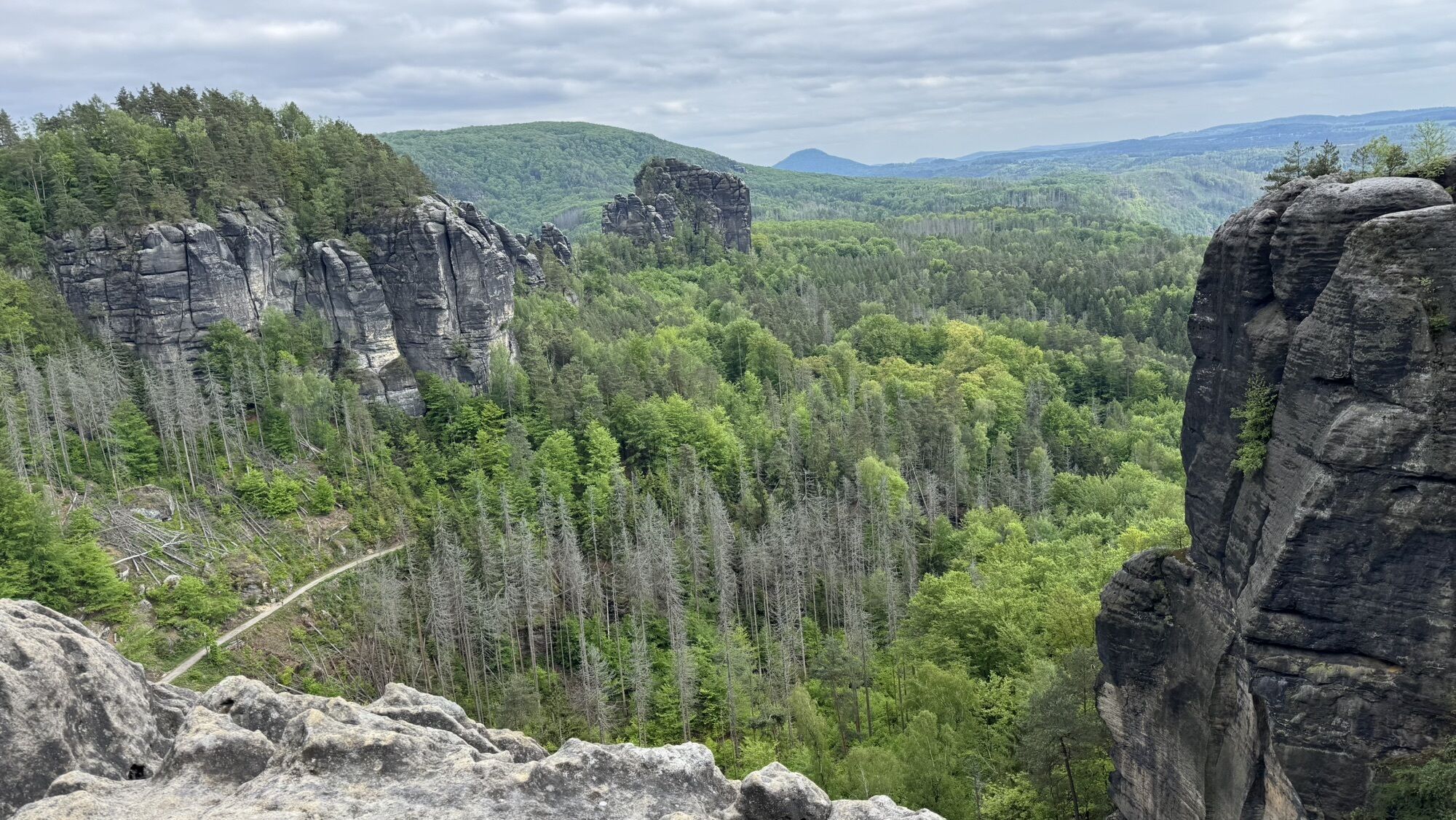
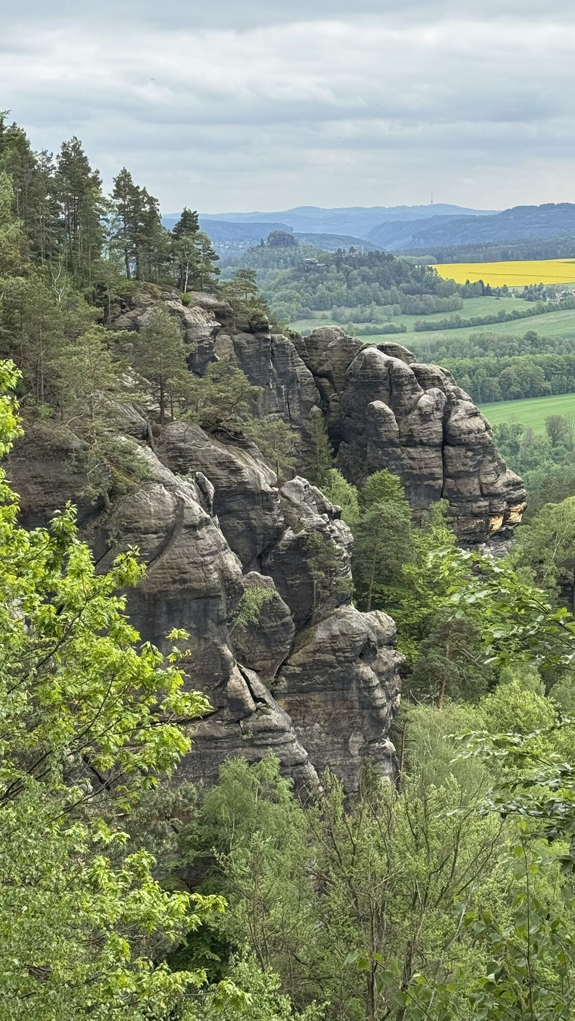
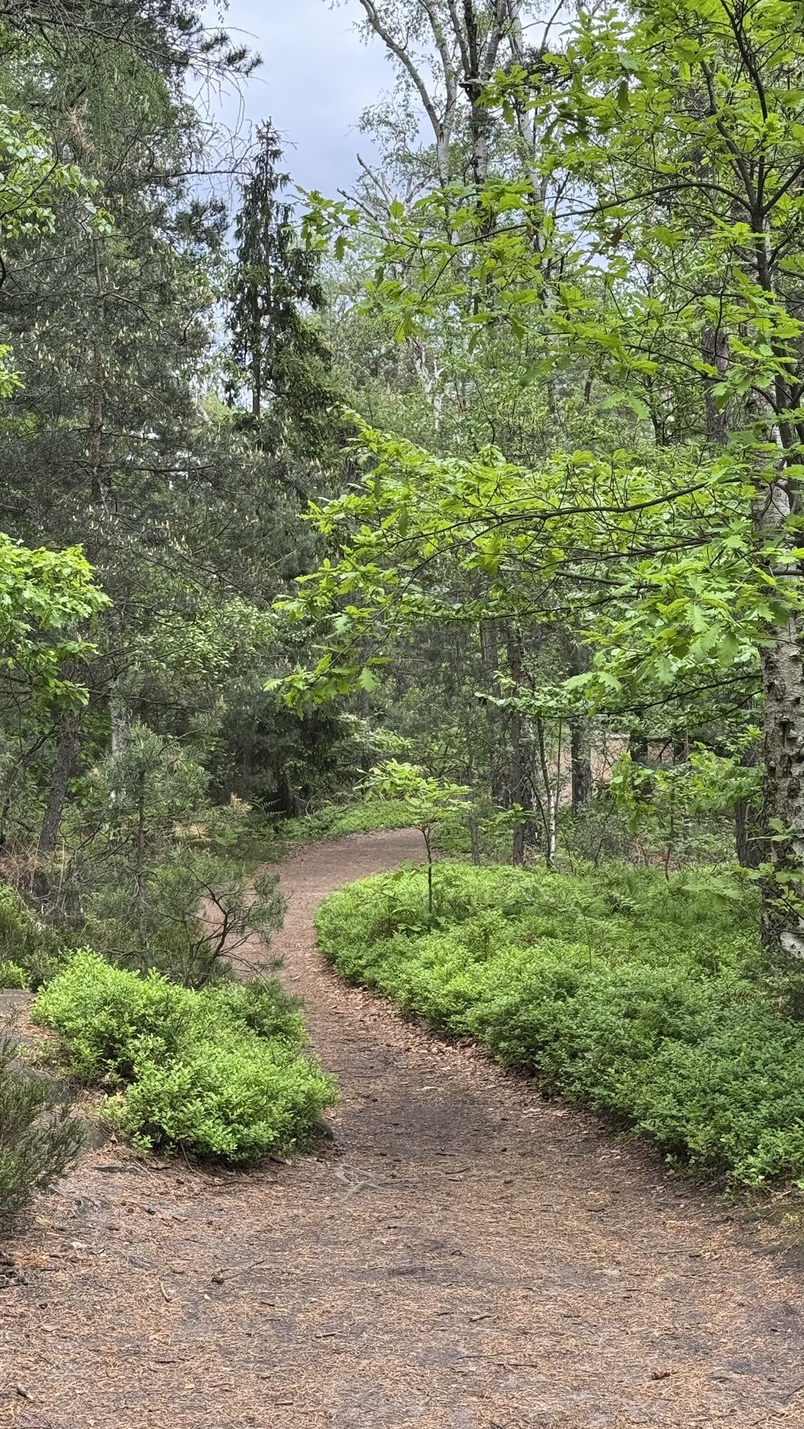
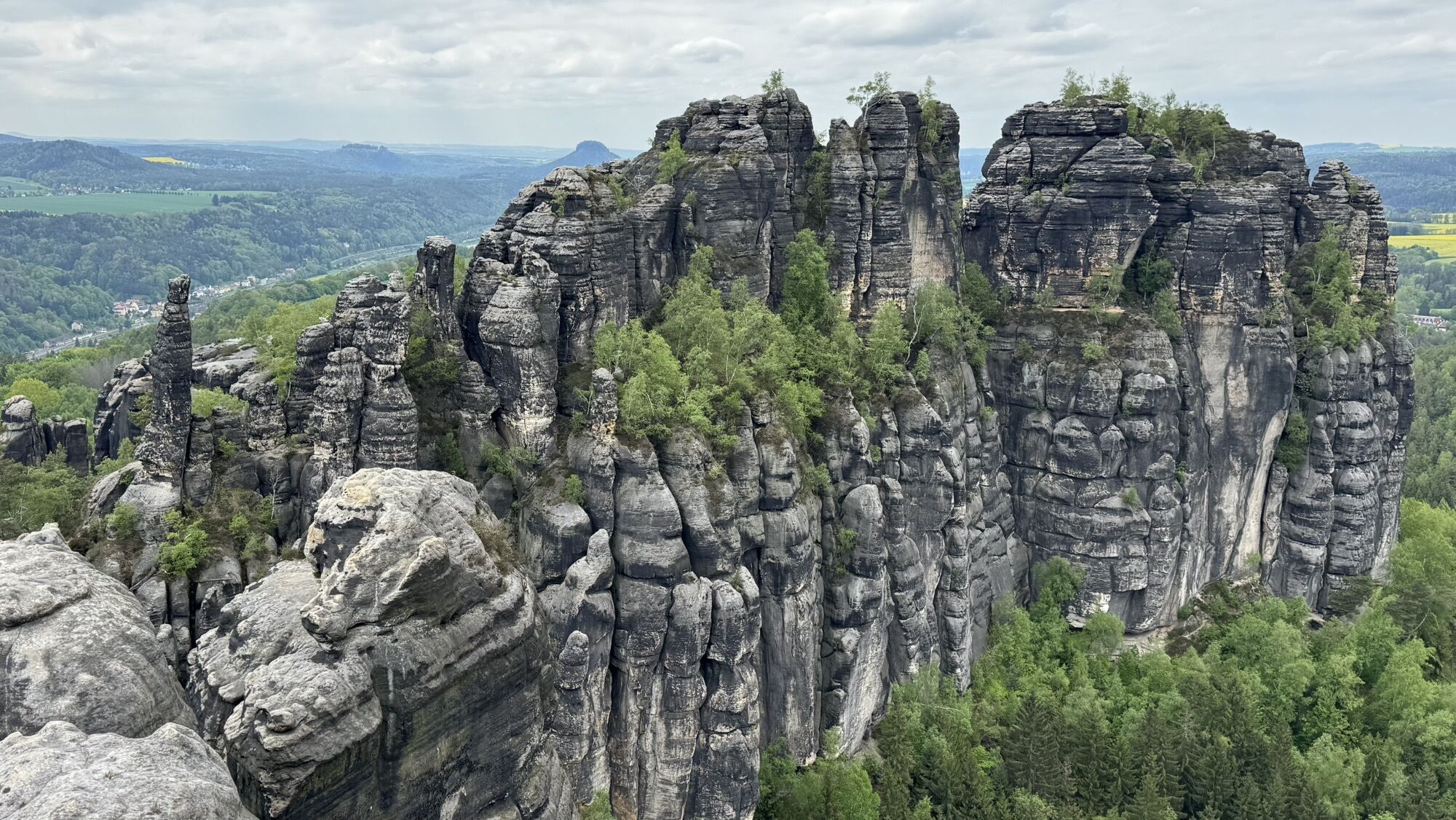
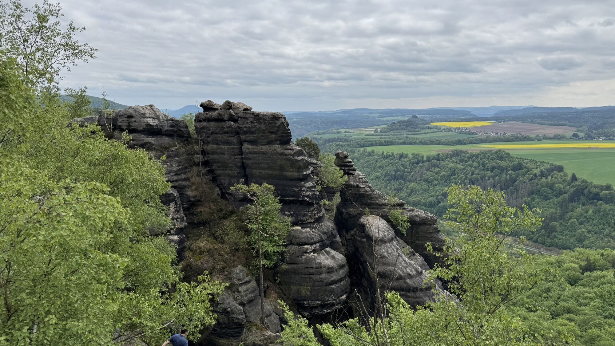
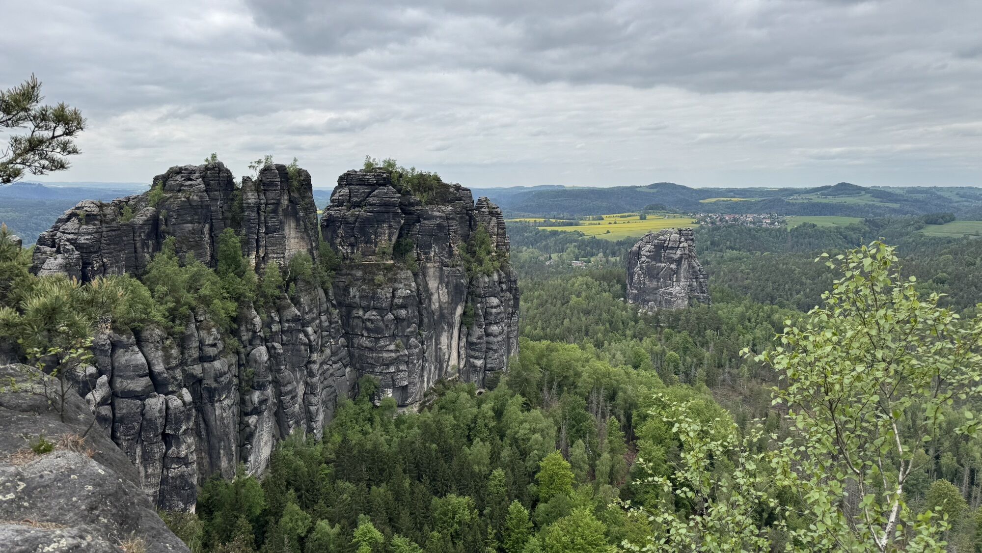
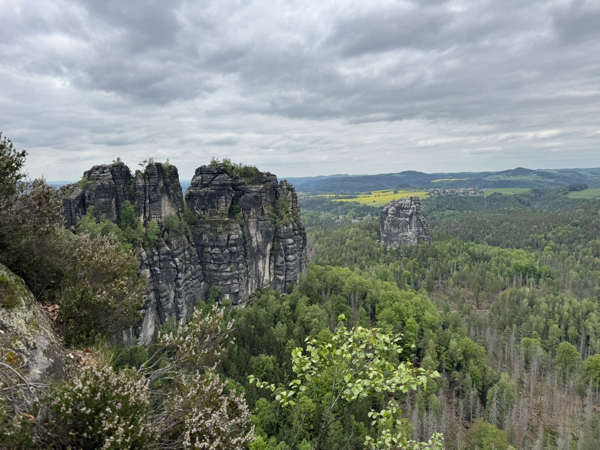
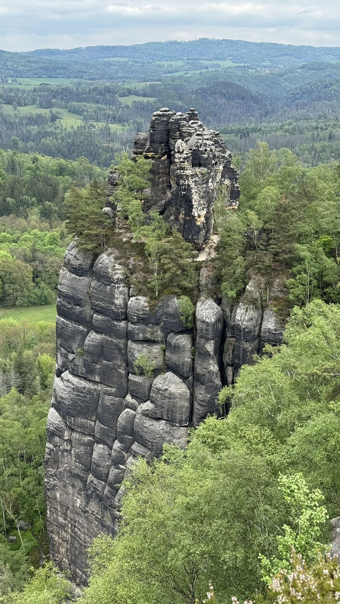
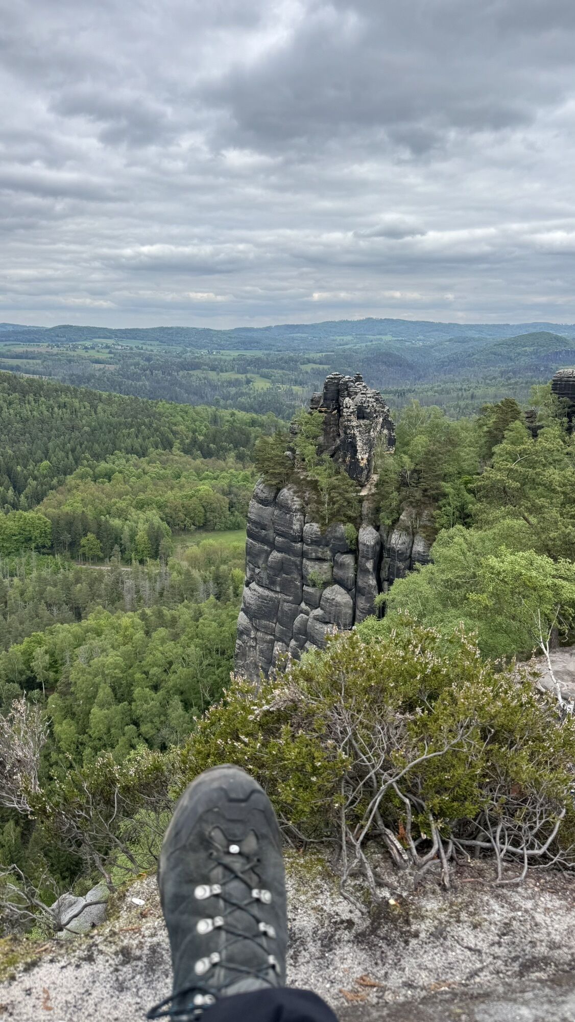
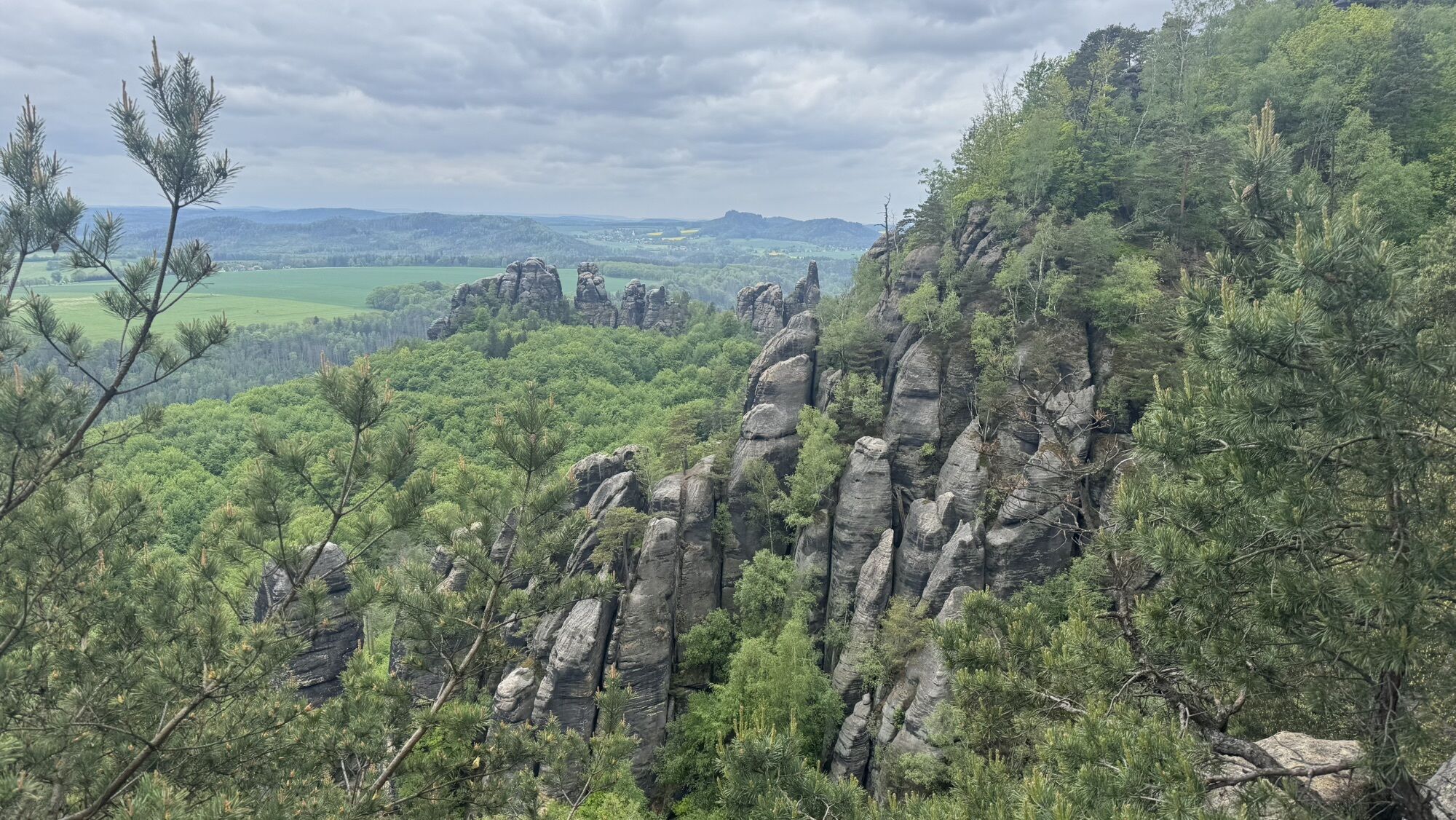
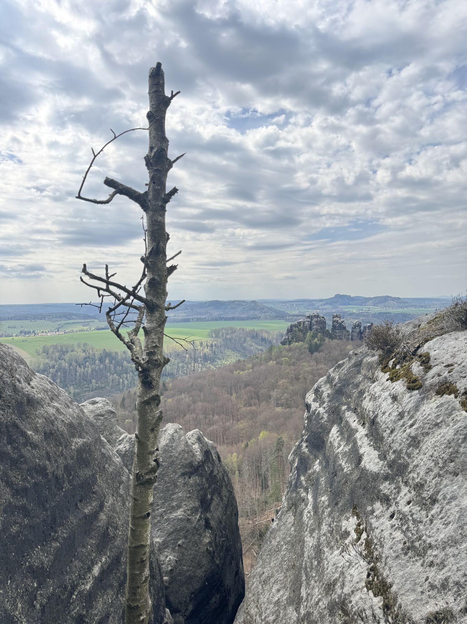
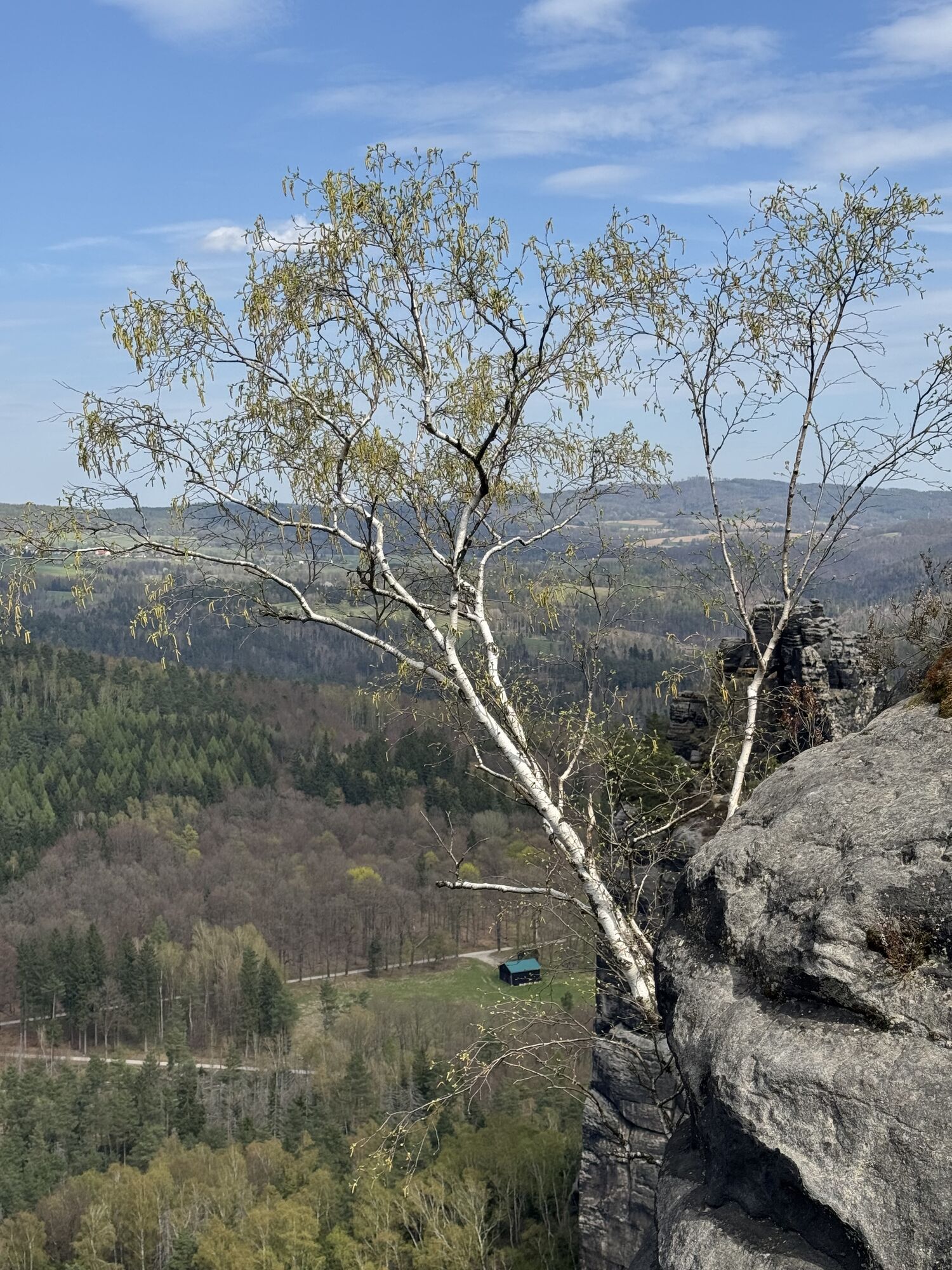
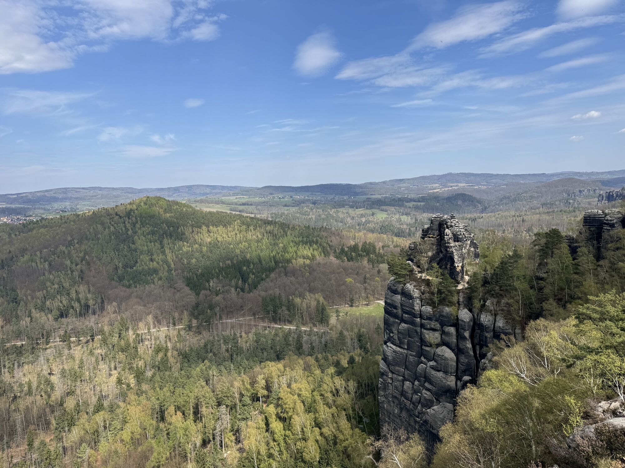
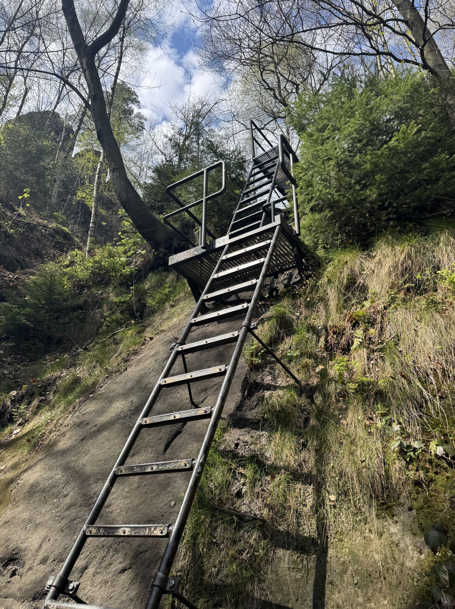
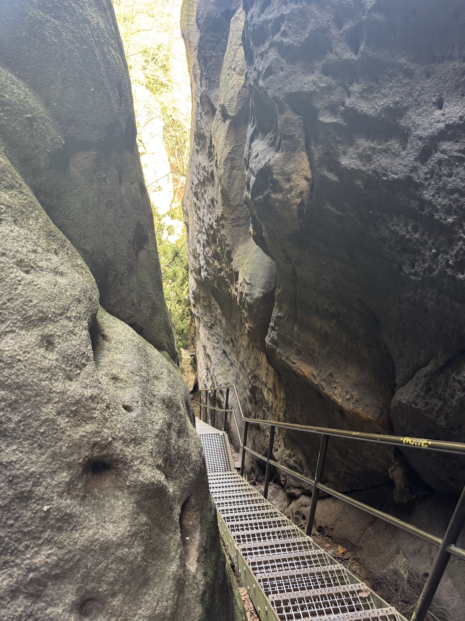
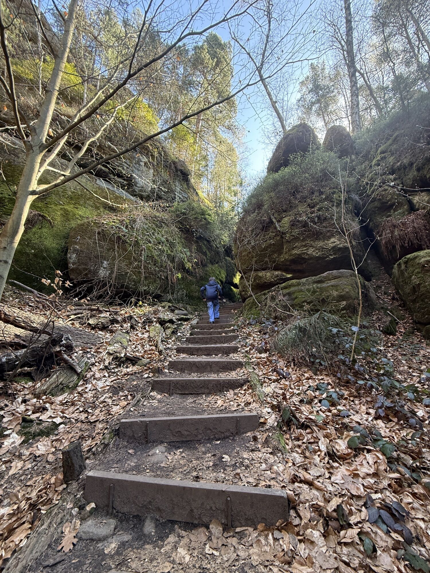
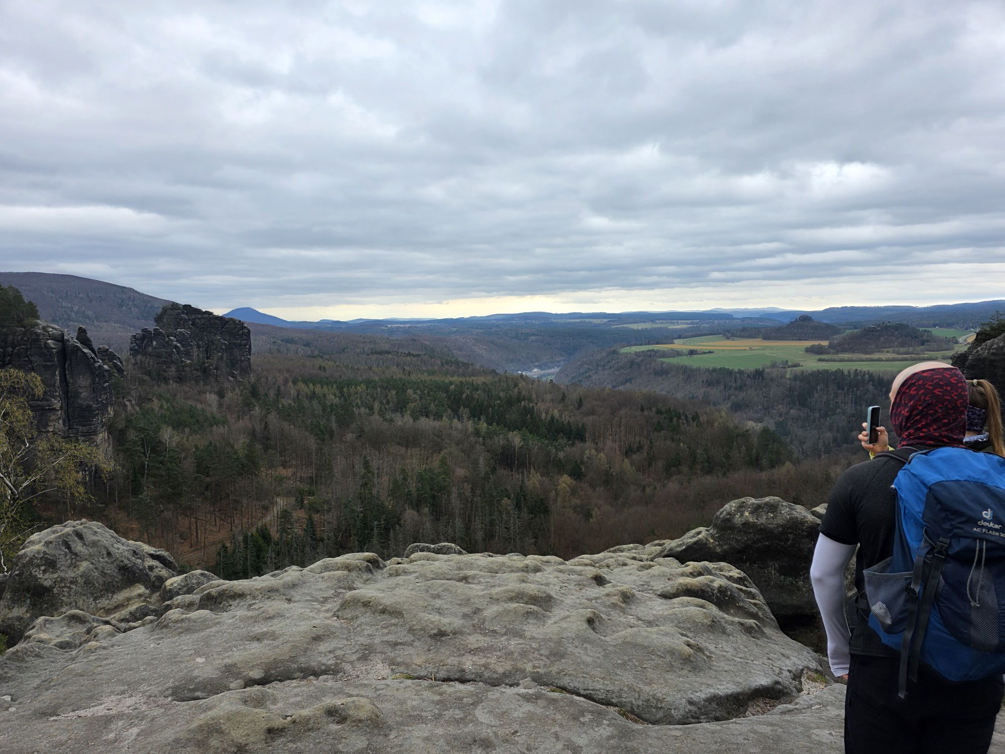
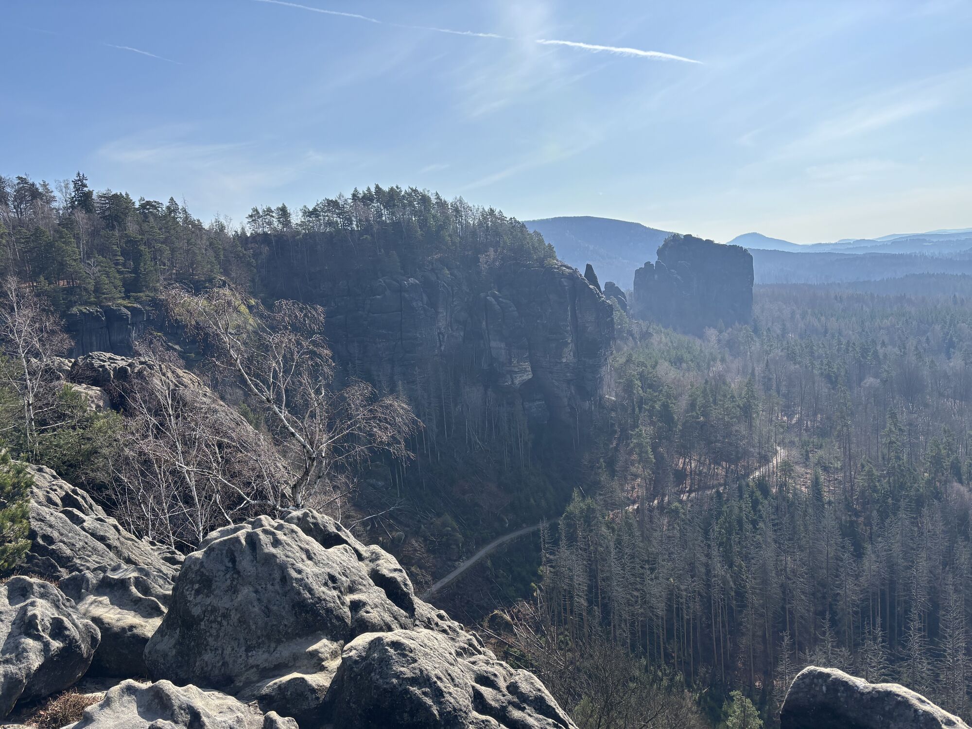
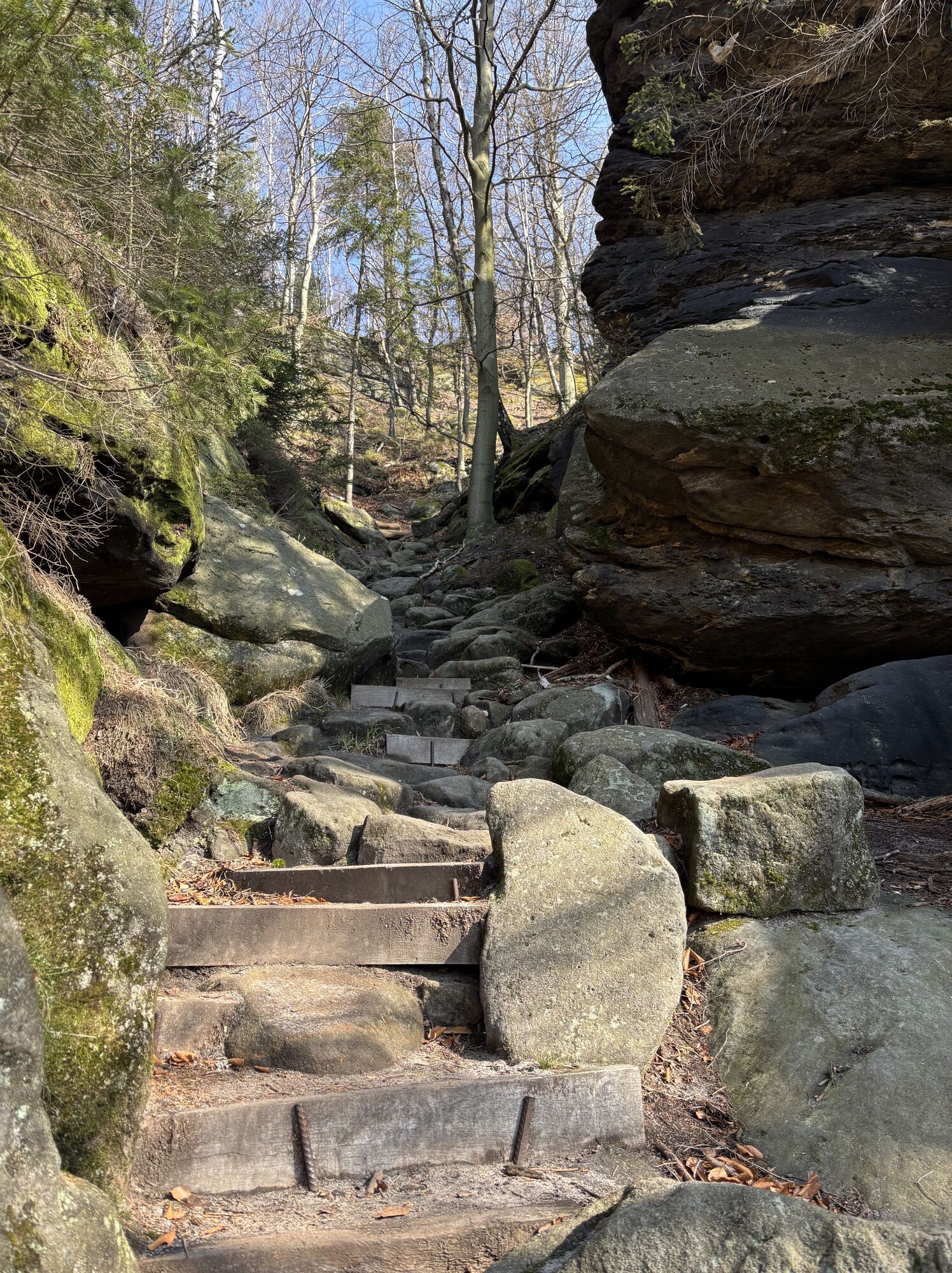
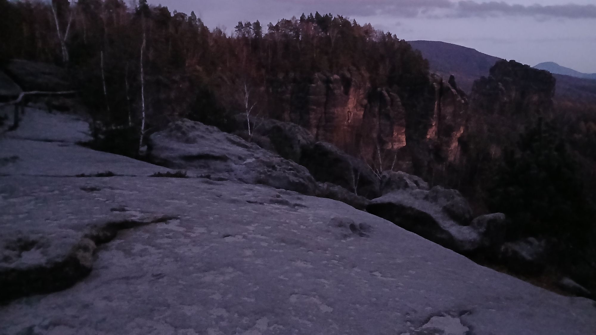
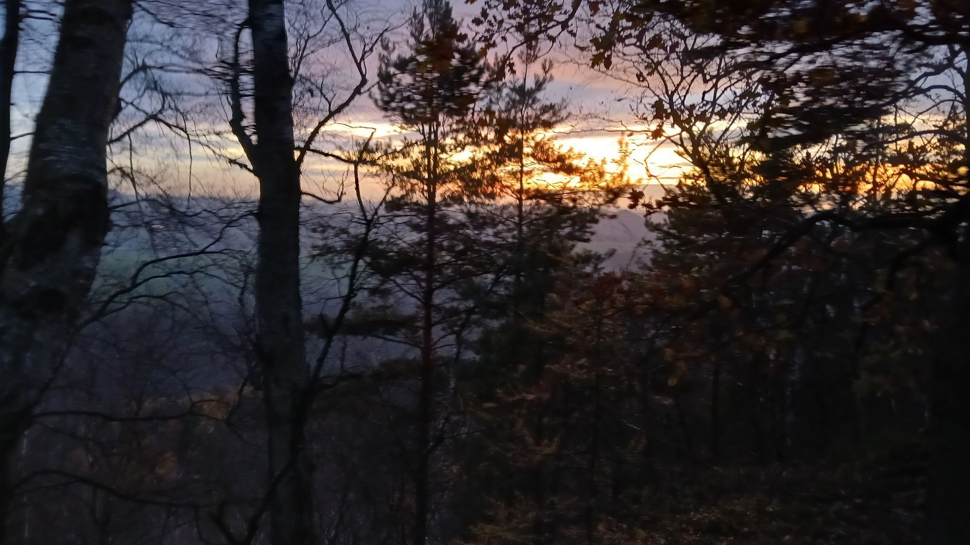
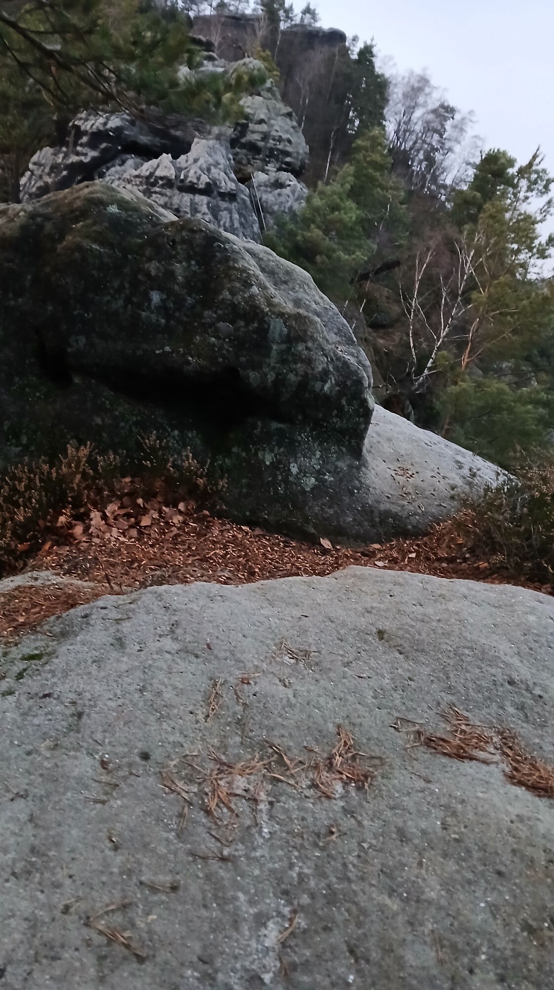
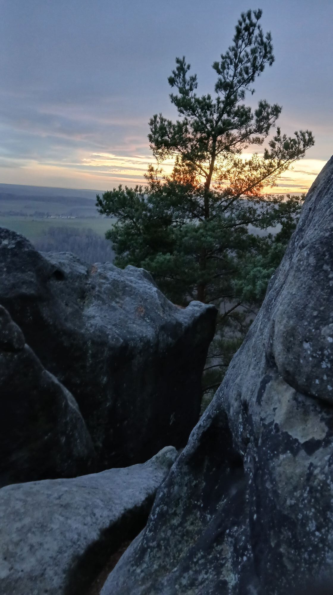
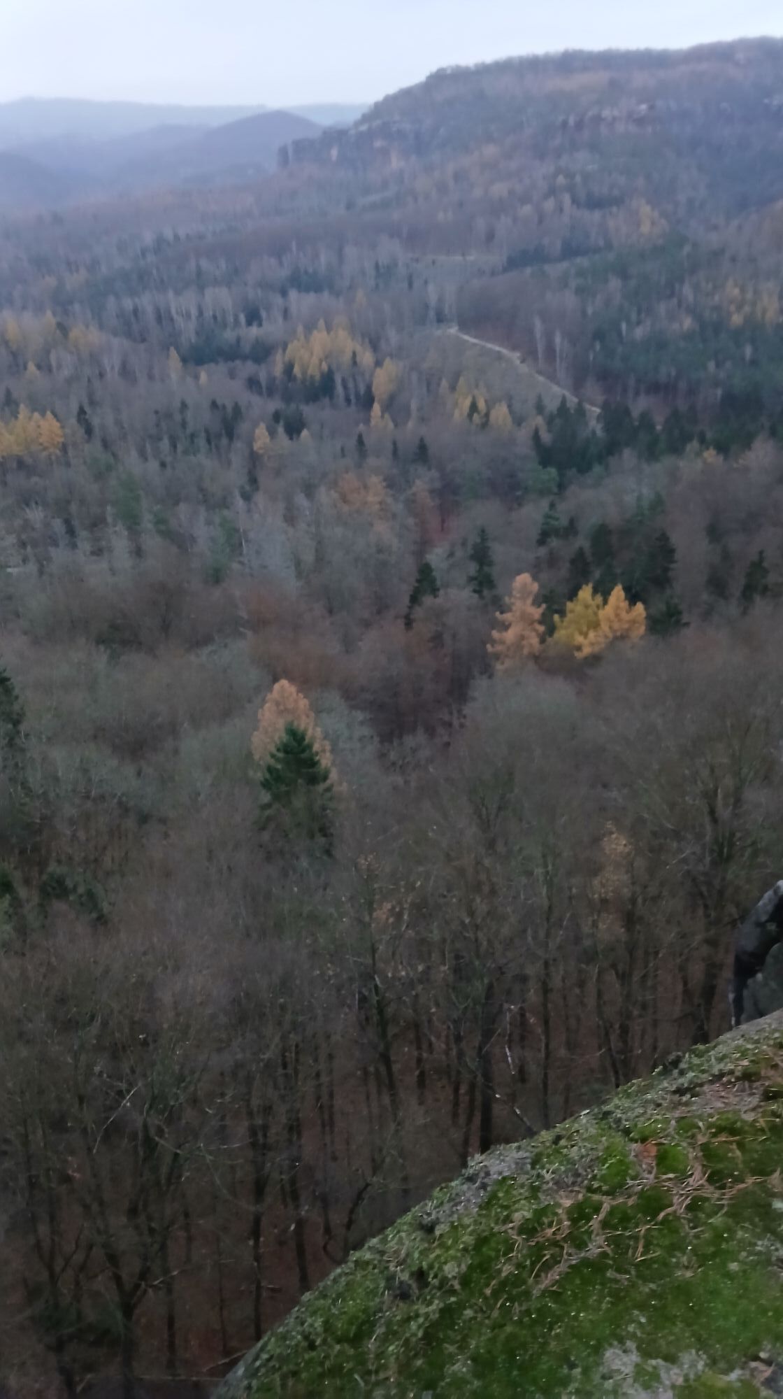
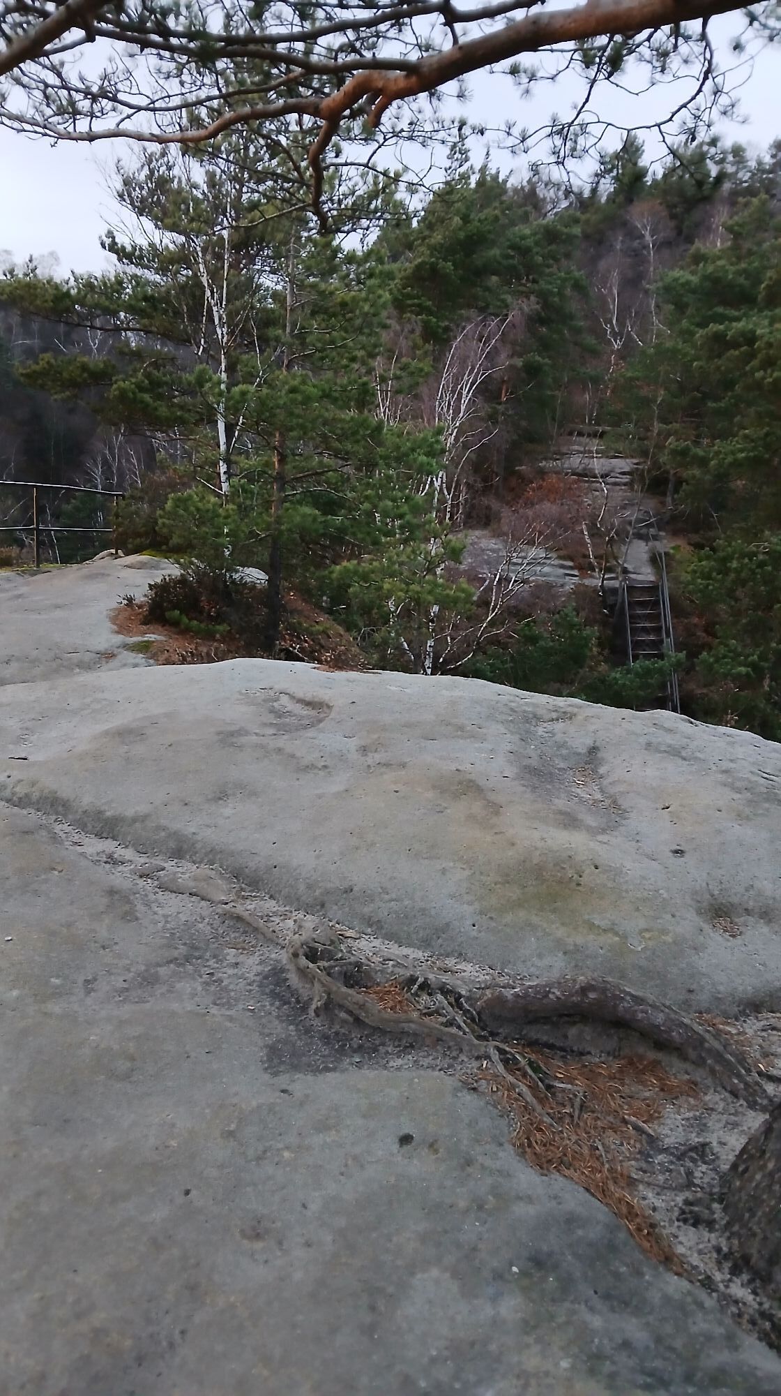
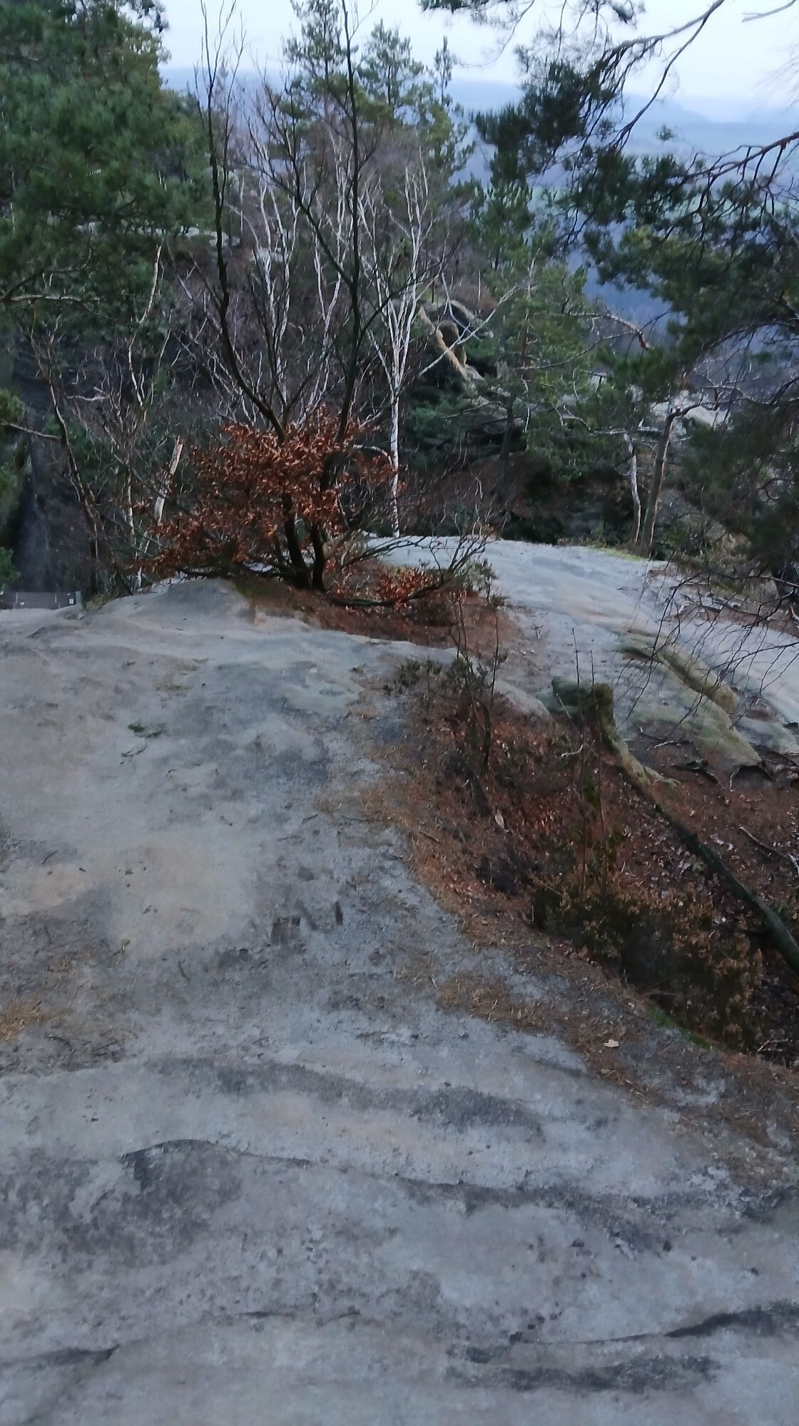
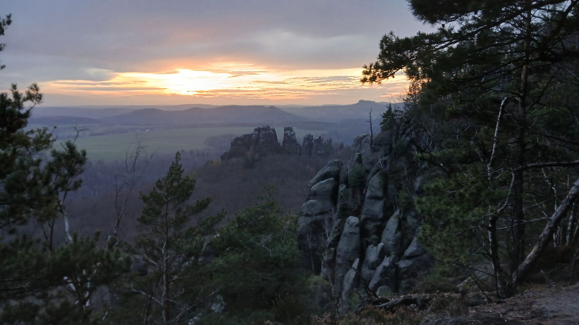
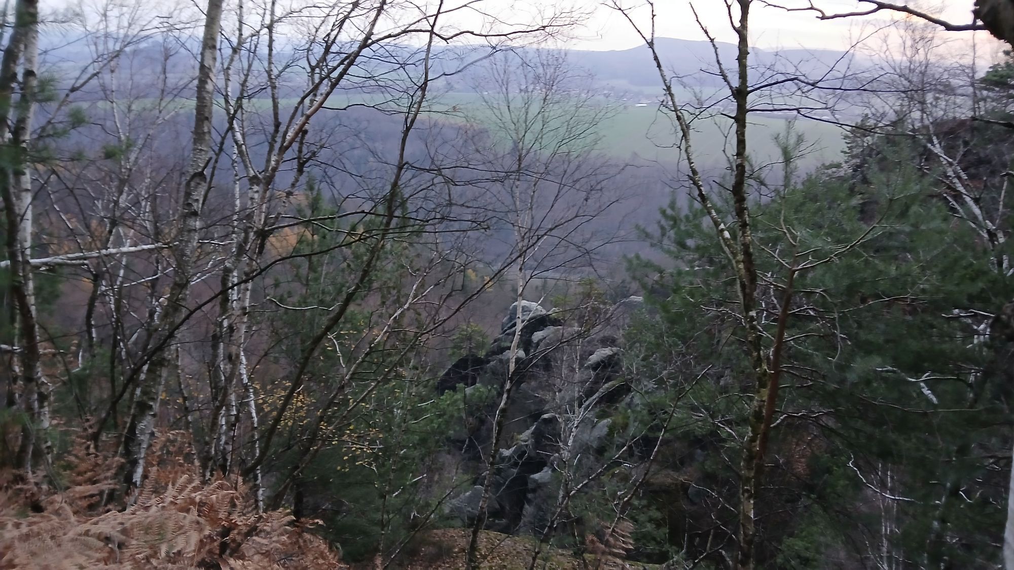
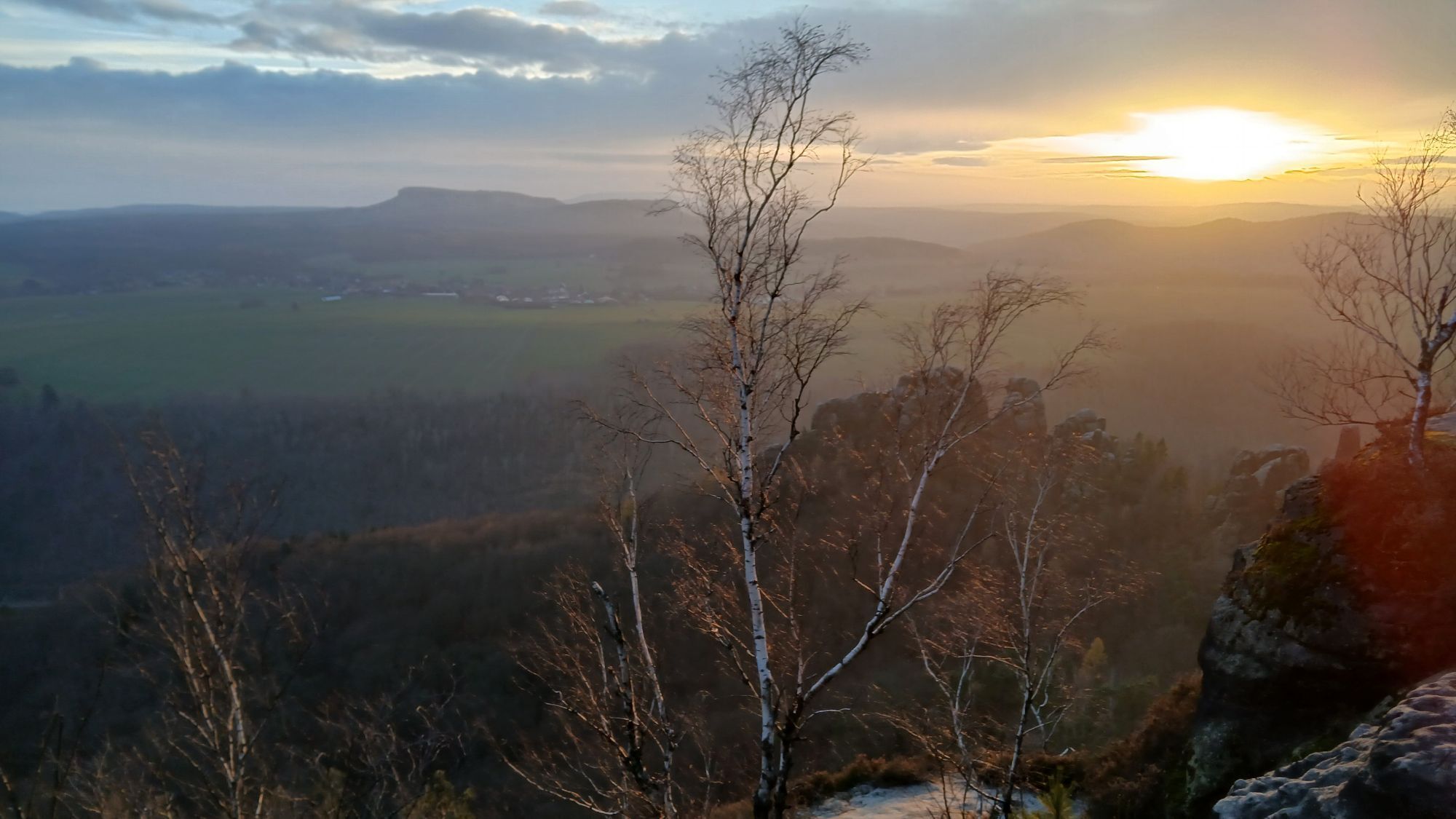
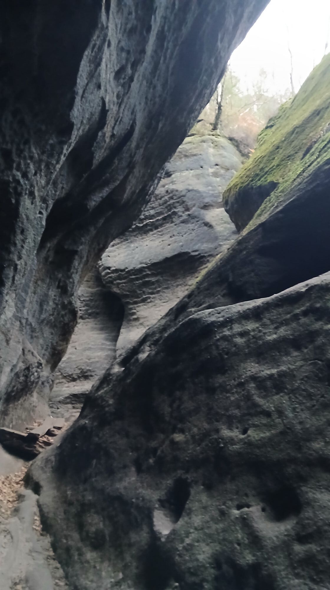
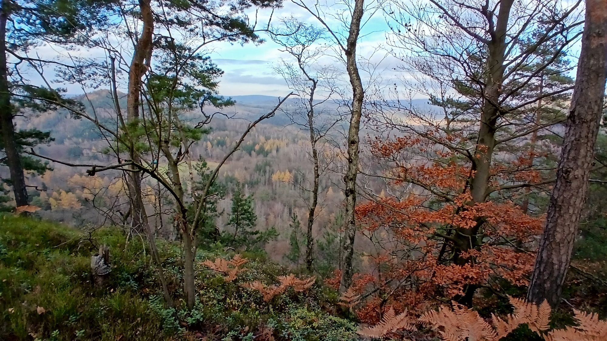
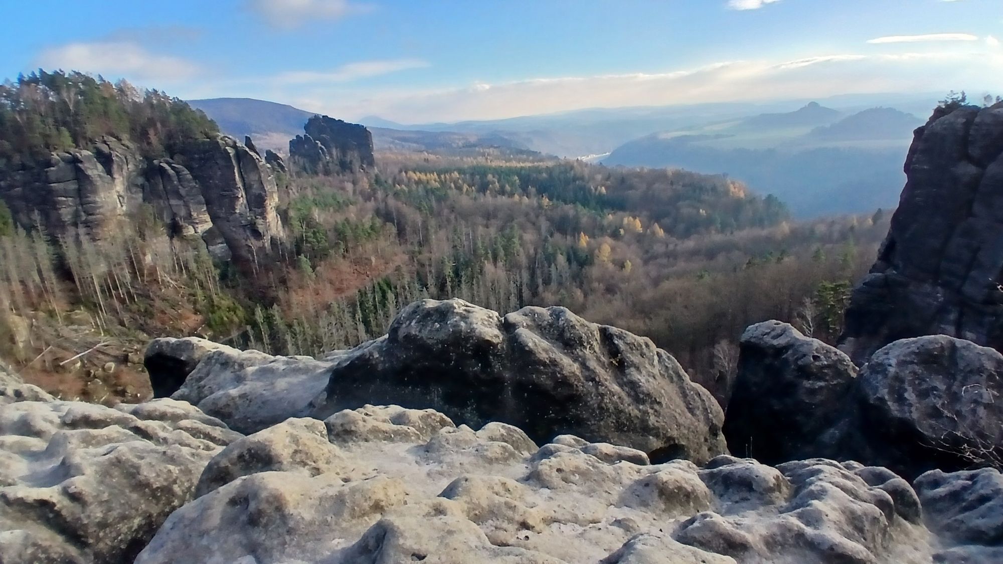
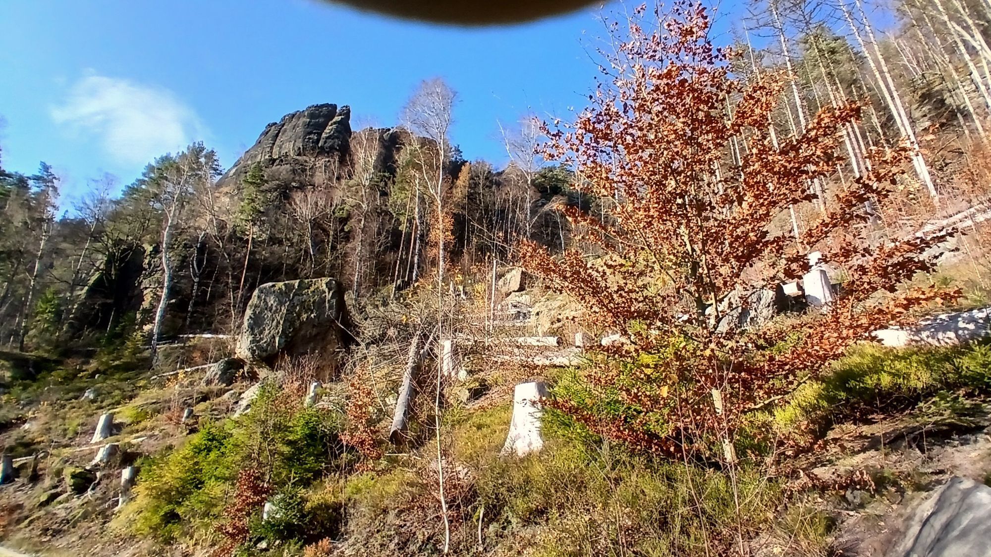
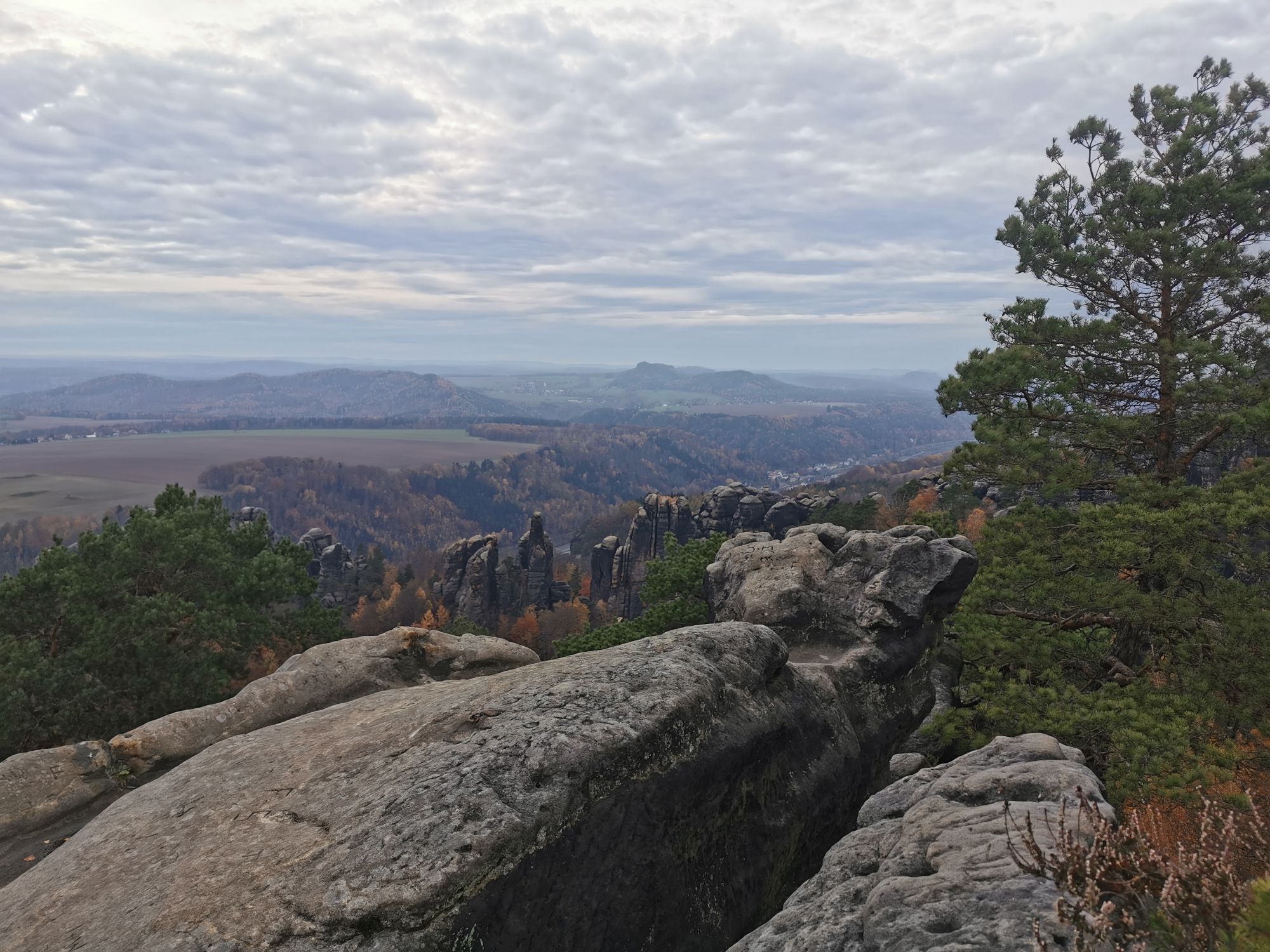
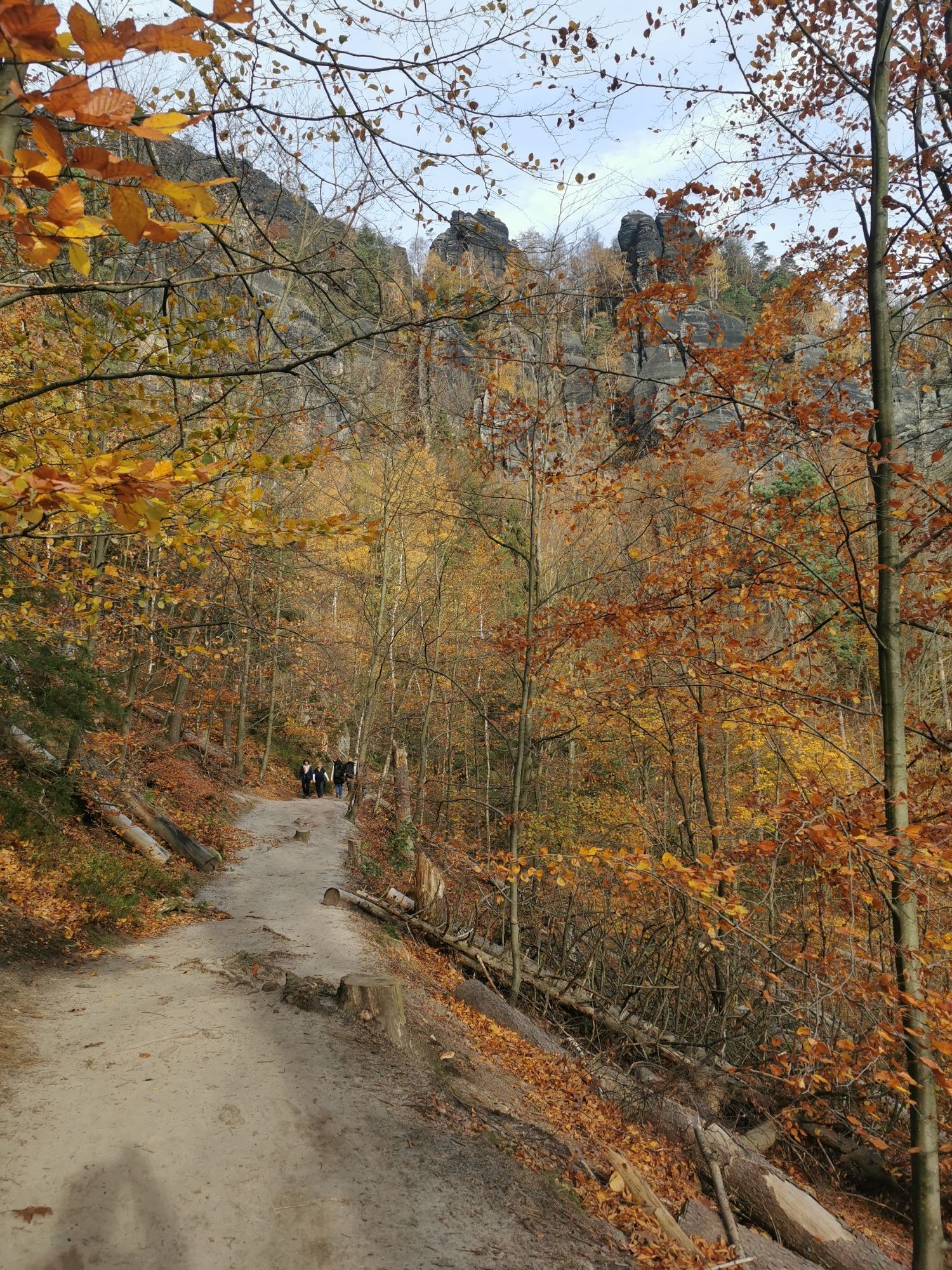
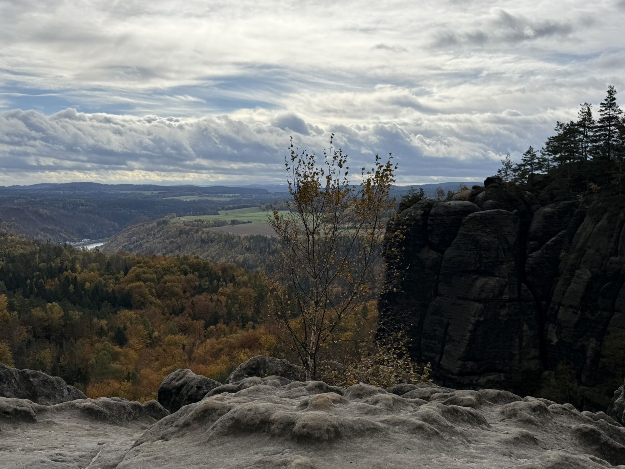
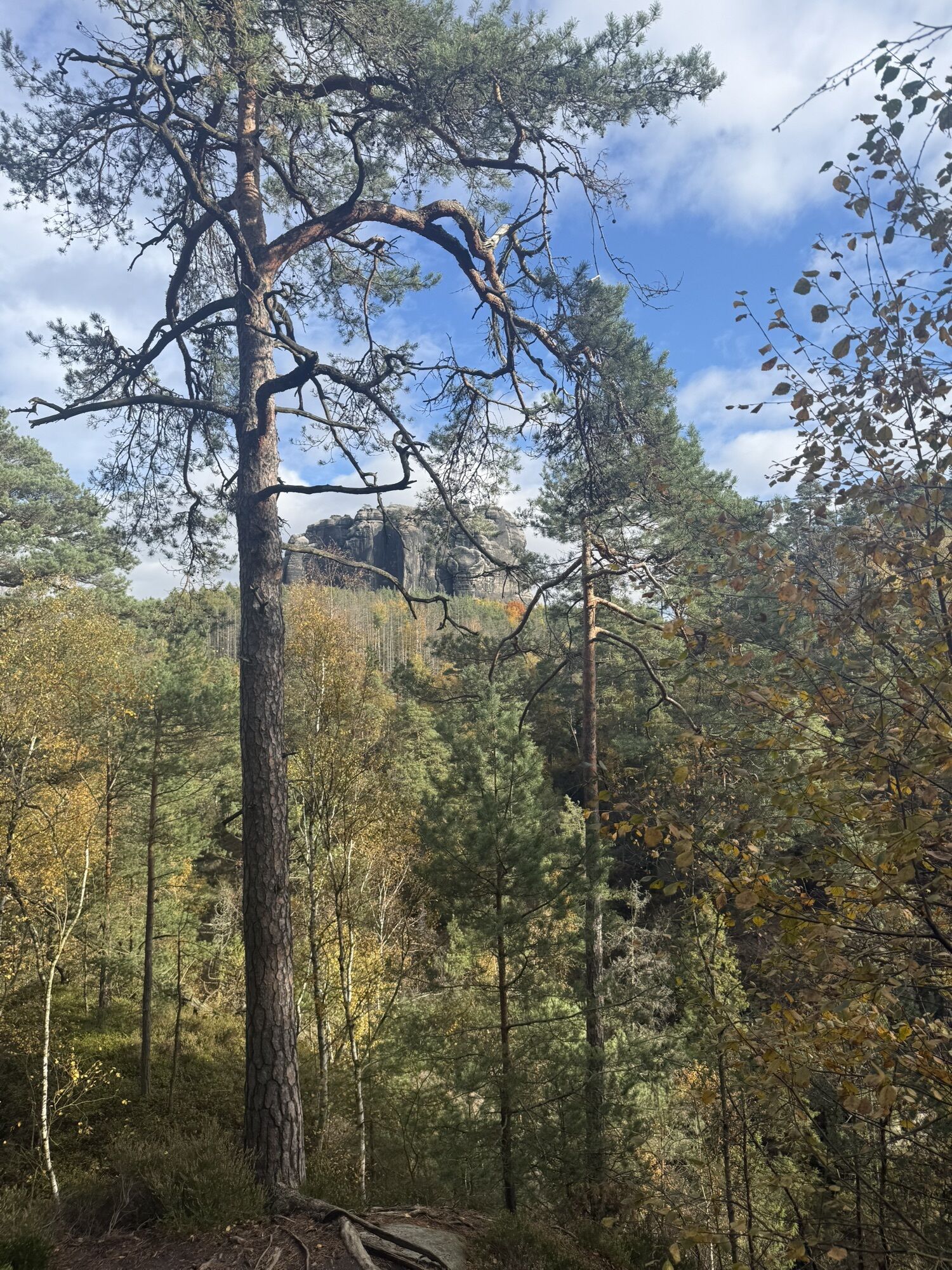
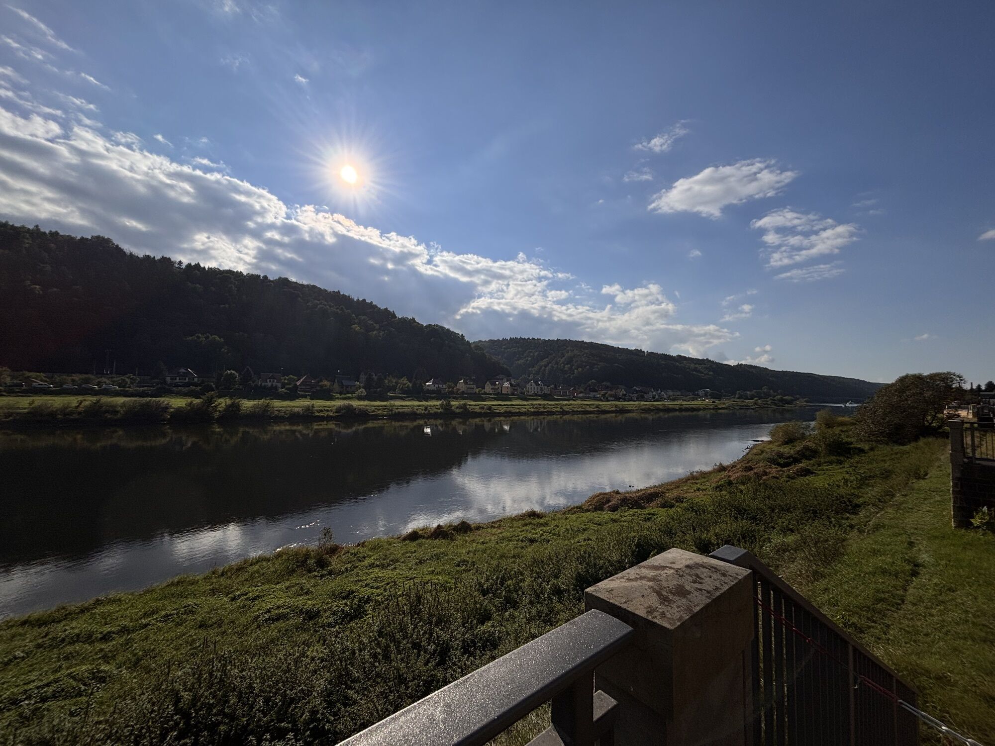
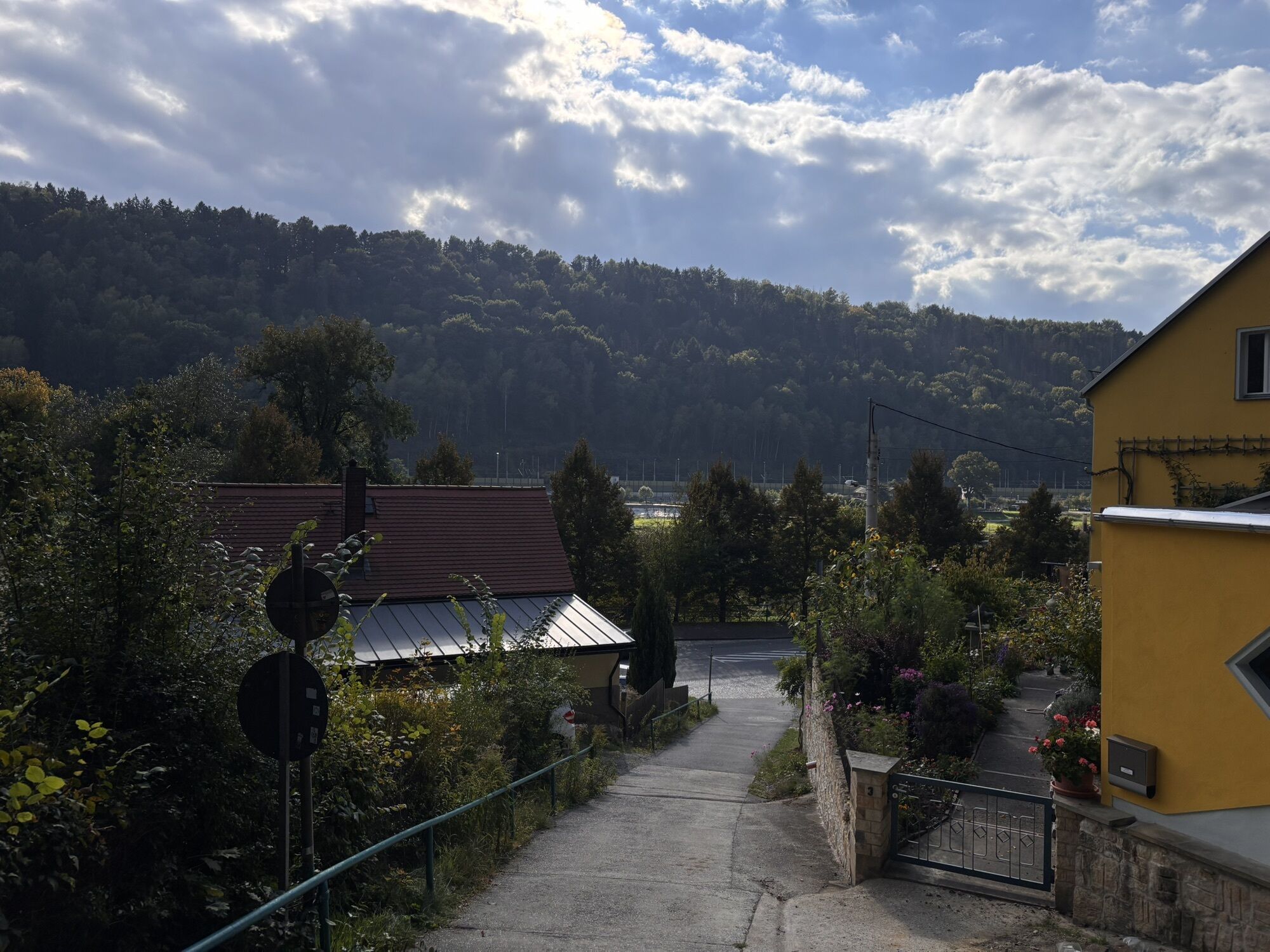
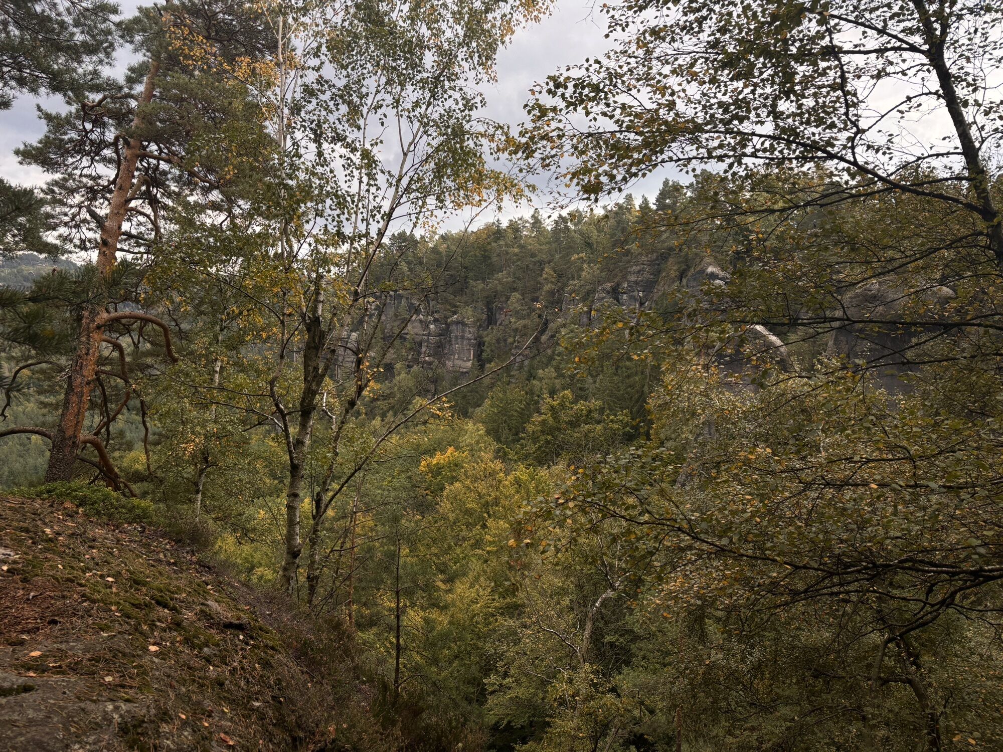
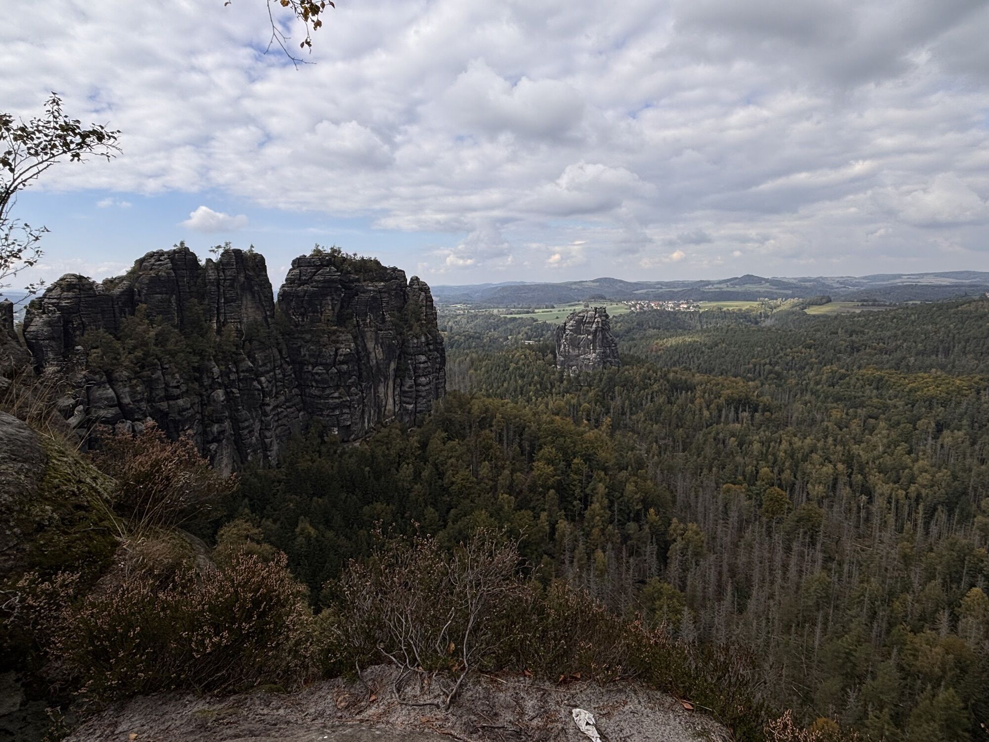
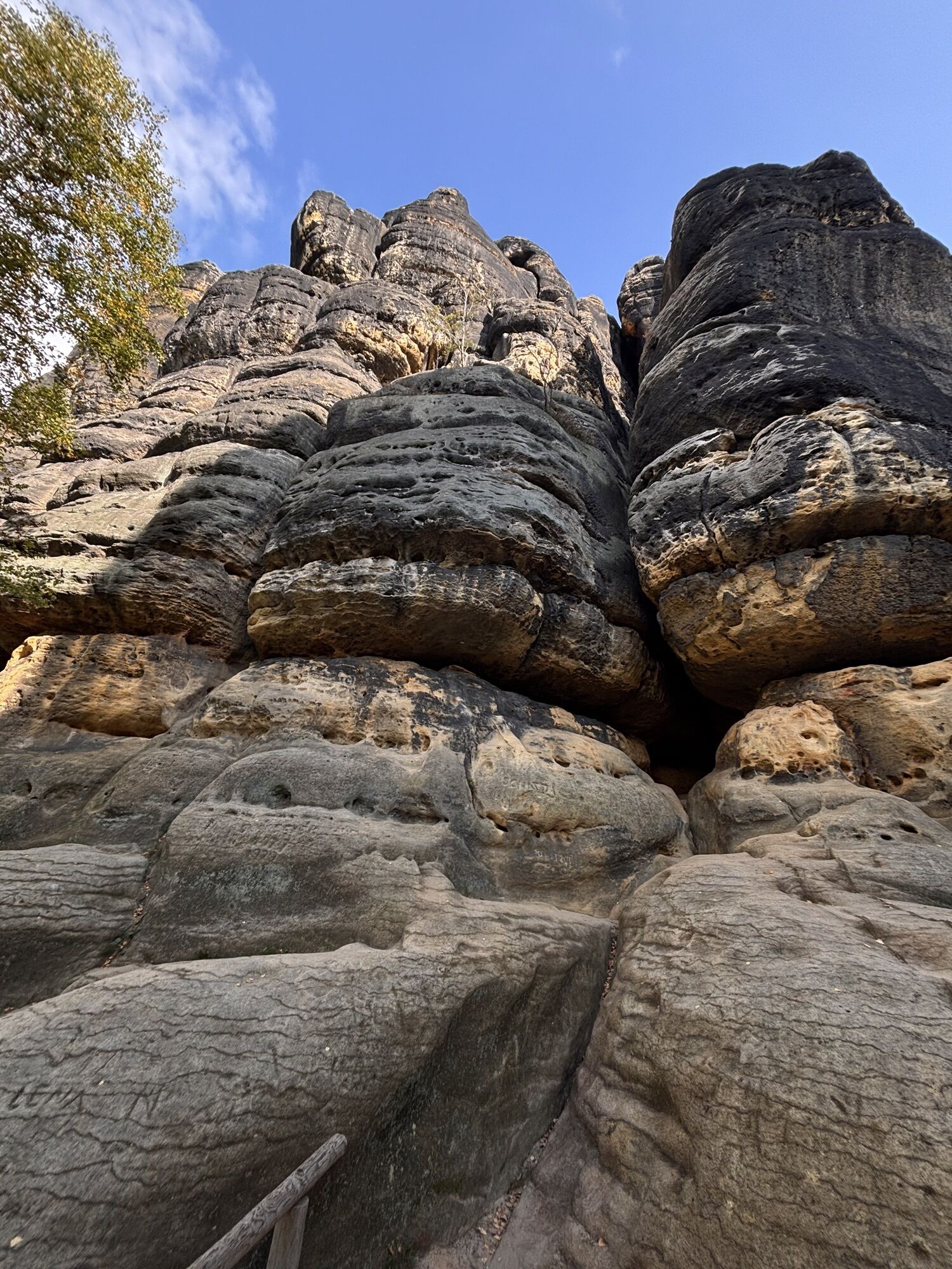
The tour starts at the market square in Bad Schandau, the spa town in the heart of Saxon Switzerland. Follow the B172 federal road eastwards for a short distance and then turn into Badallee at the crossroads where you meet the Hotel Lindenhof. After a short while, the stairway of the Luther Trail appears on your right. After climbing the stone steps, the Luther Monument awaits you, which was erected in 1817 on the occasion of the 300th anniversary of the dissemination of the 95 Theses by Martin Luther. Keep to the right along the Luther Trail, which takes you along a panoramic path past the Ostrava passenger lift. After passing the Luther Trail, follow the Ostrau ring road and then turn onto Falkensteinstraße. Take the Klüfftelweg branch to Zahnsgrund and then cross KB740. On the opposite side, follow the stairs up through Lattengrund. Continue past the spectacular Schrammstein Gate via the Wildschützensteig, which is dotted with numerous steep iron ladders, to the breathtaking Schrammstein view. Please note that the Wildschützensteig is only suitable for hikers who are sure-footed and free from vertigo. Via the Schrammstein ridge trail you reach another large plateau with a phenomenal view via further iron ladders and bridges, which invites you to linger and rest. At the "Breite Kluft" junction, you descend again, passing the striking 40 m high Teufelsturm (Devil's Tower), which is regarded as the symbol of "Saxon mountaineering". You follow the Elbleitenweg for quite a while and then turn off again to the Schrammsteinaussicht in the direction of the Obrigensteig. This takes you to the banks of the Elbe, which leads you back to Bad Schandau in a westerly direction.
Order here: "Hintere Sächsische Schweiz - Blatt 1"
Hiking shoes required
Please note: in the Saxon Switzerland National Park, only marked trails may be used in the core zone! Fines may be imposed for violations.
From Dresden, take the A17 to Pirna, then the B172 via Königstein to Bad Schandau. The border crossing to CR Hrensko - Decin is also signposted - a continuation to Prague is possible.
By train, you can reach Bad Schandau by S-Bahn line S1 every half hour from the state capital Dresden.
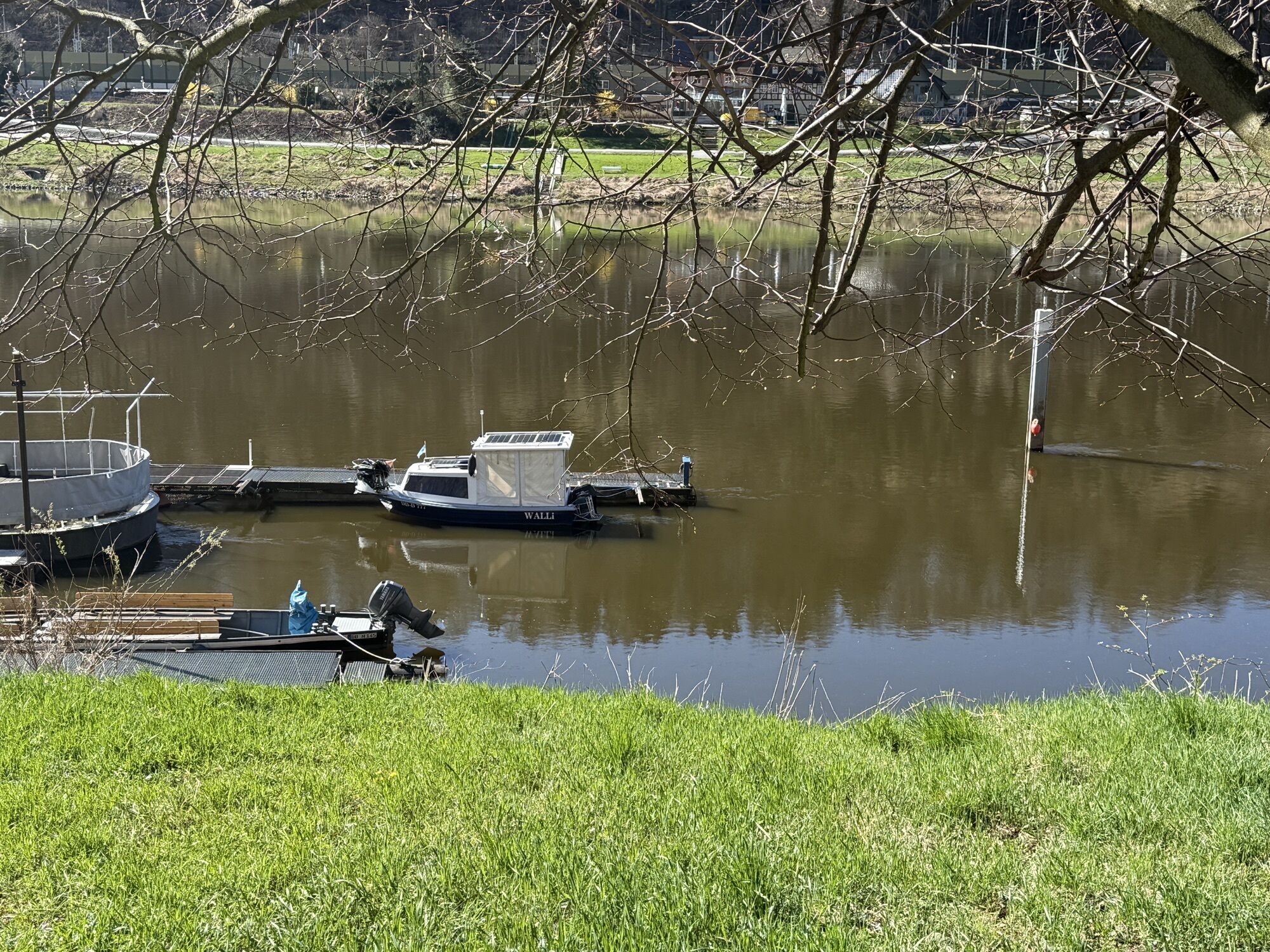
The Bad Schandau railway station is directly connected to the town centre by an Elbe ferry. The best way to get there is by S-Bahn via the Krippen stop (one stop after Bad Schandau).
Railway station, Elbe, Elbe bridge, Kiefricht, Lindenallee, tram stop
Only suitable with small, portable dogs.

Rutas populares en los alrededores
-
4,7
Rathen / Hockstein / Bastei / Rathen
medioSenderismo 14,4 km -
4,6
Von Rathewalde zur Bastei
Senderismo 12,8 km -
4,9
Rundwanderung Bastei Schwendenlöcher -Amselsee
luzSenderismo 6,21 km -
4,4
Kuhstall, Himmelsleiter und Schneiderloch
medioSenderismo 4,06 km -
5,0
Basteibrücke
luzSenderismo 2,31 km -
4,6
Pfaffenstein Sachsen/Deutschland
medioSenderismo 3,89 km -
5,0
Prebischtor
medioSenderismo 18,9 km -
5,0
Lilienstein
luzSenderismo 3,75 km -
5,0
entlang der Schrammsteine, Breite Kluft, Affenwand
medioSenderismo 11,6 km -
5,0
Traumrunde
pesadoSenderismo 10,3 km
Senderismo y rastreo


No se pierda las ofertas y la inspiración para sus próximas vacaciones
Su dirección de correo electrónico se ha añadido a la lista de correo.