Tour 5: From Bad Schandau to the Pigeon Pond
pesado
Navegue por
Navegue por
Consigue este tour en tu móvil
Tour 5: From Bad Schandau to the Pigeon Pond
pesado
Ciclismo
35,41
km
Escanee el código QR e inicie la navegación en la aplicación bergfex

Senderismo y rastreo


Tour 5: From Bad Schandau to the Pigeon Pond
pesado
Distancia
35,41
km
Duración
02:50
h
Ascenso
621
m
Nivel del mar
115 -
462
m
Descarga de pistas
Tour 5: From Bad Schandau to the Pigeon Pond
pesado
Ciclismo
35,41
km
Fotos de nuestros usuarios
-

 © Holger TurbanCreado el 28.03.2026
 -
 © Erik SchwarzCreado el 03.10.2025
 -

 © Ronny KalusaCreado el 21.08.2025
 -
 © Andreas HotzeCreado el 06.08.2025
 -
 © Andreas HotzeCreado el 06.08.2025
 -
 © Andreas HotzeCreado el 06.08.2025
 -
 © Andreas HotzeCreado el 06.08.2025
 -
 © Andreas HotzeCreado el 06.08.2025
 -
 © Andreas HotzeCreado el 06.08.2025
 -
 © Andreas HotzeCreado el 06.08.2025
 -

 © Hallunke FrankCreado el 22.03.2025
 -

 © Marc ClaessenCreado el 13.09.2020


Ruta
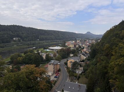
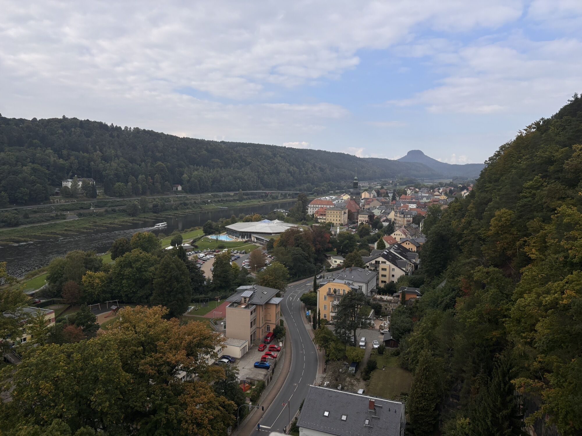
Bad Schandau
(146 m)
Ciudad
0,0 km
Cunnersdorf
(252 m)
Pueblo
8,2 km
Viehbig
(267 m)
Barrio
9,1 km
Reuterhof
(318 m)
Liquidación
26,0 km
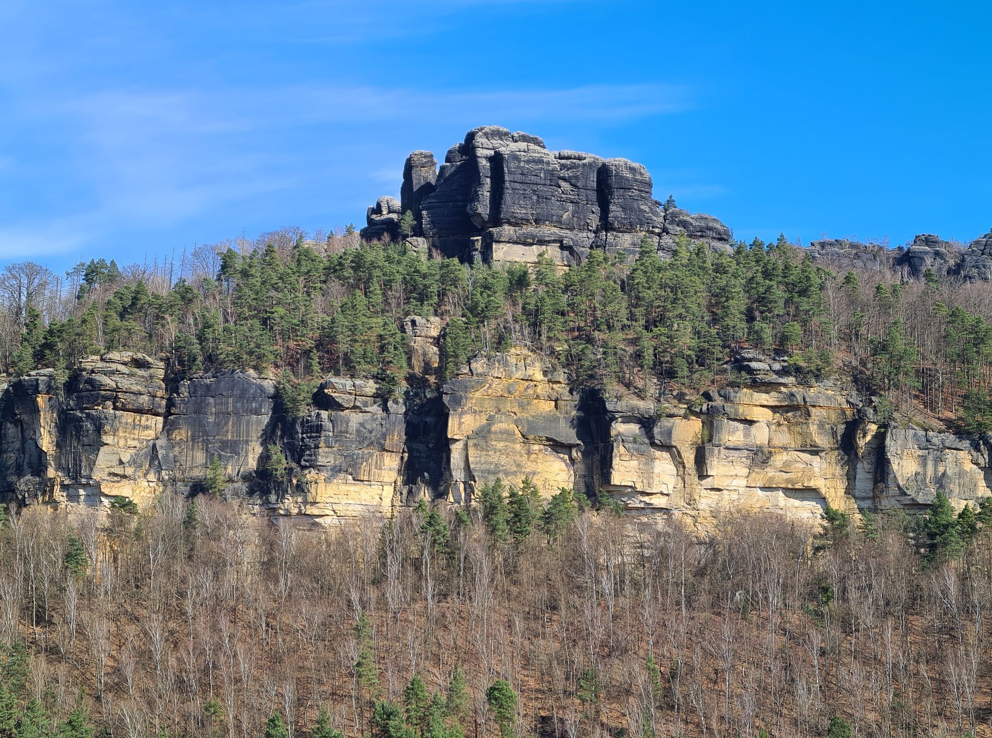
Gasthaus & Pension Zirkelstein
(270 m)
Restaurante
27,3 km
Postelwitz
(116 m)
Embarcadero
34,1 km
St. Johanniskirche
(129 m)
Lugar de culto
35,2 km
Ruta
Tour 5: From Bad Schandau to the Pigeon Pond
pesado
Ciclismo
35,41
km
Bad Schandau
(146 m)
Ciudad
0,0 km
Bad Schandau, Stadt
(116 m)
Embarcadero
0,1 km
Galgenschänke
(365 m)
Corredor/terreno
5,0 km
Jagdstübel
(246 m)
Restaurante
8,1 km
Cunnersdorf
(252 m)
Pueblo
8,2 km
Hotel Deutsches Haus
(256 m)
Restaurante
8,8 km
Viehbig
(267 m)
Barrio
9,1 km
Steinhütttenborn
(329 m)
Fuente
12,2 km
Trekkinghütte "Grenzbaude"
(429 m)
Refugio (no gestionado)
17,4 km
Ziskaquelle
(349 m)
Fuente
23,9 km
Reuterhof
(318 m)
Liquidación
26,0 km
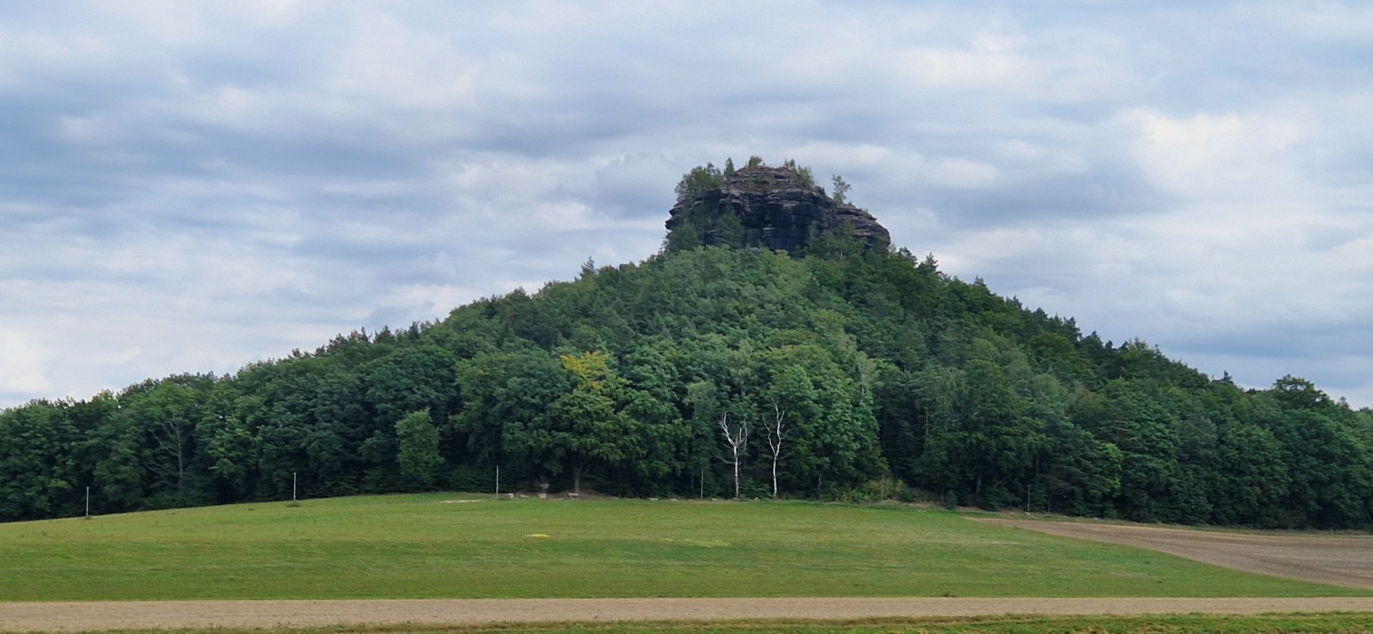
Schöna
(270 m)
Pueblo
27,2 km
Gasthaus & Pension Zirkelstein
(270 m)
Restaurante
27,3 km
Caspar-David-Friedrich-Quelle
(157 m)
Fuente
30,7 km
Landgasthaus Ziegelscheune
(124 m)
Restaurante
32,8 km
Postelwitz
(116 m)
Embarcadero
34,1 km
Bad Schandau, Stadt
(116 m)
Embarcadero
34,9 km
St. Johanniskirche
(129 m)
Lugar de culto
35,2 km
Bad Schandau
(146 m)
Ciudad
35,4 km
Autor
Proporcionado por Heike Grunow / Tourismusverband Sächsische Schweiz e.V.
Compartir gira
Tour 5: From Bad Schandau to the Pigeon Pond
pesado
Ciclismo
35,41
km
Error
Se ha producido un error. Por favor, inténtelo de nuevo.
Información de llegada
Transporte público
Stop: Bad Schandau market Line 241 (Pirna - Königstein - Bad Schandau - Hinterhermsdorf) Line 252 (Schmilka - Ostrau - Bad Schandau - Krippen - Reinhardtsdorf-Schöna)
Stop: National Park railway station Bad Schandau - the starting point can be reached by ferry Bad Schandau
S-Bahn S1 (Meißen-Triebischtal - Dresden - Bad Schandau - Schöna) National park railway U28 (Rumburk - Sebnitz - Bad Schandau - DÄÄín) RE 20 (Dresden - Bad Schandau - LitomÄÅice) Various bus lines in the region
Aparcamiento
P+R at the National Park railway station or car park at Elbkai (An der Elbe 12).
Aún no hay opiniones
Rutas populares en los alrededores
-
4,6
Von Rathewalde zur Bastei
Senderismo 12,8 km -
4,7
Rathen / Hockstein / Bastei / Rathen
medioSenderismo 14,4 km -
4,9
Rundwanderung Bastei Schwendenlöcher -Amselsee
luzSenderismo 6,21 km -
4,5
Kuhstall, Himmelsleiter und Schneiderloch
medioSenderismo 4,06 km -
5,0
Basteibrücke
luzSenderismo 2,31 km -
4,7
Pfaffenstein Sachsen/Deutschland
medioSenderismo 3,89 km -
5,0
Prebischtor
medioSenderismo 18,9 km -
5,0
entlang der Schrammsteine, Breite Kluft, Affenwand
medioSenderismo 11,6 km -
5,0
Lilienstein
luzSenderismo 3,75 km -
5,0
Traumrunde
pesadoSenderismo 10,3 km
Senderismo y rastreo

Más de 550.000 sugerencias de excursiones, mapas detallados y un intuitivo planificador de rutas hacen de esta aplicación una herramienta imprescindible para todos los amantes de la naturaleza.

No se pierda las ofertas y la inspiración para sus próximas vacaciones
Suscribirse al boletín de noticias
Error
Se ha producido un error. Por favor, inténtelo de nuevo.
Gracias por inscribirse
Su dirección de correo electrónico se ha añadido a la lista de correo.
Viajes por Europa
Austria
Suiza
Alemania
Italia
Eslovenia
Francia
Países Bajos
Belgium
Polonia
Liechtenstein
República Checa
Slovakia
España
Croacia
Bosnia y Herzegovina
Luxemburgo
Andorra
Portugal
Iceland
United Kingdom
Ireland
Greece
Albania
North Macedonia
Malta
Norway
Montenegro
Moldova
Kosovo
Hungary
San Marino
Romania
Estonia
Latvia
Belarus
Cyprus
Lithuania
Serbia
Bulgaria
Monaco
Denmark
Sweden
Finland