


Moselsteig Trail Stage 06: Schweich – Mehring
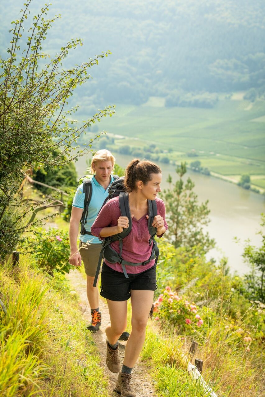
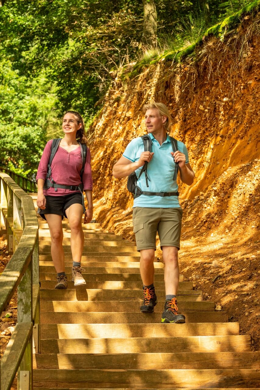
This stage of the trail requires more in the way of fitness: the path frequently changes, climbing steeply and then immediately descending downhill. The ascents will reward you with fabulous views far...
This stage of the trail requires more in the way of fitness: the path frequently changes, climbing steeply and then immediately descending downhill. The ascents will reward you with fabulous views far into the distance and down into the valley. However, you can rest on the Huxlay Plateau if you'd like to take it a little easier; on the other hand, you might prefer rather more active relaxation on the natural running track or the health and fitness trail. When you reach the end of the stage in Mehring, be sure to sample the town's 2000-year old wine-making tradition in one of the many inns and taverns in the town.
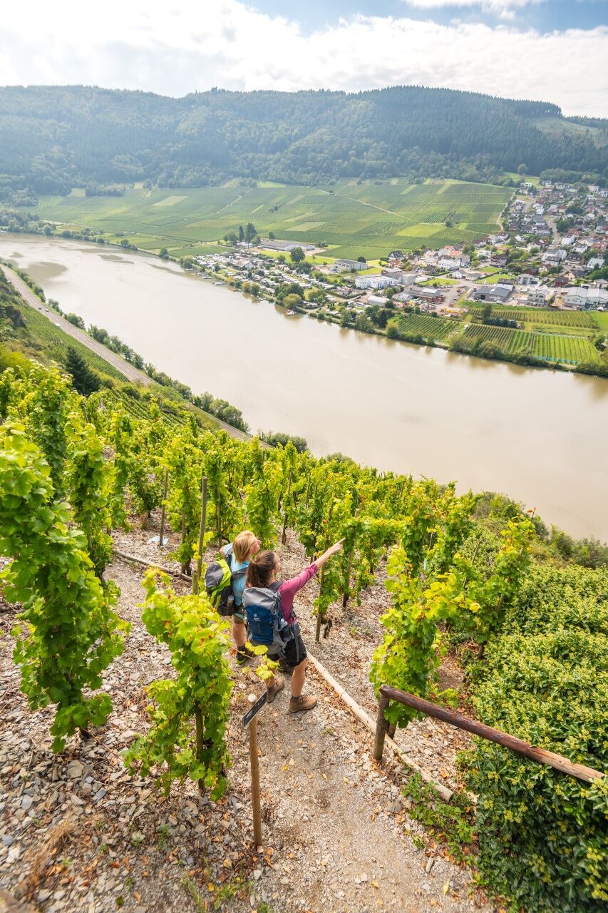
The 6th leg of the Moselsteig Trail starts in the Schweich town centre. From the Stefan-Andres fountain the trail takes you along the Brückenstraße road, past the Roman Wine Route tourist information and to the St. Martin church, which dominates the city skyline. From here, you walk on quiet town roads to the outskirts of the town. After the motorway underpass, you will reach the first vineyards. This is where the long ascent of the Mehringer mountain starts, which is quite steep at the beginning. The trail mostly runs between the edge of the forest and vineyards, and the view of the Moselle Valley distracts you from the strenuous climb. From the barbecue mountain hut Rupperoth onwards and on the following path through the forest, it gets less steep.
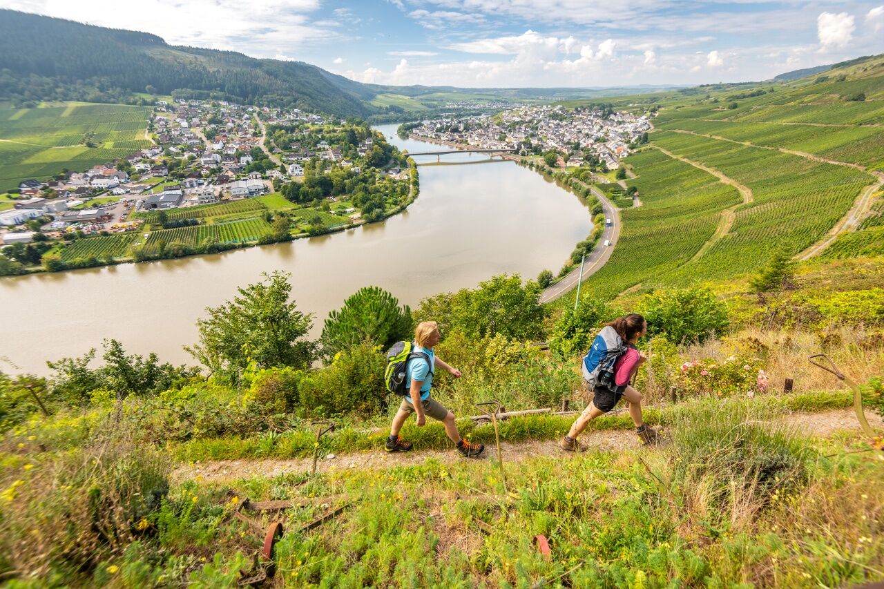
After crossing the Landwehrgraben, the Moselsteig Trail reaches a small plateau - a perfect location for a rest offering best views! This is also where the access route branches off to the towns of Longuich and Longen in the valley. The trail now continues steeply uphill, first on a path through a forest of oaks, and later on a wider path through open meadows. After a last steep section you reach the summit of the Mehringer mountain. With an altitude of over 400 m above sea level, this is one of the highest points of the entire Moselsteig Trail. The panorama view is magnificent and reaches into the Moselle Valley and also the surrounding heights of the Eifel and Hunsrück. On clear days, you can even see the Erbeskopf in Rhineland-Palatinate on the south-eastern horizon.
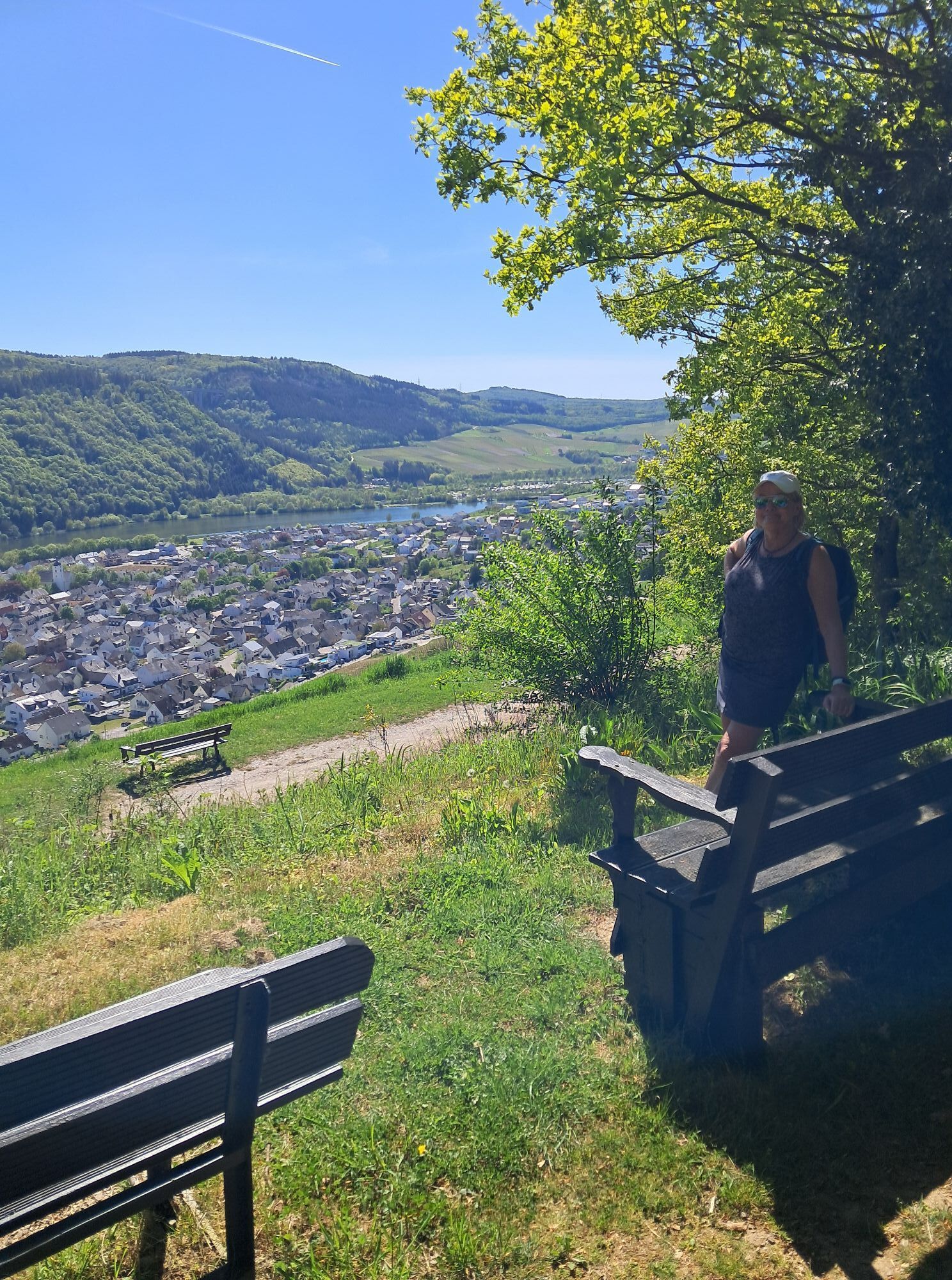
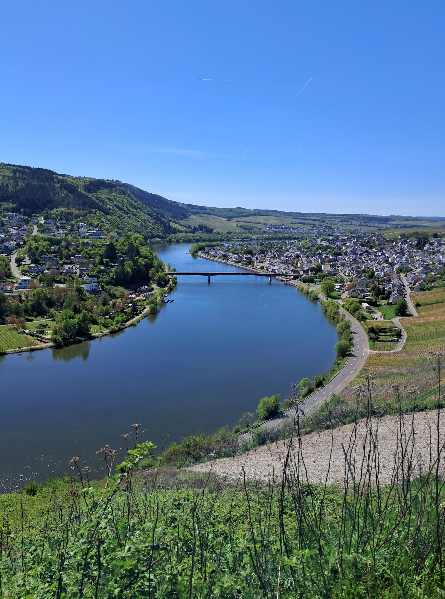
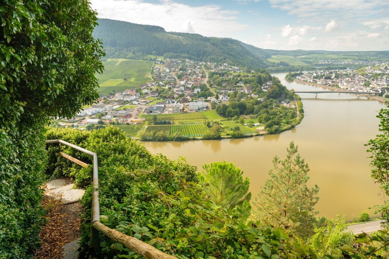
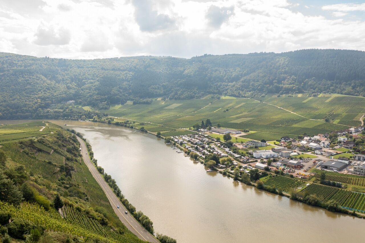
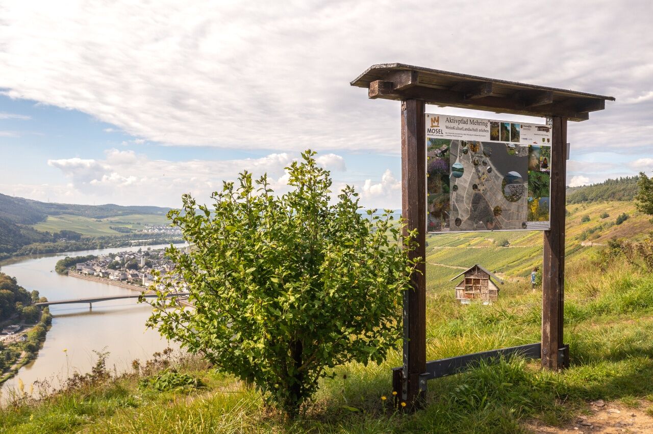
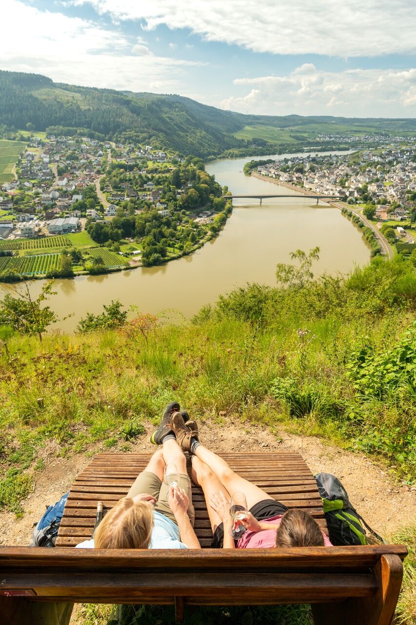
The trail first continues for a short distance through barren meadow landscapes and then steeply descends after a field section along the forest. After a section along the edge of the forest, the Moselsteig Trail now leads through open terrain on both sides. Here, the view to the east is overwhelming. Once you arrive at the loungers: Take a seat and enjoy the fabulous panorama view towards the Hunsrück, which is topped by the majestic Erbeskopf mountain! As in the previous metres of the trail, the Moselsteig Trail continues to be accompanied by the Moselsteig Side Trail Zitronenkrämerkreuz. The trail continues downhill at a moderate decline towards the slope edge, which offers a beautiful view of the Mehring river loop. From a chapel onwards, you hike through a pine forest, accompanied by an animal trail on soft and springy wood chips. Hiking on a “sky staircase” of timber steps, you will arrive at the Huxlay Plateau with its many seating and resting places, which you must take advantage of for an extensive rest. You can also enjoy the view of Mehring and the Moselle.
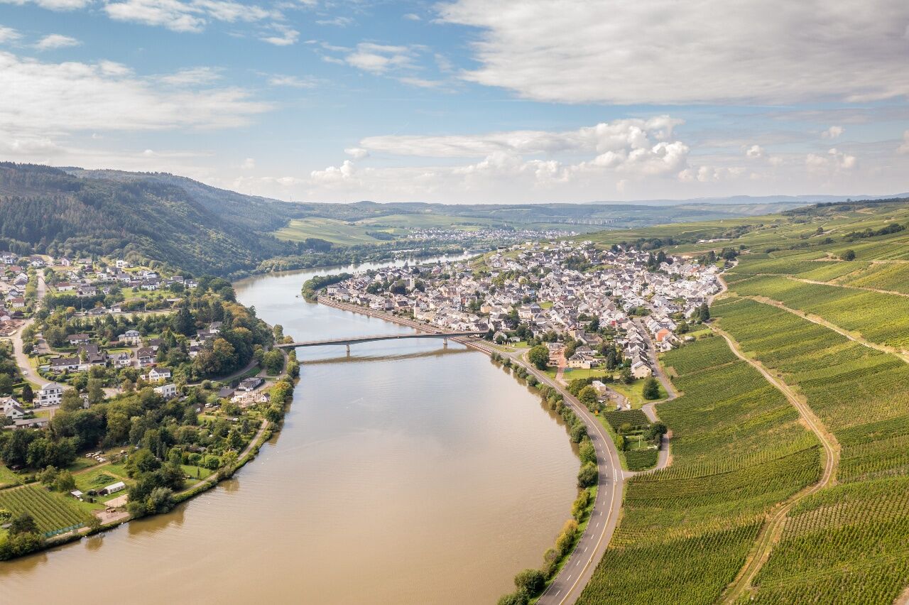
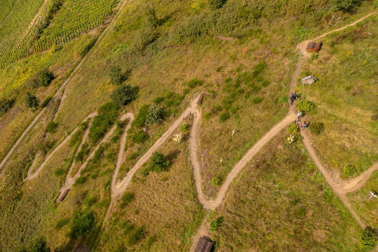
The descent starts on a path which winds down the vineyard slope in narrow serpentines. The trail ends at another rest area - hikers who would like to visit the Roman Aqua Duct in Pölich can reach the town via the access route which branches off here. The Moselsteig Trail continues on a gently declining vineyard path to the outskirts of Mehring. After a short hike through the town you will arrive at the Moselle Bridge. Follow the steps to reach the bus station at the highway. Or continue via an access route of the Moselle to the town centre with its many inns, accommodation and supply offers.
Leisure Map Moselsteig Trail – Map 2: Trier - Zell (Mosel) (Stages 5 - 14), ISBN: 978-3-89637-420-2
Sturdy hiking footwearAppropriate weatherproof hiking gearPicnic lunch
Starting point: Schweich via the A 1 (Schweich exit)or via the B 53
Destination: Mehring A 1, Mehring, Longuich or Schweich junctions, then follow the B 53
There are regular connections. Please note that during the school vacations of Rhineland-Palatinate / Saarland, at the weekend and on public holidays there may be restrictions on the frequency! Please check the daily timetable on the website of the Verkehrsverbund Region Trier (VRT):
Mehring: There is parking along the Moselstraße, which runs parallel to the B 53, or on the Peter-Schröder-Platz (0.3 km walk).
Today's stage is not too long and there are plenty of attractive rest places on the Huxlay Plateau so that we would definitely recommend scheduling in a longer stop. The path to Mehring is not far after that. A glass of chilled Moselle wine tastes particularly good with this magnificent vista.

Rutas populares en los alrededores
-
4,7
Excursión circular alrededor de Bernkastel-Kues - Tour 2: Recorrido circular por el Mosel-Radweg pasando por Trittenheim hacia Bernkastel-Kues
luzCiclismo 57,0 km -
5,0
Etapa 07 Moselsteig: Mehring – Leiwen
medioSendero de largo recorrido 14,5 km -
5,0
Etapa Moselsteig 08: Leiwen – Neumagen-Dhron
luzSendero de largo recorrido 14,1 km -
5,0
Moselsteig Etapa 05: Trier – Schweich
medioSendero de largo recorrido 20,0 km -
5,0
Moselsteig etapa 06: Schweich – Mehring
medioSendero de largo recorrido 12,4 km -
5,0
Rockenburger Urwaldpfad
medioSenderismo 13,6 km -
4,0
Ruta ciclista del Mosela Etapa 4: De Mehring a Piesport
luzCiclismo de larga distancia 25,5 km -
5,0
Traumachleife 5 Täler Tour
luzSenderismo 10,4 km -
5,0
Traumschleife Wind-Wasser-Wacken
luzSenderismo 10,9 km -
4,0
Moselsteig Etapa 09: Neumagen-Dhron – Kesten/Osann-Monzel
medioSendero de largo recorrido 18,0 km
Senderismo y rastreo


No se pierda las ofertas y la inspiración para sus próximas vacaciones
Su dirección de correo electrónico se ha añadido a la lista de correo.