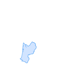
Issarbe - Table d'orientation - Pénalargue - Soum du Coutchet de Planté
luz
Navegue por
Navegue por
Consigue este tour en tu móvil
Issarbe - Table d'orientation - Pénalargue - Soum du Coutchet de Planté
luz
Senderismo
10,36
km
Escanee el código QR e inicie la navegación en la aplicación bergfex

Senderismo y rastreo


Issarbe - Table d'orientation - Pénalargue - Soum du Coutchet de Planté
luz
Distancia
10,36
km
Duración
03:06
h
Ascenso
138
m
Nivel del mar
1.321 -
1.498
m
Descarga de pistas
Issarbe - Table d'orientation - Pénalargue - Soum du Coutchet de Planté
luz
Senderismo
10,36
km
Ruta
Issarbe
(1.414 m)
Corredor/terreno
0,0 km
Mesa de orientación
(1.500 m)
Punto de vista
1,4 km
Pénalargue
(1.481 m)
Cumbre
3,6 km
Soum du Coutchet de Planté
(1.446 m)
Cumbre
4,4 km
Pénalargue
(1.481 m)
Cumbre
9,5 km
Issarbe
(1.414 m)
Corredor/terreno
10,3 km
Ruta
Issarbe - Table d'orientation - Pénalargue - Soum du Coutchet de Planté
luz
Senderismo
10,36
km
Issarbe
(1.414 m)
Corredor/terreno
0,0 km
Mesa de orientación
(1.500 m)
Punto de vista
1,4 km
Pénalargue
(1.481 m)
Cumbre
3,6 km
Soum du Coutchet de Planté
(1.446 m)
Cumbre
4,4 km
Pénalargue
(1.481 m)
Cumbre
9,5 km
Issarbe
(1.414 m)
Corredor/terreno
10,3 km
Autor
Proporcionado por Bergfex Tour Generator
Compartir gira
Issarbe - Table d'orientation - Pénalargue - Soum du Coutchet de Planté
luz
Senderismo
10,36
km
Error
Se ha producido un error. Por favor, inténtelo de nuevo.
Aún no hay opiniones
Rutas populares en los alrededores
-
GR10 Pyrenäenweg Etappe 11
medioSendero de largo recorrido 15,7 km -
O 15. Etappe Osse-en-Aspe - St. Martin, Neu-Aquitanien/Frankreich
pesadoCiclismo 25,5 km -
P 16. Etappe St. Martin - Larrau, Neu-Aquitanien/Frankreich
luzCiclismo 33,6 km -
4,0
Lescun - Plateau de Sanchèse - Cascade de Sanchèse
Senderismo 5,68 km -
Auberge Logibar - Cayolar d'Olhadibi - Laminako ziloa - Sainte-Engrâce
pesadoSenderismo 26,1 km -
Lescun - Plateau de Sanchèse - Cascade de Sanchèse
Mountainbike 5,87 km -
Lescun - Col des Ourtets - Hiru Erregeen Mahaia / Mesa de los Tres Reyes - Refugio de Linza
pesadoSenderismo 17,6 km -
Refuge de l'Abérouat - Esqueste - Hiru Erregeen Mahaia / Mesa de los Tres Reyes - Refugio de Linza
pesadoSenderismo 25,2 km -
Lescun - Cabanes d'Ansabère - Pic d'Ansabère / Petrechema - Refugio de Linza
pesadoSenderismo 19,5 km -
Lescun - Le Dec de Lhurs
pesadoSenderismo 16,2 km

Senderismo y rastreo

Más de 550.000 sugerencias de excursiones, mapas detallados y un intuitivo planificador de rutas hacen de esta aplicación una herramienta imprescindible para todos los amantes de la naturaleza.

No se pierda las ofertas y la inspiración para sus próximas vacaciones
Suscribirse al boletín de noticias
Error
Se ha producido un error. Por favor, inténtelo de nuevo.
Gracias por inscribirse
Su dirección de correo electrónico se ha añadido a la lista de correo.
Viajes por Europa
Austria
Suiza
Alemania
Italia
Eslovenia
Francia
Países Bajos
Belgium
Polonia
Liechtenstein
República Checa
Slovakia
España
Croacia
Bosnia y Herzegovina
Luxemburgo
Andorra
Portugal
Iceland
United Kingdom
Ireland
Greece
Albania
North Macedonia
Malta
Norway
Montenegro
Moldova
Kosovo
Hungary
San Marino
Romania
Estonia
Latvia
Belarus
Cyprus
Lithuania
Serbia
Bulgaria
Monaco
Denmark
Sweden
Finland