


Panorama trail Fronalpstock
If you can't cover the ridge path from Klingenstock to Fronalpstock, you won't have to do without the special panoramic experience. The Panorama-Walk is a mini-variant, so to speak, that concentrates on...
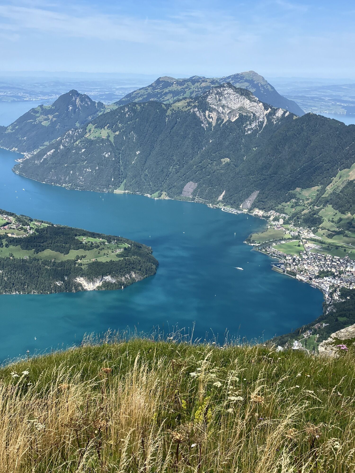
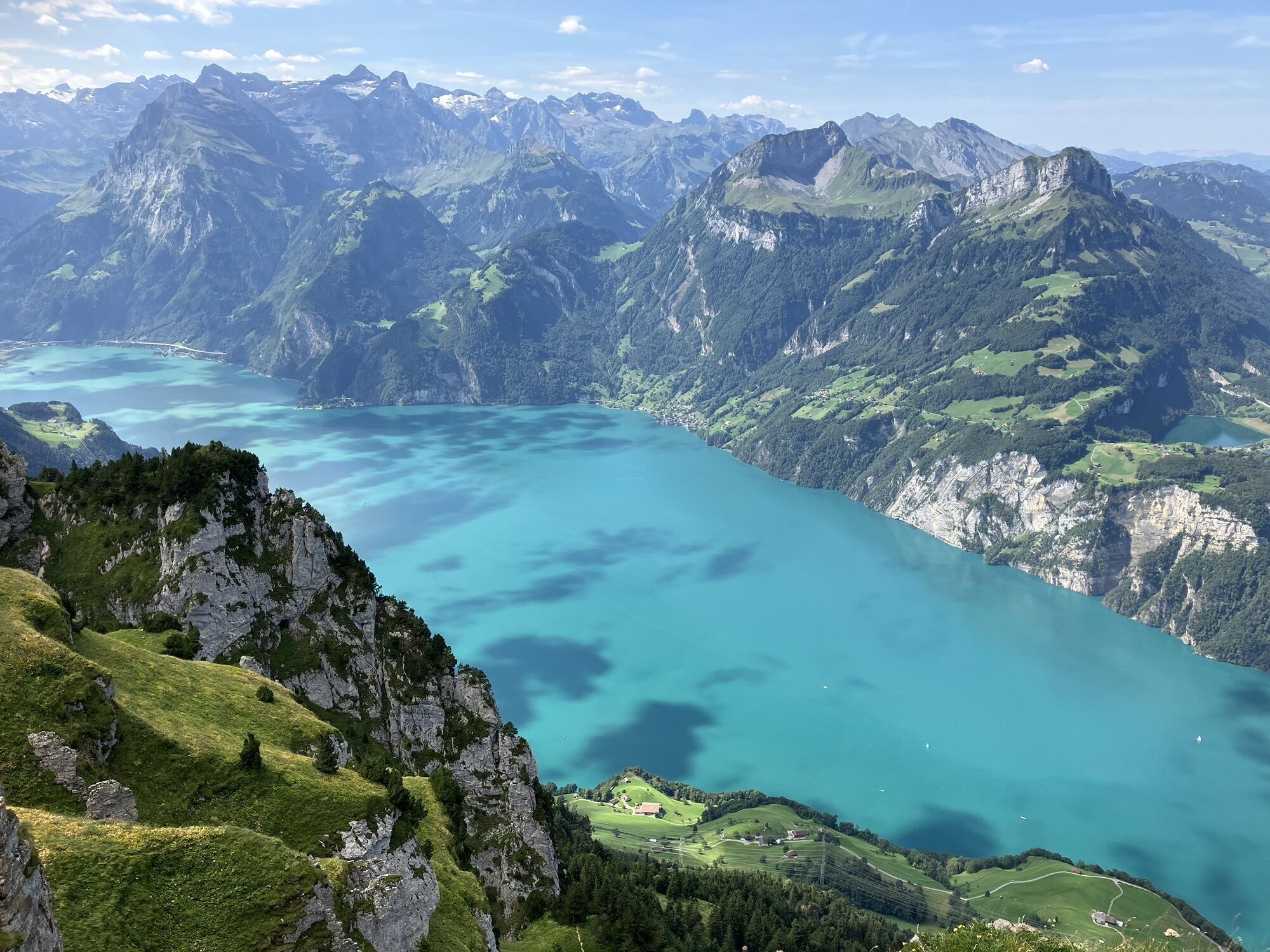
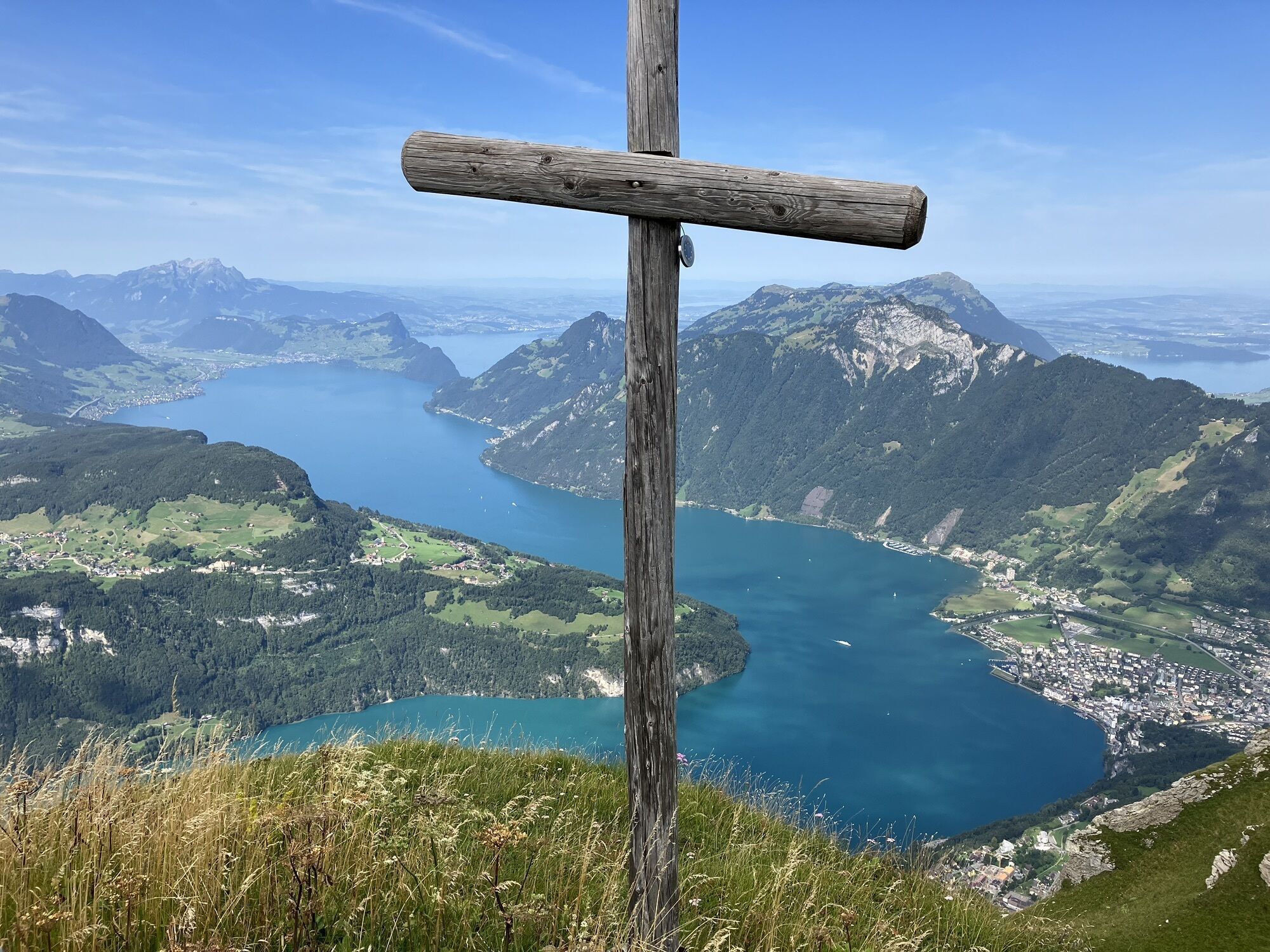
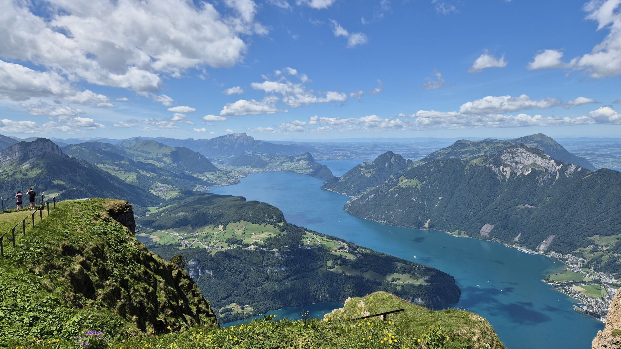
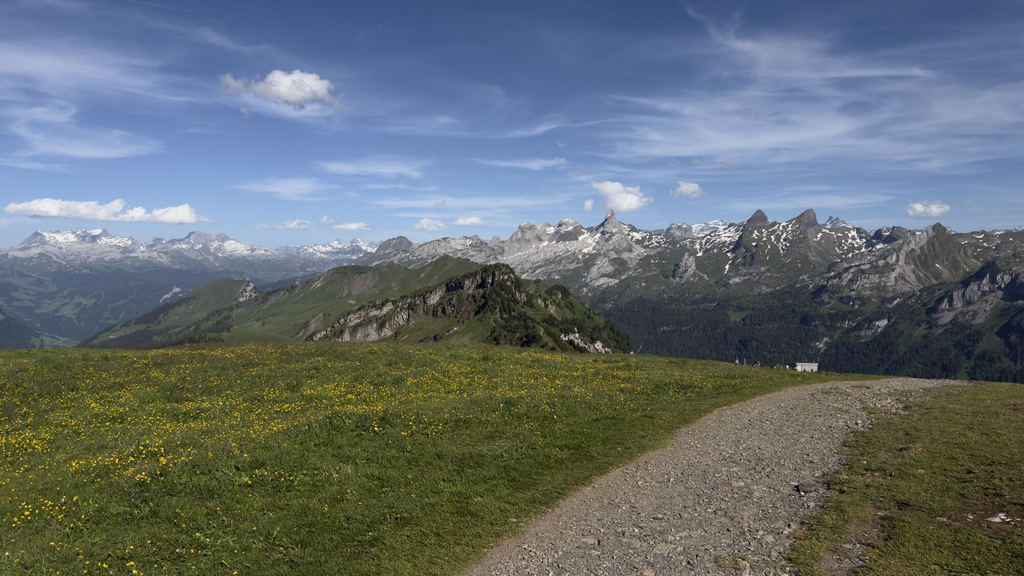
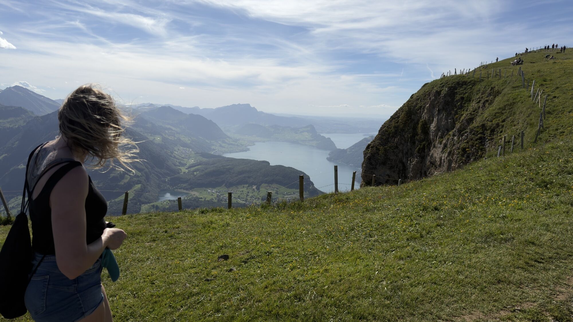
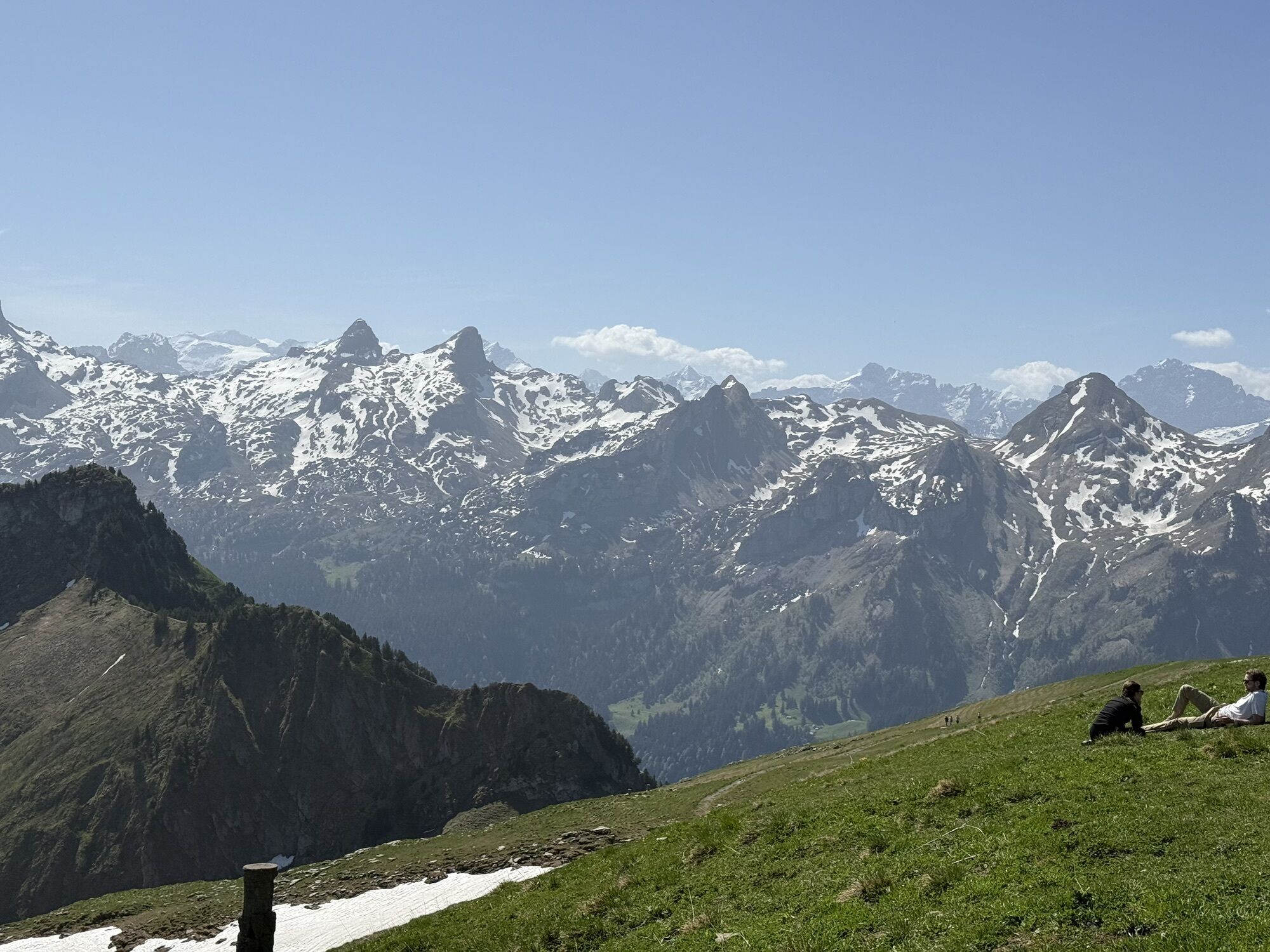
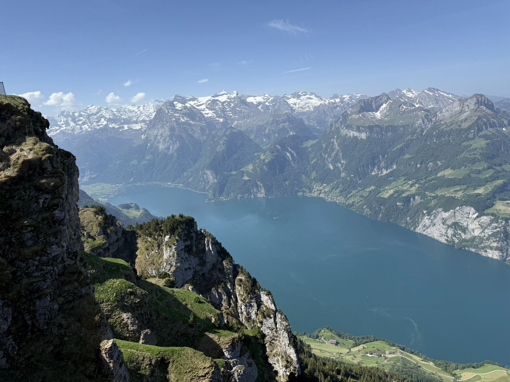
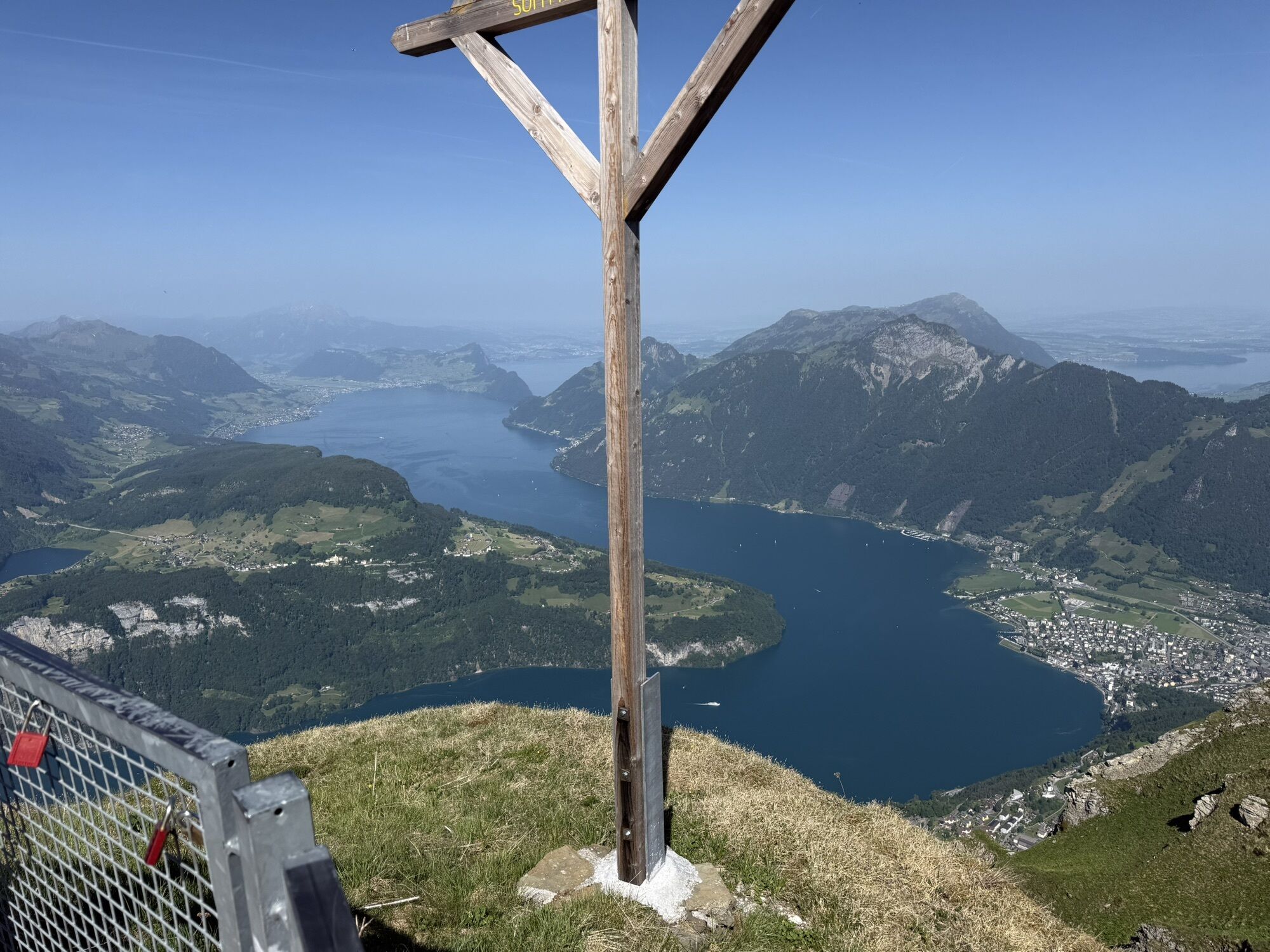
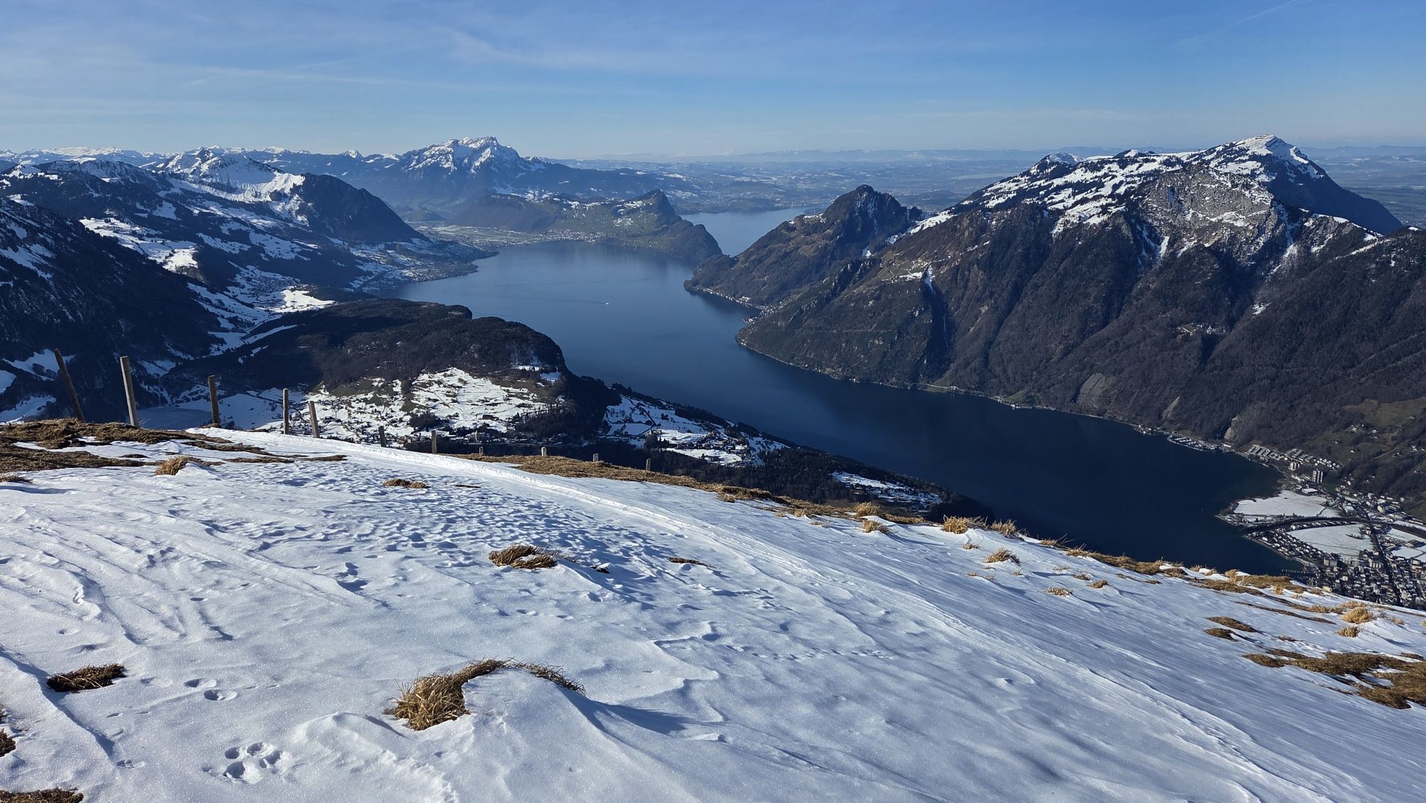
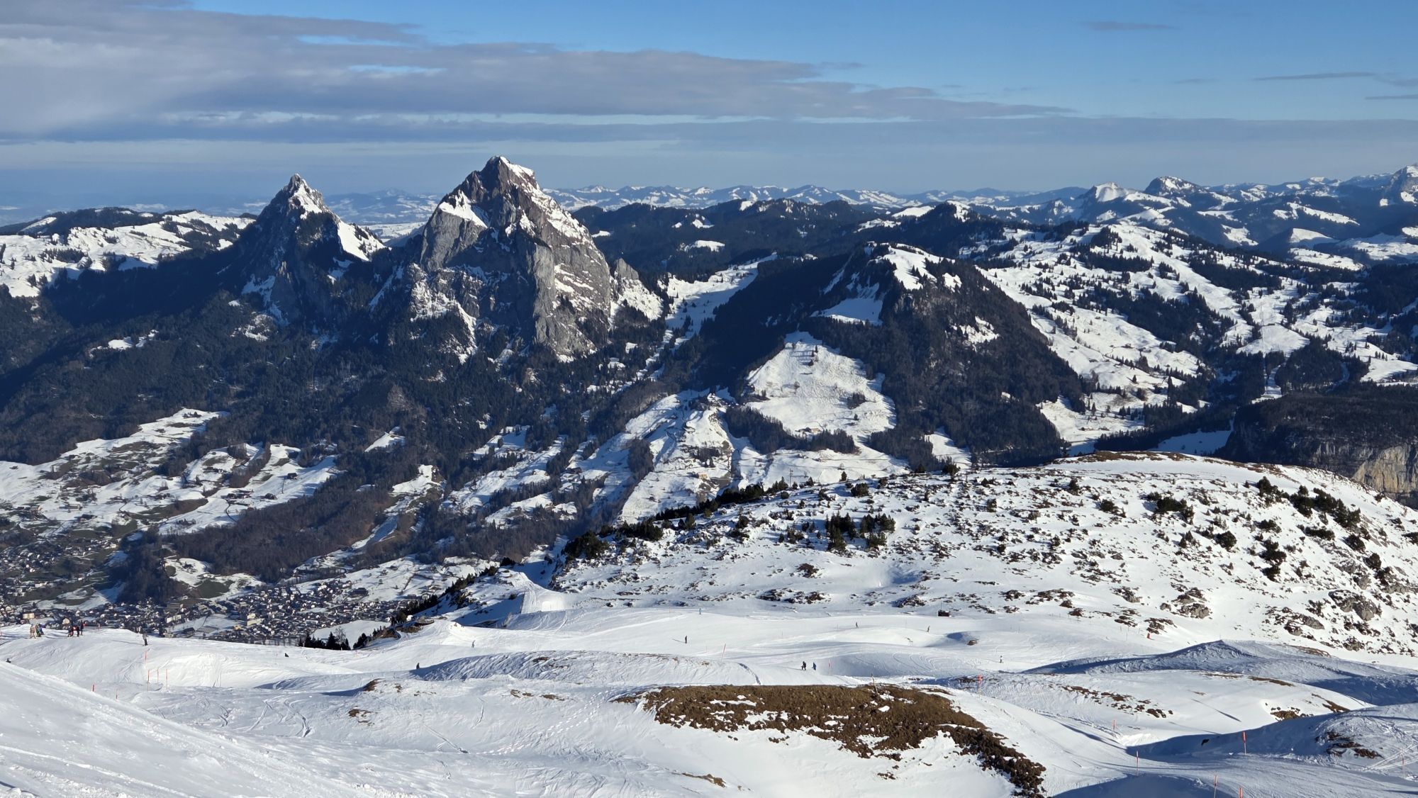
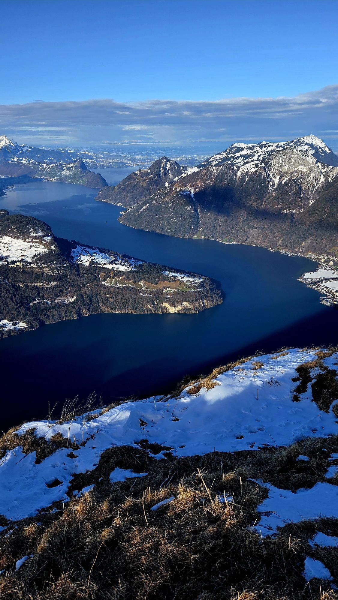
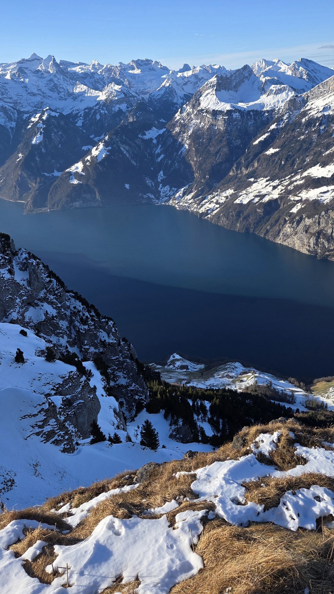
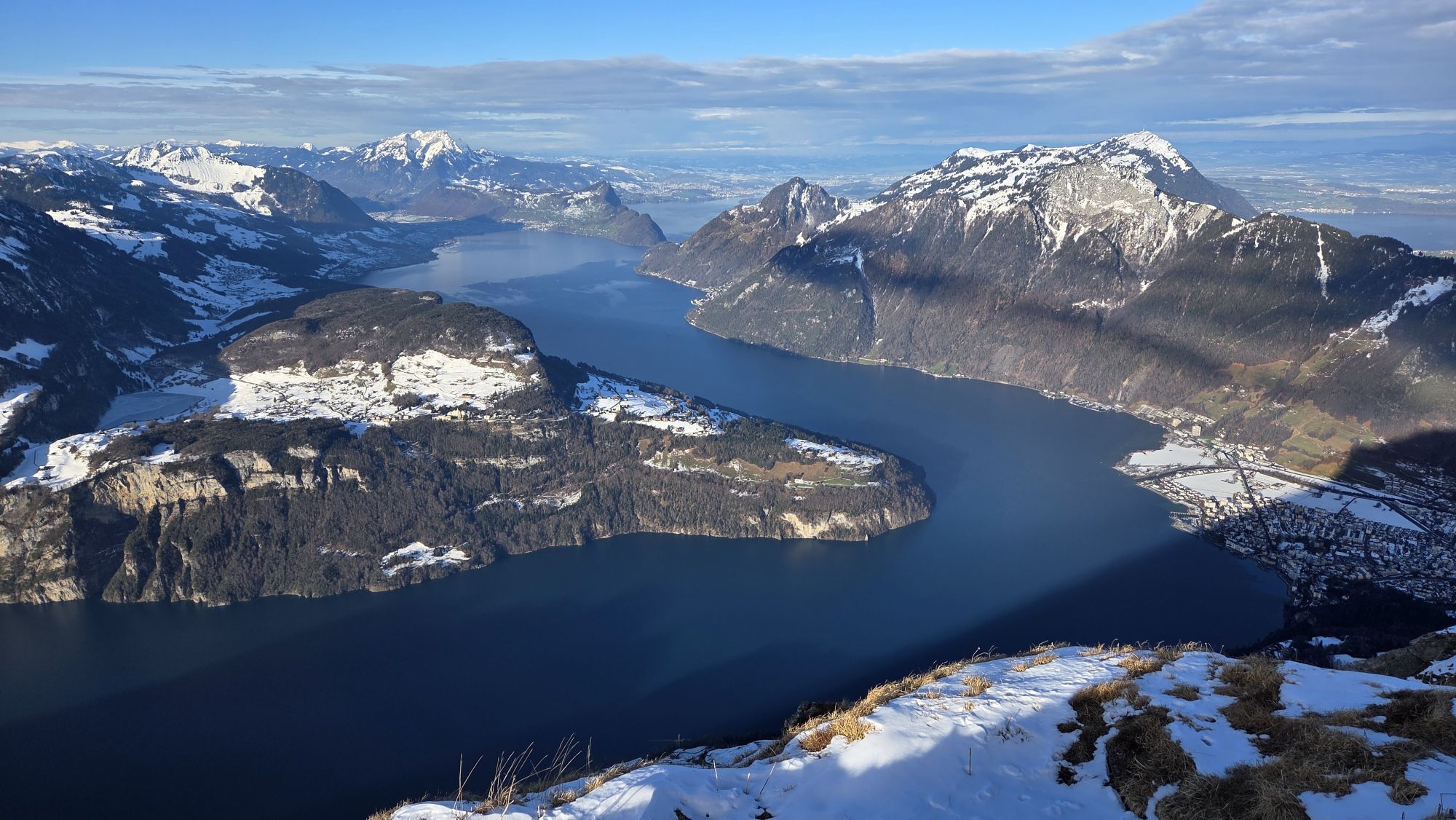
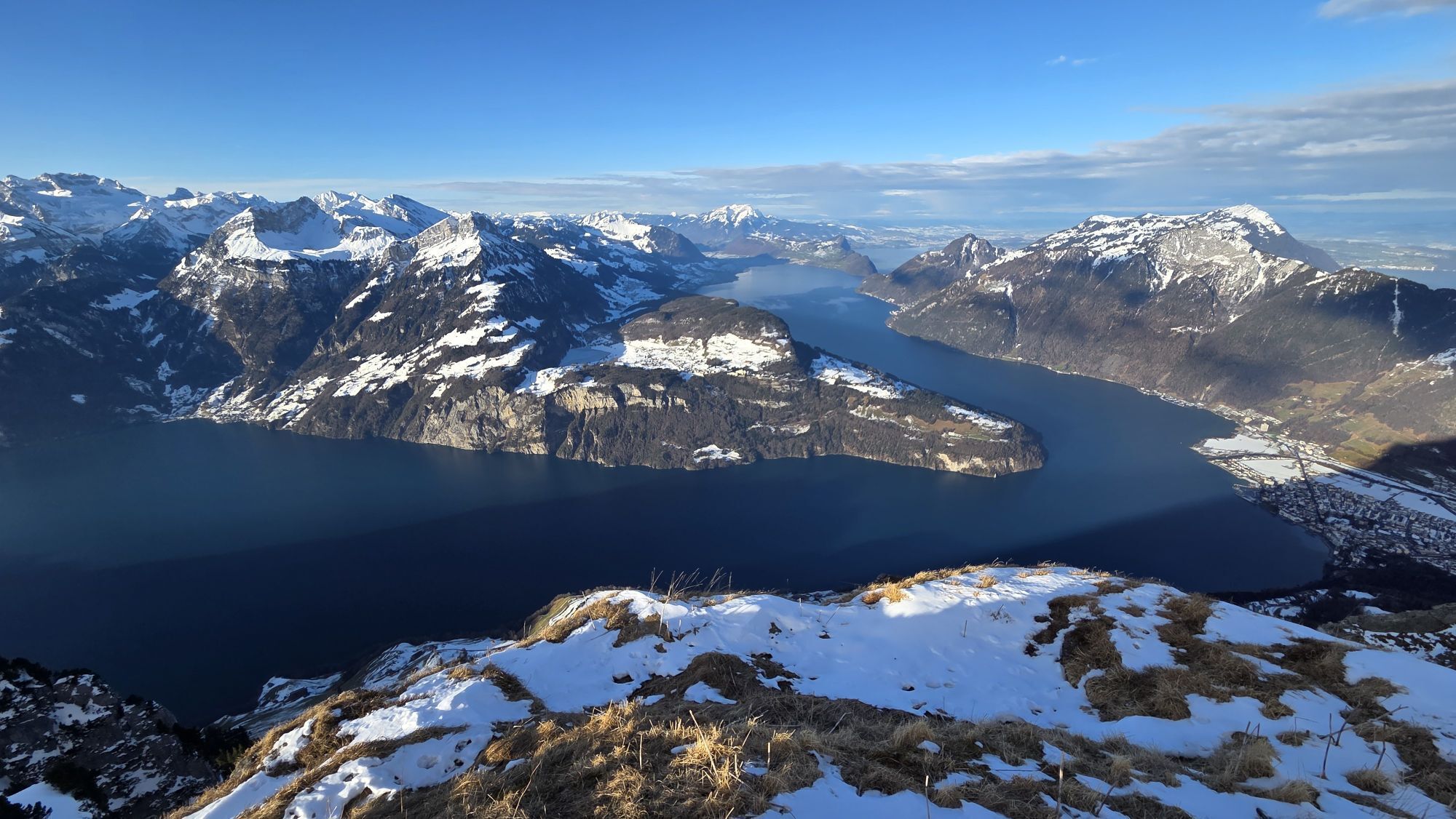
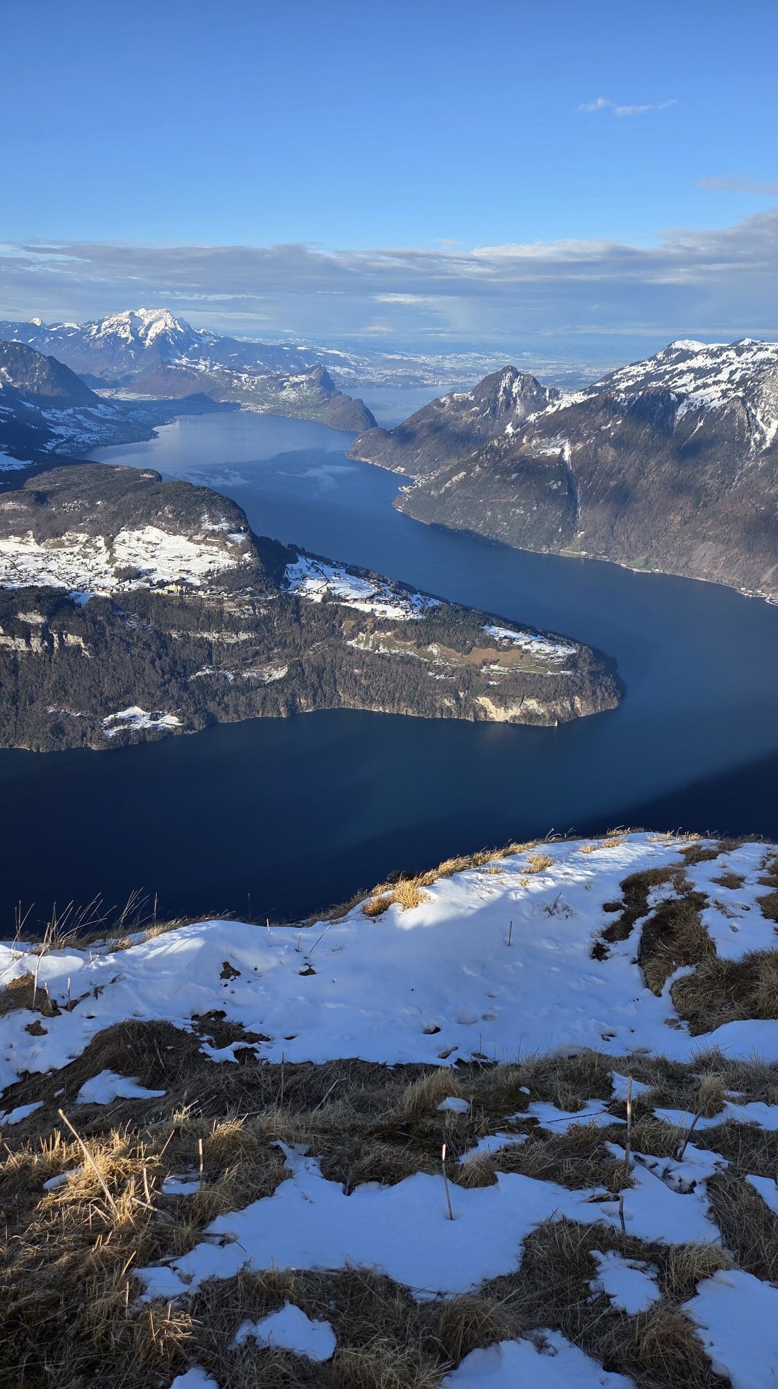
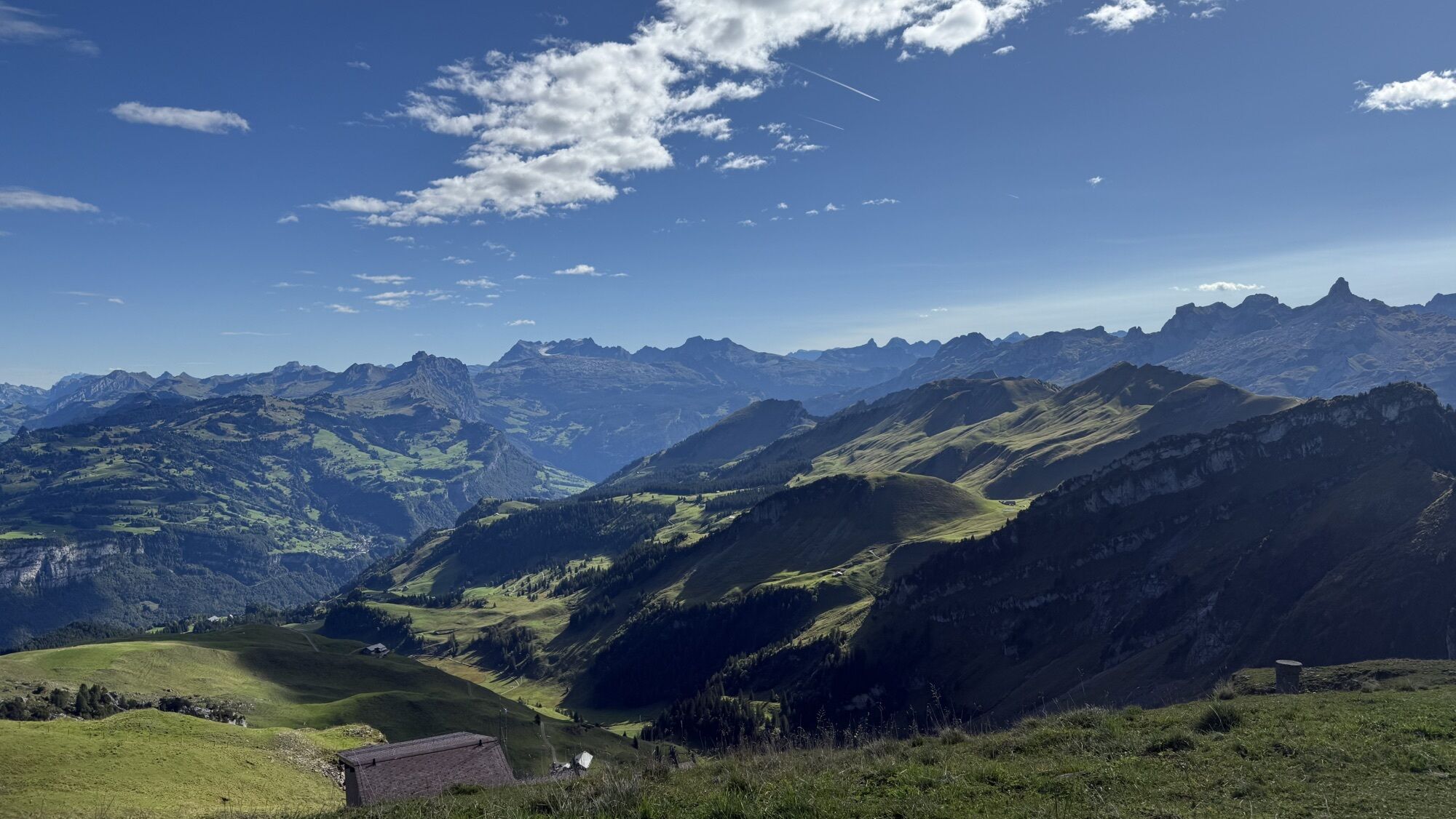
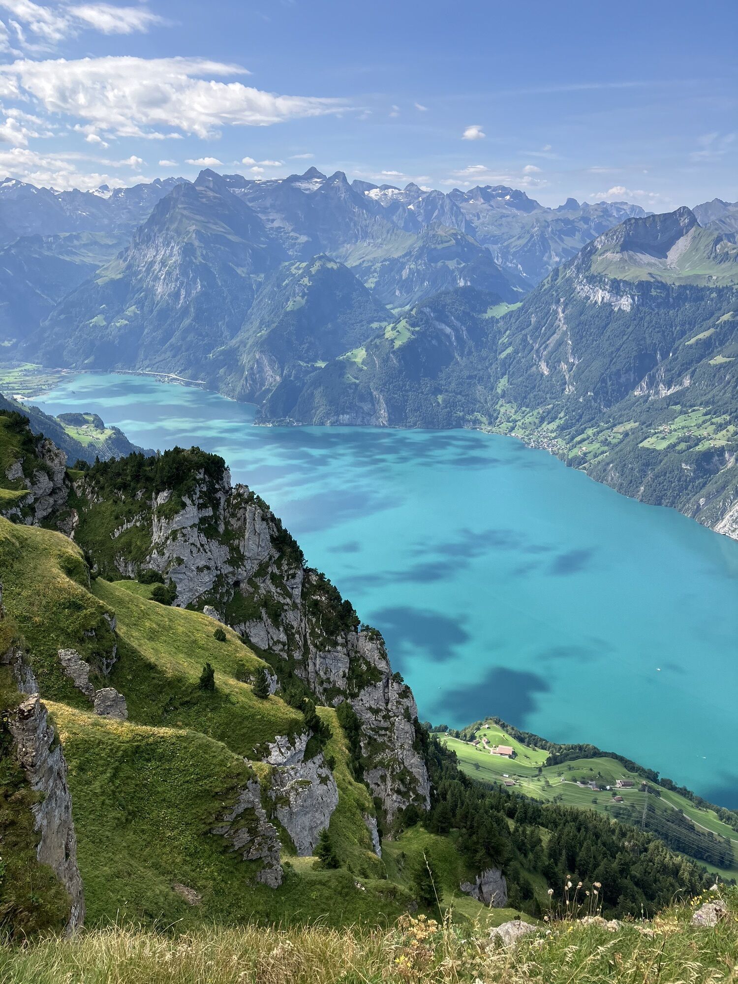
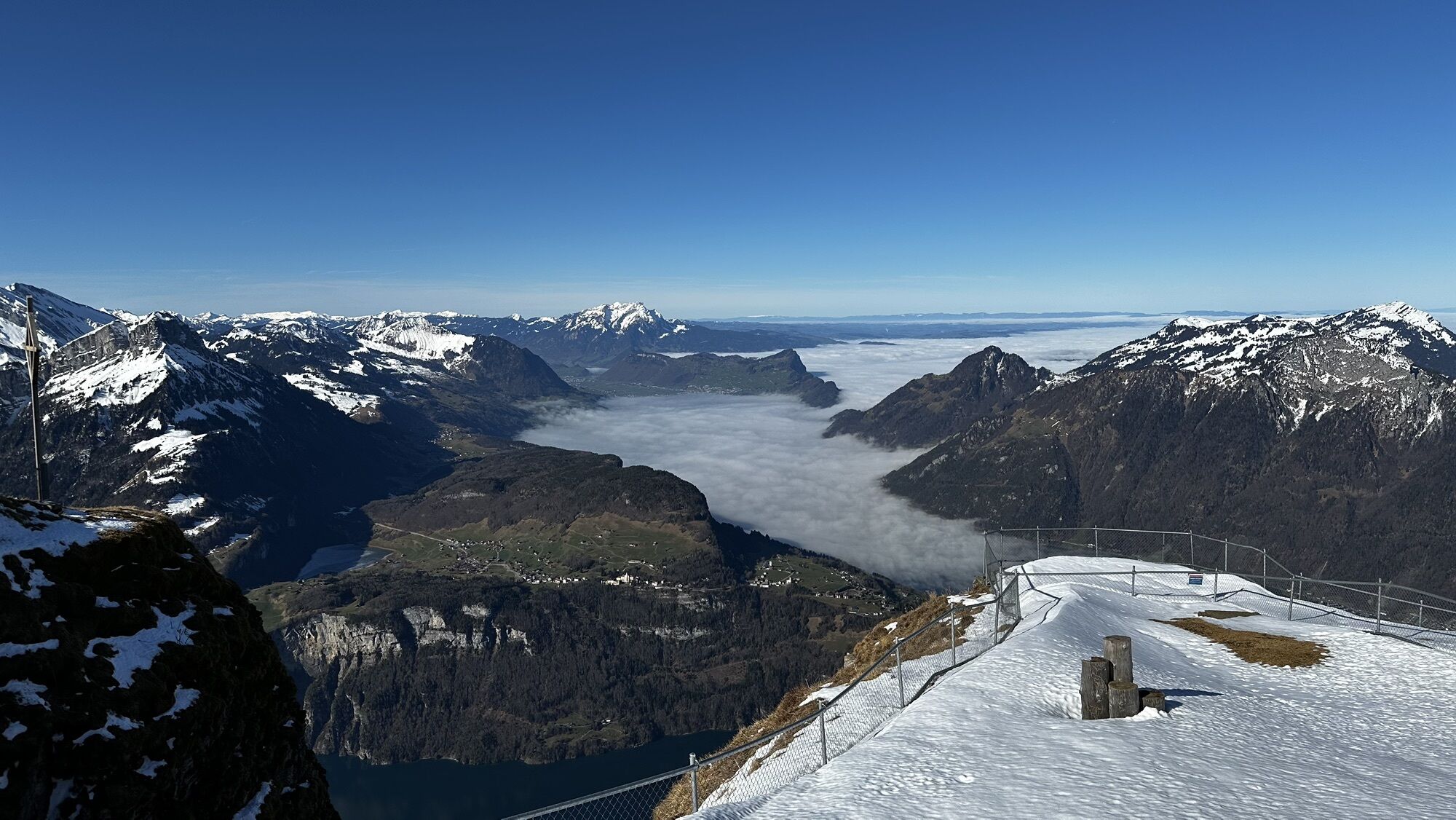
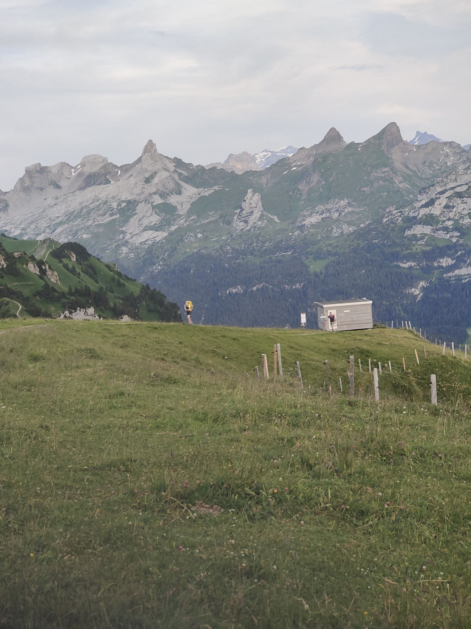
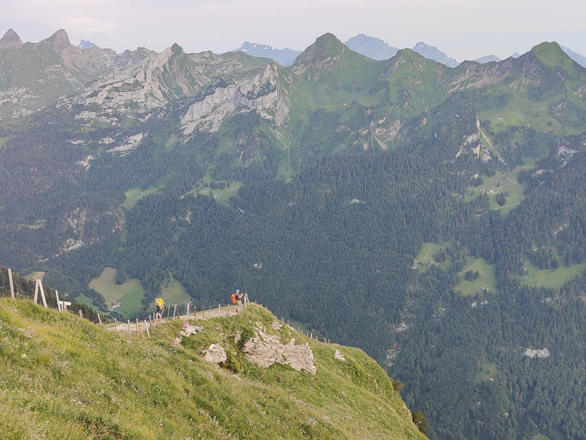
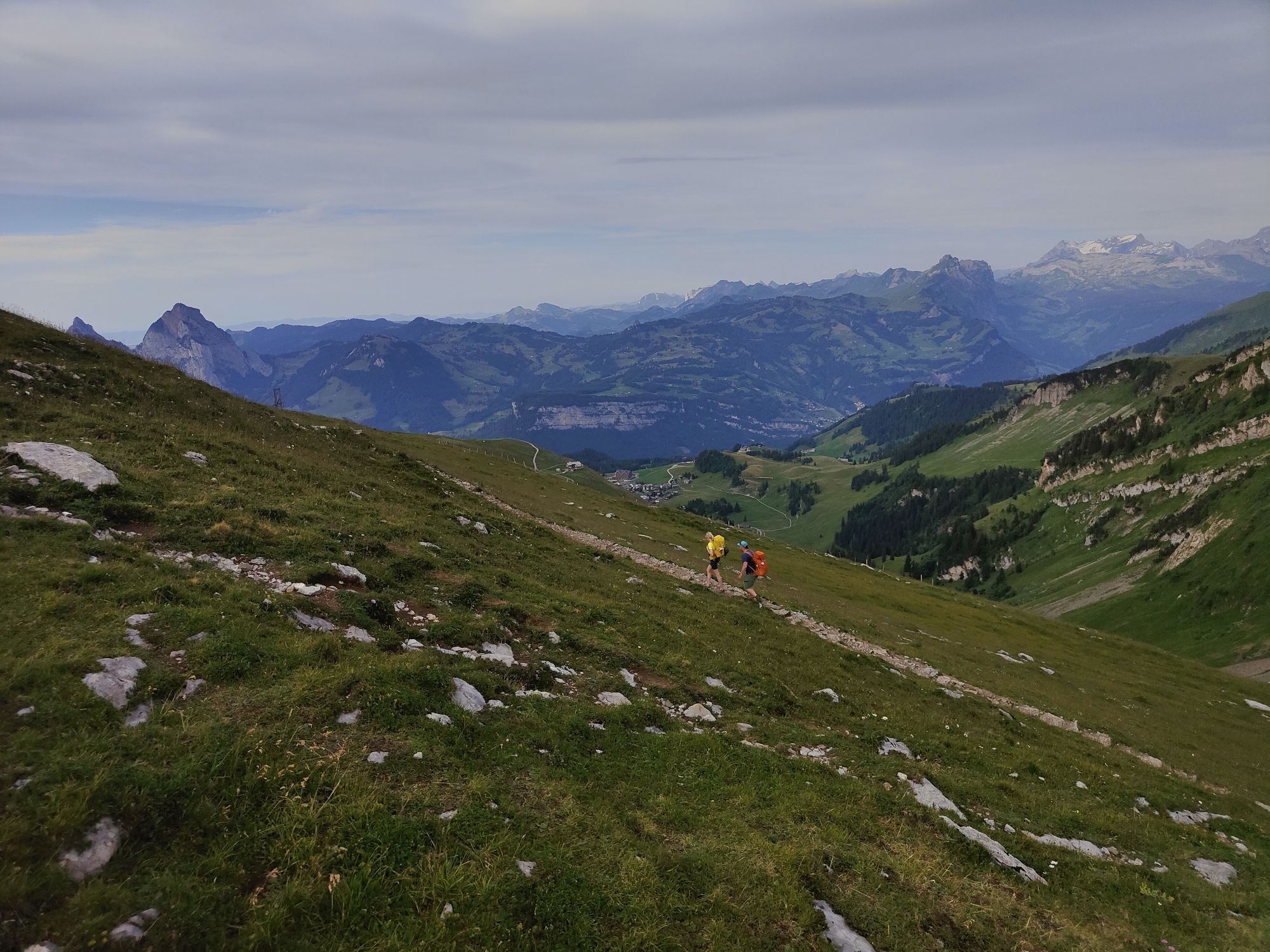
If you can't cover the ridge path from Klingenstock to Fronalpstock, you won't have to do without the special panoramic experience. The Panorama-Walk is a mini-variant, so to speak, that concentrates on the final bouquet of the ridge path. The steepest funicular in the world travels to the car-free holiday village of Stoos at 1300 metres. The chairlift then takes you up to the 1922-metre-high Fronalpstock. Once at the top, the view is overwhelming. Ten lakes and countless peaks of Central Switzerland lie at our feet. The comfortable walk, which is suitable for prams, is relatively flat and leads back to the summit restaurant. The little ones can have fun on the large playground or romp around with the dwarf goats. The picnic possibility at the playground and various resting places on the summit invite you to linger.
Fronalpstock summit 1922 - Fronalpstock summit 1922
Im Regio Shop an der Talstation der Standseilbahn sind Schwyzer Wanderkarten vorhanden:
Zum Webshop
Hiking shoes or light trekking shoes.
By car on the A4 to the Schwyz exit, then in the direction of Muotathal to the valley station of the large Schwyz-Stoos funicular or by car turn onto Morschacherstrasse (at Wolfsprung), then follow the signs to Morschach and continue to the valley station of the small Morschach-Stoos aerial cableway.
By train to Schwyz-Seewen station, then by bus to the valley station of the large Schwyz-Stoos funicular (line 1 Schwyz - Muotathal) or by train to SBB Brunnen station, then by bus to the valley station of the small Morschach-Stoos aerial cableway.
Parking is available at the valley station of the Schwyz-Stoos funicular and the Morschach-Stoos aerial cableway.
Frönelis Geissli playground & petting zoo on the Fronalpstock.
Webcams del recorrido
-
Stoos - Fronalpstock
-
Stoos - Fronalpstock
-
Stoos - Fronalpstock
-
Stoos - Fronalpstock
-
Stoos - Fronalpstock
-
Stoos - Fronalpstock
-
Stoos - Fronalpstock
-
Stoos Dorf
-
Stoos Dorf
-
Stoos Dorf
-
Stoos Dorf
-
Stoos Dorf
-
Stoos Dorf
-
Stoos - Fronalpstock
-
Stoos Dorf
-
Stoos Dorf
-
Brunnen am Vierwaldstättersee
-
Morschach
-
Rütliwiese
-
Sisikon Camping
Rutas populares en los alrededores
-
4,9
Gratwanderung Klingenstock
luzSenderismo 9,36 km -
4,5
Rundwanderung
luzSenderismo de montaña 12,9 km -
4,3
Mythenweg - Bergwanderung auf den Grossen Mythen
pesadoSenderismo 3,40 km -
4,3
Kleiner Mythen
medioSenderismo 6,31 km -
4,5
Brunni-Feuerstellen-Rundwanderung
luzSenderismo 11,5 km -
4,7
Mythen via Ibergeregg
medioSenderismo 9,73 km -
3,9
Gnipen - ab Goldau - Rundwanderung
medioSenderismo 10,6 km -
5,0
Wanderung entlang der Mythen, Alp "Zwüschet-Mythen"
medioSenderismo 10,5 km -
4,8
Rigi Kulm von Vitznau aus
medioSenderismo 17,6 km -
4,8
Holzegg - Grosser Mythen - Restaurant Grosser Mythen - Alpwirtschaft Brunnialp
medioSenderismo 5,66 km
Senderismo y rastreo


No se pierda las ofertas y la inspiración para sus próximas vacaciones
Su dirección de correo electrónico se ha añadido a la lista de correo.