


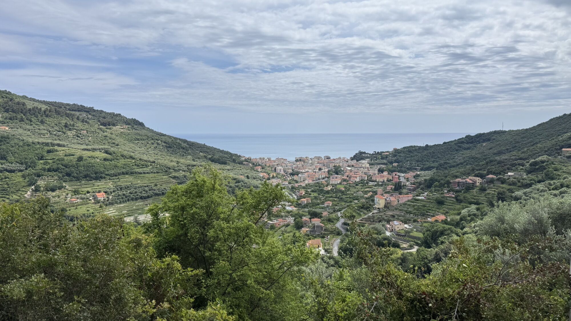
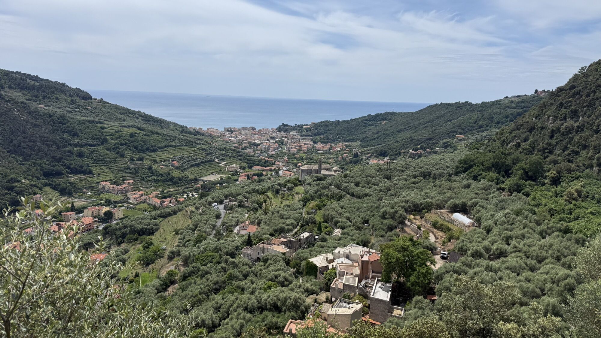
SV_12 San Cipriano – Camporotondo – Lacremà
from the church (120 m) follow for a few metres the little asphalt road to the left, then take a footpath to the right (trail sign: a red line) which proceeds level as far as a cistern for irrigation....
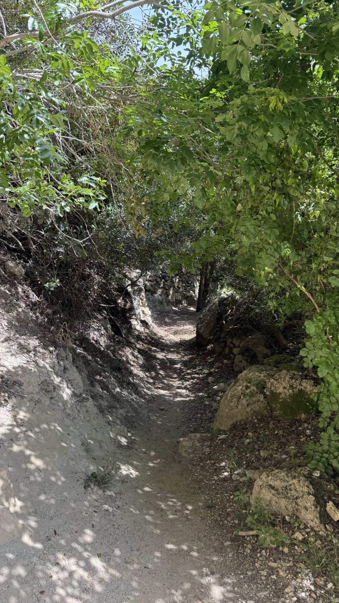
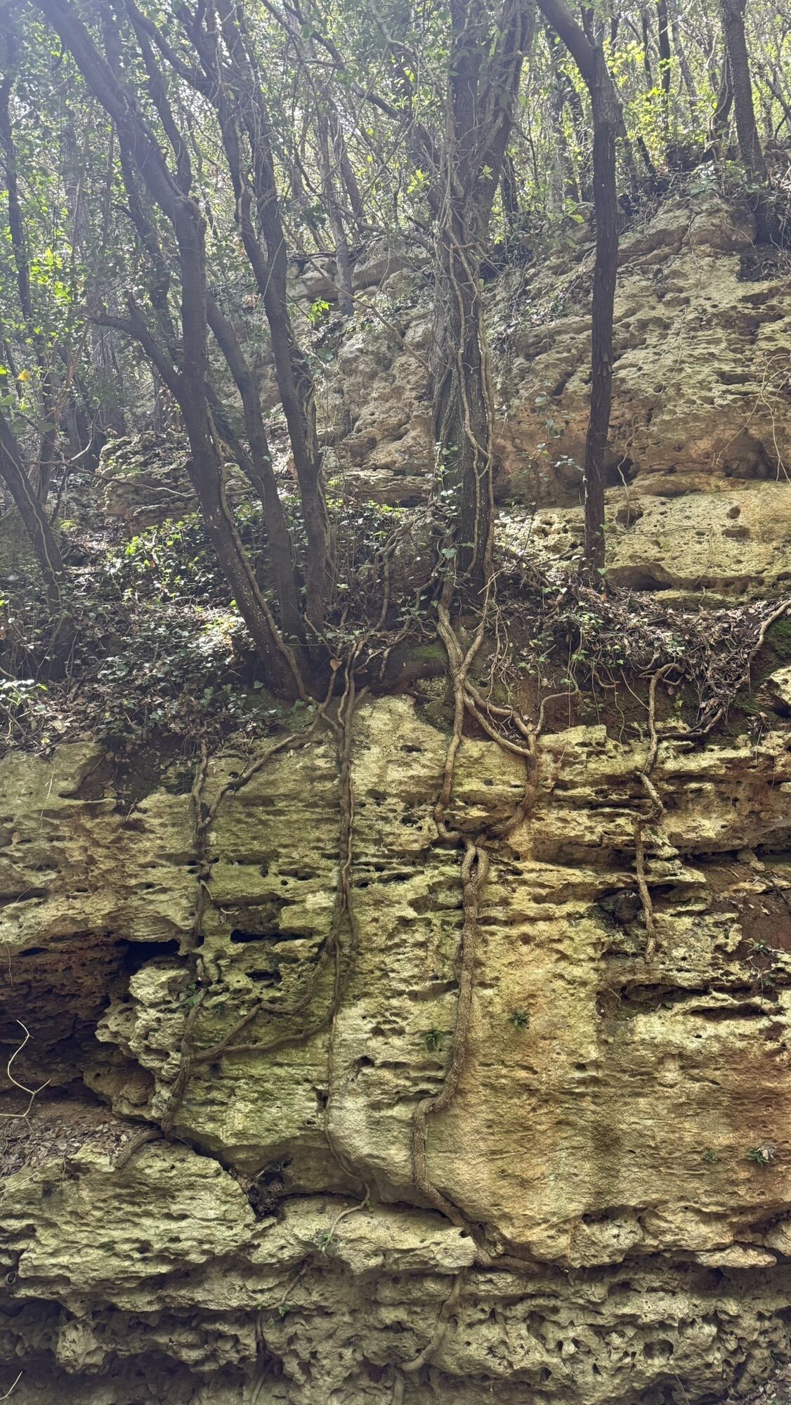
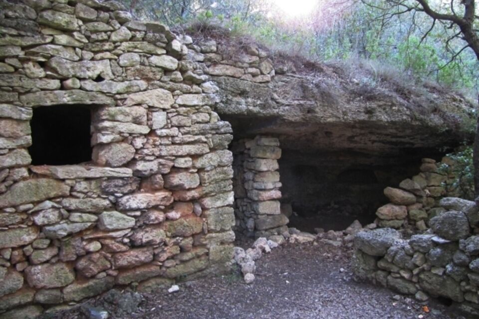
from the church (120 m) follow for a few metres the little asphalt road to the left, then take a footpath to the right (trail sign: a red line) which proceeds level as far as a cistern for irrigation. At the beginning of a little valley you find a spring. Leave the “triangle and two red lines” trail sign to the left to San Bernardino and continues in a shady wood with several dry stone walls. Here there are two suggestive primitive shelters of which one, near the footpath, is constituted by a cave surrounded by dry stone walls. Ignore a footpath which goes to Camporotondo and reach the clearing called Cian de Rue (plain of the oaks). Here you turn off the main footpath and take a level track to the right. Pass a muddy area, where wild boars often gather, walk uphill to the right through a rocky area, then carrying on walking uphill, keep the left; pass the last two large terraces and you reach a wooded ridge where you find a wide footpath (trail sign: “red dot and triangle”) coming from Camporotondo. Continue leftwards on level and almost immediately you find the remains of Cà Cerisola on the right. A little way ahead you reach a fork (c. 320 m); turn off the footpath signed by the red dot and triangle and go downhill following the “red line” footpath, reaching the bottom of Vacche' Valley near an interesting shelter under the rock constituted by many different rooms (289 m). Here you find a large footpath (trail sign: full red rhombus) which you follow going down to the right along picturesque little valley between woods and attractive grasses. The footpath passes by the characteristic Casa del Vacchè (1.30 h from San Cipriano). Carry on walking slightly downhill you reach a large clearing where, on the right, is another small shelter under the rock, while on the right you see a couple of old farms, now ruined. A little way ahead, in the wood, there is a fork: ignore the “red full rhombus” sign and follow the “three red dots”: after a slightly uphill stretch, you continue on flat ground, then walk up some steps carved into the rock before turning right to reach the megalithic site of Camporotondo (c. 290 m; 15 minutes from Casa dei Vacche') with a nice grass, ideal for picnics. On the opposite side of the area there is another interesting building partly built from already existing caves. At the left of the house, the footpath proceeds slightly uphill and in this stretch the road is signed by two trail signs: “three red dots” and “ empty red square”. In a few meters turn off this footpath and continue along a flat wooded ridge. Past a little flat rock, the footpath starts descending with frequent rocky stretches and, after many hairpin turns, it joins the track signed by the red empty square, which you follow going right as far as the characteristic village of Lacremà. By a mule-track you shortly reach the church of San Cipriano (45 minute from Camporotondo).


from Finale Ligure exit of the Savona-Ventimiglia highway drive down to Finale Marina and go left to Finale Pia. Here turn left again to Calvisio, pass the bridge on Torrente Sciusa and, past the church, turn left to via Bedina. In a few dozens metres follow a little road to the right (signs for Lacremà) which steeply rises with many hairpin turns as far as the church of San Cipriano.
Nature and Landscape * * * * * * Family * * * * * * Gourmet * * * Culture * * * * * *
Rutas populares en los alrededores
-
4,8
SV_08 Monte di Capo Noli e Caverna dei Falsari
Senderismo 5,49 km -
Rocche Bianche e Monte Mao (Finale Ligure)
medioMountainbike 37,0 km -
4,0
Final de Enduro 2008
medioMountainbike 38,2 km -
Tierras Altas y Alta Vía
medioMountainbike 63,0 km -
Leg 19 from Noli to Finalborgo
Senderismo 18,9 km -
5,0
Il Paradiso di Manù - Noli - Monte Capo Noli - Varigotti
medioSenderismo 10,1 km -
5,0
E-bike Tour Colla San Giacomo
medioCiclismo 30,3 km -
Manìe Mània
pesadoMountainbike 26,9 km -
Cravarezza
pesadoMountainbike 46,0 km -
EWS Rock and Roll
medioMountainbike 31,8 km
Senderismo y rastreo


No se pierda las ofertas y la inspiración para sus próximas vacaciones
Su dirección de correo electrónico se ha añadido a la lista de correo.