


324 Fideriser Heuberge

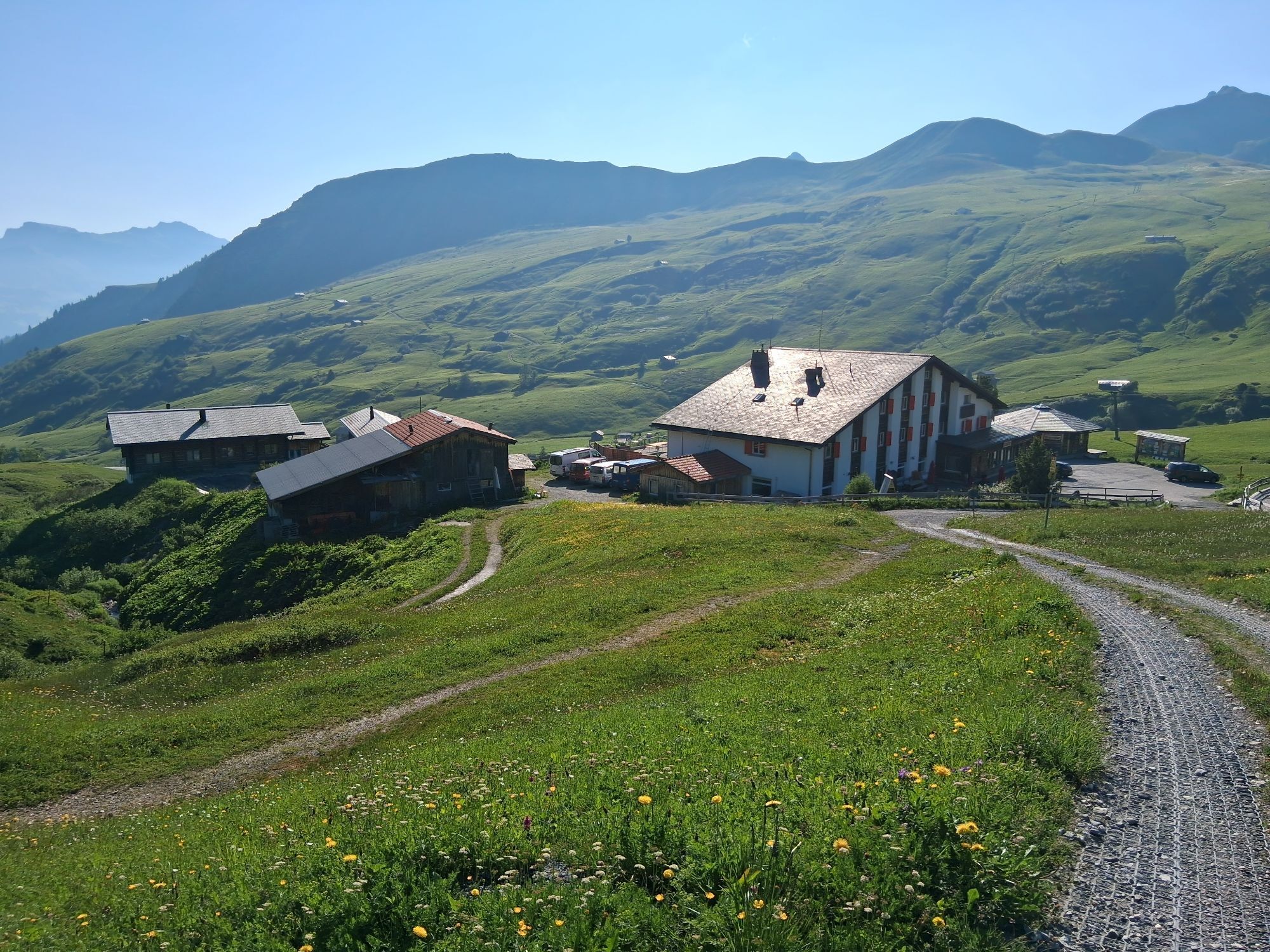
The route takes us out of the pretty mountain village of Fideris on an initially steep section along an asphalted mountain road towards the Fideriser Heuberge. After some 2 km the steep climb levels off...
The route takes us out of the pretty mountain village of Fideris on an initially steep section along an asphalted mountain road towards the Fideriser Heuberge. After some 2 km the steep climb levels off as we go past pleasant pasture huts and beyond the confines of the forest. Shortly before the Berghaus Arflina it all gets seriously steep again. Once we reach the mountain restaurant it's time for a break to take in the wonderful mountain panorama and savour the moment. The single trail that's up next is initially still quite steep and technically demanding. It includes sections where you will simply need to push your bike. But then, at an altitude of around 2200 m, we reach the turning point of the tour, and what follows is a long and well-deserved downhill run. In fact the descent is also part of Route 333, the famous Swiss Bike Masters. The high-speed alpine trail takes us past the Alp Nova and on down into the valley. Half-way down, the route branches off from the alpine road to take us back on to a beautiful single trail through the forest. The exciting and entertaining route alternates sections of trail and forestry track as we speed on down back to Fideris and the starting point of our tour.


Fideris - Fideriser Heuberge - Alp Nova - Fideris
Über die A13 und die B28 nach Fideris.
Kurz nach dem Dorfeingang stehen auf der linken Strassenseite kostenlose Parkplätze zur Verfügung. Das Abstellen von Fahrzeugen auf dem Dorfplatz ist nur gegen Gebühr möglich.
Prättigau Marketing
Feldweg 19
7233 Jenaz
Tel. +41 (0)81 325 11 11
info@praettigau.info
www.praettigau.info
Unbedingt im Winter zurückkommen und den längsten Schlittelweg der Schweiz ausprobieren!
Webcams del recorrido
Rutas populares en los alrededores
-
4,8
Camino del contrabandista
medioSendero temático 8,60 km -
4,8
Vía ferrata Sulzfluh, St. Antönien
pesadoVía ferrata 11,3 km -
3,9
Arosa-Medergen-Tritt-Latschüelfurgga-Strelapass-Davos
medioSenderismo 22,5 km -
5,0
Chrüz
luzEsquí de travesía 4,39 km -
4,0
Gandasee - Bergsee am Fuße der Madrisa
medioSenderismo 6,23 km -
5,0
Ruta circular Madrisa
medioEsquí de travesía 25,7 km -
5,0
Rätschenfluh - cima panorámica de primera clase
pesadoSenderismo 11,5 km -
5,0
Excursión a la cima Riedkopf
medioSenderismo 10,6 km -
3,5
Arosa-Maienfelder Furgga-Stafelalp-Davos
medioSenderismo 15,9 km -
4,5
Gafierjoch
medioEsquí de travesía 6,60 km
Senderismo y rastreo


No se pierda las ofertas y la inspiración para sus próximas vacaciones
Su dirección de correo electrónico se ha añadido a la lista de correo.