Landgasthof Löhner - Diepersdorf - Rockenbrunn - Moritzberg
medio
Consigue este tour en tu móvil
Landgasthof Löhner - Diepersdorf - Rockenbrunn - Moritzberg
medio
Senderismo
9,20
km
Escanee el código QR e inicie la navegación en la aplicación bergfex

Senderismo y rastreo


Landgasthof Löhner - Diepersdorf - Rockenbrunn - Moritzberg
medio
Distancia
9,20
km
Duración
02:30
h
Ascenso
274
m
Nivel del mar
381 -
599
m
Descarga de pistas
Landgasthof Löhner - Diepersdorf - Rockenbrunn - Moritzberg
medio
Senderismo
9,20
km
Ruta
Diepersdorf
(392 m)
Pueblo
0,1 km
Grüne Au
(409 m)
Barrio
2,0 km
Moritzberg
(604 m)
Cumbre
6,1 km
Weißenbrunn-Blick
(456 m)
Punto de vista
7,2 km
Diepersdorf
(392 m)
Pueblo
8,8 km
Ruta
Landgasthof Löhner - Diepersdorf - Rockenbrunn - Moritzberg
medio
Senderismo
9,20
km
Landgasthof Löhner
(383 m)
Restaurante
0,0 km
Diepersdorf
(392 m)
Pueblo
0,1 km
Rockenbrunn
(388 m)
Barrio
1,0 km
Grüne Au
(409 m)
Barrio
2,0 km
Klingender Wasserfall
(388 m)
Cascada
3,6 km
Moritzberg
(595 m)
Barrio
5,9 km
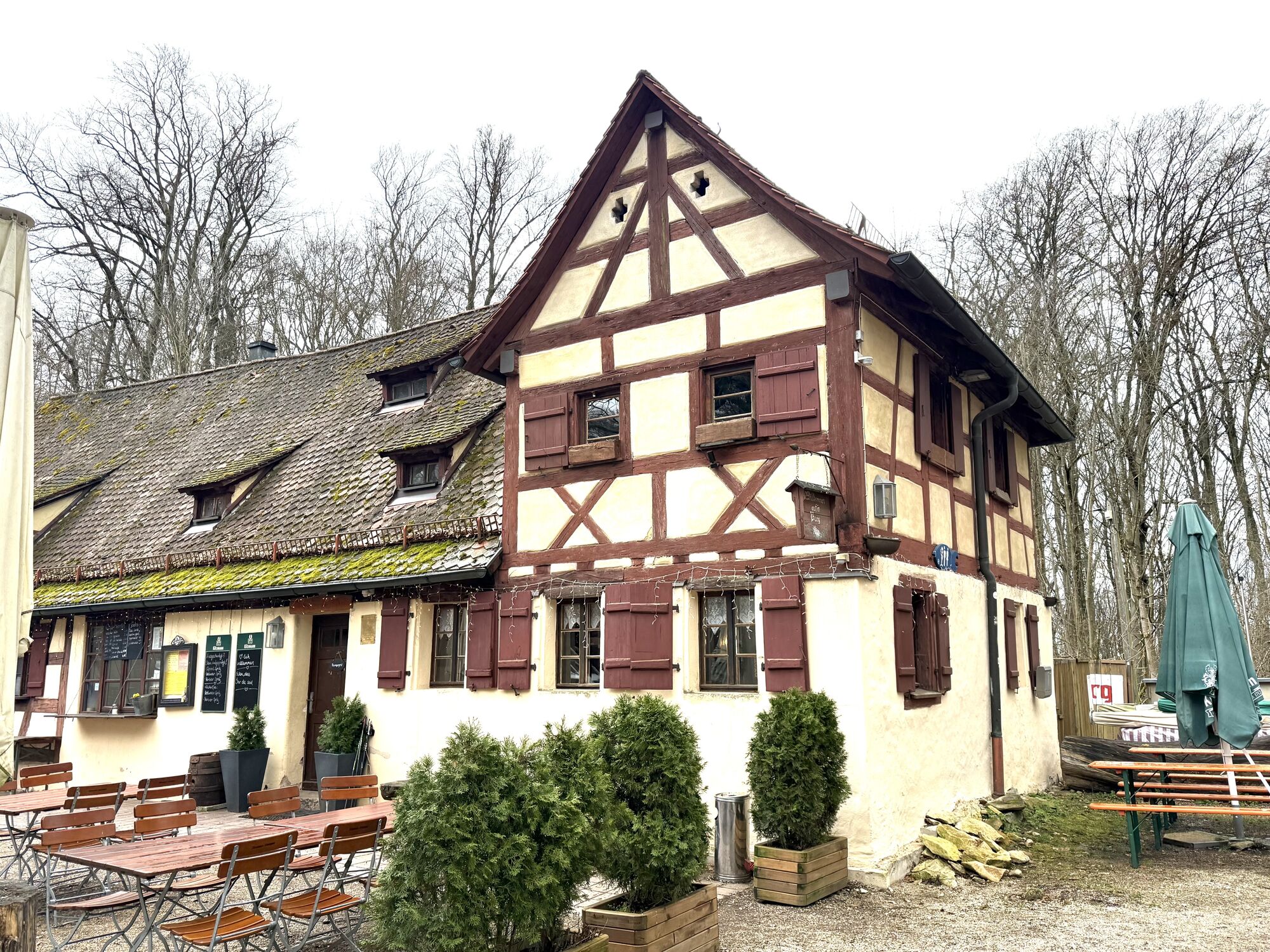
Berggasthof Moritzberg
(599 m)
Restaurante
5,9 km
Sankt-Mauritius-Kapelle
(598 m)
Lugar de culto
5,9 km
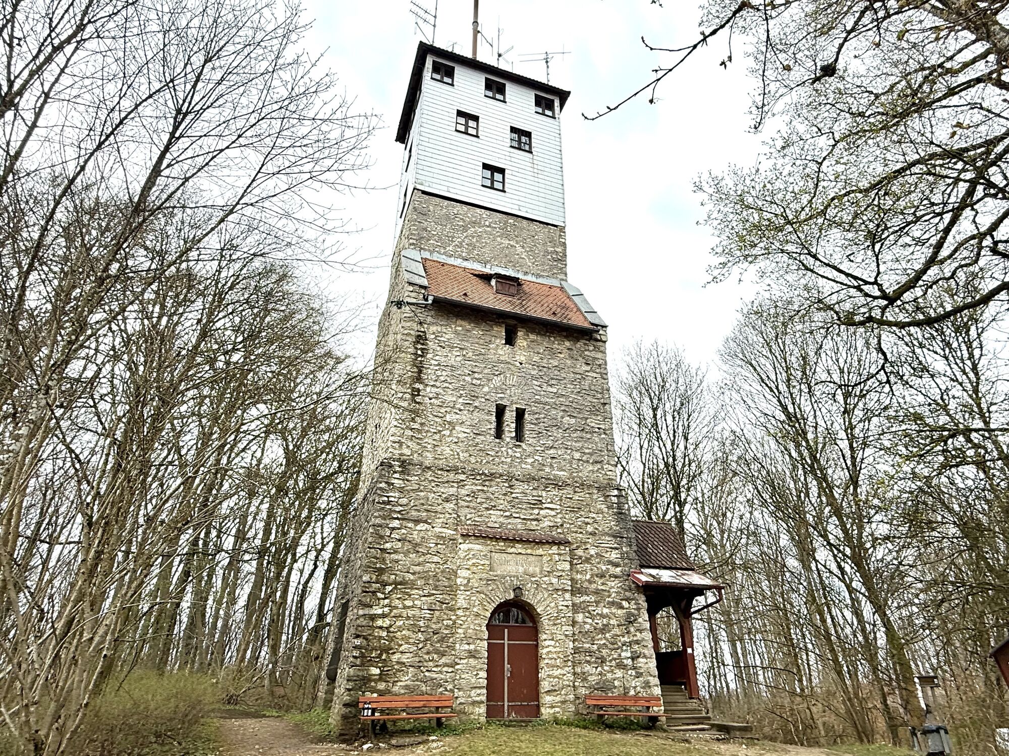
Moritzberg
(604 m)
Cumbre
6,1 km
Weißenbrunn-Blick
(456 m)
Punto de vista
7,2 km
Distlerhof
(437 m)
Restaurante
8,1 km
Diepersdorf
(392 m)
Pueblo
8,8 km
Landgasthof Löhner
(383 m)
Restaurante
9,2 km
Autor
Proporcionado por Bergfex Tour Generator
Compartir gira
Landgasthof Löhner - Diepersdorf - Rockenbrunn - Moritzberg
medio
Senderismo
9,20
km
Error
Se ha producido un error. Por favor, inténtelo de nuevo.
Aún no hay opiniones
Rutas populares en los alrededores
-
5,0
Happurger Stausee + Hohler Fels
medioSenderismo 9,12 km -
4,5
Karlshöhle – Gustav-Adolf-Höhle Runde von Feucht
Senderismo 8,11 km -
NaturErlebnisPfad im Naturschutzgebiet Pegnitztal Ost
luzSenderismo de invierno 6,37 km -
Auf den Moritzberg und zum klingenden Wasserfall
luzSenderismo 14,1 km -
5,0
Schwarzenbruck, Bayern
luzSenderismo 5,97 km -
Speikern-Festung Rothenberg-Glatzenstein
luzSenderismo 13,4 km -
Uscita notturna
luzCiclismo de carrera 33,3 km -
3,0
Anton Leidinger Weg
medioSenderismo 70,0 km -
Von Ottensoos der Pegnitz entlang- Mittelfranken/Deutschland
luzE-Bike 59,2 km -
Engelthal, Mittelfranken
Senderismo 7,66 km
Senderismo y rastreo

Más de 550.000 sugerencias de excursiones, mapas detallados y un intuitivo planificador de rutas hacen de esta aplicación una herramienta imprescindible para todos los amantes de la naturaleza.

No se pierda las ofertas y la inspiración para sus próximas vacaciones
Suscribirse al boletín de noticias
Error
Se ha producido un error. Por favor, inténtelo de nuevo.
Gracias por inscribirse
Su dirección de correo electrónico se ha añadido a la lista de correo.
Viajes por Europa
Austria
Suiza
Alemania
Italia
Eslovenia
Francia
Países Bajos
Belgium
Polonia
Liechtenstein
República Checa
Slovakia
España
Croacia
Bosnia y Herzegovina
Luxemburgo
Andorra
Portugal
Iceland
United Kingdom
Ireland
Greece
Albania
North Macedonia
Malta
Norway
Montenegro
Moldova
Kosovo
Hungary
San Marino
Romania
Estonia
Latvia
Belarus
Cyprus
Lithuania
Serbia
Bulgaria
Monaco
Denmark
Sweden
Finland