






Hirtenpfad in herrlichem Weiß - Schneeschuhtrail
El sendero de los pastores te lleva por terrenos variados, extensiones blancas, bordes de bosques cubiertos de nieve y rocas. Con maravillosas vistas del valle del Gletscherhochtal, con sus hermosas granjas...
El sendero de los pastores te lleva por terrenos variados, extensiones blancas, bordes de bosques cubiertos de nieve y rocas. Con maravillosas vistas del valle del Gletscherhochtal, con sus hermosas granjas de la Selva Negra, a través del valle del Ursee hasta Lenzkirch, hasta el Hochfirst y, en un día claro, hasta los Alpes, se camina alrededor de Raitenbuch.

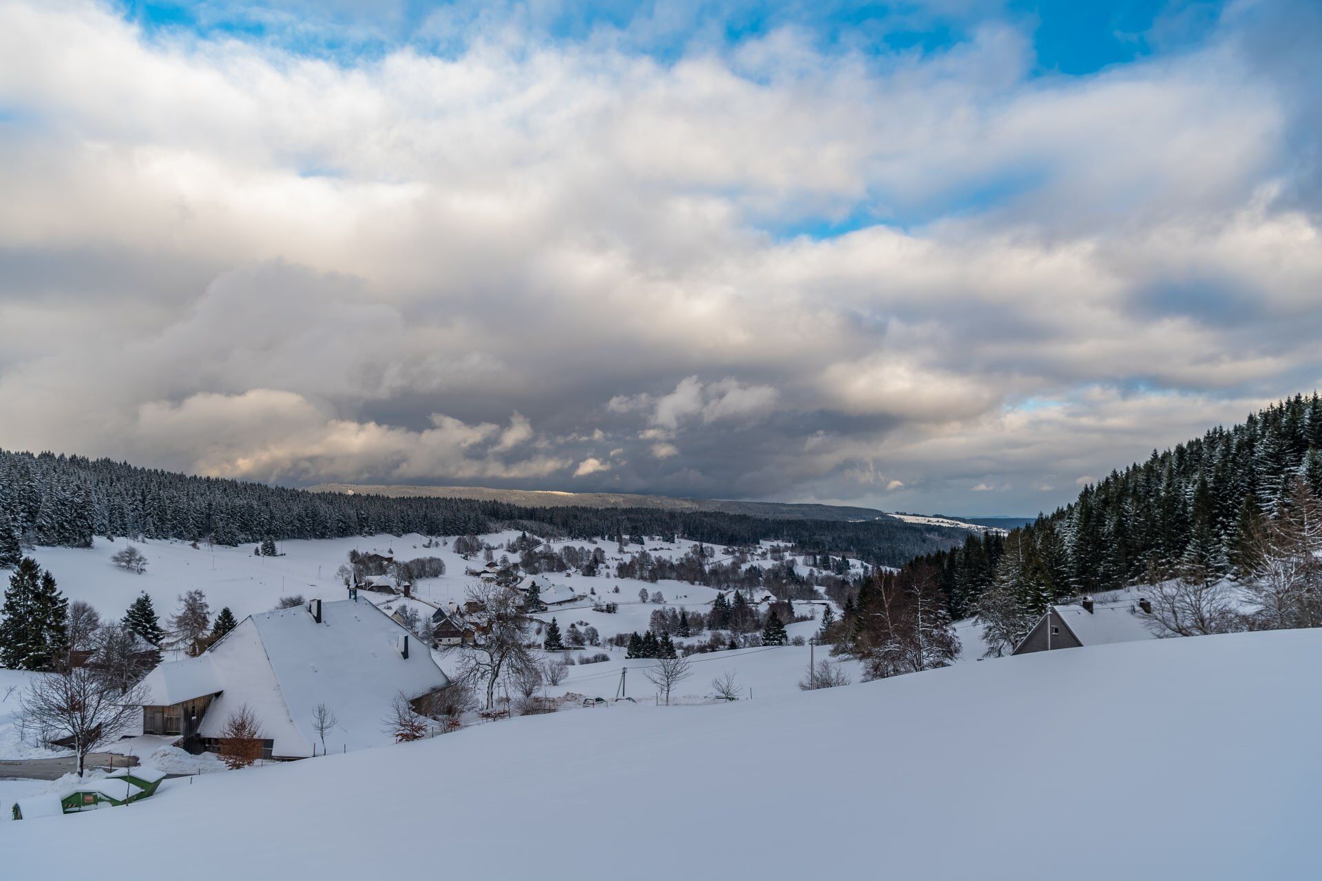

You start one of the most beautiful snowshoe trails in the Upper Black Forest on the Raitenbucher Höhe (1050 m above sea level) with a view over Raitenbuch and northwards to the Hochfirst. The trail can be walked in both directions and is signposted with round signs. Follow the route downhill towards Raitenbuch and Lenzkirch. The trail branches off to the right opposite the signpost for the Hirtenpfad. It leads you downhill along the edge of the forest, through the forest and across snow-covered meadows. After a climb at the edge of the forest, the route branches off to the left and leads down an open basin to a path that takes you to the next farm. There you turn right across the open landscape and cross the Raitenbucher Straße. You pass through a beautiful hedgerow landscape above, cross a narrow local road and turn right and soon sharp left across slightly ascending fields to Berger Straße. A steep, short ascent follows and then the route continues along the edge of the forest above the high pastures. As you catch your breath, you can enjoy a new view of the Raitenbuch high valley. Past the Luzenhäusle and up through a high spruce forest, another snow-covered field opens up in front of you to the highest point of the trail. It's worth taking a look back here, perhaps you'll be rewarded with a view of the Alps. It is now only 700 metres to the hikers' car park, via Raitenbucher Straße, where you can enjoy another wonderful view over the valley.
Sí
We recommend winterproof equipment!
Anreise zum Startpunkt
NOTE: From the Fischbacherhöhe to the Raitenbucher Höhe (starting point of the Hochschwarzwälder Schneeschuhtrails Hirtenpfad) you hike approx. 2.5 km.
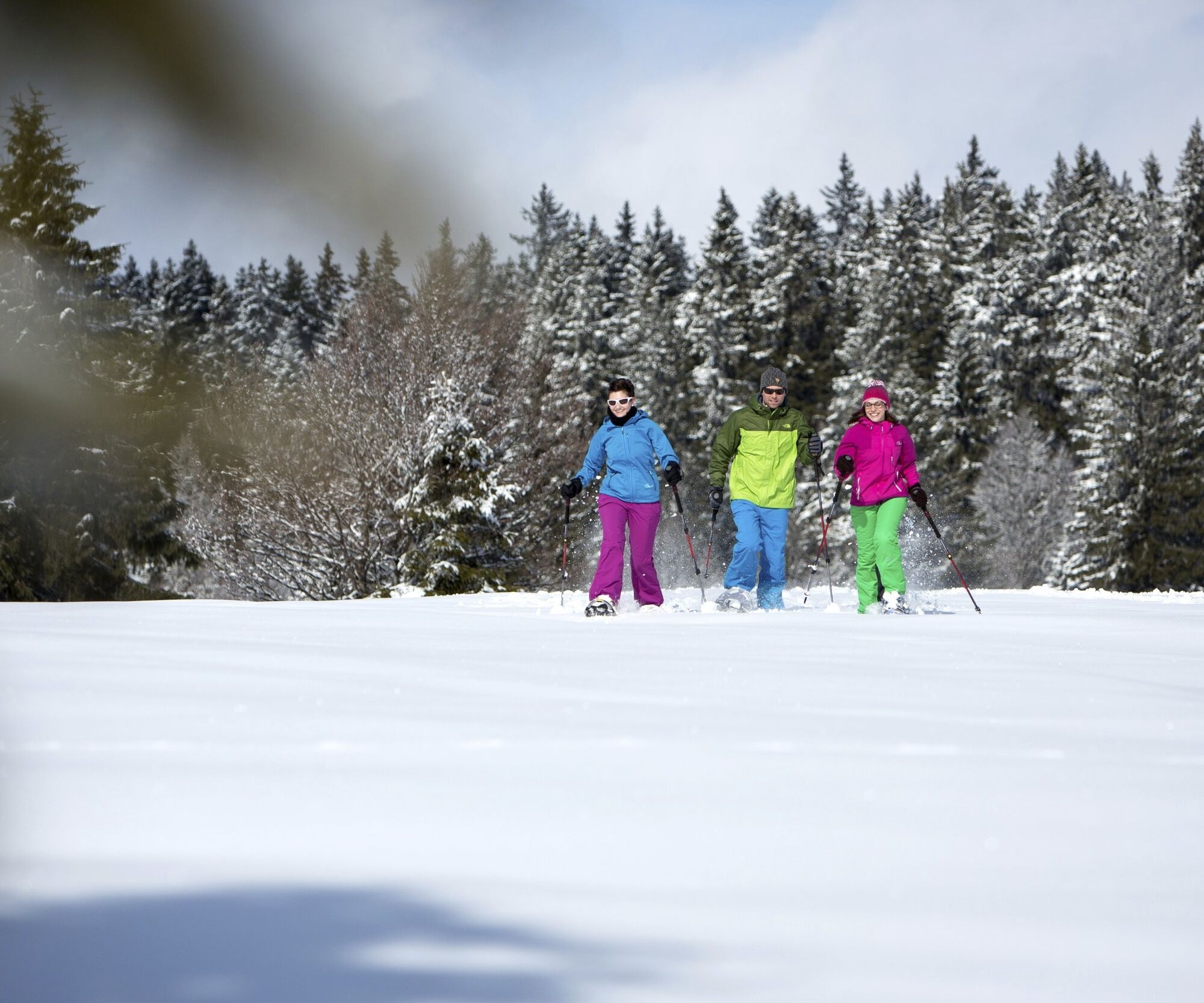
Snowshoe trails are specially signposted hiking trails, away from cleared hiking paths and cross-country ski trails, through unspoilt winter landscapes. These routes can only be travelled with snowshoes. Safe walking on uneven terrain is a prerequisite!
Infórmate
Siempre en directo con más de 9.500 webcams. bergfex Como usuario Pro, ahora puede ver las webcams correspondientes a muchos tours en la app de tours desde. Esto le permite ver las condiciones actuales directamente.
Rutas populares en los alrededores
-
4,7
Heimatpfad Hochschwarzwald- Mühlen und Sägen in der Schlucht
medioSenderismo 7,42 km -
3,8
Seerundweg Titisee
luzSenderismo 5,84 km -
4,1
Höhenklimaweg Titisee-Rundweg
medioSenderismo 7,44 km -
3,9
Von Titisee zum aussichtsreichen Hochfirst
medioSenderismo 10,6 km -
3,8
Genießerpfad - Säbelthomaweg
medioSendero temático 11,3 km -
4,2
Ravennaschlucht
Senderismo 6,90 km -
4,8
Sonnenaufgang und Feldbergsteig
medioSenderismo 11,6 km -
4,0
Höhenmeter auf dem Herzogenhorn
medioSenderismo 11,1 km -
5,0
Genießerpfad - Menzenschwander Geißenpfad
medioSendero temático 9,78 km -
5,0
Wutachschlucht+Lotenbachklamm
luzSenderismo 10,0 km
Senderismo y rastreo


No se pierda las ofertas y la inspiración para sus próximas vacaciones
Su dirección de correo electrónico se ha añadido a la lista de correo.





