De l’Aze à l’Ergues - Beaujolais Vert - Claveisolles
luz
Navegue por
Navegue por
Consigue este tour en tu móvil
De l’Aze à l’Ergues - Beaujolais Vert - Claveisolles
luz
Senderismo
13,05
km
Escanee el código QR e inicie la navegación en la aplicación bergfex

Senderismo y rastreo


De l’Aze à l’Ergues - Beaujolais Vert - Claveisolles
luz
Distancia
13,05
km
Duración
04:30
h
Ascenso
418
m
Nivel del mar
420 -
583
m
Descarga de pistas
De l’Aze à l’Ergues - Beaujolais Vert - Claveisolles
luz
Senderismo
13,05
km
You'll love it:
- A route that swings from one valley to the other: one, on the V side, watered by the Aze, then its neighbor, on the Saint-Nizier side, where the Ergues flows. The "twin" streams, separated...
Descripción de la
You'll love it:
- A route that swings from one valley to the other: one, on the V side, watered by the Aze, then its neighbor, on the Saint-Nizier side, where the Ergues flows. The "twin" streams, separated at their source, meet further south, at Le Gravier, to form the Azergues River.
- The relief of the high Beaujolais valleys, carved by water, and connecting with the peaks: Tourvéon and Saint-Rigaud, Roche d'Ajoux...
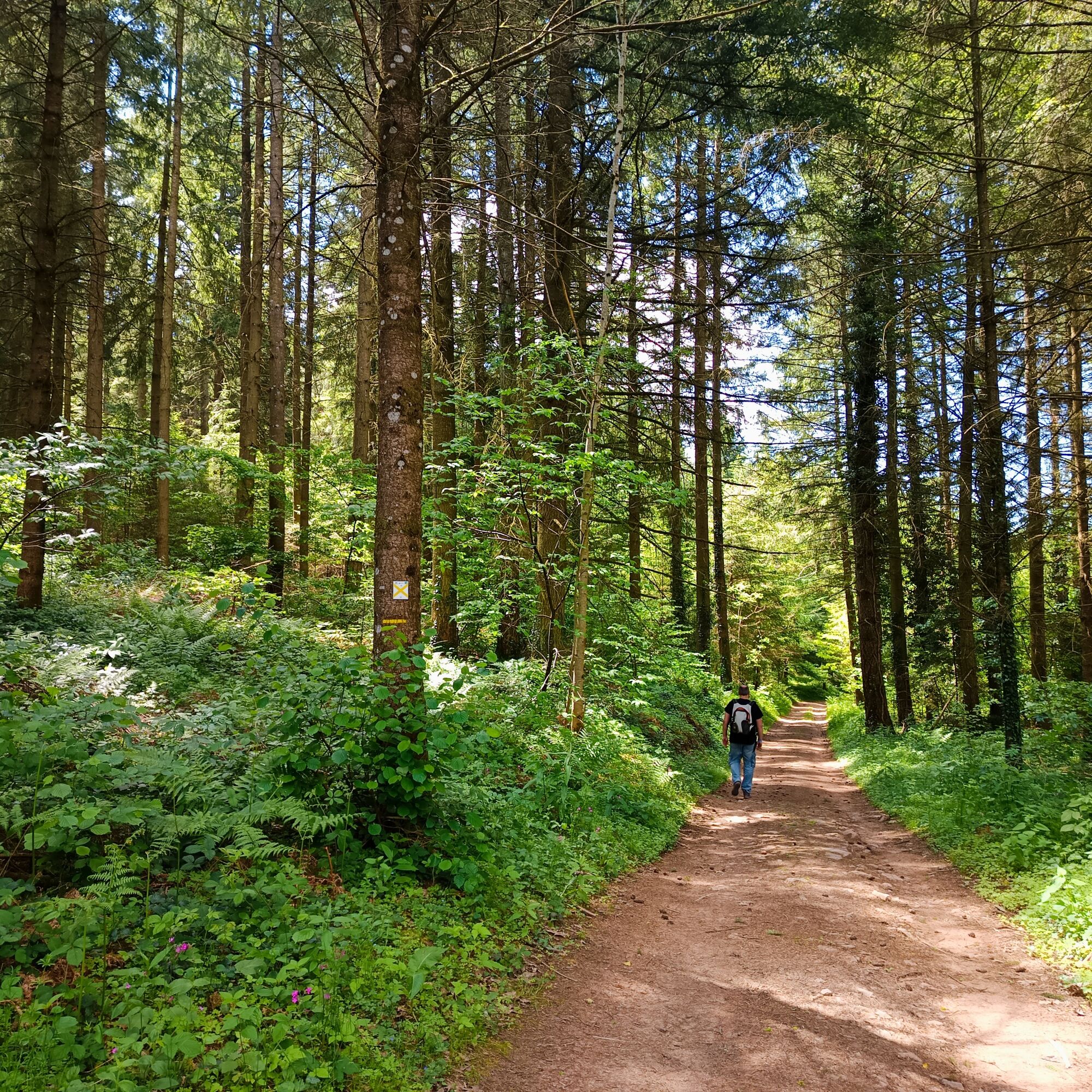
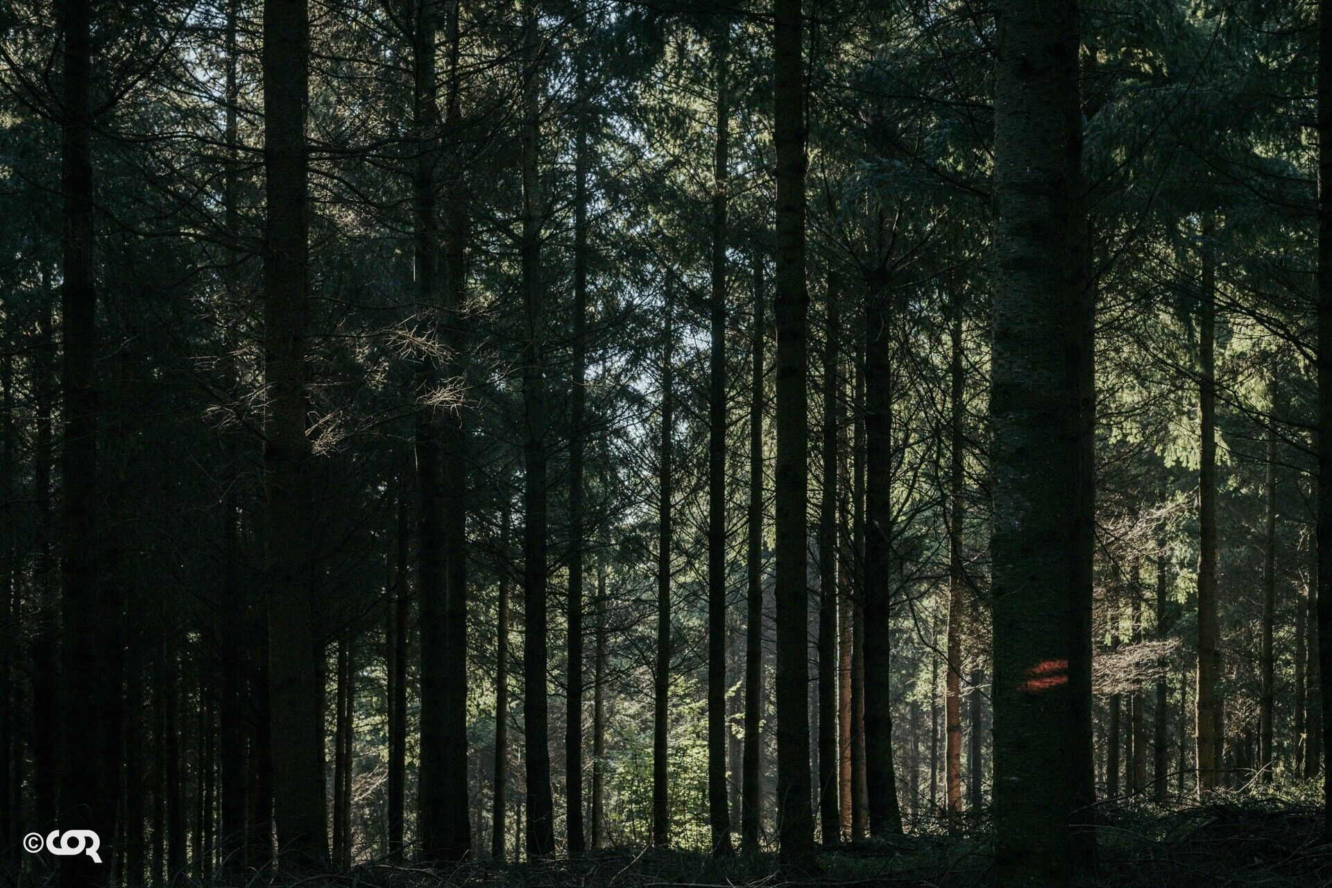
- Dense forests for sensory hikes. The earthy scent of humus and the tangy scent of conifers mingle, the chiaroscuro of the undergrowth swept by rays of light, the freshness of the foliage, the rough texture of the bark of century-old Douglas fir trees...
- Between two Douglas fir trees, an opening onto pastures tended by herds of goats and dairy cows, a vision of a gourmet promise for cheese lovers.
You'll enjoy it best:
- In active mode: Nordic walking or trail running.
- In summer for the freshness of the forests, in winter to immerse yourself in nature gone wild.
- Admiring the tops of the majestic Douglas fir trees.
- Stopping at a producer's store or farm to create a 100% cheese picnic. While passing by, say hello to the goats.
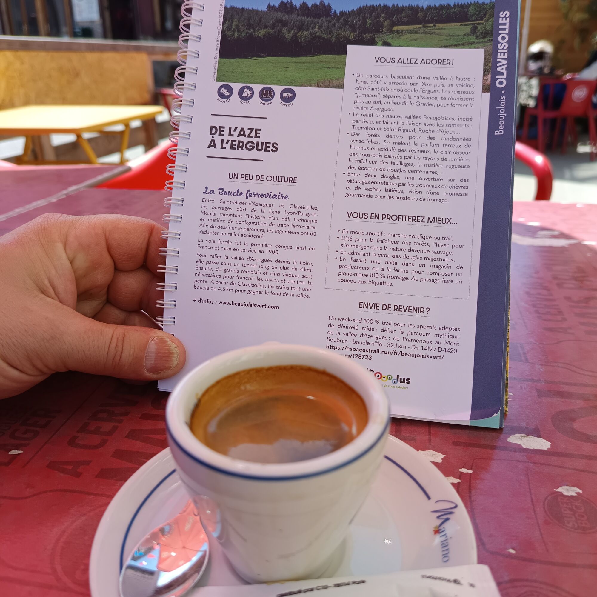
A bit of culture:
The Railway Loop
Between Saint-Nizier-d'Azergues and Claveisolles, the engineering structures of the Lyon/Paray-le-Monial line tell the story of a technical challenge in railway layout. To design the route, engineers had to adapt to the rugged terrain.
The railway was the first designed in this way in France and opened in 1900. To connect the Azergues Valley from the Loire, it passes through a tunnel over 4 km long. Large embankments and five viaducts are then required to cross the ravines and counter the slope. From Claveisolles, the trains make a 4.5 km loop to reach the valley floor.
- A route that swings from one valley to the other: one, on the V side, watered by the Aze, then its neighbor, on the Saint-Nizier side, where the Ergues flows. The "twin" streams, separated at their source, meet further south, at Le Gravier, to form the Azergues River.
- The relief of the high Beaujolais valleys, carved by water, and connecting with the peaks: Tourvéon and Saint-Rigaud, Roche d'Ajoux...
- Dense forests for sensory hikes. The earthy scent of humus and the tangy scent of conifers mingle, the chiaroscuro of the undergrowth swept by rays of light, the freshness of the foliage, the rough texture of the bark of century-old Douglas fir trees...
- Between two Douglas fir trees, an opening onto pastures tended by herds of goats and dairy cows, a vision of a gourmet promise for cheese lovers.
You'll enjoy it best:
- In active mode: Nordic walking or trail running.
- In summer for the freshness of the forests, in winter to immerse yourself in nature gone wild.
- Admiring the tops of the majestic Douglas fir trees.
- Stopping at a producer's store or farm to create a 100% cheese picnic. While passing by, say hello to the goats.
A bit of culture:
The Railway Loop
Between Saint-Nizier-d'Azergues and Claveisolles, the engineering structures of the Lyon/Paray-le-Monial line tell the story of a technical challenge in railway layout. To design the route, engineers had to adapt to the rugged terrain.
The railway was the first designed in this way in France and opened in 1900. To connect the Azergues Valley from the Loire, it passes through a tunnel over 4 km long. Large embankments and five viaducts are then required to cross the ravines and counter the slope. From Claveisolles, the trains make a 4.5 km loop to reach the valley floor.
Ruta
Église Saint-Laurent
(464 m)
Lugar de culto
0,1 km
Le Magot
(441 m)
Liquidación
3,3 km
Église Saint-Nizier
(520 m)
Lugar de culto
6,0 km
Les Petits Trèves
(432 m)
Liquidación
6,8 km
Pont Gaillard
(431 m)
Liquidación
11,0 km
Combe Certain
(494 m)
Barrio
12,0 km
Église Saint-Laurent
(464 m)
Lugar de culto
12,9 km
Ruta
De l’Aze à l’Ergues - Beaujolais Vert - Claveisolles
luz
Senderismo
13,05
km
Église Saint-Laurent
(464 m)
Lugar de culto
0,1 km
Claveisolles
(460 m)
Pueblo
0,2 km
La Corcelle
(485 m)
Liquidación
0,8 km
Le Magot
(441 m)
Liquidación
3,3 km
Le Paquet
(462 m)
Liquidación
3,8 km
Chevenal
(523 m)
Liquidación
5,1 km
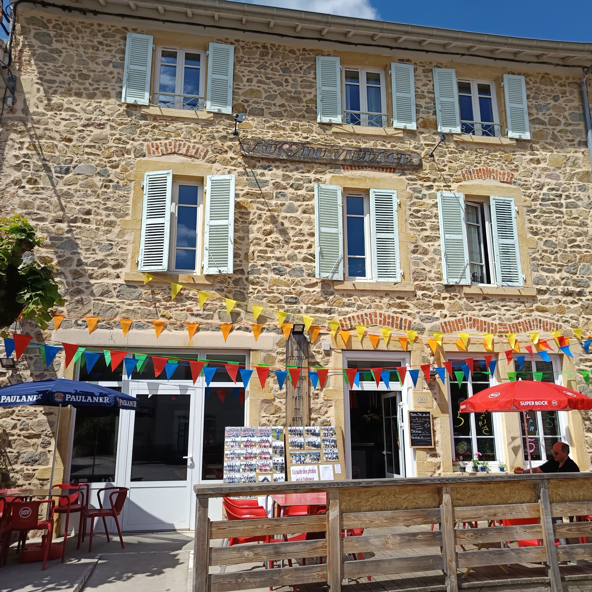
Au Coeur du Village
(518 m)
Restaurante
5,9 km
Église Saint-Nizier
(520 m)
Lugar de culto
6,0 km
Saint-Nizier-d'Azergues
(519 m)
Pueblo
6,1 km
Les Petits Trèves
(432 m)
Liquidación
6,8 km
Vigue
(474 m)
Liquidación
10,0 km
Pont Gaillard
(431 m)
Liquidación
11,0 km
Chazelles
(453 m)
Liquidación
11,6 km
Combe Certain
(494 m)
Barrio
12,0 km
Fadoux
(465 m)
Barrio
12,3 km
Claveisolles
(460 m)
Pueblo
12,8 km
Église Saint-Laurent
(464 m)
Lugar de culto
12,9 km
Autor
Proporcionado por Rhône Tourisme
El tour De l’Aze à l’Ergues - Beaujolais Vert - Claveisolles es proporcionado por outdooractive.com.
Compartir gira
De l’Aze à l’Ergues - Beaujolais Vert - Claveisolles
luz
Senderismo
13,05
km
Error
Se ha producido un error. Por favor, inténtelo de nuevo.
Aún no hay opiniones
Rutas populares en los alrededores
-
La forêt de la Cantinière - Beaujolais - Saint-Cyr-le-Châtoux
luzSenderismo 11,3 km -
Randonnée sur la Voie du Tacot
pesadoSenderismo 77,0 km -
Las piedras doradas - Entre Piedras Doradas y Valle del Azergues - Ruta 7.4
pesadoCiclismo de carrera 57,6 km -
El monte Brouilly, entre viña y cultura - Beaujolais - Saint-Lager
luzSenderismo 7,47 km -
The Cantinière forest
luzSendero temático 2,96 km -
Circuito MTB B9 Marchampt
pesadoMountainbike 19,8 km -
Around the Lac des Sapins - Beaujolais Vert - Cublize
luzSenderismo 4,76 km -
Circuito MTB M9 de Propières a Azolette
pesadoMountainbike 20,4 km -
Le tour de la montagne de Crochet et du mont Tourvéon
luzSenderismo 13,1 km -
Circuito BTT B8 de Quincié-en-Beaujolais a Marchampt
luzMountainbike 17,1 km

Senderismo y rastreo

Más de 550.000 sugerencias de excursiones, mapas detallados y un intuitivo planificador de rutas hacen de esta aplicación una herramienta imprescindible para todos los amantes de la naturaleza.

No se pierda las ofertas y la inspiración para sus próximas vacaciones
Suscribirse al boletín de noticias
Error
Se ha producido un error. Por favor, inténtelo de nuevo.
Gracias por inscribirse
Su dirección de correo electrónico se ha añadido a la lista de correo.
Viajes por Europa
Austria
Suiza
Alemania
Italia
Eslovenia
Francia
Países Bajos
Belgium
Polonia
Liechtenstein
República Checa
Slovakia
España
Croacia
Bosnia y Herzegovina
Luxemburgo
Andorra
Portugal
Iceland
United Kingdom
Ireland
Greece
Albania
North Macedonia
Malta
Norway
Montenegro
Moldova
Kosovo
Hungary
San Marino
Romania
Estonia
Latvia
Belarus
Cyprus
Lithuania
Serbia
Bulgaria
Monaco
Denmark
Sweden
Finland