


Tour della Bessanese


The Tour della Bessanese (TB) is a circular route in the high mountains (2200-3200 m) that winds through the Southern Graian Alps, on the border between Italy and France, around the peaks of the Uja di...
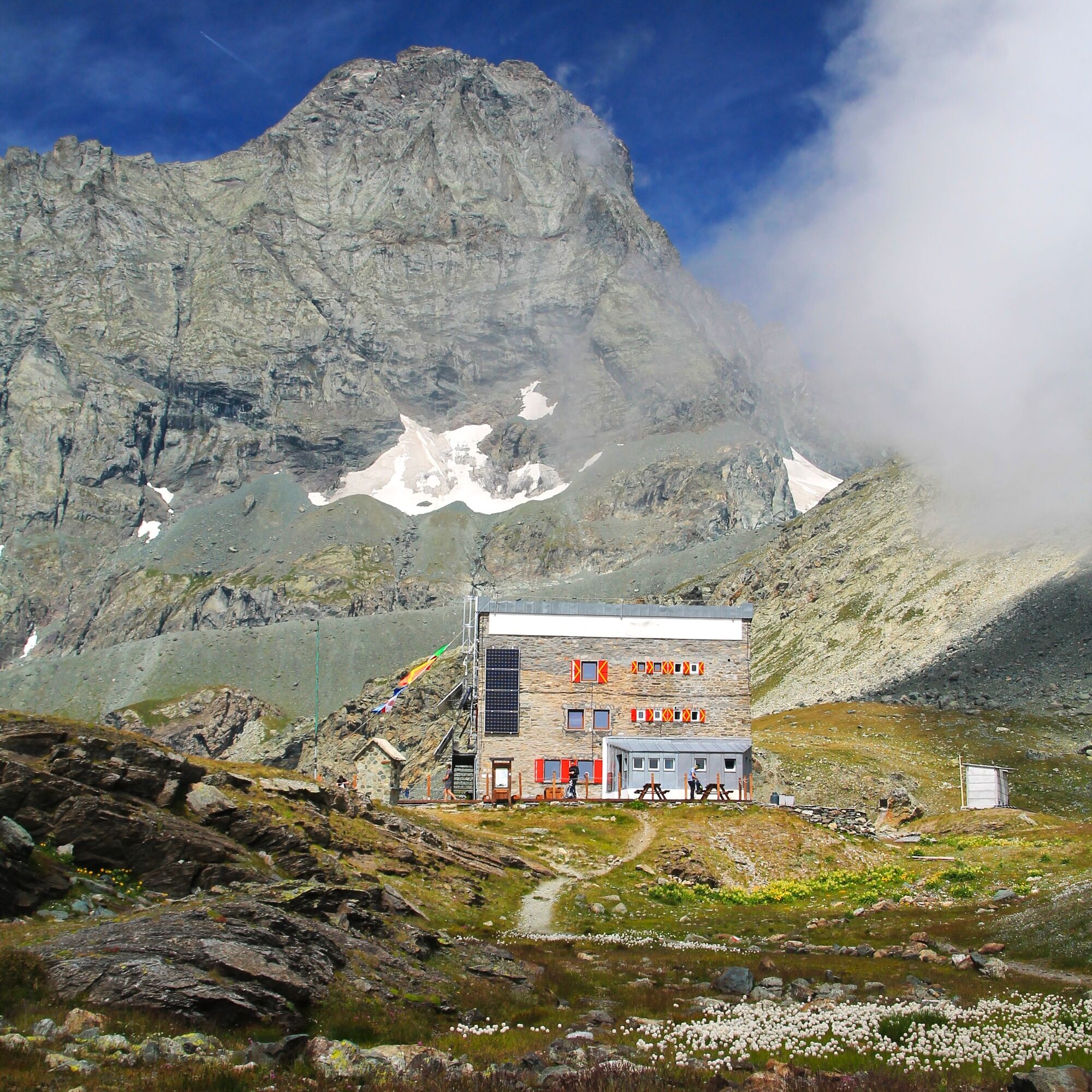
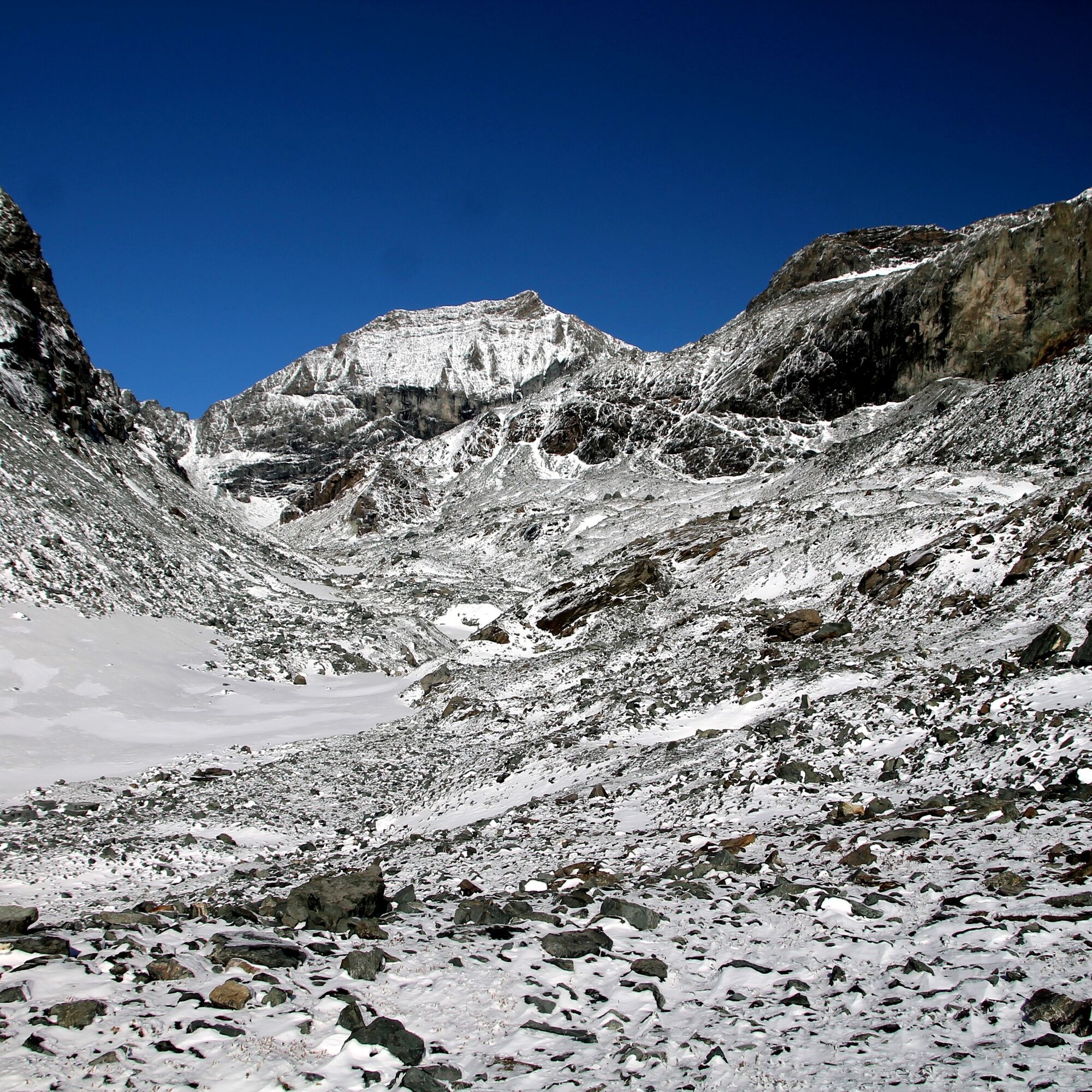
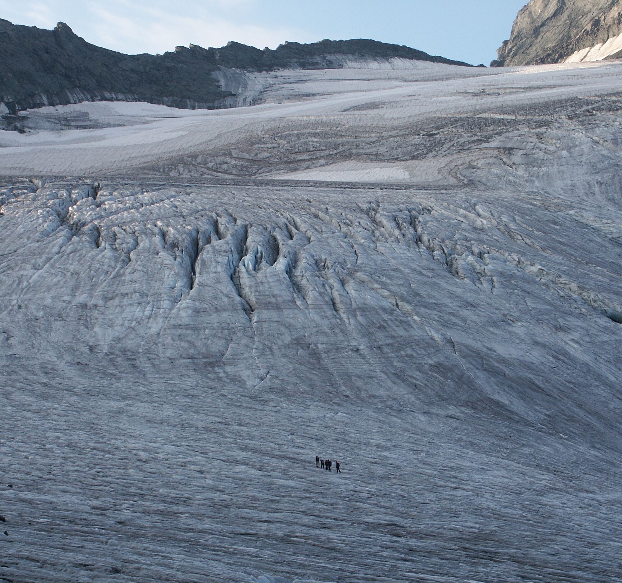
The Tour della Bessanese (TB) is a circular route in the high mountains (2200-3200 m) that winds through the Southern Graian Alps, on the border between Italy and France, around the peaks of the Uja di Bessanese (3604 m) and the Red Cross (3566 m). The entire route covers about 32 km, divided into three stages, and runs almost entirely on paths or suitably marked tracks.Although it does not have any particularly difficult mountain sections, the route is classified as EE (for Expert Hikers) due to its extreme high mountain environment, whichbecomes even harder in non-optimal climatic conditions and when there is snow or fog.Adequate equipment and good physical fitness are therefore required. It can start from any of the three mountain huts of the Tour (Refuge d'Averole, Rifugio Gastaldi and Rifugio Cibrario).Stops will be in these mountain huts which are serviced in the summer and equipped with winter rooms that are always open. Although it is possible to take the Tour in both directions, it is advisable to go in a clockwise direction. The best time to tackle the route is from the end of June to early September. From the French side the Refuge d'Averole mountain hut can be reached from the Municipality of Bessans Averole (Haute Maurienne).From the Italian side, the Rifugio Gastaldi can be reached from the Municipality of Balme (Pian della Mussa) and the Rifugio Cibrario from the Municipality of Usseglio, both in the Lanzo Valleys about 50 km from Torino.
The Tour della Bessanese (TB) is a circular route in the high mountains (2200-3200 m) which winds through the Southern Graian Alps, on the border between Italy and France, around the Uja diBessanese (3604 m) and the Croce Rossa (3566m). The route has a total development of about 32 km, divided into three stages, and takes place almost entirely on a path or on suitably marked traces of path. Although it does not present particular climbing difficulties, the route is classified as EE (Expert Hikers) due to the of the severe high mountain environment in which it takes place, an environment which is even more difficult in non-optimal climatic conditions and in the presence of snow or fog. The departure can take place from any of the three refuges of the Tour (Rifugio d´Averole, Rifugio Gastaldi and Rifugio Cibrario). The stopovers are located in the aforementioned shelters which are kept in the summer and equipped with winter rooms that are always open. The itinerary was promoted within the platform as part of the PITEM M.I.T.O. project. – Outdoor OFF - Interreg Italy-France Cross-Border Cooperation Program ALCOTRA 2014-2020.


Per affrontarlo è richiesta un’adeguata attrezzatura tecnica - scarponi impermeabili e bastoncini - oltre a un buon allenamento fisico.
The Bessanese Tour is a high mountain trek for expert hikers.
If you choose the arrival at the Gastaldi Refuge as your first stage: direction Valli di Lanzo along the SS1 dir. Lanzo, Ceres, Balme, Pian della Mussa. If you choose the stage starting from the Cibrario Hut: direction Valli di Lanzo along the SS1 dir. Usseglio.
There are no train or bus connections that connect the area of interest to the Bessanese Tour. It is necessary to use a car
Pian della Mussa: paid parking service for the summer season.
Usseglio: free parking
http://www.tourdellabessanese.eu/it/home
https://www.cailanzo.it
https://www.turismovallidilanzo.it
https://refugedaverole.ffcamfr
https://www.rifugiogastaldi.com
Although it is possible to take the Tour in both directions, it is advisable to go clockwise. The optimal period to tackle the route goes from the end of June to the beginning of September. From the French side, you can reach the Averole Refuge from the Municipality of Bessans Averole (Haute Maurienne). From the Italian side, the Gastaldi refuge can be reached from the Municipality of Balme (Località Pian della Mussa) and the Cibrario refuge from the Municipality of Usseglio, both in the Lanzo valleys about 50 km from Turin.
Rutas populares en los alrededores
-
4,7
Rocciamelone partedjo dalla Riposa. Mompantero, Piemont/Italien
medioSenderismo 10,6 km -
5,0
Anillo del lago de Ovarda
pesadoSenderismo 15,9 km -
Anillo de vivac Molino
medioSenderismo 7,55 km -
Anillo Turlo lakes de Malciaussia
medioSenderismo 9,49 km -
5,0
Lagos Verdes y Lago Paschiet
medioSenderismo 7,51 km -
Goldtoni - Alpenbogen A118 Lago di Malciaussia-Balme
medioSendero de largo recorrido 24 km -
Goldtoni - Alpenbogen A117 Susa-Lago di Malciaussia
medioSendero de largo recorrido 24,7 km -
Lago Negro desde el lago Malciaussia
luzSenderismo 4,79 km -
Goldtoni - Alpenbogen A119 Balme-Pialpetta
medioSendero de largo recorrido 19,9 km -
Col de l'Iseran desde Termignon
pesadoCiclismo de carrera 38,3 km
Senderismo y rastreo


No se pierda las ofertas y la inspiración para sus próximas vacaciones
Su dirección de correo electrónico se ha añadido a la lista de correo.