


Enduro : A La Ramasse


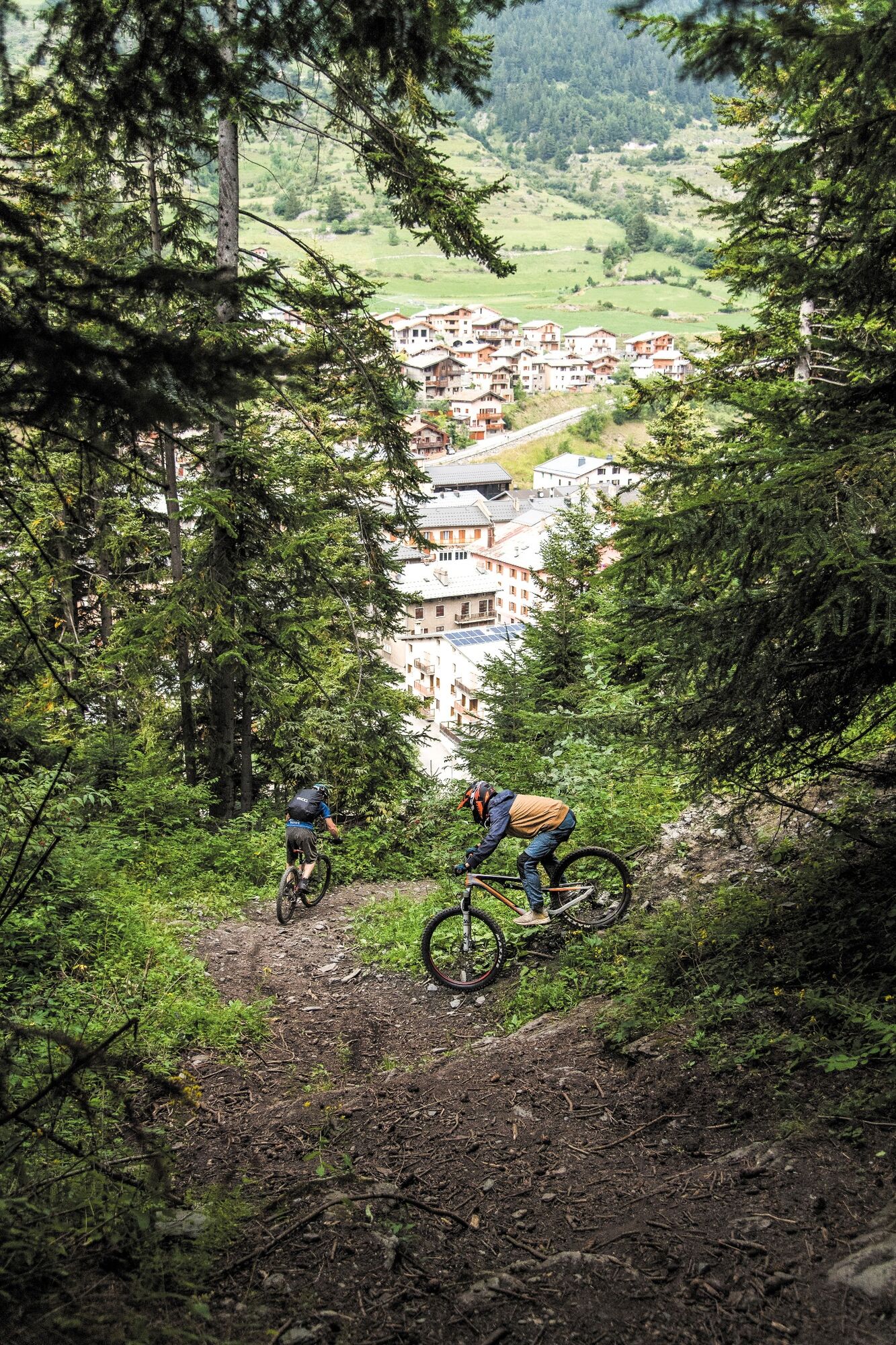
Sometimes set up to be fun or old, the route is a playground! Whether you are a beginner or a seasoned endurist! The departure from the Mont Cenis pass or from the Val Cenis ski lifts offers a plunging...
Sometimes set up to be fun or old, the route is a playground! Whether you are a beginner or a seasoned endurist! The departure from the Mont Cenis pass or from the Val Cenis ski lifts offers a plunging view of the valley and the surrounding mountains. The trail is easy and winds through an alpine pasture, the continuation in the forest will require a little more attention. You will certainly be more inclined to focus on the pleasure of driving!

As hazards may occur at any time on the routes, the GPX tracks provided are not contractual. They are provided for information only. Riders use them at their own risk, depending on their level of technological proficiency and their understanding of the terrain.
Rutas populares en los alrededores
-
Refuge du Fond d'Aussois - a wild valley in the Vanoise - 2-day hike
luzSenderismo 9,24 km -
The White Lake
luzSenderismo 4,42 km -
En bicicleta por el Col du Mont-Cenis desde Lanslebourg
pesadoCiclismo de carrera 9,84 km -
Sentier pédestre des Sculptures - Land Art Montagne
luzSendero temático 5,16 km -
Col du Mont-Cenis desde Modane
pesadoCiclismo de carrera 34,8 km -
Little ascent of Plan d'Aval
pesadoCiclismo de carrera 6,37 km -
5,0
Goldtoni - Alpenbogen A068 Refuge de la Leisse-Termignon Val Cenis
medioSendero de largo recorrido 28,7 km -
Col de l'Iseran from Termignon
pesadoCiclismo de carrera 38,3 km -
Petit Mont-Cenis pass
pesadoCiclismo de carrera 18,0 km -
Walking in the heart of the village of Bessans
luzSendero temático 1,74 km
Senderismo y rastreo


No se pierda las ofertas y la inspiración para sus próximas vacaciones
Su dirección de correo electrónico se ha añadido a la lista de correo.