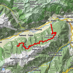
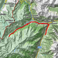
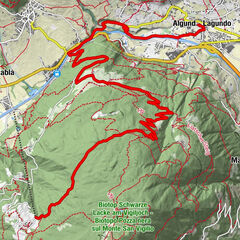
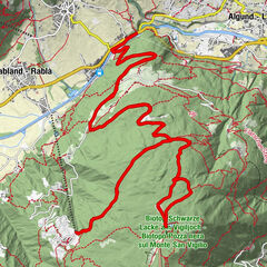
Datos del tour
141,5km
294 - 907m
Distancia
1.142hm
1.156hm
Ascenso
09:18h
 
Duración
Dificultad
medio
Valoración
Técnica
Nivel
Paisaje
Experiencias

La mejor temporada
ene
feb
mar
abr
may
jun
jul
ago
sep
oct
nov
dic
Punto álgido
907 m
GPS Downloads
  • GPX GPS Exchange Format (XML)
  • KML Google Earth, Google Maps
Códigos de descarga QR para teléfonos móviles
Más circuitos por las regiones

Excursiones opcionales por los alrededores

Bike Highline Meran

difícil Mountainbike
24,25km | 1670hm | 05:16h

Pfelders / Lazins Alm

Mountainbike
23,86km | 1354hm | 03:30h

Leichte Abfahrt Aschbach & Mohlboch Trail

fácil Mountainbike
16,15km | 75hm | 00:53h

Steinbruch Trail

difícil Mountainbike
26,9km | 1304hm | 04:59h