Face to face with the Matterhorn from Rotenboden to the Riffelalp

Senderismo

© Gornergrat Bahn - Christian Pfammatter Fotografie
© Gornergrat Bahn

© Gornergrat Bahn
© Gornergrat Bahn
© Gornergrat Bahn
© Gornergrat Bahn


- Breve descripción
-
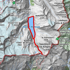
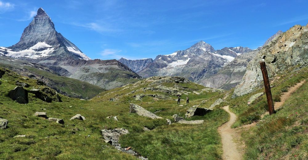
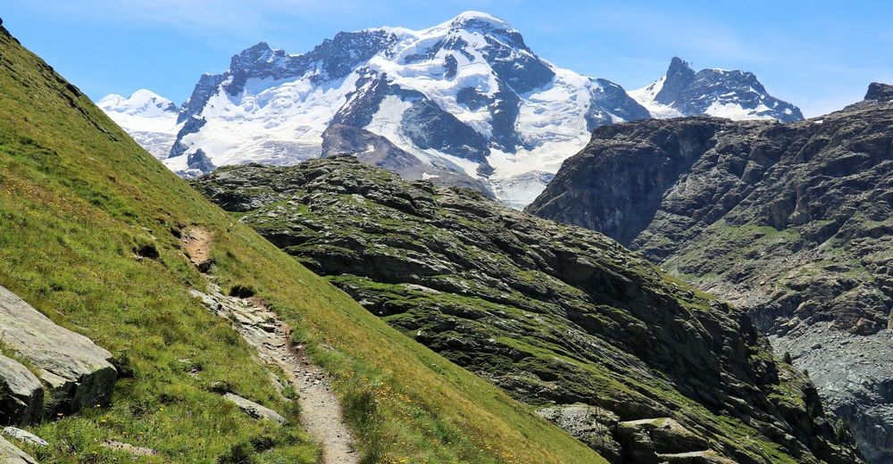
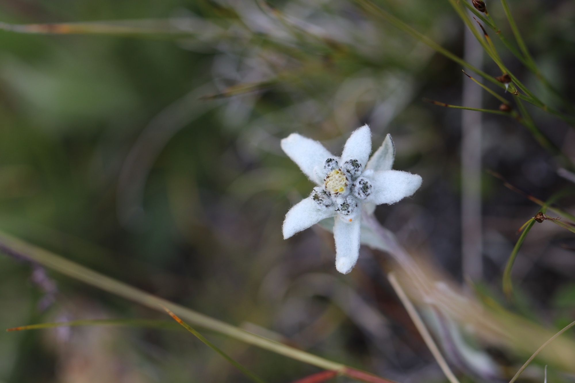
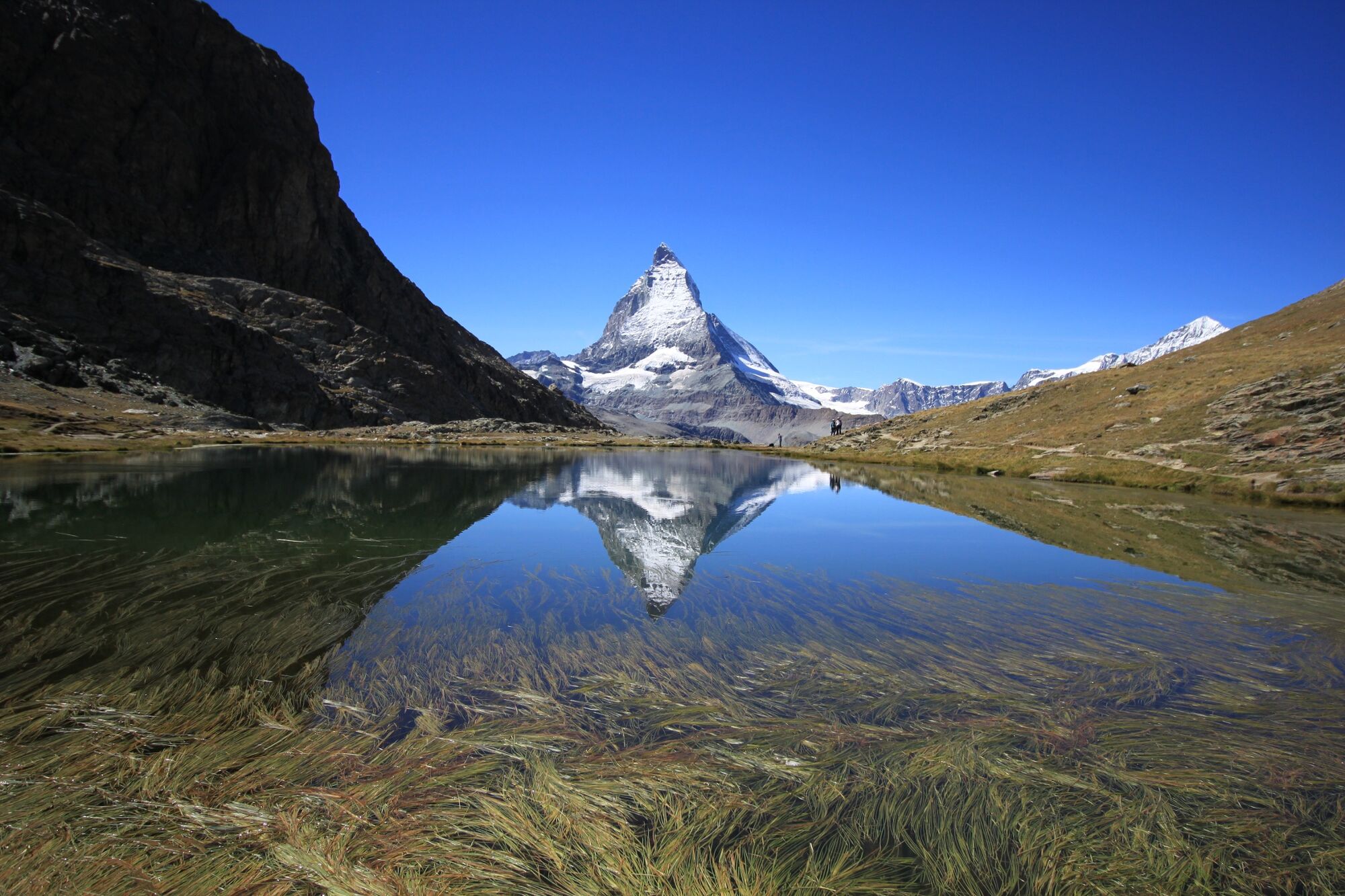
A pleasant hike starting at the Gornergrat railway station at Rotenboden (2,815m) to Riffelalp (2,211m). The path takes walkers past the Riffelsee lake with its incomparable reflection of the Matterhorn and, in the lower part of the hike, diverse alpine flora.
- Dificultad
-
medio
- Valoración
-
- Ruta
-
Rotenboden (2.819 m)0,0 kmRiffelalp (2.222 m)5,4 kmAl Bosco5,4 kmRiffelalp5,8 km
- La mejor temporada
-
enefebmarabrmayjunjulagosepoctnovdic
- Punto álgido
- 2.811 m
- Punto final
-
Riffelalp station (2211 m.a.s.l.)
- Perfil alto
-
 © outdooractive.com


- Autor
-
La gira Face to face with the Matterhorn from Rotenboden to the Riffelalp es utilizado por outdooractive.com proporcionado.
GPS Downloads


Información general
Punto de avituallamiento
Secreto
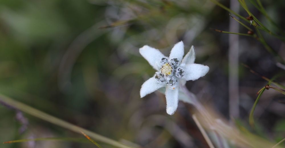
Flora
Fauna
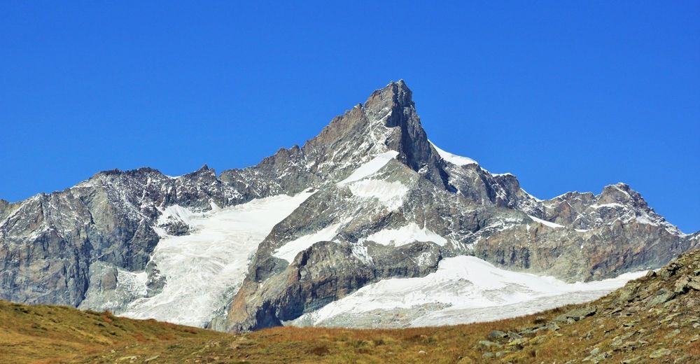
Vistas panorámicas
Más circuitos por las regiones
-
Unterwallis
1196
-
Mattertal
555
-
Zermatt
154