© Passion Fotografie - Zermatt Tourismus
© Alpin Center Zermatt - Zermatt Tourismus

- Breve descripción
-
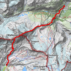
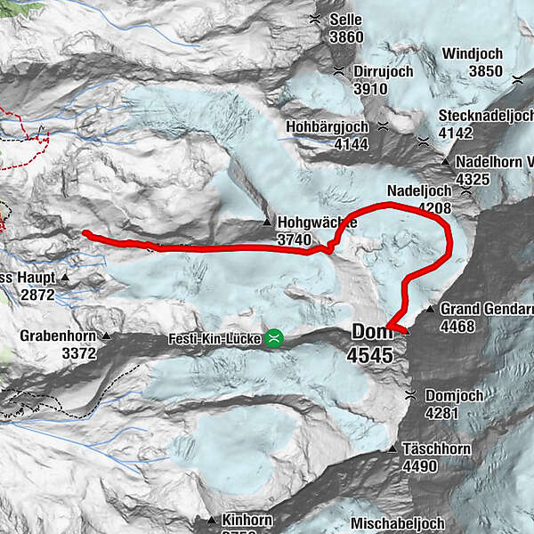
The Dom, at 4,545 m, is the highest mountain located completely within Switzerland. This majestic mountain is part of the Mischabel group. The starting point of this tour is the Dom Hut at 2,940 m.
- Dificultad
-
difícil
- Valoración
-
- Ruta
-
Dom (4.545 m)5,6 kmDomhütte SAC11,5 km
- La mejor temporada
-
enefebmarabrmayjunjulagosepoctnovdic
- Punto álgido
- 4.478 m
- Punto final
-
Dom (4,545 m)
- Perfil alto
-
 © outdooractive.com


- Autor
-
La gira Dom Ascent es utilizado por outdooractive.com proporcionado.
GPS Downloads


Información general
Punto de avituallamiento
Vistas panorámicas
Más circuitos por las regiones
-
Oberwallis
40
-
Saastal
27
-
Saas-Fee
14