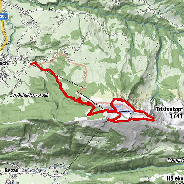
Andelsbuch Tal-,Bergstation Panoramaweg

Senderismo
Datos del tour
8,23km
648
- 1.689m
1.024hm
157hm
04:00h
- Breve descripción
-
Steiler Anstieg, Aussicht lohnt sich mit dem Bodensee im Hintergrund und mit 2Einkehrmöglichkeiten
- Dificultad
-
medio
- Valoración
-
- Ruta
-
Bergrestaurant Niedere4,4 kmAlpe Niedere4,4 kmTheodul-Kapelle Niedere4,6 kmFallkopf (1.600 m)4,8 kmVordere Niedere (1.678 m)5,4 kmHintere Niedere (1.711 m)6,6 kmPanoramarestaurant Baumgarten7,3 km
- La mejor temporada
-
enefebmarabrmayjunjulagosepoctnovdic
- Punto álgido
- 1.689 m
GPS Downloads


Superficie de carretera
Asfalto
Gravilla
Pradera
Bosque
Roca
Expuesto
Más circuitos por las regiones
-
Bodensee - Deutschland
1106
-
Bregenzerwald
2297
-
Bizau
629


