Damüls Fontanella I Türtschalpe und Alpe Unterdamüls

Logotipo Damüls Fontanella I Türtschalpe und Alpe Unterdamüls
Datos del tour
12,13km
1.163 - 1.780m
Distancia
686hm
449hm
Ascenso
03:00h
 
Duración
Breve descripción

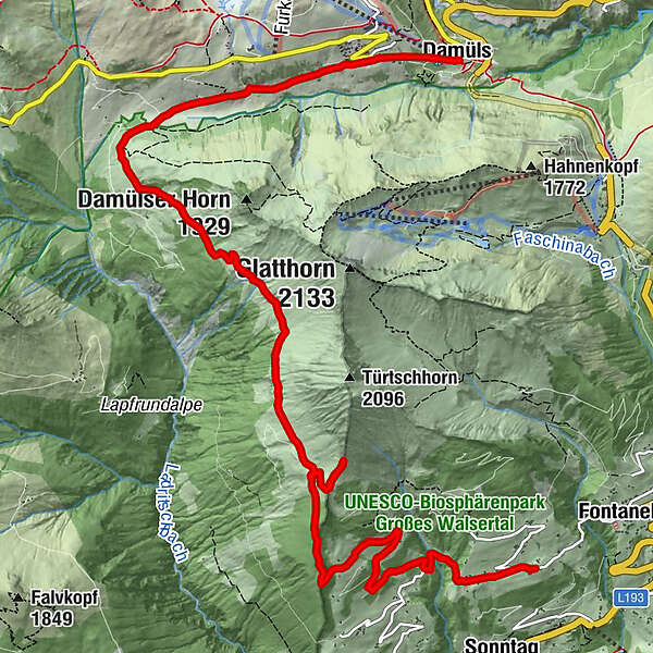
Fontanella - Türtschalpe - Alpe Unterdamüls - Kirchdorf Damüls

Dificultad
medio
Valoración
Técnica
Nivel
Paisaje
Experiencias
Ruta
Gadastatt
2,0 km
Türtschalpe (1.641 m)
4,2 km
Türtschalpe
4,4 km
Alpe Unterdamüls
9,1 km
Damüls (1.423 m)
12,0 km

Punto álgido
1.780 m
Punto final

Damüls Kirchdorf

Perfil alto

Autor

Valoración global

5

0

%

4

0

%

3

0

%

2

0

%

1

0

%

Error
Se ha producido un error. Por favor, inténtelo de nuevo.
Gracias por su comentario

Se ha eliminado la calificación

GPS Downloads
  • GPX GPS Exchange Format (XML)
  • KML Google Earth, Google Maps
Códigos de descarga QR para teléfonos móviles

Información general

Punto de avituallamiento
Más circuitos por las regiones

Excursiones opcionales por los alrededores

Panorama hike Dornbirn Karren

medio Senderismo
3,43km | 472hm | 01:20h

Hoher Freschen

difícil Senderismo
16,13km | 1005hm | 07:00h

Üble Schlucht / Laterns

medio Senderismo
6,3km | 322hm | 02:30h

Faschina | Rund um's Zafernhorn

medio Senderismo
10,09km | 634hm | 04:15h