Au-Schoppernau | Diedamskopf - Falzerkopf

Senderismo

- Breve descripción
-
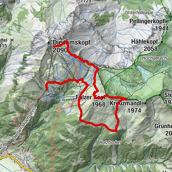
Mittelstation - Breitenalpe - Falzalpe - Neuhornbachhaus - Neuhornbachjoch - Falzer Kopf - Kreuzle - Bergstation
- Dificultad
-
medio
- Valoración
-
- Ruta
-
Breitenalpe2,1 kmNeuhornbachhaus (1.700 m)4,1 kmFalzer Kopf (1.968 m)5,8 kmPanoramarestaurant9,2 km
- La mejor temporada
-
enefebmarabrmayjunjulagosepoctnovdic
- Punto álgido
- 2.015 m
- Punto final
-
Diedamskopf Bergstation
- Perfil alto
-

- Autor
-
La gira Au-Schoppernau | Diedamskopf - Falzerkopf es utilizado por outdooractive.com proporcionado.
GPS Downloads


Información general
Punto de avituallamiento
Vistas panorámicas
Más circuitos por las regiones
-
Bregenzerwald
2297
-
Diedamskopf
755


