

© Warth-Schröcken Tourismus - Sebastian Stiphout

- Breve descripción
-
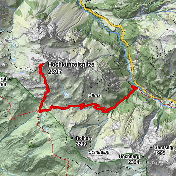
From the Landsteg the path leads along the Schandelstobel to the Schadonapass. The closer you get to the Schadonaalp, the louder you hear the hundred sheep grazing on the lush green alpine meadows. Ca. 100 meters in front of the Biberacher Hütte, which invites you to stop after the descent, the path leads you towards the summit, which is already at 2.112 meters and offers a gigantic view. On the increasingly rocky substrate you will reach the summit of the Hochkünzelspitze. Don’t forget to sign up for the summit book before returning on the same path.
- Dificultad
-
difícil
- Valoración
-
- Ruta
-
Rothenplatz4,8 kmSchadonapass (1.836 m)5,0 kmHochkünzelspitze (2.397 m)7,3 kmSchadonapass (1.836 m)9,6 kmRothenplatz9,8 km
- La mejor temporada
-
enefebmarabrmayjunjulagosepoctnovdic
- Punto álgido
- 2.366 m
- Punto final
-
Landsteg
- Perfil alto
-

-

-
AutorLa gira Hochkünzelspitze (2397 m) es utilizado por outdooractive.com proporcionado.
GPS Downloads


Información general
Punto de avituallamiento
Vistas panorámicas
Más circuitos por las regiones


