Invierno
Verano
El tiempo
Webcams
Alojamientos
Excursiones
Historial de búsqueda
Sugerencias de búsqueda
No se han encontrado resultados
Buscar en
Senderismo
Inicio
Verano Schweiz
Valais
Oberwallis
Unterbäch
Excursiones
Senderismo
Región
Alojamientos
El tiempo
Webcams
Excursiones
Deporte
Fotos
Vídeos
Foro
Estación de esquí
Senderismo
Unterbäch
Mapa
mostrar
ocultar
Filtro de circuitos
Tipo de excursión
(Todos)
Senderismo (859)
Sendero temático (51)
long-distance walking trail (23)
Camino de peregrinación (4)
Mountain hiking (3)
Búsqueda de texto completo
Nivel
mín.
1 fácil
2 moderadamente
3 mediana dificultad
4 dificultad alta
5 muy difícil
6 extremo
máx.
1 fácil
2 moderadamente
3 mediana dificultad
4 dificultad alta
5 muy difícil
6 extremo
Técnica
mín.
1 fácil
2 moderadamente
3 mediana dificultad
4 dificultad alta
5 muy difícil
6 extremo
máx.
1 fácil
2 moderadamente
3 mediana dificultad
4 dificultad alta
5 muy difícil
6 extremo
Longitud (km)
Metros de altura
otros filtros
Buscar
Posponer
940 Excursiones.
ordenado por
Relevanz
Relevancia
längste Distanz
kürzeste Distanz
duración máxima
duración mínima
metros más verticales
menos metros verticales
alto estado
baja condición
alta tecnología
baja tecnología
Nombre A-Z
Nombre Z-A
Von der Moosalp auf das Augstbordhorn
medio
Senderismo
5,0
11,13
km
04:45
h
887
hm
2.052 - 2.965
m
Técnica
Nivel
Moosalp – Augstbordhorn
difícil
Senderismo
5,97
km
05:36
h
946
hm
2.058 - 2.928
m
Técnica
Nivel
Moosalp - Augstbordhorn - Moosalp
medio
10,78
km
05:30
h
874
hm
2.052 - 2.950
m
Técnica
Nivel
Moosalp Panoramaweg
fácil
Senderismo
6,36
km
02:05
h
178
hm
1.937 - 2.117
m
Técnica
Nivel
Panoramaweg Stand (Moosalp)
fácil
Senderismo
6,36
km
02:00
h
178
hm
1.937 - 2.117
m
Técnica
Nivel
Panorama Rundweg – Stand
medio
Senderismo
3,4
km
01:45
h
180
hm
1.937 - 2.105
m
Técnica
Nivel
Wasserlehrpfad
medio
Senderismo
5,0
7,2
km
02:17
h
69
hm
1.368 - 2.117
m
Técnica
Nivel
Suonenwanderung Bürchen - Brandalp
fácil
Senderismo
3,97
km
01:15
h
78
hm
1.591 - 1.715
m
Técnica
Nivel
Kinderwanderweg MoosAlbi uns seine Waldtiere
fácil
Senderismo
3,5
km
01:30
h
300
hm
1.458 - 1.589
m
Técnica
Nivel
Von Eischoll auf das Signalhorn
difícil
Senderismo
18,88
km
07:30
h
1.264
hm
1.217 - 2.885
m
Técnica
Nivel
Frauen-Zitatenweg
fácil
Sendero temático
3,84
km
01:00
h
17
hm
1.221 - 1.592
m
Técnica
Nivel
Haltsuon
fácil
Senderismo
3,6
km
01:00
h
77
hm
1.149 - 1.236
m
Técnica
Nivel
Kulturweg Ausserberg - Raron
fácil
Senderismo
4,48
km
01:15
h
10
hm
637 - 926
m
Técnica
Nivel
Sonnenwanderung am Höhenweg Südrampe BLS
difícil
Senderismo
20,88
km
07:00
h
634
hm
797 - 1.183
m
Técnica
Nivel
Rundwanderung ins Bietschtal
medio
Senderismo
7,23
km
02:45
h
361
hm
635 - 1.004
m
Técnica
Nivel
Erlebniswanderung im UNESCO-Weltnaturerbe
medio
Senderismo
3,61
km
01:45
h
280
hm
640 - 932
m
Técnica
Nivel
The Jolischlucht gorge
medio
Senderismo
8,06
km
02:45
h
377
hm
637 - 1.009
m
Técnica
Nivel
Unbekannte Lötschberger Südrampe
medio
Senderismo
7,81
km
02:40
h
115
hm
635 - 1.070
m
Técnica
Nivel
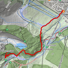
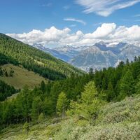
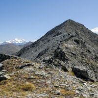
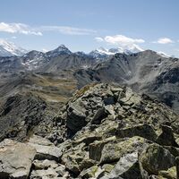
Wanderung auf die Topalihütte in den Walliser Alpen
medio
Senderismo
7,98
km
04:30
h
1.543
hm
1.117 - 2.660
m
Técnica
Nivel
Panorama - Höhenweg
medio
Senderismo
8,67
km
03:30
h
720
hm
1.823 - 2.504
m
Técnica
Nivel
Páginas:
1
2
3
4
5
6
7
8
siguiente
Tous según tipos
Senderismo
Invierno
Bike
Running
Alpino
Motorsport
Senderismo
Sendero temático
long-distance walking trail
Camino de peregrinación
Mountain hiking
Touren nach Regionen
Oberwallis
4
Gipfeltouren in der Region
Albristhorn (2.762 m)
5
Üssers Barrhorn (3.610 m)
5
Bella Tola (3.025 m)
5
Torrenthorn (2.997 m)
5
Üssers Barrhorn Nord (3.592 m)
4
Corne de Sorebois (2.895 m)
13
Crêt du Midi (2.332 m)
6
Seewlehore (2.467 m)
5
Hempliger (2.483 m)
5
Tschingellochtighorn (2.735 m)
7
Excursiones opcionales por los alrededores
Chandolin : Rando Parc / Illhorn
medio
Esquí de travesía
3,62
km |
725
hm |
01:50
h
Lötschenlücke
medio
Esquí de travesía
26,18
km |
491
hm |
05:30
h
Höhenweg Kreuzboden - Almagelleralp - Saas-Almagell
Senderismo
9,74
km |
151
hm |
03:30
h
Gletschergrotte Winter Hiking Trail
fácil
Senderismo de invierno
2,1
km |
188
hm |
01:00
h
Vecinos
Moosalpregion
Lötschberg-Region
Rund um Visp
Gampel-Bratsch
Turtmanntal
Regiones favoritas
Simplon
Brig Simplon
Zermatt
Aletsch Arena
Gondo-Zwischbergen
Goms
Bürchen
Saas-Fee
Blatten-Belalp
Raron-Niedergesteln
Saas Grund - Hohsaas
Arolla
Thyon les Collons
Pays du Saint-Bernard
St-Luc / Chandolin
Zinal
Champéry
Rund um Visp
Lötschental
Brig-Glis
Sorteo
Produkt-Paket für die ganze Familie
Primavera XXL-Gewinnspiel
No se han encontrado entradas.
La búsqueda no está disponible actualmente.
Afine su búsqueda.
Resultados de la búsqueda local
(<= 25km)
Más resultados
(> 25km)
%count% Resultados de búsqueda
%name%
%type%
%elevation%
%population%
%lpButton%