© Ötztal - Roland Grüner
- Breve descripción
-
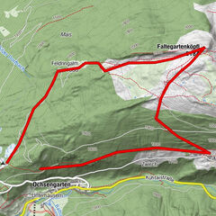
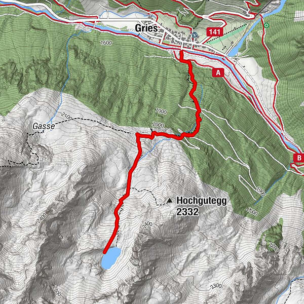
GRIES PARKPLATZ -> Center Gries -> steep track in direction Nissl Alm -> Nissl Alm -> steep track in direction Schönrinnenkarsee -> SCHÖNRINNENKARSEE
Increased truck and car traffic on the entire Sulztalweg.
Driving times:
Trucks: Mon - Fri from 06:00 a.m. - 10:00 p.m
Car: all day
- Dificultad
-
medio
- Valoración
-
- Ruta
-
Gries (1.569 m)Nisslalm (2.051 m)1,3 kmGries (1.569 m)5,3 km
- La mejor temporada
-
enefebmarabrmayjunjulagosepoctnovdic
- Punto álgido
- 2.358 m
- Punto final
-
Gries, parking at the end of the village
- Perfil alto
-

- Autor
-
La gira Lake Schönrinnenkarsee es utilizado por outdooractive.com proporcionado.
GPS Downloads


Información general
Punto de avituallamiento
Vistas panorámicas
Más circuitos por las regiones
-
Ötztal
1107
-
Längenfeld - Huben - Gries
354