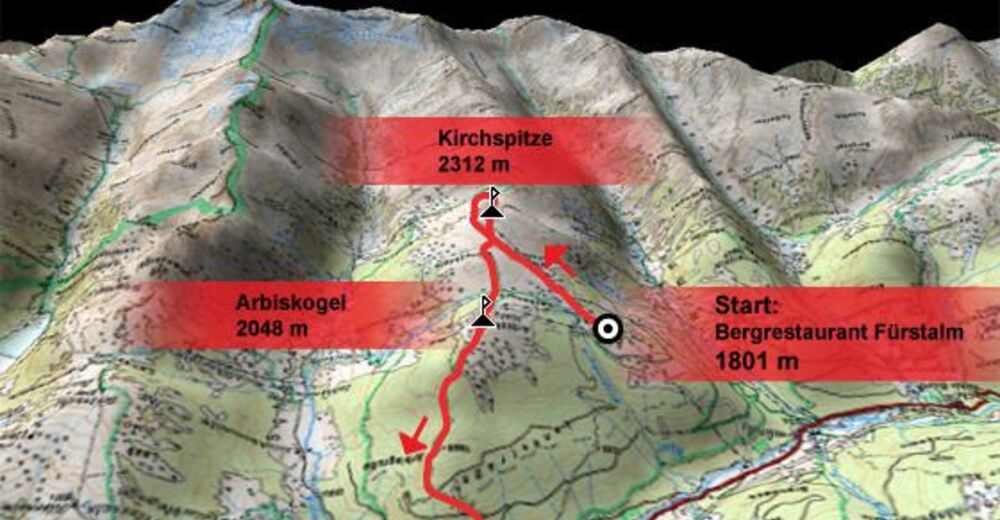
Datos del tour
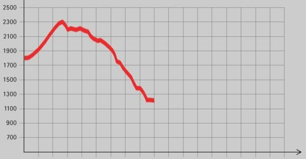
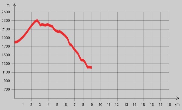
9,36km
1.250
- 2.277m
1.537hm
1.537hm
07:00h
- Breve descripción
-
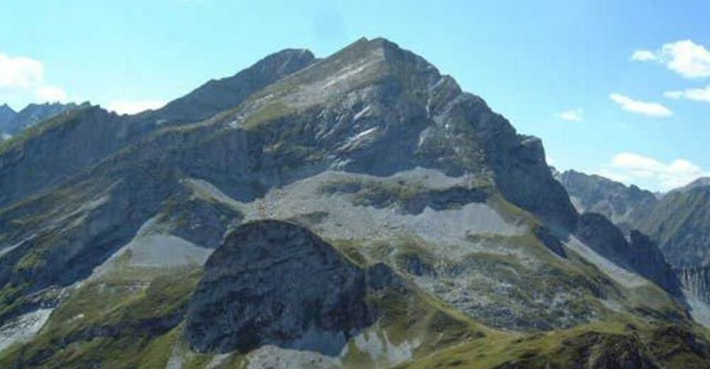
Schöne Tour auf einen der Hausberge der Gerloser.
- Dificultad
-
medio
- Valoración
-
- Punto de salida
-
ArenaFUNten-Club in Gerlos
- Ruta
-
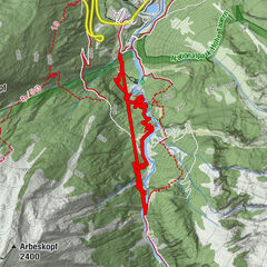
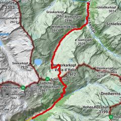
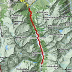
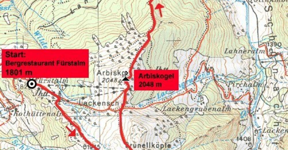
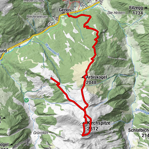
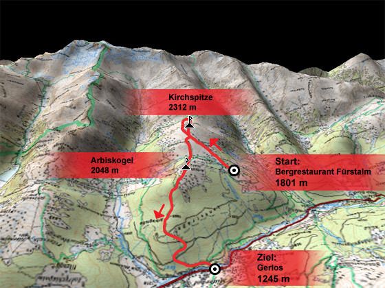
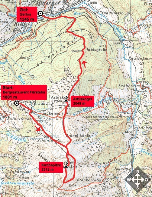
Gerlos (1.247 m)Arbiskogel (2.048 m)4,0 kmLackenscharte (1.985 m)4,3 kmKirchspitze (2.312 m)6,9 kmFürstalm9,3 km
- La mejor temporada
-
enefebmarabrmayjunjulagosepoctnovdic
- Punto álgido
- 2.277 m
- Descanso/Avituallamiento
-
Keine bewirtschafteten Hütten am Berg! (Ausgenommen die Stackerlalm beim Abstieg.)
- Material cartográfico

GPS Downloads


Superficie de carretera
Asfalto
Gravilla
Pradera
Bosque
Roca
Expuesto
Más circuitos por las regiones
-
Zillertal Arena
1322
-
Gerlos
284