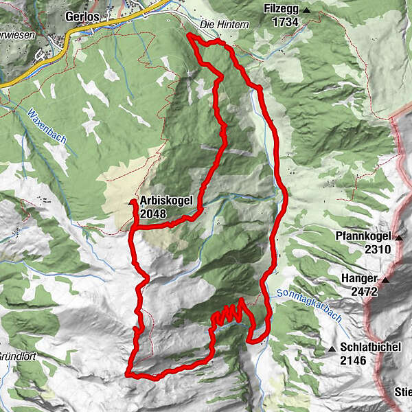
Schönachtal - Arbiskogel - Kirchspitze

Senderismo

Datos del tour
17,44km
1.296
- 2.308m
1.082hm
1.083hm
05:10h
- Breve descripción
-
Wunderschöne Wanderung vom Parkplatz Schönachtal über den Arbiskogel zur Kirchspitze und anschließendem Essen und Trinken in der Jörgleralm.
- Dificultad
-
medio
- Valoración
-
- Ruta
-
Lackenscharte (1.985 m)4,8 kmArbiskogel (2.048 m)5,2 kmKirchspitze (2.312 m)7,3 kmIssalm12,2 kmLackenalm13,7 kmLahneralm14,6 kmJörgleralm im Schönachtal15,7 km
- La mejor temporada
-
enefebmarabrmayjunjulagosepoctnovdic
- Punto álgido
- 2.308 m

GPS Downloads


Más circuitos por las regiones
-
Zillertal Arena
1322
-
Gerlos
284