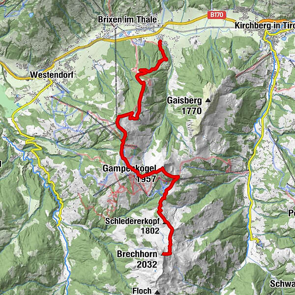
Fleiding (Seehöhe 1.892 m) und Gampenkogel (Seehöhe 1.957 m)

Senderismo
Datos del tour
13,18km
824
- 1.996m
2.037hm
2.037hm
10:00h
- Breve descripción
-
Gehzeit: ca. 6h
Höhendifferenz: 1.092/1.157 Hm - Dificultad
-
medio
- Valoración
-
- Ruta
-
Karalm4,4 kmPanoramarestaurant Choralpe (1.820 m)5,3 kmPanorama5,5 kmChor-Kapelle5,6 kmGuggenkögele (1.886 m)5,9 kmAdler6,3 kmAlpenrosenbahn II6,3 kmTalkaser6,4 kmHöhningerscharte (1.723 m)6,9 kmEinködlscharte (1.700 m)7,9 kmGampenkogel (1.957 m)8,7 kmStreitschlagalm9,9 kmBrechhornhaus10,5 kmKreuzjoch (1.619 m)10,9 kmSchledererkopf (1.802 m)11,4 kmBrechhorn (2.032 m)13,1 km
- Punto álgido
- 1.996 m
GPS Downloads


Más circuitos por las regiones