Hintere Fundusalm - Umhausen

Logotipo Hintere Fundusalm - Umhausen
Datos del tour
8,79km
980 - 1.963m
Distancia
918hm
38hm
Ascenso
03:25h
 
Duración
Breve descripción

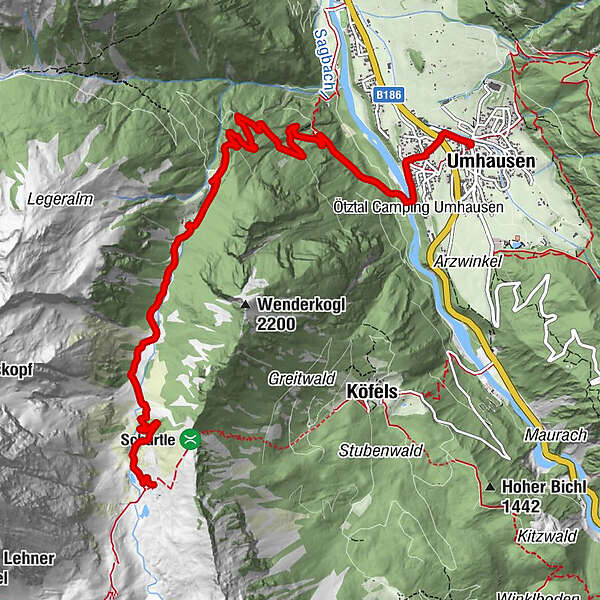
UMHAUSEN -> car park "Mure" -> district Neudorf  -> Fundus bridge -> crossroads Fundustal/Leierstal -> Vordere Fundusalm -> HINTERE FUNDUSALM

Dificultad
fácil
Valoración
Técnica
Nivel
Paisaje
Experiencias
Ruta
St. Vitus
0,0 km
Gasthof Krone
0,0 km
Umhausen (1.031 m)
0,0 km

La mejor temporada
ene
feb
mar
abr
may
jun
jul
ago
sep
oct
nov
dic
Punto álgido
1.963 m
Punto final

Hintere Fundusalm

Perfil alto

Autor
La gira Hintere Fundusalm - Umhausen es utilizado por outdooractive.com proporcionado.

Valoración global

5

0

%

4

0

%

3

0

%

2

0

%

1

0

%

Error
Se ha producido un error. Por favor, inténtelo de nuevo.
Gracias por su comentario

Se ha eliminado la calificación

GPS Downloads
  • GPX GPS Exchange Format (XML)
  • KML Google Earth, Google Maps
Códigos de descarga QR para teléfonos móviles

Información general

Punto de avituallamiento
Vistas panorámicas
Más circuitos por las regiones

Excursiones opcionales por los alrededores

Stuibenfall hike - Umhausen

fácil Senderismo
2,95km | 392hm | 01:45h

Hohe Geige über Gawinden und den Westgrat

difícil Senderismo
14,27km | 1752hm | 08:30h

Obsteig - Simmering Alm

medio Senderismo
13,94km | 937hm | 06:30h

Nissalm

fácil Senderismo
5,17km | 424hm | 01:50h