
Datos del tour
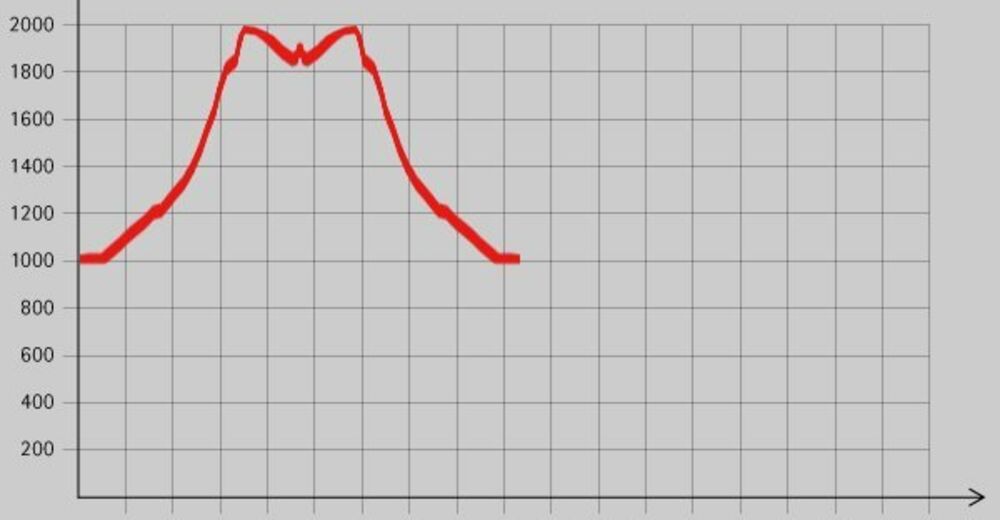
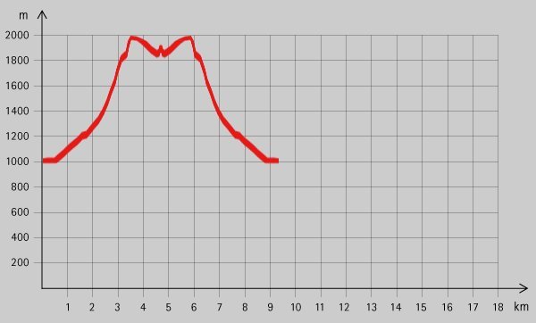
5,54km
987
- 2.003m
1.097hm
1.097hm
07:00h
- Breve descripción
-
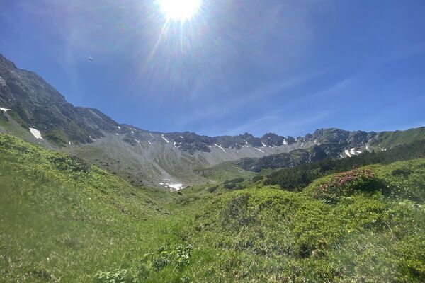
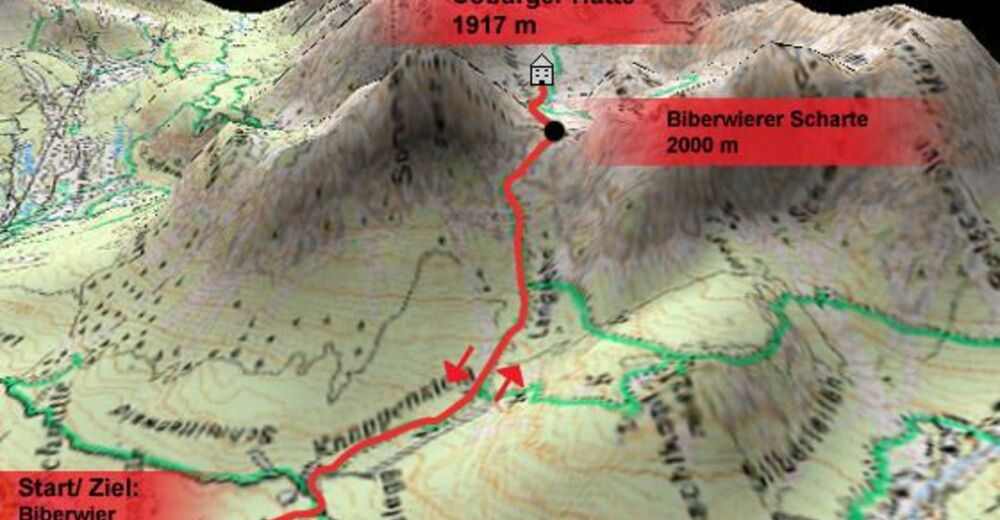
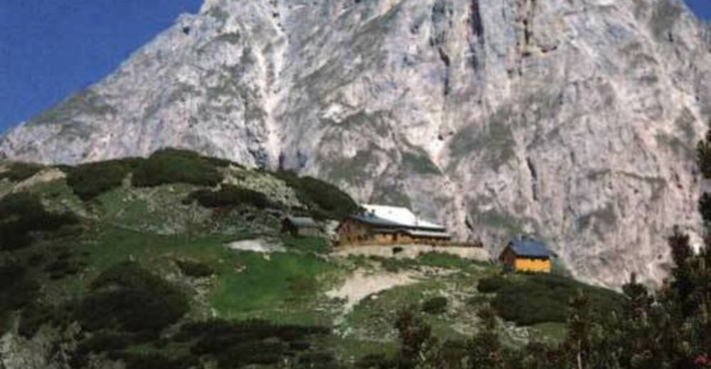
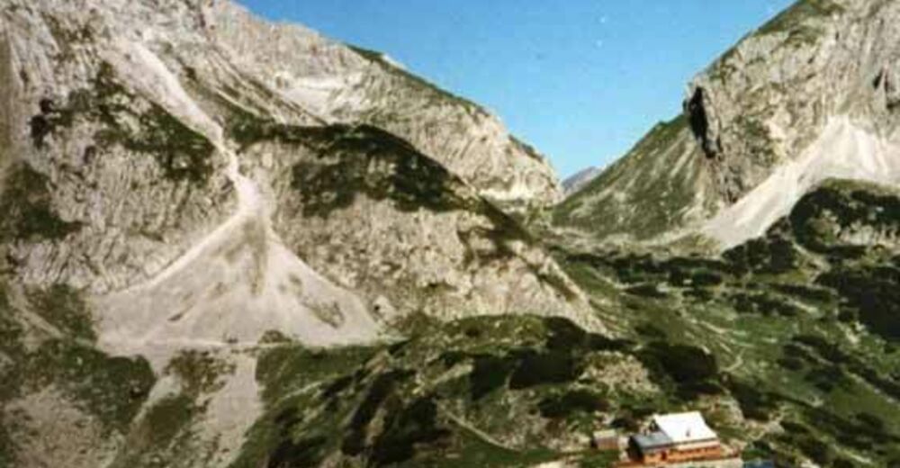
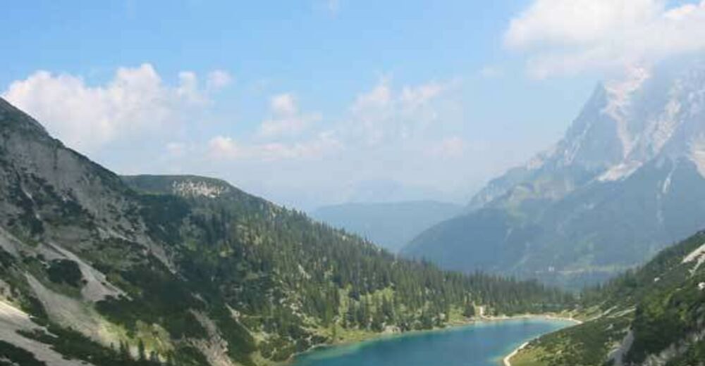
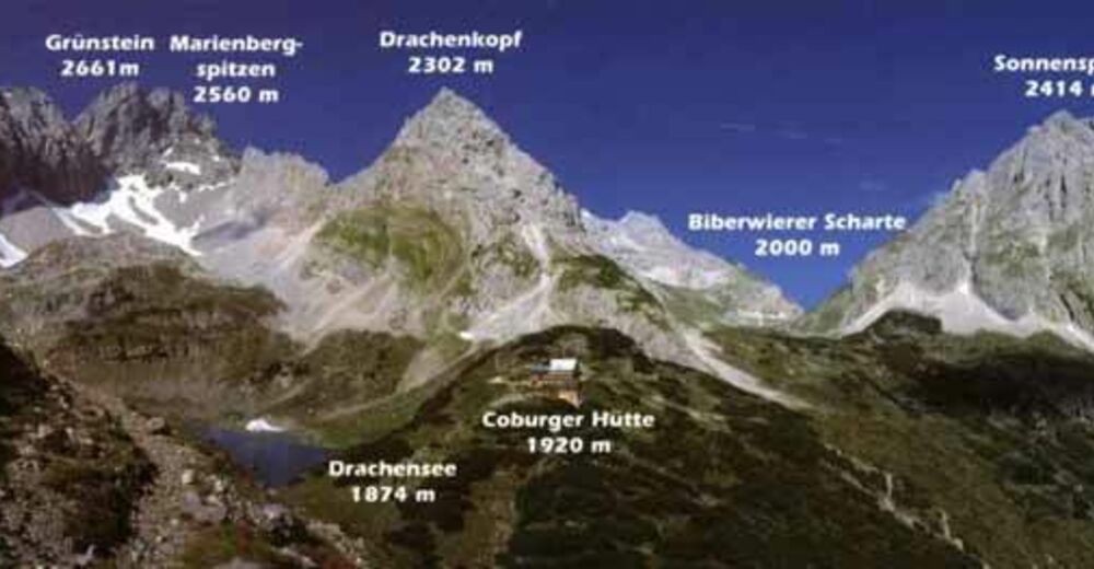
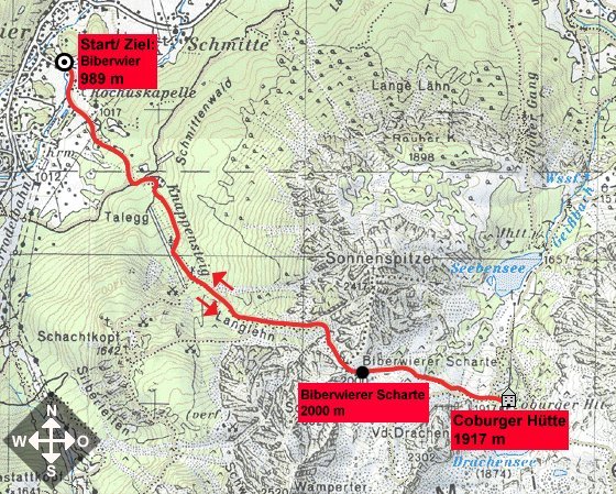
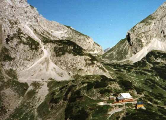
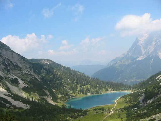
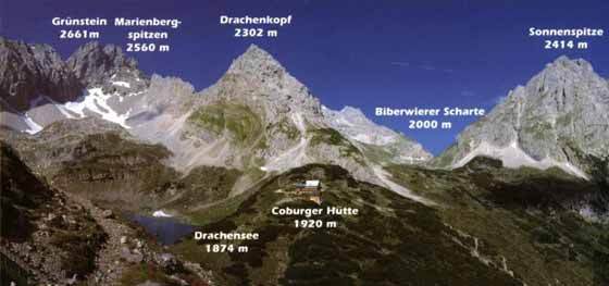
Schöne, aber auch hochalpine Tour mit Hütte am Ziel. Der Biberwierer Zustieg zur Coburger Hütte. Nur für geübte Bergwanderer!
- Dificultad
-
difícil
- Valoración
-
- Punto de salida
-
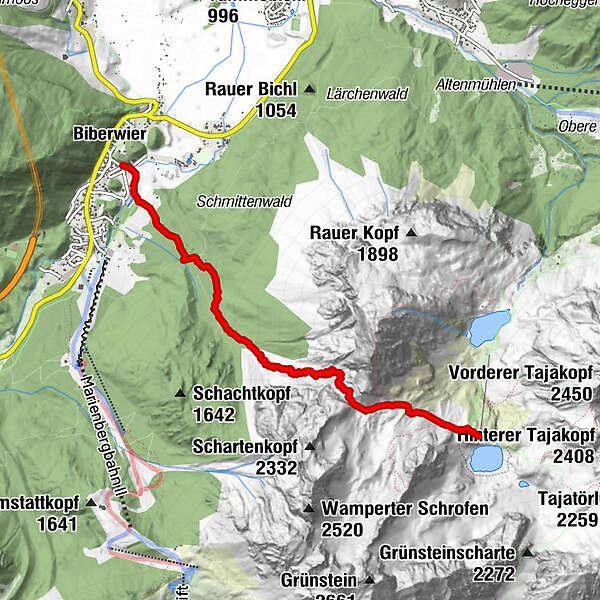
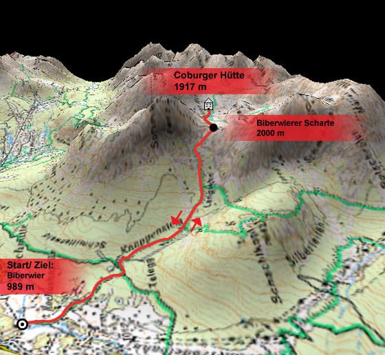
Biberwier
- Ruta
-
Biberwier (989 m)Coburger Hütte5,5 km
- La mejor temporada
-
enefebmarabrmayjunjulagosepoctnovdic
- Punto álgido
- 2.003 m
- Descanso/Avituallamiento
-
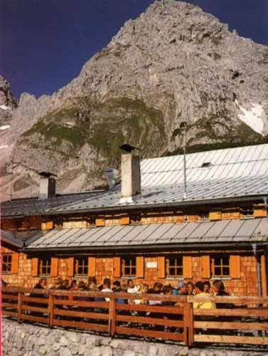
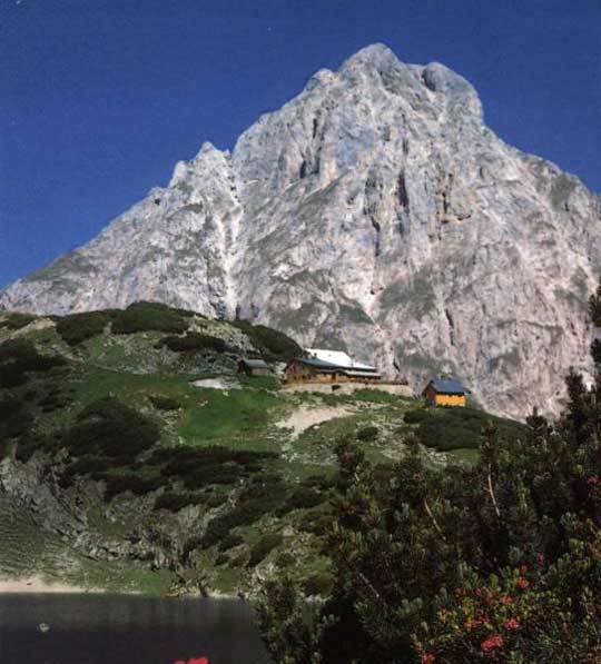
Coburger Hütte
- Material cartográfico
GPS Downloads


Superficie de carretera
Asfalto
Gravilla
Pradera
Bosque
Roca
Expuesto
Más circuitos por las regiones
-
Zugspitz Arena
1723
-
Biberwier
350