

© Saalbach Hinterglemm - Best Mountain Artists

© Saalbach Hinterglemm - Best Mountain Artists

© Saalbach Hinterglemm - Best Mountain Artists
- Dificultad
-
difícil
- Valoración
-
- Ruta
-
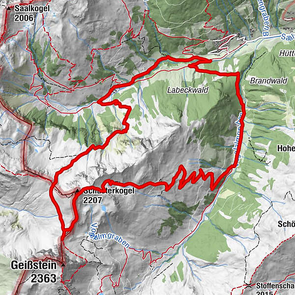
Steffelalm0,2 kmSchusterkogel (2.207 m)8,3 kmSchlaberstatt (2.048 m)9,3 kmSchusterscharte (1.985 m)10,3 kmJägerkapelle13,7 kmLindlingalm (1.370 m)14,0 km
- La mejor temporada
-
enefebmarabrmayjunjulagosepoctnovdic
- Punto álgido
- 2.174 m
- Punto final
-
Lengau
- Perfil alto
-


-

-
AutorLa gira Schusterkogel es utilizado por outdooractive.com proporcionado.
GPS Downloads


Información general
Punto de avituallamiento
Vistas panorámicas
Más circuitos por las regiones


