2020_Rad-Marathon Tannheimer Tal_129km

Ciclismo de carrera

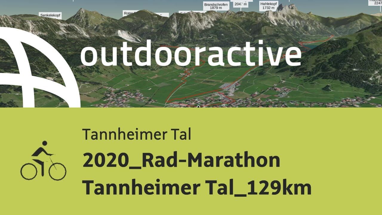
© Outdooractive – 3D Videos

- Breve descripción
-
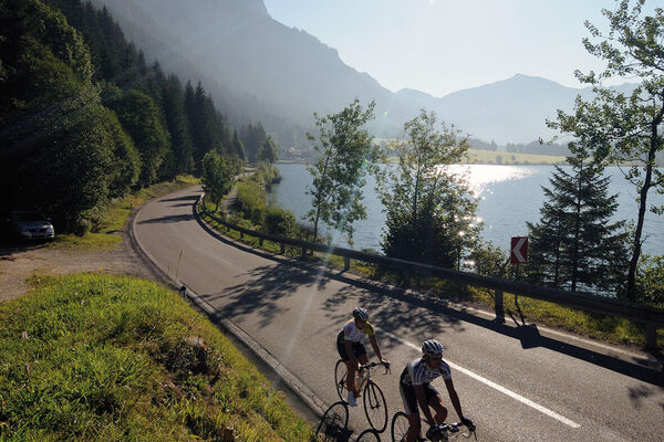
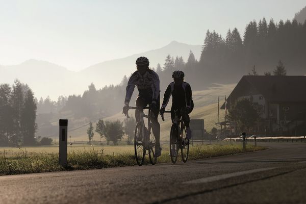
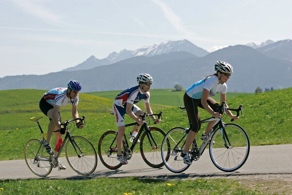
On Sunday, 5 July 2020 the 12th edition of the RAD-MARATHON Tannheimer Tal should take place. The 129 kilometres route leads from Tannheim via Grän to Pfronten in the Allgäu and further via Reutte into the nature park region Lechtal to Holzgau and back along the river Lech via the Gaicht pass into the Tannheimer Tal.
- Dificultad
-
medio
- Valoración
-
- Ruta
-
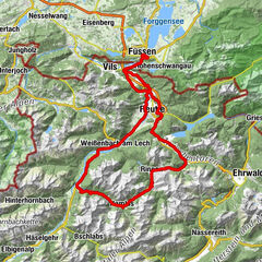
Tannheim (1.097 m)0,0 kmSt. Nikolaus0,1 kmSt. Martin2,0 kmInnergschwend2,2 kmLumberg4,3 kmMichaelskapelle4,6 kmWasserscheide Vils/Steinacher Achen (1145m)4,8 kmEnge5,1 kmSeealp7,2 kmÖsch14,8 kmSteinach15,4 kmSt. Michael15,6 kmSchönbichl17,9 kmSchwarzer Adler20,8 kmVils (826 m)20,9 kmKrone21,1 kmRiedle24,9 kmMusau (821 m)25,1 kmLeite25,7 kmBrandstatt (842 m)26,4 kmHl. Antonius26,5 kmMariae Heimsuchung27,1 kmRoßschläg27,2 kmOberletzen28,5 kmMariahilfkapelle28,9 kmOberletzen29,0 kmHinterbichl30,5 kmReutte (853 m)32,2 kmLechaschauer Kirche32,3 kmLechaschau (846 m)32,5 kmBuchenort32,6 kmGraben33,7 kmPlatten33,9 kmSoyers Sennerland34,5 kmHöfen (868 m)34,6 kmThermic Ranch34,6 kmHornberg35,6 kmWeißenbach am Lech (885 m)39,8 kmStuibenhütte (920 m)43,7 kmViele Brunnen45,3 kmJagdthüttenalpe47,2 kmStanzach (940 m)50,1 kmVorderhornbach (973 m)52,5 kmPfarrkirche Vorderhornbach52,5 kmGasthof Rose52,5 kmFilialkirche Martinau53,8 kmGasthof Klimm56,4 kmLechzeit56,5 kmPfarrkirche St. Martin61,4 kmHäselgehr (1.006 m)61,9 kmSchönauerkapelle63,4 kmGrießau64,3 kmElbigenalp (1.039 m)66,5 kmObergiblen69,3 kmGrüner Baum70,0 kmGasthof Post70,1 kmAntoniuskapelle71,0 kmUnterstockach71,6 kmStockach72,4 kmGasthof Alte Schule72,5 kmPfarrkirche Stockach72,5 kmBildstock Maria la Salette73,7 kmHolzgau (1.114 m)75,2 kmDreifaltigkeitskapelle78,2 kmStockach80,4 kmPfarrkirche Stockach80,5 kmGasthof Alte Schule80,5 kmUnterstockach81,3 kmAntoniuskapelle82,0 kmGrüner Baum82,8 kmGasthof Post82,8 kmObergiblen83,5 kmElbigenalp (1.039 m)86,4 kmGrießau88,6 kmHäselgehr (1.006 m)90,9 kmPfarrkirche St. Martin91,5 kmElmen (976 m)96,6 km14-Nothelfer Kapelle98,4 kmStanzach (940 m)102,0 kmGasthaus Post102,0 kmPfarrkirche Stanzach102,1 kmBlockau102,8 kmForchach (910 m)106,7 kmDorfkirche112,4 kmWeißenbach am Lech (885 m)112,4 kmRauth117,2 kmStegmühlkapelle117,3 kmGasthof Klausenstüberl117,3 kmMariahilf Kapelle118,3 kmNesselwängle (1.136 m)119,9 kmSchmitte121,0 kmSchmittekapelle121,1 kmWasserscheide Vils/Lech (1.150 m)121,2 kmHaller122,0 kmSt. Johannes122,3 kmVia Salina Hotel am See122,4 kmHaldensee124,1 kmSt. Jakobus124,1 kmTannheim (1.097 m)128,0 km
- La mejor temporada
-
enefebmarabrmayjunjulagosepoctnovdic
- Punto álgido
- 1.151 m
- Punto final
-
6675 Tannheim / Tannheimer Tal / Tyrol - Local centre Tannheim municipal office
- Perfil alto
-

- Autor
-
La gira 2020_Rad-Marathon Tannheimer Tal_129km es utilizado por outdooractive.com proporcionado.
GPS Downloads


Más circuitos por las regiones
-
Tannheimer Tal
52
-
Stanzach
16