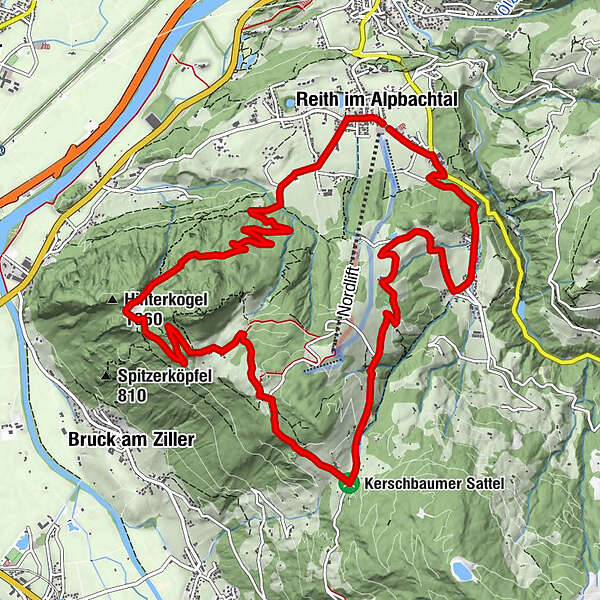
MTB-Route 318 Reither Kogel (Reith i. Alpbachtal)

Mountainbike

© Alpbachtal Tourismus - AS Tourismus/Matthias Sedlak

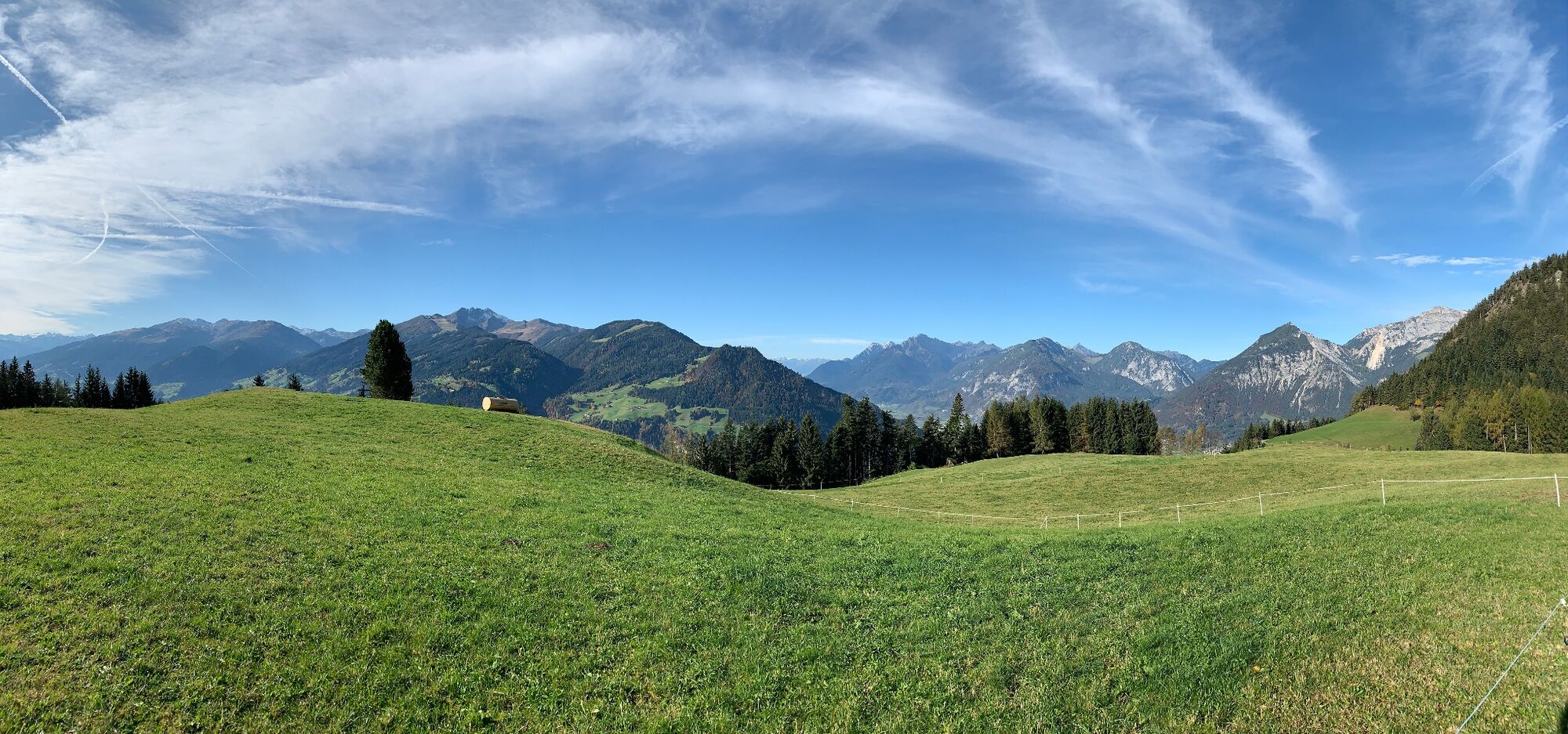
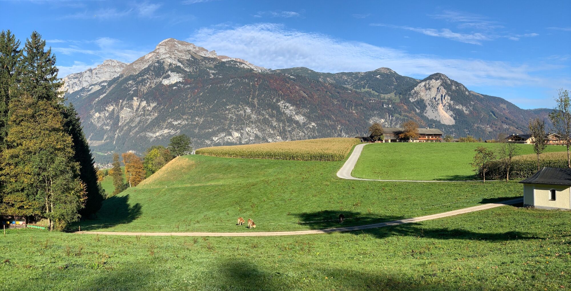
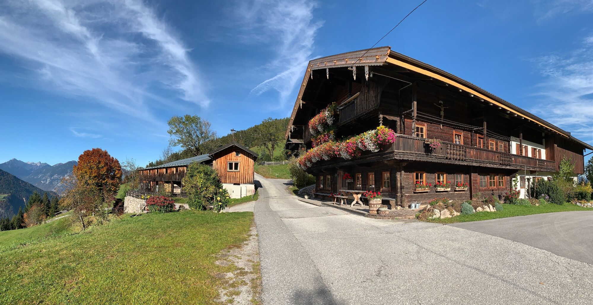
© Alpbachtal Tourismus - Manuel Hufnagel

© Alpbachtal Tourismus - Gabriele Grießenböck
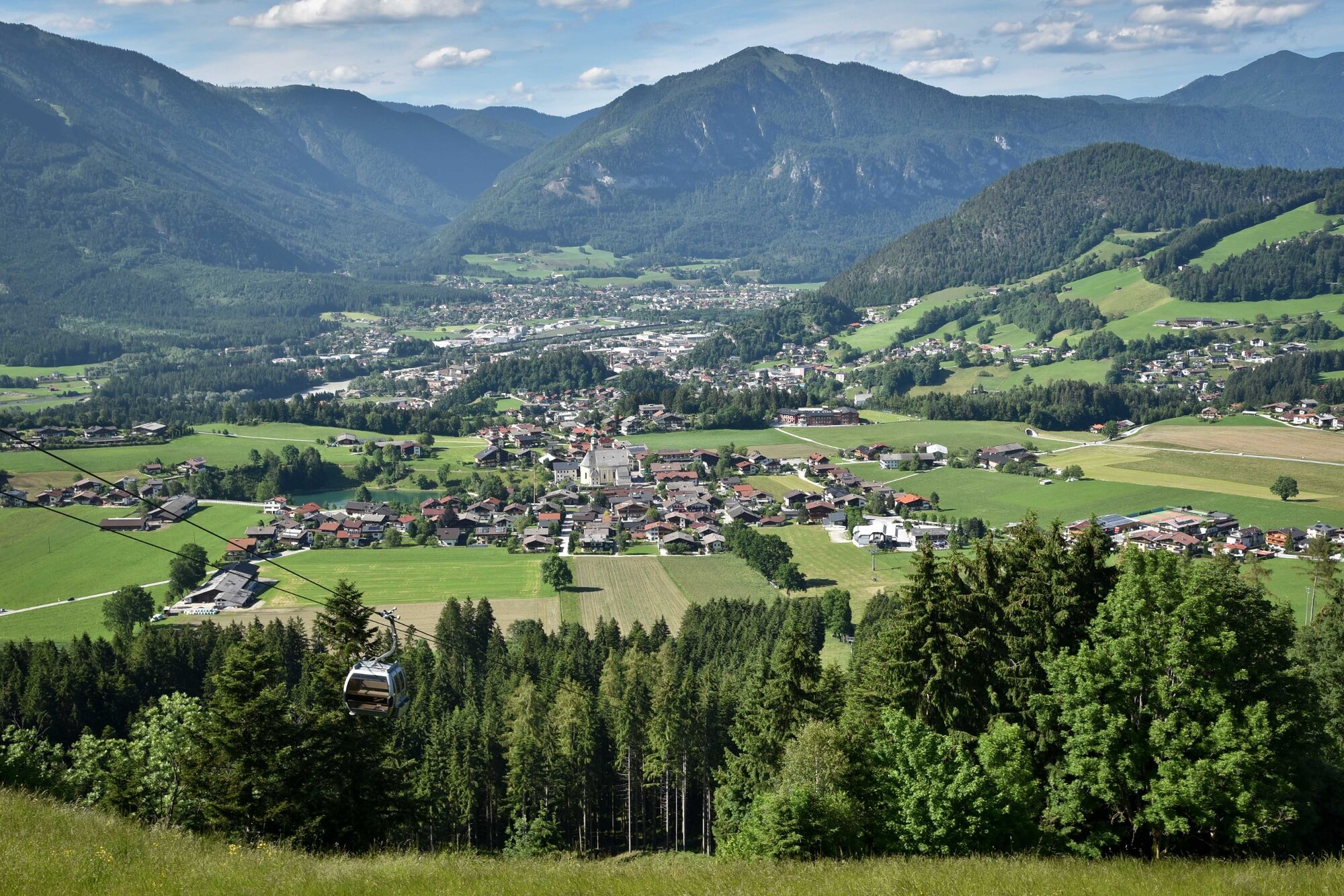
© Alpbachtal Tourismus - Manuel Hufnagel

© Outdooractive – 3D Videos

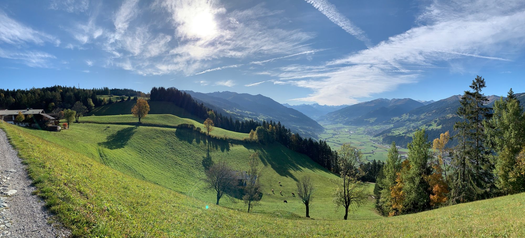
© Alpbachtal Tourismus - Manuel Hufnagel

© Alpbachtal Tourismus - Manuel Hufnagel

- Breve descripción
-
Enjoyable looped route around the Reither Kogel
- Dificultad
-
medio
- Valoración
-
- Ruta
-
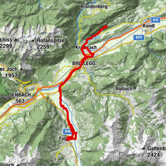
Reith im Alpbachtal (638 m)0,1 kmHub Kapelle1,2 kmAussichtspunkt Hinterkogel6,0 kmRosenkranz Kapelle9,3 kmGschwendt Almstüberl10,3 kmKapelle Maria vom Guten Rat12,1 kmHygna (817 m)12,1 kmReither Anger (659 m)13,9 kmReith im Alpbachtal (638 m)14,0 km
- La mejor temporada
-
enefebmarabrmayjunjulagosepoctnovdic
- Punto álgido
- 1.199 m
- Punto final
-
Reitherkogelbahn, Reith car park
- Perfil alto
-


-

-
AutorLa gira MTB-Route 318 Reither Kogel (Reith i. Alpbachtal) es utilizado por outdooractive.com proporcionado.
GPS Downloads


Información general
Punto de avituallamiento
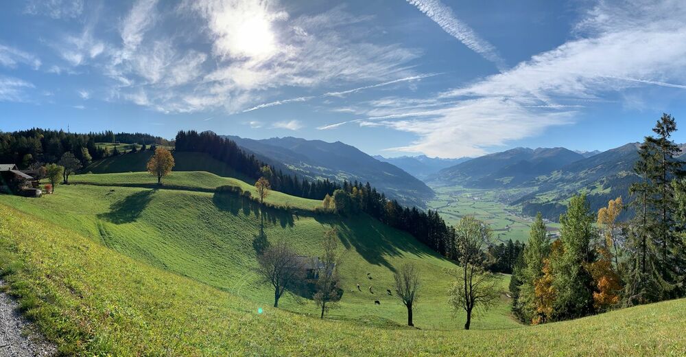
Vistas panorámicas
Más circuitos por las regiones
-
Alpbachtal
301
-
Reith im Alpbachtal
124