

© Tourismusverband Region Murau - Tom Lamm

© Tourismusverband Region Murau - Ikarus.cc

© Tourismusverband Region Murau - Johanna Jäger

- Breve descripción
-
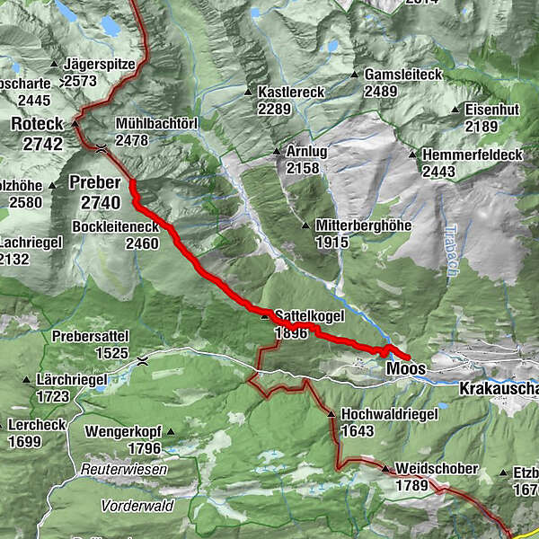
The Preber summit is a rewarding and very popular tour destination for young and old. It can be hiked from the Styrian side but also from the Salzburger side.
- Dificultad
-
difícil
- Valoración
-
- Ruta
-
MoosGrazer Hütte3,5 kmSattelkogel (1.896 m)3,6 kmSatteleben (1.870 m)3,7 kmBockleiteneck (2.460 m)6,3 kmRossscharte6,9 kmPreber (2.740 m)7,6 km
- La mejor temporada
-
enefebmarabrmayjunjulagosepoctnovdic
- Punto álgido
- 2.726 m
- Punto final
-
Klausnerberg saw
- Perfil alto
-


- Autor
-
La gira Preber summit tour es utilizado por outdooractive.com proporcionado.
GPS Downloads


Información general
Punto de avituallamiento
Vistas panorámicas
Más circuitos por las regiones


