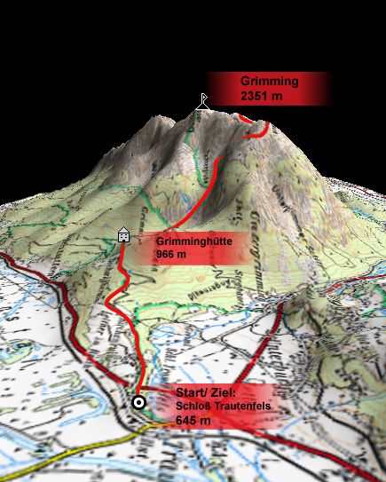
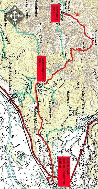
Trautenfels: Über die Grimminghütte zum Grimming

Senderismo
Datos del tour
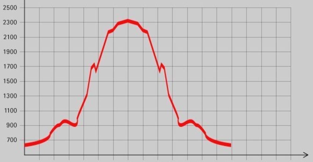
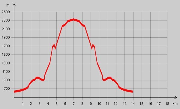
7,56km
658
- 2.314m
1.686hm
1.686hm
08:30h
- Breve descripción
-
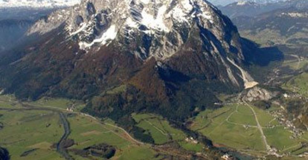
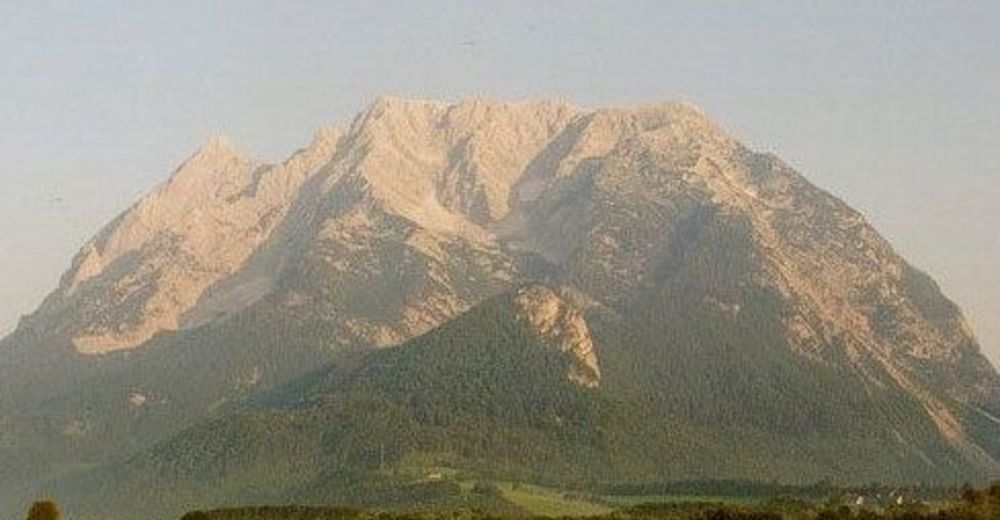
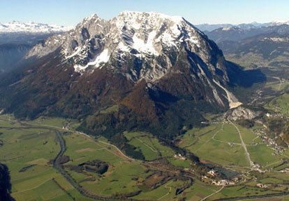
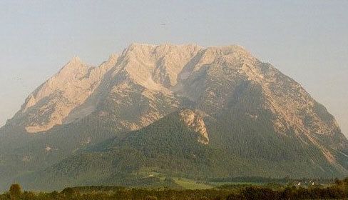
Wunderschöne Bergtour im hochalpinen Gelände mit toller Aussicht vom Gipfel aus.
- Dificultad
-
difícil
- Valoración
-
- Punto de salida
-
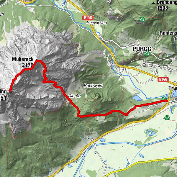
Schloß Trautenfels (645 m)
- Ruta
-
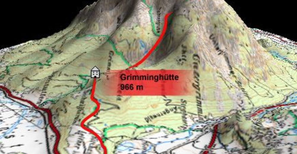
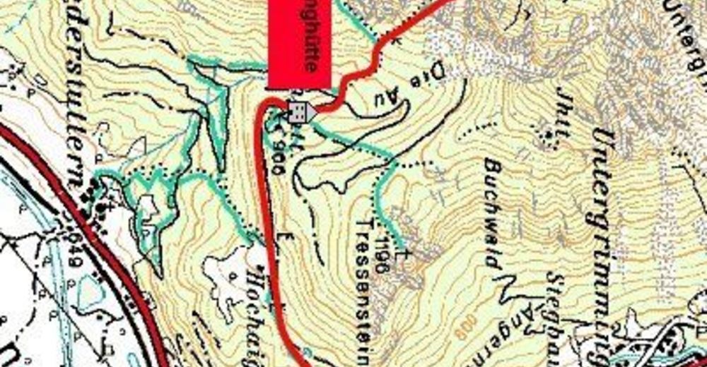
TrautenfelsGrimminghütte2,9 kmGrimmingbründl4,1 kmMultereck (2.176 m)6,1 kmGrimming (2.351 m)7,5 km
- La mejor temporada
-
enefebmarabrmayjunjulagosepoctnovdic
- Punto álgido
- 2.314 m
- Descanso/Avituallamiento
-
Grimminghütte
- Material cartográfico
GPS Downloads


Superficie de carretera
Asfalto
Gravilla
Pradera
Bosque
Roca
Expuesto
Más circuitos por las regiones
-
Ausseerland - Salzkammergut
3382
-
Gröbminger Land
1190
-
Tauplitz
305


