

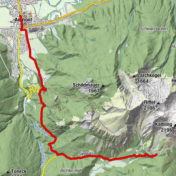
Datos del tour
8,42km
638
- 1.481m
847hm
847hm
05:30h
- Dificultad
-
medio
- Valoración
-
- Punto de salida
-
Admont
- Ruta
-
Amanduskirche0,1 kmAdmont0,3 kmKematen2,0 kmSieglalm6,0 kmOberst Klinke Hütte8,4 km
- La mejor temporada
-
enefebmarabrmayjunjulagosepoctnovdic
- Punto álgido
- 1.481 m
- Descanso/Avituallamiento
-
Gasthöfe in Admont oder Oberst Klinke Hütte

GPS Downloads


Superficie de carretera
Asfalto
Gravilla
Pradera
Bosque
Roca
Expuesto
Más circuitos por las regiones
-
Gesäuse
2224
-
Urlaubsregion Pyhrn - Priel
1440
-
Kaiserau
293


")
