Datos del tour
18,91km
1.078
- 2.815m
1.742hm
1.739hm
10:00h
- Breve descripción
-
Vom Wald ins Hochgebirge - unterwegs auf den höchsten Gipfel der Niederen Tauern!
- Dificultad
-
difícil
- Valoración
-
- Punto de salida
-
Wirtshaus "Weiße Wand"
- Ruta
-
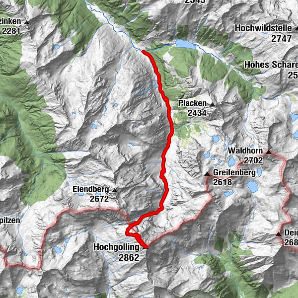
Gasthof Zum Riesachfall0,1 kmKleiner Riesachfall0,2 kmehem. Untere Stegeralm4,5 kmGollinghütte (1.642 m)5,6 kmObere Steinwenderalm6,0 kmHochgolling (2.862 m)9,4 kmObere Steinwenderalm12,4 kmGollinghütte (1.642 m)13,2 kmehem. Untere Stegeralm14,0 kmKleiner Riesachfall18,4 kmGasthof Zum Riesachfall18,7 km
- La mejor temporada
-
enefebmarabrmayjunjulagosepoctnovdic
- Punto álgido
- 2.815 m
- Descanso/Avituallamiento
-
Gollinghütte - Einkehr
Rast: Gollingscharte
GPS Downloads


Más circuitos por las regiones