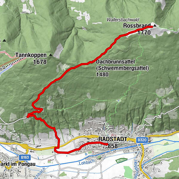
Rossbrand über Jausenstation Habersatt (63/460)

Senderismo


© Copyright Bryan Reinhart 2010 - Bryan Reinhart

© Copyright Bryan Reinhart 2010 - Bryan Reinhart
Datos del tour
17,2km
839
- 1.759m
950hm
06:30h
- Valoración
-
- Punto de salida
-
Stadtteich
- Ruta
-
Radstadt (858 m)Evangelische Kirche Radstadt0,4 kmForellencamp0,9 kmRadstädterhütte8,4 kmRossbrand (1.770 m)8,4 km
- Punto álgido
- 1.759 m
- Descanso/Avituallamiento
-
Gasthof - Jausenstation Habersatt, Radstädter Hütte am Gipfel

GPS Downloads


Superficie de carretera
Asfalto
Gravilla
Pradera
Bosque
Roca
Expuesto
Más circuitos por las regiones
-
Schladming - Dachstein
2999
-
Salzburger Sportwelt
2192
-
Radstadt
596


