

© Tourismusverband Piesendorf Niedernsill - Ferienregion Nationalpark Hohe Tauern - Tourismusverband Piesendorf Niedernsill
© Tourismusverband Piesendorf Niedernsill - Ferienregion Nationalpark Hohe Tauern - Tourismusverband Piesendorf Niedernsill
© Tourismusverband Piesendorf Niedernsill - Ferienregion Nationalpark Hohe Tauern - Tourismusverband Piesendorf Niedernsill
- Breve descripción
-
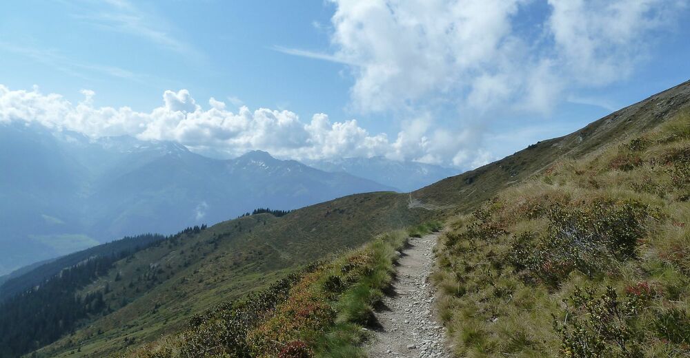
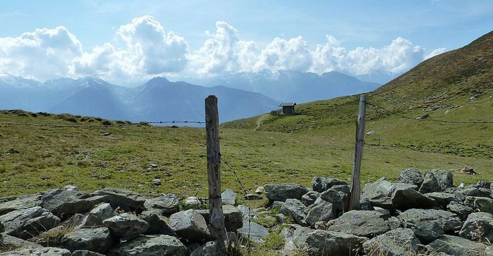
The Pinzgauer Spaziergang is one of the most beautiful high-altitude paths in the Eastern Alps with breathtaking views of the Hohe Tauern peaks.
- Dificultad
-
medio
- Valoración
-
- Ruta
-
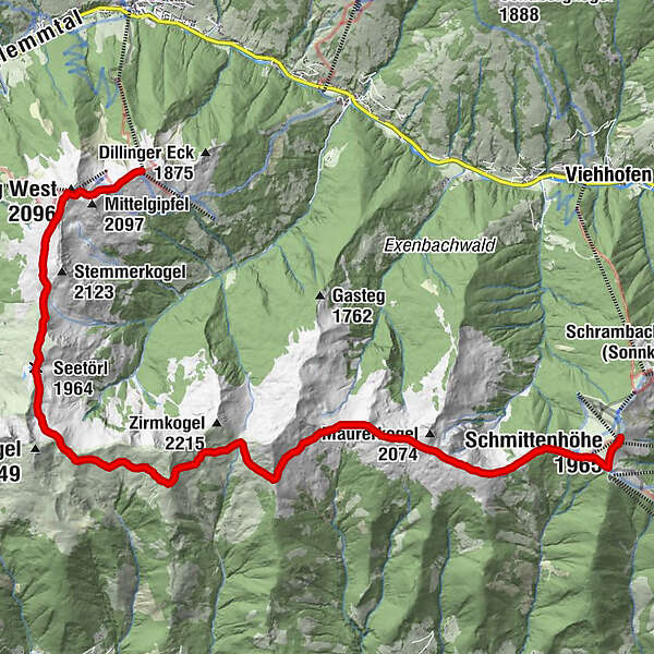
Schmittenhöhe (1.965 m)0,0 kmBerghotel Schmittenhöhe0,1 kmElisabeth-Kapelle0,2 kmEderhütte1,0 kmKettingtörl (1.780 m)1,1 kmKettingkopf (1.865 m)1,7 kmKesselscharte (1.847 m)2,3 kmRohrertörl (1.919 m)5,0 kmKlammscharte (1.993 m)7,5 kmKlinglertörl (2.059 m)11,1 kmSeetörl (1.964 m)12,5 kmSchattberg West (2.096 m)15,5 kmWestgipfelhütte15,6 kmSkyRest16,8 kmSchattberg-Ost (2.018 m)16,9 km
- La mejor temporada
-
enefebmarabrmayjunjulagosepoctnovdic
- Punto álgido
- 2.075 m
- Punto final
-
Schattberg (Saalbach)
- Perfil alto
-


-

-
AutorLa gira Pinzgauer Spaziergang nach Saalbach es utilizado por outdooractive.com proporcionado.
GPS Downloads


Información general
Punto de avituallamiento
Vistas panorámicas
Más circuitos por las regiones


