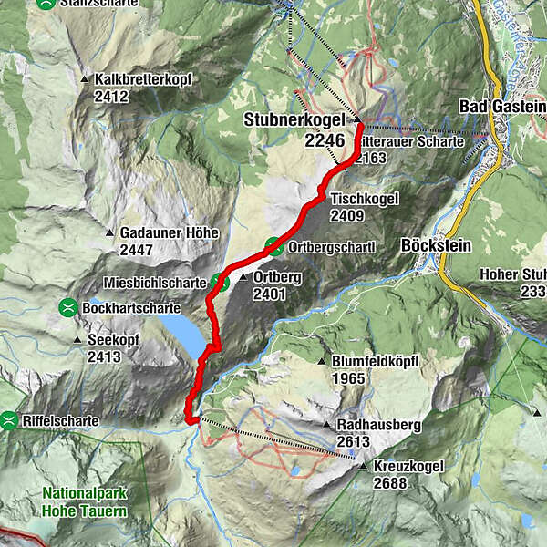
Bad Gastein: Zittrauer Tisch und Miesbichlscharte

Senderismo

- Dificultad
-
difícil
- Valoración
-
- Ruta
-
Gipfelrestaurant Stubnerkogel0,1 kmAussichtsplattform Glocknerblick0,3 kmZitterauer Scharte (2.163 m)0,9 kmTischkogel (2.409 m)1,8 kmZitterauer Tisch (2.463 m)2,1 kmZitterauer Alpe4,0 kmBockhartseehütte6,9 kmValeriehaus8,2 kmNaßfeld8,2 kmRestaurant Talstation8,2 kmSportgastein8,2 km
- La mejor temporada
-
enefebmarabrmayjunjulagosepoctnovdic
- Punto álgido
- 2.412 m
- Punto final
-
Sportgastein/Naßfeld
- Perfil alto
-

-

-
AutorLa gira Bad Gastein: Zittrauer Tisch und Miesbichlscharte es utilizado por outdooractive.com proporcionado.
GPS Downloads


Información general
Punto de avituallamiento
Cultural/Histórico
Flora
Fauna
Vistas panorámicas
Más circuitos por las regiones


