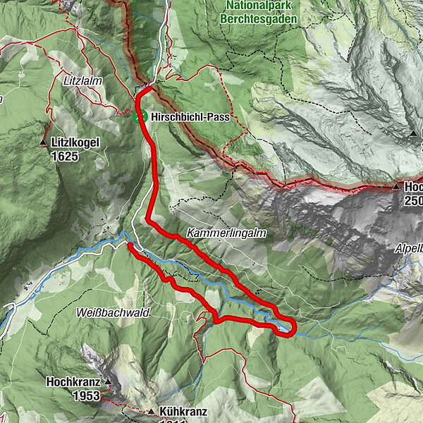
Via the Weißbachalm to the Hirschbichl

Senderismo


- Breve descripción
-
On the forest road via the Weißbachalm (401) to the Kaltwasserstube (small reservoir) and via Falleck to Hirschbichl.
- Dificultad
-
medio
- Valoración
-
- Ruta
-
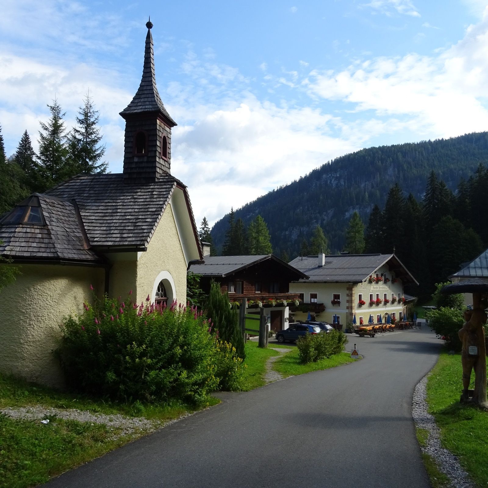
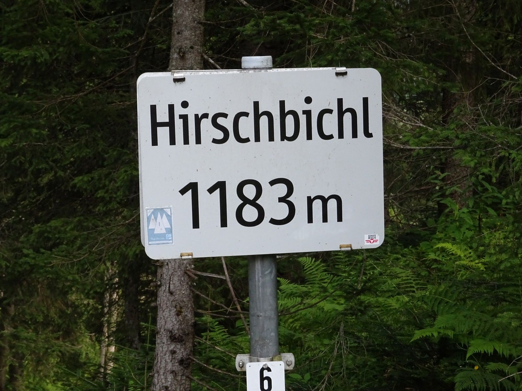
Falleck4,9 kmReubel5,8 kmPoint6,0 kmHirschbichl-Pass (1.183 m)6,2 kmMooswachtkapelle6,6 kmHirschbichl6,6 kmAlpengasthof Hirschbichl6,6 kmBergheim Hirschbichl6,7 km
- La mejor temporada
-
enefebmarabrmayjunjulagosepoctnovdic
- Punto álgido
- 1.167 m
- Punto final
-
Gasthaus Hirschbichl
- Perfil alto
-

-

-
AutorLa gira Via the Weißbachalm to the Hirschbichl es utilizado por outdooractive.com proporcionado.
GPS Downloads


Información general
Punto de avituallamiento
Más circuitos por las regiones
-
Saalfelden - Leogang
1787
-
Weißbach bei Lofer
327


